A vast Atlantic desert, a living Sahrawi culture, and one of the world’s longest unresolved decolonization questions—explained with care, depth, and practical context.
Western Sahara is a wedge of Atlantic desert on the north-west shoulder of Africa, bordered by Morocco to the north, Algeria for a 42-kilometre sliver in the north-east, Mauritania to the east and south, and 1,110 kilometres of cold, fish-heavy ocean to the west. It covers roughly 266,000 square kilometres — about the size of Colorado, or of the United Kingdom plus Ireland — and holds an estimated 610,800 people in 2026. That works out at barely two people per square kilometre, among the lowest densities on Earth, and the figure is misleading even so: something close to 98% of those people live in towns, and most of them in one city, Laayoune.
It is also the last territory on the United Nations list of Non-Self-Governing Territories anywhere on the African mainland, and the only one whose administering power is not formally recognised. Spain ran it as a colony from 1884 and left in 1975–76 without completing decolonisation. Morocco moved in, the Polisario Front declared the Sahrawi Arab Democratic Republic, and the two fought until a ceasefire in 1991 that was supposed to be followed within months by a referendum on self-determination. The referendum never happened. The ceasefire itself collapsed on 13 November 2020 and has not been restored.
What a traveller actually encounters is more prosaic than that summary suggests. Morocco administers roughly three-quarters of the territory — everything west of a sand wall called the Berm — and inside that zone there are tarmac roads, airports, hotels, ATMs, 5G, a Formula-flat coast road running 540 kilometres from Laayoune to Dakhla, and one of the best kitesurfing lagoons in the world. There are no border formalities of any kind coming from Morocco; there is no such thing as a Western Sahara entry stamp. The politics are everywhere and almost entirely invisible.
🏙 Laayoune (El Aaiun)
The largest city in the territory, administered by Morocco. 262,791 inhabitants at the September 2024 Moroccan census — not the 250,000 usually quoted, which is a decade old.
02
📜 Name & Identity
The name in English is simply descriptive — the western end of the Sahara — and it is a twentieth-century administrative invention rather than anything the inhabitants called themselves. In Arabic it is as-Sahra al-Gharbiyah; in Spanish, Sahara Occidental. Under Spain the colony carried two older regional names that are still the ones locals use for the halves of the country: Saguia el-Hamra ("the red irrigation channel"), the northern zone around Laayoune and Smara, and Rio de Oro ("river of gold"), the long southern coast and hinterland around Dakhla. The Portuguese named the latter in the 1400s for the gold dust traded there; there is no river.
What each party calls the place is itself the dispute in miniature. Morocco calls it the Southern Provinces and administers it as parts of three ordinary Moroccan regions. The Polisario Front calls it the Sahrawi Arab Democratic Republic (SADR), proclaimed at Bir Lehlou on 27 February 1976, one day after the last Spanish administrator left. The United Nations calls it neither, listing it as a Non-Self-Governing Territory whose administering power is still formally recorded as Spain. Newspapers that want to avoid taking sides tend to write "the disputed territory of Western Sahara," which is what this page does too.
The people are Sahrawis — from the Arabic for "of the desert" — historically nomadic tribes of mixed Arab (Beni Hassan) and Sanhaja Berber descent, unified by Hassaniya Arabic, a distinct Arabic dialect carrying a substratum of the near-extinct Berber language Zenaga. Hassaniya has around 5.6 million speakers across Western Sahara, Mauritania, southern Morocco, western Algeria and Mali, where it is an official language. Morocco's 2011 constitution names it in Article 5 as "Hassania," an element of Moroccan cultural unity to be preserved — a component to be protected rather than an official language, a distinction worth reading carefully. Spanish survives as a widely used second language among Sahrawis educated in the refugee camps and in Cuba, which makes Western Sahara one of the very few places in Africa — alongside Equatorial Guinea, and setting aside the Spanish cities of Ceuta and Melilla, which are Spain — where Spanish carries real weight.
03
🏔 Geography & Landscape
Western Sahara is overwhelmingly flat. The interior is hamada — stony, wind-scoured plateau, the least photogenic and most characteristic Saharan surface — broken by ergs of dune, dry watercourses called wadis or sequias, and salt pans (sebkhas). The one great drainage line is the Saguia el-Hamra, which runs west past Smara to the sea at Laayoune and flows perhaps once in a decade.
The relief is so subdued that the territory's highest point has no name: an unremarkable rise of 701 metres east of Aousserd in the far south-east. Sources that name a peak here should be treated with suspicion. The low point, Sebjet Tah at 55 metres below sea level, is a salt depression straddling the Moroccan border and is more interesting than the summit. Land borders total 2,046 km: Mauritania 1,561 km, Morocco 443 km, Algeria 42 km.
The coast is where the territory earns its living and most of its wonder. The Canary Current drags cold water up from the depths along the whole shelf, and that upwelling makes this one of the richest fishing grounds on the planet — sardine, octopus, cephalopods, and the reason so much of the political argument is ultimately about fish. The same cold water fights the desert to a draw: Dakhla in July averages a mild 26°C while the interior 200 km inland is punching past 45°C. Fog rolls in off the water and, in a place that may see 40 mm of rain in a year, is a meaningful source of moisture for what little vegetation there is.
That vegetation is thorny and sparse — acacia in the wadis, tamarisk, euphorbia, and after a rare rain a brief, startling green. The fauna is more interesting than the flora: dorcas gazelle, fennec fox, desert hedgehog, sand cat and Ruppell's fox in the interior; and offshore, the northernmost population of the Atlantic humpback dolphin, a species found nowhere outside African coastal waters. The Cabo Blanco peninsula at the southern tip, which the Western Sahara–Mauritania border runs straight down, holds around half the world's Mediterranean monk seals — the breeding caves are on the western, Western Saharan side, though the colony is managed from Mauritania and almost always reported as Mauritanian.
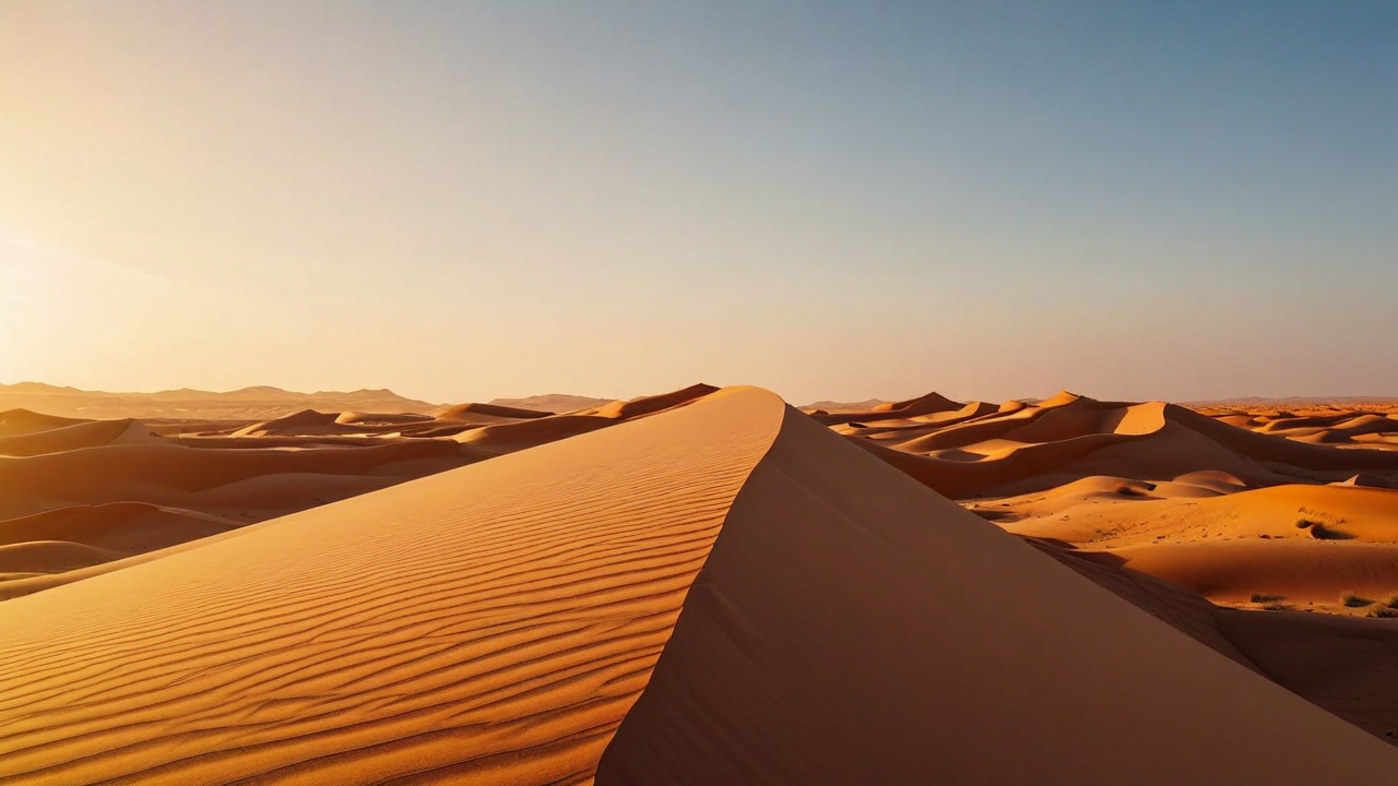
Where the Sahara runs out of land. The cold Canary Current keeps the coast mild while the interior bakes.
04
🗺 Map of Western Sahara
Laayoune, Dakhla and the coast road; the Bou Craa mine and its conveyor to the sea; the Berm and the Free Zone settlements of Tifariti and Bir Lehlou behind it; the Guerguerat crossing into Mauritania; and, off the map to the north-east, the refugee camps near Tindouf in Algeria where a large part of the Sahrawi nation actually lives.
Boundaries shown are for orientation only and do not imply endorsement of any territorial claim.
05
📜 History
For most of recorded history this coast belonged to nobody in the sense that states use the word. It was moved through by camel-herding tribes — the Reguibat above all — who followed grazing across what are now four national borders and owed allegiance to lineage rather than territory. Islam arrived with the Almoravid movement in the eleventh century, which began among Sanhaja Berbers of this desert and ended up ruling from Marrakesh to the Ebro. In the fifteenth century the Portuguese and then the Spanish began touching the shore for fish and for the gold-dust trade at Rio de Oro.
Spain declared a protectorate over Rio de Oro in December 1884, in the immediate aftermath of the Berlin Conference, and spent the next fifty years barely leaving the coast. Effective control of the interior was not achieved until 1934, and the interior did not consent to it: Smara, the one true inland town, had been founded in the 1890s by the scholar-warrior Ma al-Aynayn, whose descendants led resistance into the 1930s. What changed everything was geology. Phosphate was confirmed at Bou Craa in the 1960s and mining began in 1972, turning a strategically marginal sand colony into an asset.
By the mid-1970s Spain was preparing to leave and the Polisario Front, founded 10 May 1973, was fighting to make sure the territory left as a state. Morocco and Mauritania both claimed it. In October 1975 the International Court of Justice, asked for an advisory opinion, found historic ties of allegiance between some Sahrawi tribes and the Moroccan sultan but no tie of territorial sovereignty that would displace the right of self-determination. King Hassan II read the same opinion as a green light and launched the Green March on 6 November 1975: some 350,000 Moroccan civilians walked south over the border carrying flags and Qurans.
Spain folded. The Madrid Accords of 14 November 1975 handed administration to Morocco and Mauritania; the last Spanish administrator left and Spain's withdrawal was complete on 26 February 1976. (Both dates circulate as "when Spain left" — the agreement is 1975, the departure is 1976.) The Polisario proclaimed the SADR the next day at Bir Lehlou. Tens of thousands of Sahrawis fled east; Moroccan aircraft bombed the columns with napalm at Umm Dreiga and Guelta Zemmur, and the survivors ended up in camps on the hammada near Tindouf in Algeria, where their grandchildren still live.
Mauritania was fought to exhaustion and quit in 1979; Morocco took its share. From 1980 Morocco began building the Berm in six successive phases, ending in April 1987, and the wall worked — it converted a mobile guerrilla war Morocco was losing into a static one it could afford. A UN-brokered ceasefire took effect on 6 September 1991, with MINURSO established that April to run a referendum within months. Voter identification bogged down immediately in the question of who counted as Sahrawi, and the referendum was never held.
Two later dates matter. In October 2010 some 20,000 Sahrawis established a protest camp at Gdeim Izik outside Laayoune over jobs, housing and discrimination; Moroccan forces dismantled it on 8 November 2010 and the ensuing violence killed people on both sides. Some observers call it the first spark of the Arab Spring, which began in Tunisia six weeks later. Twenty-odd men convicted in the aftermath are still serving long sentences; in May 2026 the UN Human Rights Committee found that their cases involved torture, coerced confessions and a failure to investigate. And on 13 November 2020, after Sahrawi protesters blockaded the Guerguerat road for three weeks, Morocco sent troops into the buffer zone, the Polisario declared the ceasefire void, and a low-intensity war resumed along the Berm that has not formally ended.
06
🏛️ Spanish Sahara — Colony, Provinces & Withdrawal
Spain established a durable colonial foothold on the Atlantic coast in 1884, initially around Río de Oro and later in Saguia el-Hamra. Colonial rule was thin outside a handful of coastal posts, but it redirected caravan routes, encouraged settlement around Laayoune and Dakhla, and eventually treated the territory as two Spanish provinces rather than an overseas colony. Sahrawi communities continued to move across borders that European governments had drawn through older grazing lands.
By the 1960s, decolonization pressure was rising across Africa. The United Nations placed Western Sahara on its list of Non-Self-Governing Territories, while Morocco and Mauritania advanced competing historical claims. Spain organized a local assembly but delayed the self-determination process, and the Polisario Front emerged in 1973 as an armed independence movement. The colonial period ended without an agreed final status.
The 1975 Madrid Accords transferred administrative responsibilities to Morocco and Mauritania, but they did not transfer sovereignty or settle the territory's legal status. Spain withdrew in early 1976. That distinction remains essential: modern institutions, roads, Spanish loanwords, and family memories reflect the colonial era, while the unresolved decolonization question continues to frame international diplomacy.
07
🟢 The Green March & the Western Sahara War
In November 1975, Morocco organized the Green March, sending about 350,000 civilians toward the territory after the International Court of Justice had recognized historical ties of allegiance but found no tie of territorial sovereignty sufficient to remove the principle of self-determination. The march became a foundational episode in modern Moroccan national identity and a profoundly different symbol for Sahrawis who experienced displacement and war.
Armed conflict followed between the Polisario Front and Moroccan and Mauritanian forces. Mauritania renounced its claim in 1979, after which Morocco took control of the area it had administered. Fighting combined mobile desert warfare with air power and eventually a vast system of defensive earthworks, mines, radar, and fortified positions known collectively as the Berm.
The conflict displaced large numbers of Sahrawis to camps near Tindouf in western Algeria. Families were divided across the Berm, and political institutions developed separately in Moroccan-administered cities, the Polisario-administered zone, and the refugee camps. These parallel experiences explain why a single travel narrative can never represent every Sahrawi life.
08
🕊️ Ceasefire, MINURSO & the Broken Pause
A United Nations-backed settlement plan produced a ceasefire in 1991 and created MINURSO, the UN mission intended to monitor the truce and prepare a referendum. Disputes over voter eligibility and the referendum's choices prevented the vote from taking place. Negotiations continued in cycles, but no mutually accepted political settlement emerged.
The ceasefire largely froze the front for nearly three decades. That relative calm ended in November 2020 after tensions at Guerguerat, near the Mauritanian border. The Polisario Front declared the ceasefire over, and the UN has since reported recurring low-intensity hostilities and restrictions affecting the mission's work.
For readers, the practical lesson is simple: the map is not merely descriptive. It separates different systems of administration, security, documentation, communications, and access. Conditions can change faster than a conventional guidebook can be revised, so official travel advice and current local information must take precedence over itineraries.
09
⚖ Political Status & Who Governs What
This is the part most travel writing skips, and it is the reason the place is on any list at all. As of September 2026 the position is this.
On the ground. Morocco administers everything west of the Berm — usually given as about 80% of the territory, though the CIA World Factbook says "about three-quarters" — including every city, the entire coast, the phosphate mine and all the infrastructure. The Polisario Front administers the remainder, a thinly populated strip along the Algerian and Mauritanian frontiers that it calls the Liberated Territories and Morocco calls the buffer strip; outsiders usually say Free Zone. Its administrative centres are Tifariti and Bir Lehlou. The SADR government itself sits not in Western Sahara at all but at Rabouni, near Tindouf inside Algeria.
Diplomatically. The United States recognised Moroccan sovereignty on 10 December 2020, in exchange for Moroccan normalisation with Israel — the only major power to go that far, and a position reaffirmed by successive administrations since. Spain endorsed Morocco's autonomy plan as the most realistic basis in March 2022, reversing decades of neutrality by the former colonial power. France went further in a letter from President Macron to King Mohammed VI on 30 July 2024, reaffirmed before the Moroccan parliament that October. The United Kingdom followed in June 2025, making three of the five permanent Security Council members supporters of the autonomy plan.
At the United Nations. The decisive moment came on 31 October 2025, when the Security Council adopted Resolution 2797 by 11 votes to none, with China, Pakistan and Russia abstaining and Algeria declining to take part. For the first time the Council took Morocco's 2007 autonomy proposal as the basis for a solution, and the text made no reference to an independence referendum. MINURSO's mandate was renewed to 31 October 2026. Supporters read this as pragmatism after fifty years of deadlock; the Polisario, Algeria and a good deal of international-law scholarship read it as the Council quietly abandoning a right of self-determination it is not empowered to trade away. Both readings are seriously argued, and this page does not pick between them.
In the courts, the opposite happened. On 4 October 2024 the Court of Justice of the European Union annulled the EU–Morocco fisheries and agriculture agreements as far as they covered Western Sahara, holding that the territory is separate and distinct from Morocco, that Morocco has neither sovereignty nor an administering mandate over it, and that any such agreement requires the consent of the Sahrawi people. It is the sharpest legal statement anyone has made in decades, and it points the other way from Resolution 2797.
Recognition of the SADR peaked at more than 80 states; around 36 to 37 currently maintain it, many others having frozen or withdrawn recognition under Moroccan pressure. The SADR is nonetheless a full member of the African Union — it was admitted to the OAU in 1982, which caused Morocco to walk out in 1984 and stay out until it rejoined the AU on 30 January 2017, accepting a body in which it now sits alongside a state it does not recognise.
🏛 Who holds which office, September 2026
Morocco (administering power in practice): King Mohammed VI, head of state since 23 July 1999. Prime Minister Aziz Akhannouch, appointed 10 September 2021 — note that Morocco votes in a general election on 23 September 2026, three weeks after this page was last revised, and Akhannouch has said he will not stand; this line will need rechecking. SADR / Polisario Front: President and Secretary-General Brahim Ghali (b. 1949, Smara), in office since 12 July 2016, re-elected at the 16th Polisario Congress in January 2023. Prime Minister Bouchraya Hammoudi Bayoun, in office since 13 January 2020. United Nations: Personal Envoy of the Secretary-General Staffan de Mistura, appointed 6 October 2021 and still in post — he visited the Sahrawi side in June 2026, having signalled in late 2024 that he intended to step down.
10
🧱 The Berm — A Landscape Divided
The Berm is a network of sand walls, trenches, fences, observation posts, and military positions extending for thousands of kilometers through the desert. It separates most Moroccan-administered population centers and Atlantic infrastructure to the west from areas administered by the Polisario Front to the east. It is not a tourist sight or a line to approach for photographs.
Minefields and unexploded ordnance remain a lethal danger on both sides and around older routes. Wind, flooding, and drifting sand can obscure warning signs or move surface indicators. Travelers should never improvise off-road routes, follow unverified map tracks, or assume open-looking desert is safe.
The barrier also has a human geography. Sahrawi families have lived apart for generations, and UN-supported confidence-building programs have at times enabled visits and communication. Understanding the Berm means seeing both its military function and its lasting effect on kinship, movement, pastoral life, and memory.
11
⛺ The Tindouf Refugee Camps
Five large Sahrawi refugee camps lie near Tindouf in western Algeria, outside Western Sahara itself. They have existed since the mid-1970s and are commonly named for towns in the territory: Laayoune, Smara, Dakhla, Auserd, and Boujdour. The camps are administered through Sahrawi institutions while humanitarian agencies provide food, health, water, and education support.
Extreme heat, scarce water, isolation, and limited employment make daily life difficult. At the same time, residents have built schools, clinics, cultural organizations, archives, and representative structures over decades. Describing the camps only through deprivation misses the agency and complex social life of the people who live there.
Visits require separate planning, permissions, security assessment, and an Algeria-focused itinerary; they are not an extension of a drive through Moroccan-administered Western Sahara. Ethical visitors avoid treating refugee life as spectacle, seek informed consent before photography, and support accountable organizations rather than distributing gifts ad hoc.
12
🌐 Recognition, Diplomacy & Competing Narratives
The United Nations continues to classify Western Sahara as a Non-Self-Governing Territory whose final status has not been resolved. Morocco administers most of the territory and proposes autonomy under Moroccan sovereignty. The Polisario Front, representing the Sahrawi Arab Democratic Republic, seeks a self-determination process that includes independence.
International positions are not static. States recognize, suspend, or revise relations with the Sahrawi Arab Democratic Republic, while other governments support Morocco's autonomy proposal or emphasize a mutually acceptable UN-led solution. Diplomatic language therefore needs dates and sources; sweeping claims about what “the world recognizes” age quickly.
This guide uses geographic and administrative descriptions rather than presenting one side's sovereignty claim as settled fact. Place names also carry politics: Laayoune and El Aaiún, Dakhla and Villa Cisneros, or “southern provinces” and “occupied territories” signal different histories and viewpoints. Where useful, alternatives are shown without asking readers to adopt a political slogan.
13
🤵 People & Culture
The population of the territory itself — around 610,800 — is now a mix of Sahrawis and Moroccan settlers and workers who came south with the state, the subsidies and the phosphate. Nobody agrees on the ratio, and the disagreement is not academic: any referendum electorate would turn on it, which is precisely why MINURSO's identification exercise ground to a halt in the 1990s having enrolled 42,378 voting-age adults in the camps and settled nothing.
A very large part of the Sahrawi nation does not live in Western Sahara at all. UNHCR's planning figure is 173,600 people in the five camps near Tindouf in Algeria as of July 2025 — a number Algeria and the Polisario put at about 165,000, Morocco at 45,000–50,000, and which UNHCR itself worked to at 90,000 for two decades. It is the world's second longest-standing refugee situation, now in its fiftieth year. The camps are named after towns the refugees left: El Aaiun, Awserd, Smara, Dakhla and Boujdour, plus the "27 February" camp built around a women's boarding school and the administrative centre at Rabouni. Camp literacy went from roughly 5% at foundation to about 90% by the mid-1990s, largely through schooling in Algeria, Cuba and Spain — which is why so many older Sahrawi professionals speak Spanish, and why the territory produced a body of literature written in Spanish rather than Arabic.
Sahrawi society is tribal and, unusually for the region, notably less restrictive towards women than its neighbours: women traditionally own the tent, initiate divorce without stigma, and in the camps have run much of the administration for fifty years. The melhfa, the brilliantly coloured length of cloth women wrap over the whole body, is the most visible marker of Sahrawi identity anywhere in the Sahara, and its colours are worn as ordinary daily fashion rather than modesty wear.
Music is haul, the Hassani modal tradition shared with Mauritania, historically the property of the hereditary iggawin musician caste, built on the tidinit lute and the ardin, a harp played only by women. Its international face is Aziza Brahim, born in the camps in 1976 and now recording for the German label Glitterbeat — her fifth album Mawja ("wave" in Hassaniya) appeared in February 2024. On the Moroccan-administered side, Group Doueh of Dakhla plug the same modes into electric guitars by way of Hendrix and James Brown, released internationally by Sublime Frequencies.
One correction worth making, because guidebooks get it wrong: the great Hassani cultural festival, the Moussem of Tan-Tan, inscribed on UNESCO's Intangible Cultural Heritage list in 2008, takes place in Tan-Tan, which is in Morocco proper, north of the 27°40' parallel and outside Western Sahara. It is culturally Sahrawi and geographically Moroccan, which is exactly the sort of distinction this territory punishes you for blurring.
14
🗣️ Hassaniya Arabic & a Multilingual Territory
Hassaniya Arabic is central to Sahrawi identity. It developed across the western Sahara among communities shaped by Arab, Amazigh, and West African histories and preserves vocabulary tied to camels, pastoral routes, kinship, poetry, weather, and desert ecology. Pronunciation and everyday expressions differ noticeably from Moroccan Darija and from Modern Standard Arabic.
Modern Standard Arabic is used in formal writing and education, while Moroccan Arabic is widely heard in Moroccan-administered cities. Spanish remains culturally important among many Sahrawis and in the refugee camps, a legacy of colonial education and continuing links with Spain. French appears in administration, commerce, and regional travel, and Amazigh languages form part of the broader cultural landscape.
The Arabic edition of this guide uses readable Modern Standard Arabic while identifying Hassaniya terms and contexts rather than pretending that the two are identical. Visitors earn goodwill by learning greetings, asking which language a person prefers, and avoiding assumptions about identity based on accent alone.
15
🎶 Poetry, Music & Oral Memory
Sahrawi culture gives unusual weight to oral art. Hassaniya poetry can record genealogy, praise, longing, satire, moral argument, and precise knowledge of landscape. A verse remembered and performed may carry social authority in ways that a translated summary cannot reproduce.
Haul music, shared across the western Sahara and Mauritania, uses voice, handclaps, percussion, and string instruments such as the tidinit and ardin. Contemporary Sahrawi musicians have carried these sounds into electric guitar arrangements and international festivals, often joining personal stories with exile, resistance, and desert imagery.
Music heard at a wedding, family gathering, or tea session belongs to a social setting rather than a staged attraction. Ask before recording, credit artists carefully, and remember that lyrics may speak to political histories whose meanings are not obvious to an outsider.
16
🐪 Nomadic Heritage & Desert Knowledge
Many Sahrawi traditions emerged from mobile pastoral life across a region that ignored today's borders. Families followed pasture and water, read wind and cloud patterns, maintained trade and kinship routes, and adapted tents, clothing, food, and work to extreme heat and scarcity. Mobility was an organized knowledge system, not aimless wandering.
Camels provided transport, milk, status, and resilience, while goats and sheep supported household economies. The khaima, a woven tent, remains a powerful social and political symbol even for urban families. Hospitality rituals convert a difficult environment into a space of obligation, conversation, and protection.
Urbanization, borders, conflict, drought, wage employment, and motor vehicles have transformed pastoral practice. Yet desert knowledge remains alive in vocabulary, family memory, seasonal camps, music, tea, and the ability to interpret terrain. Responsible guides are cultural interpreters as well as drivers.
17
🏙 Laayoune (El Aaiun)
Laayoune is not an old city. The Spanish founded it in 1938 as a garrison beside the Saguia el-Hamra, and it has been built and rebuilt since — first as a Spanish colonial capital, then, after 1975, as the showpiece of Moroccan investment in the Southern Provinces. The result is a low, bright, spacious town of 262,791 people (2024 census) with wide boulevards, a great deal of new public architecture, universities, a stadium, and more state employment per head than almost anywhere in Morocco.
The Spanish bones are still visible if you look: the cathedral of San Francisco de Asis, still functioning as a parish, the old Parador, and the Colomina district's low white houses with their arcades. Place Mechouar and Place Dchira are where the city actually gathers in the evening. The souk sells Sahrawi silverwork, leather, camel-wool blankets and the melhfas, and is a far better place to buy Saharan craft than anything in Marrakesh at three times the price. Twenty-five kilometres away at El Marsa is the port, and the terminus of the conveyor belt from Bou Craa.
Practical truth: Laayoune is a functional administrative city rather than a beautiful one, and most travellers use it as a stop on the long drive south or as the arrival airport. It also holds a distinction that people heading for Mauritania take surprisingly seriously: it is widely said to have the last McDonald's in Africa going south, the next being in South Africa.
18
🏄 Dakhla
Dakhla is the reason most non-specialist travellers come. The town sits at the tip of a 40-kilometre sand spit that runs parallel to the coast, enclosing a shallow, flat, turquoise lagoon on one side while the open Atlantic breaks on the other. Spain founded it in 1884 as Villa Cisneros, the capital of Rio de Oro, and used it as a penal colony; today it is the Moroccan regional capital of Dakhla-Oued Ed-Dahab, a region of 219,965 people at the 2024 census, more than four-fifths of them urban.
The wind is the asset. Cross-shore and remarkably consistent from roughly March to October, blowing across water that is waist-deep for hundreds of metres, it has made Dakhla one of the best places on Earth to learn to kitesurf and a fixture on the professional circuit — the GKA Kite-Surf World Cup has run here repeatedly, with a 2026 edition scheduled for West Point on 4–11 October (still shown as unconfirmed on the tour's own event page at the time of writing). Note that despite frequent claims otherwise, there is no PWA windsurfing world cup stop at Dakhla on the 2025 or 2026 calendars.
Beyond the kite camps: Dragon Island, a low hill in the lagoon reachable on foot at low tide; the White Dune, a sand mountain sliding directly into the water about 40 km north; the natural hot spring at Asmaa; oyster farms in the lagoon that sell by the dozen at prices that seem like a misprint; and, for the patient, the chance of seeing Atlantic humpback dolphins. The bay is a Ramsar wetland of international importance (see the nature section) and the second most important wintering site for migratory waterbirds in the whole Moroccan-administered area, averaging some 60,000 birds.
Dakhla is also being rebuilt around a very large bet. The Dakhla Atlantic Port at N'tireft, roughly 40 km north of the city, is a commercial port, fishing port and shipyard costing somewhere between US$1.2 and 1.6 billion depending on which figure you take. It passed 70% completion in early 2026 and is scheduled to finish at the end of 2028, with operations from 2029. Morocco intends it as the Atlantic outlet of a corridor serving the landlocked Sahel. It will change this town completely.
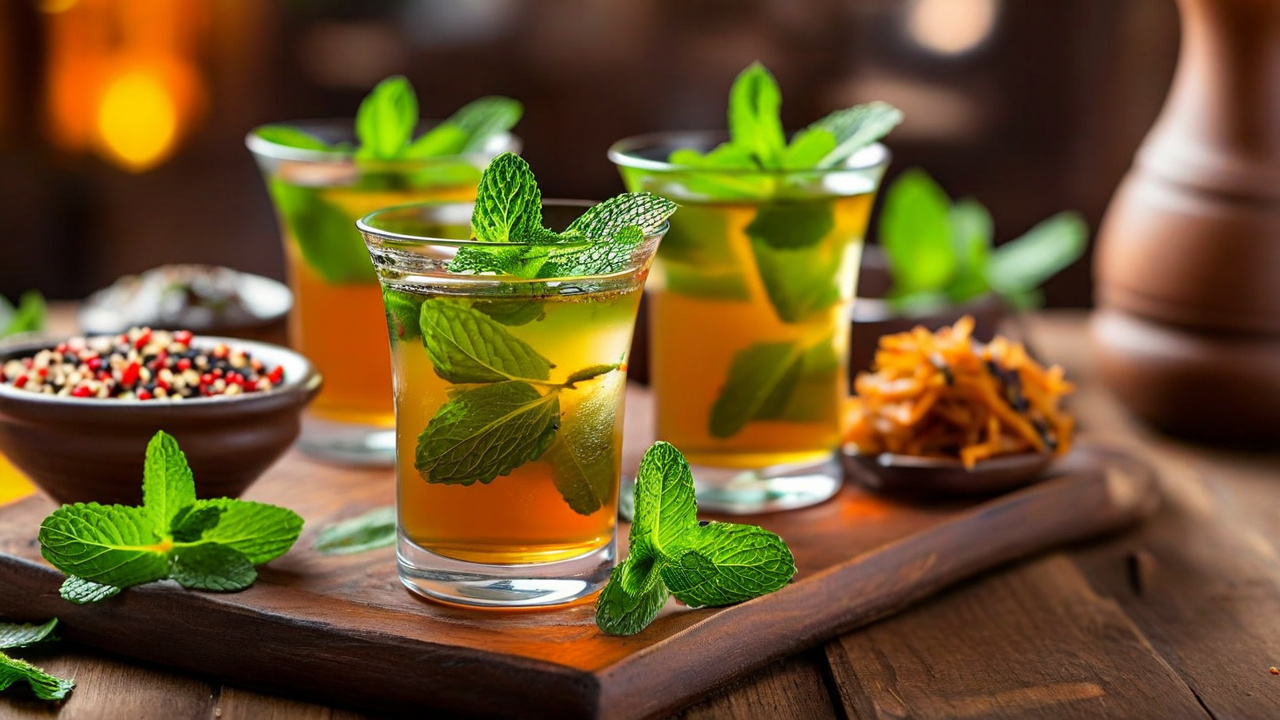
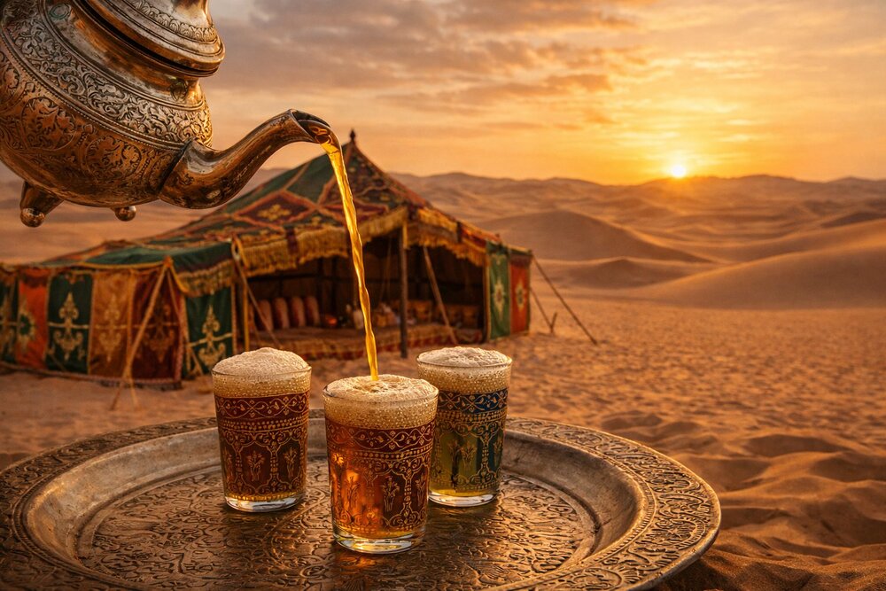
Tea is poured from a height to build the foam. Refusing all three rounds is the one reliable way to give offence.
19
🗻 Smara, Boujdour & the Free Zone
Smara (Es-Semara) is the only town in the territory that was not founded by Europeans. Ma al-Aynayn built it in the 1890s as a religious and military capital, with a stone zawiya, a mosque and a library said to have held thousands of manuscripts. A French column sacked it in 1913. The ruins of the zawiya still stand at the edge of the modern town, and for Sahrawis on both sides of the Berm, Smara is the closest thing the territory has to a spiritual centre — which is why one of the five refugee camps carries its name.
Boujdour (Bojador), midway down the coast, is a fishing town beside the cape that terrified fifteenth-century Portuguese navigators; getting past Cape Bojador in 1434 was the psychological breakthrough that opened the Atlantic route to the rest of Africa. Today it is a working port with a small, plain waterfront and a growing wind-energy sector.
The Free Zone east of the Berm is not accessible to ordinary travellers, and it is important to be blunt about why: it is a live military frontier with hostilities ongoing since November 2020, and it is heavily mined. The UN Mine Action Service reports having cleared 43 of 67 known minefields and 508 of 541 cluster-munition strike areas, rendering safe more than 30,000 items and releasing some 150 million square metres of land since 2008 — and having recorded more than a thousand mine casualties east of the Berm. Independent travellers who try to reach Tifariti or Bir Lehlou are turned back at best. Access, where it happens, is through the Polisario authorities from Tindouf, not from the Moroccan side.
20
🍲 Cuisine
An honesty note before the recipes. There is no large published canonical recipe corpus for Sahrawi cooking. It is a nomadic cuisine, transmitted in households, built on what a camel-herding family could carry or slaughter, and the quantities below are family-scale approximations rather than fixed measures. A great deal of what gets served in Laayoune and Dakhla restaurants is straightforwardly Moroccan — tagine, harira, pastilla — and should be enjoyed as such rather than relabelled. Where a dish is shared across the Saharan Hassaniya world or belongs to a neighbour, this page says so.
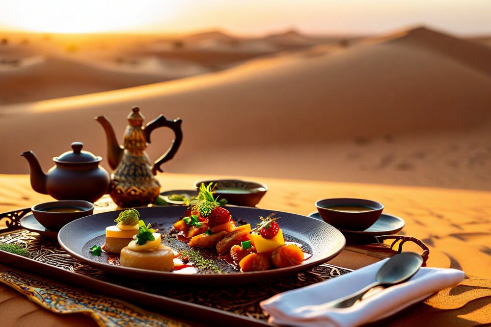
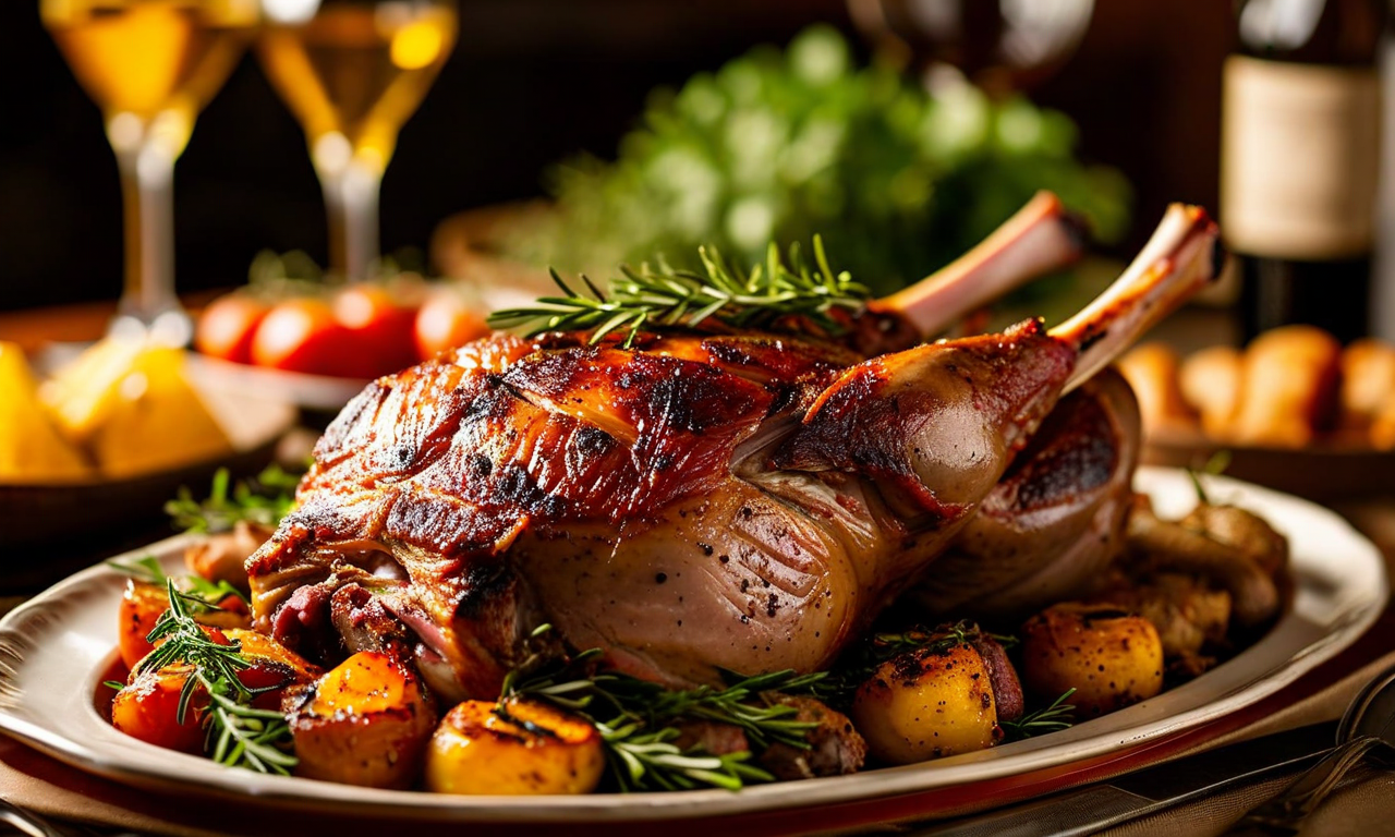
The genuine Sahrawi core is short and severe: camel, goat, barley, dates, milk, tea, and bread cooked in sand. Coastal tribes added fish, and Spanish rule left behind a taste for rice with fish that older Sahrawis still call arroz con pescado. Camel is not a novelty here — the Moroccan-administered zone counts roughly 105,000 camels against about 6,000 herders, and cooperatives in Dakhla and Guelmim now pasteurise camel milk and make yoghurt from it.
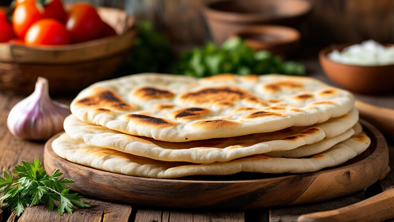
🍞 Khubz al-Mella — Sand Bread
Shared across Saharan nomad cultures — Sahrawi, Tuareg (as taguella), Algerian Saharan and Mauritanian. Not exclusive to Western Sahara.
You need: 500 g strong flour · ~300 ml water · 2 tsp salt. That is the whole list — no yeast, no fat.
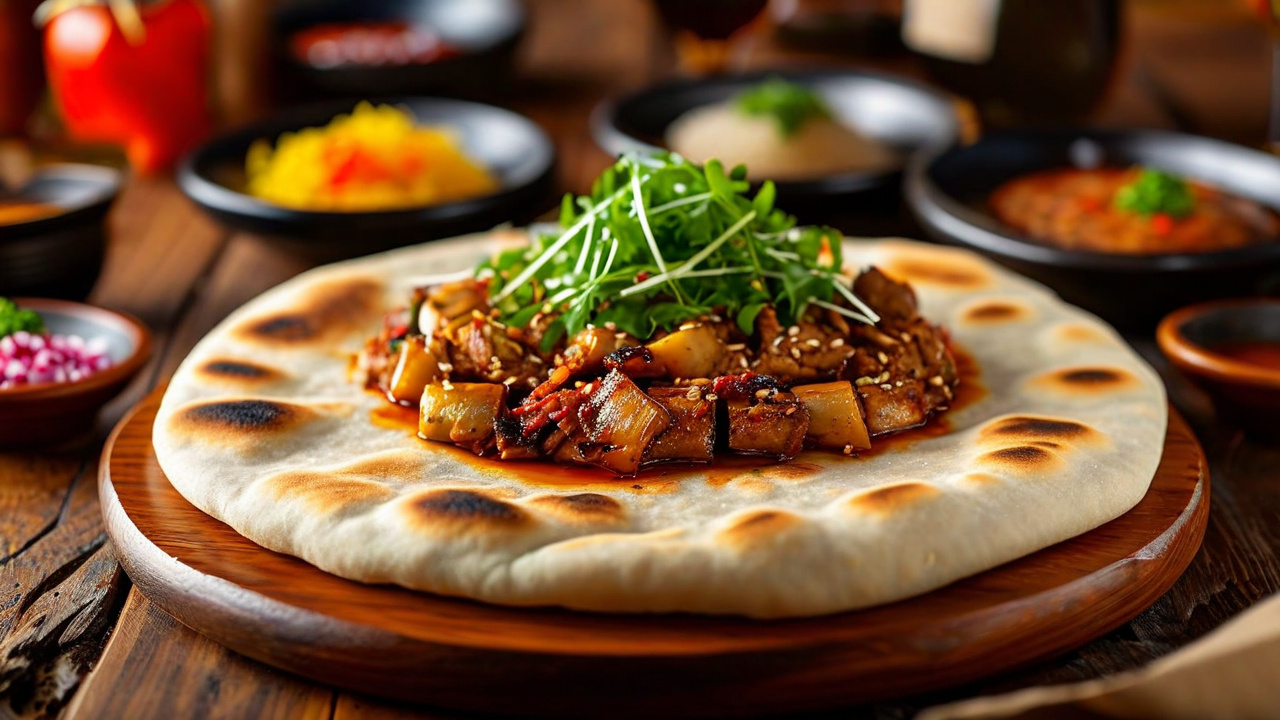
Method: Work flour, salt and water into a stiff, dense dough and shape it into a thick disc about 20 cm across. Build a fire on clean, dry sand and let it burn down to embers. Rake the embers aside and scoop out a shallow hollow in the superheated sand. Lay the disc in, cover it with hot sand, then rake the embers back over the top. Leave it 40–60 minutes. Lift it out, beat and brush it thoroughly — the surface takes a lot more cleaning than you expect — and break it by hand. It is dense, faintly smoky and keeps for days, which was always the point.
🌽 Camel Couscous
Couscous is pan-Maghrebi, not Sahrawi. What makes this version local is the meat.
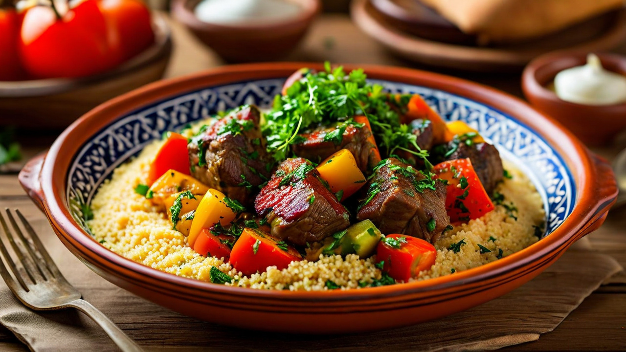
You need: 1 kg camel shoulder or shin, cubed · 500 g coarse couscous · 1 large onion · 200 g soaked chickpeas · carrots, turnip, pumpkin · 2 tsp ground ginger · 1 tsp turmeric · black pepper · a pinch of saffron · salt · olive oil.
Method: Camel is lean and takes time; start it early. Brown the meat with sliced onion, spices and oil in the base of a couscoussier, cover generously with water and simmer 2–3 hours with the chickpeas until it gives up. Add the hard vegetables for the last 40 minutes, the soft ones for the last 20. Meanwhile steam the couscous over the pot three separate times, raking it out between steamings with wet hands and a little oil so the grains stay separate. Mound the couscous, hollow the top, pile in meat and vegetables, and moisten with broth. Serve the remaining broth alongside.
🍲 Mreifisa
The one dish most often described specifically as a dish of this region — though the published sourcing is thin, so treat the detail as one household's version.
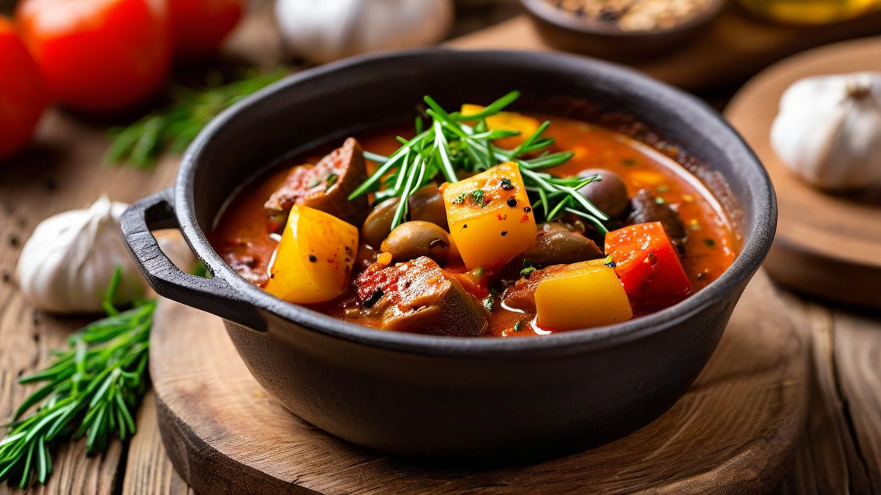
You need: 800 g camel, lamb or rabbit on the bone · 2 onions · 4 garlic cloves · 1 tsp cumin · 1 tsp black pepper · salt · oil or a spoon of clarified butter · one round of sand bread (above), torn.
Method: Brown the meat hard with sliced onion and crushed garlic. Add cumin, pepper and salt, cover with water and simmer, tightly lidded, until the meat pulls away from the bone — two hours for lamb, three for camel. The sauce should reduce to something thick and dark rather than soupy. Tear the sand bread into rough pieces across a wide communal dish, pour the stew and its sauce over so the bread drinks it, and eat from the shared plate with the right hand.
🥛 Boulaghmane (Beleghman)
Sahrawi and Mauritanian. Frequently mis-described online as "couscous with camel meat" — it is neither couscous nor a meat dish.
You need: 300 g barley flour · 60–80 g clarified butter (smen), camel-hump fat or oil · 2 tbsp sugar · a good pinch of salt · a little warm water.
Method: Toast the barley flour in a dry pan over a low flame, stirring constantly, until it darkens a shade and smells nutty — 8–10 minutes, and it will catch if you look away. Off the heat, work in the sugar and salt, then the melted fat, then just enough warm water to bring it to a thick paste. Eat it as a paste or roll it into balls. No cooking, no leavening, keeps for days, and a handful will carry an adult a long way. In the refugee camps a saltless variant called zammit has come back into daily use during food shortages, which tells you what this food is for.
Also worth seeking out: tichtar, camel meat cut into strips and air-dried for two to four days, which Slow Food lists on its Ark of Taste as at risk of disappearing; lehssa, a plain barley soup that is the standard dish for breaking the Ramadan fast; and zrig, milk or thinned yoghurt with sugar, drunk with dates. Do not be sold thieboudienne as Sahrawi — it is Senegal's national dish, from Saint-Louis, and it is on UNESCO's intangible heritage list as Senegalese. The same caution applies to amlou (Amazigh, from the argan-growing Souss valley — argan does not grow here) and couscous bidaoui, which means "Casablancan."
21
🔥 Desert Foodways — Scarcity, Skill & Hospitality
Sahrawi food is shaped by ingredients that travel well and by the ethics of sharing. Flour, barley, dates, milk, tea, dried foods, and meat can become generous meals through time, technique, and collective service. A dish's meaning often lies as much in who prepares and shares it as in a fixed recipe.
Sand-baked bread demonstrates practical ingenuity: dough is cooked beneath hot sand and embers, then cleaned and broken for a group. Camel milk and meat carry pastoral associations, while fish reflects the Atlantic economy. In cities, Moroccan, Canarian, Mauritanian, and global influences expand the table without erasing Sahrawi habits.
Guests should follow the host's rhythm, use the right hand when sharing communal food, and communicate dietary needs early. In Ramadan, eating and drinking publicly during daylight can be insensitive or restricted. Photography of preparation should always be requested, especially in private homes or camps.
22
🍷 Wine, Spirits & Drinking Culture
Western Sahara produces no wine, and there is no Kaufmann Wine Score for this page. That is a real absence rather than an omission: there is no viticulture, no distillery and no commercial alcohol production of any kind in the territory. The climate would not allow it without irrigation that nobody is going to spend on grapes, and the population is Muslim.
What travellers actually need to know is more specific than "it's a dry country," because it is not uniformly dry. In the Moroccan-administered zone the same rules apply as in Morocco proper: alcohol is legal, sold to foreigners, and served in licensed hotels and tourist restaurants. In practice this means Dakhla is where you can get a drink — the bars at North Lagoon, Palais Rhoul, Ocean Vagabond Lassarga and several kite camps serve beer, wine and spirits — and Dakhla is, memorably, the last place to buy a beer before crossing into the Islamic Republic of Mauritania, where alcohol is prohibited outright. Evidence for licensed venues in Laayoune is thin and this page will not claim either way.
In the Polisario-administered Free Zone and the refugee camps in Algeria, alcohol is effectively unavailable, and looking for it would be both futile and rude. Nowhere in Western Sahara is alcohol part of social life. Offering a drink to a Sahrawi host is a misstep; the correct offer is tea, and the tea is the whole ceremony.
23
🥤 Atay — The Three Rounds
If Western Sahara has a national institution that both sides of the Berm share without argument, it is tea. Atay (Hassaniya et-tay) is not a drink but a sitting, and it runs to three rounds poured from the same pot, each stronger and sweeter than the last.
Each round carries a meaning. The Sahrawi writer Senia Bachir Abderahman, from Smara camp, gives it as: the first glass is bitter as life, the second sweet as love, the third soft as death. Reporters who have sat through it in Laayoune record the same order. Note that order carefully — the version that circulates online with "bitter as death" first has the whole sequence backwards, and the sequence is the point: the bitterness comes first and the gentleness comes last.
The method: Chinese gunpowder green tea, fresh spearmint, and sugar in lumps, on a low charcoal brazier beside the tray. The maker — usually a man, and it is an honour rather than a chore — brews, then pours from two or three feet above the glasses, glass to glass, again and again. The height is not showmanship: it aerates the tea, dissolves the sugar and raises the head of foam that a good pour is judged on. The first inch goes back in the pot. He tastes repeatedly and adjusts. Some Sahrawi households add a little gum arabic (al-3elk), which is a genuinely local touch.
It can take twenty minutes or it can take three hours, and the length is a message about how welcome you are. Sahrawis drink it several times a day. Leaving before the third glass is the one reliable way to insult a host, and no explanation you offer will land. Sit down, take all three, and understand that the conversation is the thing being served.
Beyond tea: camel milk, fresh or as zrig, thinned with water and sugared; strong Moroccan coffee, sometimes spiced with cardamom or black pepper; and fresh juices in the coastal towns. Sahrawis do not have a cocktail culture, and inventing one for them here would be a fabrication.
24
☔ Climate & When to Go
Western Sahara has two climates that happen to share a country. On the coast, the cold Canary Current holds temperatures in an extraordinarily narrow band — Dakhla runs roughly 17–20°C at night and 22–27°C by day for most of the year, with sea fog, near-constant wind, and almost no rain. Fifty kilometres inland, the same day can be 45°C or more in summer, and winter nights near freezing. The territory as a whole gets under 50 mm of rain a year, and in places under 20 mm.
The wind that makes Dakhla is the north-easterly trade, strongest and steadiest from March to October, which is the kitesurfing season. The hazard in spring is the sirocco or chergui, a hot dust-bearing wind off the interior that can drop visibility to nothing and shut airports for a day.
📅 Best time to visit
October to April for general travel and the desert — comfortable days, cool nights, no interior furnace. April to September if you are coming to kitesurf: the wind is at its most reliable and the water is warm enough for a shorty. Avoid July–August inland unless heat is the attraction. Ramadan shifts opening hours and mealtimes across the whole territory; check the dates before booking.
25
✈ Getting There & Around
By air. Two airports matter. Hassan I Airport, Laayoune (EUN) handled 190,416 passengers in the first seven months of 2026, up nearly 11% year on year. Dakhla (VIL) is the busier tourist gateway. Both are served by Royal Air Maroc from Casablanca, Agadir and Marrakesh, and — the fact most guides omit — there are genuine international connections that do not route through mainland Morocco: Binter Canarias flies Gran Canaria to both Laayoune and Dakhla, putting the territory about ninety minutes from the Canary Islands, and Royal Air Maroc and Transavia France both serve Dakhla from Paris-Orly. Saying only that "flights operate from Casablanca and other Moroccan cities" understates how reachable this place has become.
By road from the north. The N1 runs the length of the territory on good tarmac. CTM and Supratours run long-distance coaches: Agadir to Laayoune is about 12 hours and roughly 266 MAD, Marrakesh to Laayoune about 16 hours and 387 MAD, Marrakesh to Dakhla about 24 hours and 545 MAD. Laayoune to Dakhla is roughly 540 km and 7–8 hours on quality asphalt. Expect several routine police checkpoints; have your passport out, expect to give your details, expect no trouble.
South to Mauritania: the Guerguerat crossing. This is the only open Morocco–Mauritania border and the only legal overland route between Europe and sub-Saharan Africa on this side of the continent — which means everyone driving to West Africa passes through Western Sahara. It lies about 367 km south of Dakhla, roughly five hours, and is generally open around 09:00–18:00. Between the Moroccan exit post and the Mauritanian entry post there is about 4 km of no-man's-land with no facilities and a well-earned reputation for wrecked cars and litter; fuel, food and a guesthouse exist only on the Moroccan side. A daily Supratours bus leaves Dakhla at 08:00 for the border (around 190 MAD, book a day ahead); a Mauritanian minibus leaves the border about 15:00 for Nouadhibou.
⚠ Mauritanian visa: the rule changed
Travel accounts from 2024 describe a straightforward visa-on-arrival at Guerguerat for about €55 in cash. Mauritania launched an e-Visa system on 5 January 2025 and multiple sources since then state that visa-on-arrival is no longer issued at land borders or airports; apply online through ANRPTS in advance, allowing several days. Some reports say the fee is still collected in exact euro or dollar cash at the post. Verify with the Mauritanian authorities before you commit to the drive — being turned around at Guerguerat means a five-hour return to Dakhla. Two further crossings, at Amgala and on a Smara–Bir Mogrein line, have been reported as planned but neither is confirmed open.
26
🚙 The Atlantic Road & Overland Reality
The paved Atlantic corridor connects Morocco with Laayoune, Boujdour, Dakhla, Guerguerat, and Mauritania. Distances are vast, services can be widely separated, and windblown sand, fatigue, livestock, heavy trucks, and nighttime visibility all create hazards. A route that looks simple on a map demands disciplined fuel and rest planning.
Police or gendarmerie checkpoints are common. Carry documents, remain patient, and answer questions consistently. Rules and sensitivities around photography apply especially near military, police, port, airport, energy, and communications infrastructure. Drones should never be assumed legal merely because they are sold or used elsewhere.
Leaving the highway requires local expertise. Old tracks may cross mined or militarized ground, mobile coverage is uneven, and mechanical recovery can be distant. Satellite communication and redundant water may be appropriate for organized expeditions, but equipment never substitutes for permissions, route knowledge, and a competent local operator.
27
📋 Practical Information
Entry. There is no separate Western Sahara immigration regime and no Western Sahara stamp. You clear Moroccan immigration, whether at Laayoune or Dakhla airport, at the Guerguerat land border, or earlier at Casablanca. Most Western nationalities — EU, UK, US, Canada, Australia — get 90 days visa-free; others need Morocco's 30-day e-Visa. Passport valid six months. There are no checks whatsoever on the road crossing the notional northern boundary.
Money. The Moroccan dirham (MAD) throughout the Moroccan-administered zone; the Algerian dinar circulates in the camps. In early September 2026 the dirham runs at roughly 9.3 MAD to the US dollar and 10.8 MAD to the euro — a rate that has barely moved in two years. ATMs are plentiful in Laayoune and Dakhla and cards are widely accepted, which is not something you can say about most of this latitude. Carry cash for the desert and the border.
Connectivity. Morocco's three operators — Maroc Telecom, Orange and Inwi — all bill Western Sahara at domestic rates, and 5G launched commercially in 2025. Guides disagree on whether all three genuinely have coverage here; they agree that Maroc Telecom has the best reach outside the towns, so buy that SIM if you are driving. Coverage in Laayoune and Dakhla is solid and sparse in between.
Language. Hassaniya Arabic in the street, Moroccan Darija and Modern Standard Arabic in offices, French in business and signage, Spanish among older and camp-educated Sahrawis, and enough English in the kite camps of Dakhla to get by. A few words of Hassaniya go a very long way.
Health. No mandatory vaccinations from most countries; hepatitis A, typhoid and tetanus are the usual recommendations. Drink bottled or filtered water. The genuine risks here are environmental rather than infectious: heat, dehydration and sun in the interior, and the sea, which is cold and has serious current outside the lagoon. Hospitals exist in Laayoune and Dakhla; anything complex means evacuation to Agadir or Casablanca, so take insurance that covers it.
Etiquette. This is a conservative Muslim society and a politically watchful one. Dress modestly away from kite beaches. Ask before photographing people, and do not photograph military installations, checkpoints, the Berm or police. Discussing the political status with strangers can put them at risk rather than you; let Sahrawis raise it if they want to. Right hand for eating and giving. Accept the tea.
28
🩺 Health, Water & Connectivity
Laayoune and Dakhla have pharmacies and medical facilities, but specialized care and evacuation options are limited compared with major Moroccan cities. Comprehensive insurance must explicitly cover the destination, planned activities, and evacuation; territorial status and official warnings can affect whether a policy responds.
Heat and dehydration are routine risks. Drink regularly, protect skin and eyes, manage salt intake sensibly, and avoid scheduling strenuous activity in peak afternoon heat. Wind and dust can aggravate respiratory conditions, while long road journeys increase fatigue and reduce access to prompt care.
Mobile data is generally available in the main western towns and along much of the principal road, but gaps remain. Download maps and essential documents, carry power banks, and tell a trusted contact your route. Connectivity becomes far less predictable away from the administered coastal corridor.
The US State Department issues no advisory for Western Sahara. Because Washington recognises Moroccan sovereignty, the territory falls under the Morocco advisory: Level 2 — Exercise Increased Caution, due to terrorism, reissued after periodic review on 21 April 2025, alongside the global Worldwide Caution.
That Level 2 is a nationwide terrorism rating and says nothing about the specific hazards here. The two that matter are landmines along and east of the Berm, and the fact that armed hostilities have been under way since the ceasefire collapsed on 13 November 2020. Neither affects Laayoune, Dakhla or the coast road, all of which are calm and routinely travelled.
In practice: the Moroccan-administered coastal zone is safe and heavily policed. Violent crime against visitors is rare, petty theft is lower than in Marrakesh or Casablanca, and the density of checkpoints means you are rarely far from an official. Solo travellers, including women, report the coast road as straightforward.
The hard limits are geographic. Do not attempt to approach or cross the Berm. Do not drive off tarmac in the eastern half of the territory. The UN Mine Action Service has cleared a great deal since 2008 but has recorded over a thousand mine casualties east of the wall, and reduced its own exclusion zone from 30 km to 15 km only in March 2025. Cluster-munition remnants are a separate and continuing problem. Independent travel into the Free Zone is not permitted from the Moroccan side and travellers who try are turned back.
Two smaller cautions. Photographing anything military, including checkpoints and the wall, will get your camera taken and possibly you detained. And political activity is not tolerated — foreign journalists and activists have been expelled from Laayoune, and Sahrawi human-rights defenders face serious consequences. If you are here as a tourist, be a tourist.
30
💰 Cost of Living & Budget
Western Sahara is cheaper than mainland Morocco for food and transport and dearer for accommodation, because supply is thin and much of it is built for the kitesurf market. Fuel is subsidised. A single person's monthly cost of living in Laayoune runs about US$623 with rent, US$449 without (mid-2026).
Item
Typical price
Budget hotel, Dakhla
US$19–23 / night
Mid-range hotel, Dakhla or Laayoune
€50–80 / night
Kite camp, full board, per week
€750–1,000 pp
Private kitesurf lesson
from €65 / hour
Half-day kite gear rental
~€40
Meal, local restaurant
40–80 MAD
Coach, Agadir–Laayoune (12 h)
266 MAD
Coach, Dakhla–Guerguerat border
190 MAD
Shared taxi within town
5–10 MAD
Small rental car
~US$25 / day
Coach fares are drawn from 2024–2026 traveller reports and drift upward; treat them as indicative. Kite-package prices are 2026 published rates.
31
🏨 Accommodation
Dakhla is where the interesting beds are, and almost all of them are strung along the lagoon road south of town at the "PK" kilometre markers rather than in the city. Dakhla Attitude is the best-known eco-resort — full board, kite and wing school, spa, padel — though recent reviews are mixed enough to be worth reading before booking. PK25 Hotel uses sandbag-walled bungalows for thermal control and sits on the water. Ocean Vagabond Lassarga, at the tip of the peninsula, runs its watersports centre under ION Club with IKO and VDWS instructors and has a bar. In town, Dar Rio Oro is a small French-run guesthouse with a rooftop terrace and free transfers, from around €77; being owner-operated, it is worth confirming directly before you rely on it. At the upper end, North Lagoon (adults-only) and Palais Rhoul & Spa are the four-star options, both licensed.
Laayoune is a business-hotel town. Sahara Line Hotel in the centre, twenty-five air-conditioned rooms, from about €50, is the reliable mid-range choice; Hotel Parador is the four-star near the airport with a garden, pool terrace and restaurant, around US$101–114. Sahariano Hotel City Center sits below them at about US$55. You will see the Hotel Nagjir recommended in older guides — it no longer has a live presence on the major booking platforms, so verify it exists before you plan around it.
There is no hostel scene, no significant camping infrastructure outside the kite camps, and effectively no tourist accommodation at all between Laayoune and Dakhla. Plan the drive as a single day.
32
🎉 Festivals & Events
FiSahara — the Sahara International Film Festival is the one genuinely singular event connected to this territory, and it does not take place in it. Founded with a first edition on 20–23 November 2003 and driven by the Peruvian director Javier Corcuera, it is the only film festival in the world held in a refugee camp — screenings projected onto walls and screens in the Sahrawi camps near Tindouf, with the audience seated on sand. Its top prize, the White Camel, is voted by that audience, and the trophy tradition is a live white she-camel given to the refugee family that hosted the winning team. After a two-year gap the 19th edition ran 27 April – 3 May 2026 in Ausserd camp under the theme "Walking to Our Land: The Radical Hope of Return," with more than 25 films and visitors from over twenty countries; the White Camel went to Cherien Dabis's All That's Left of You. The festival also founded a film school, the EFA Abidin Kaid Saleh, in Boujdour camp in 2011.
The Sahara Marathon, run in the same camps since 2001, is the other. The full 42.195 km route links three camps — El Aaiun to Auserd to Smara — with a half marathon, 10 km, 5 km and a children's race alongside; runners stay with Sahrawi families and the entry fee is explicitly part solidarity payment. The 2026 edition ran on 24 February 2026; the next is 7 March 2027.
In the Moroccan-administered zone the calendar is sporting and civic: the GKA Kite-Surf World Cup at Dakhla (a 2026 edition is scheduled for 4–11 October at West Point, still listed as unconfirmed), Moroccan national holidays including Green March Day on 6 November and Throne Day on 30 July, and the Islamic calendar — Ramadan, Eid al-Fitr and Eid al-Adha — which shapes everything.
27 February is SADR national day, marking the 1976 proclamation at Bir Lehlou; 2026 was the fiftieth anniversary, though reporting places the major commemorative events in April 2026 rather than on the date itself. It is observed in the camps and the Free Zone, not in Moroccan-administered towns.
33
📅 Cultural Calendar & Community Life
Public calendars vary by place and administration. Islamic dates move through the solar year, so Ramadan, Eid al-Fitr, and Eid al-Adha change season annually. Family schedules, opening hours, transport demand, and the pace of evenings can shift significantly during these periods.
Sahrawi cultural festivals celebrate poetry, music, camel traditions, handicrafts, film, and oral heritage. Some events are organized in Moroccan-administered cities, others in the Tindouf camps or abroad, and each setting carries its own institutions and political framing. Verify dates and access conditions directly with organizers.
Weddings and family gatherings may offer the richest cultural encounters, but an invitation is personal, not a tourism product. Dress respectfully, follow the host's lead, ask before photographing people, and be prepared for long evenings structured around conversation, food, music, and repeated rounds of tea.
34
🏛 UNESCO & World Heritage
Western Sahara has no UNESCO World Heritage Sites. That is a true zero, not a gap in this page. The territory is not a State Party to the World Heritage Convention — it is a Non-Self-Governing Territory and has no entry at all on the UNESCO States Parties register — so nothing here can be inscribed under its own name.
Nor is anything inscribed under Morocco's name that lies inside the territory. Morocco has nine World Heritage Sites, all cultural, and all nine are in Morocco proper: Fez, Marrakesh, Ait-Ben-Haddou, Meknes, Volubilis, Tetouan, Essaouira, El Jadida and Rabat. The nearest inscribed site to Western Sahara in any direction is Banc d'Arguin National Park in Mauritania.
There is exactly one thread connecting the territory to the World Heritage system, and it is a loose one. Morocco's Tentative List has carried an entry called "Parc national de Dakhla" (reference 1183) since 12 October 1998 — a proposed natural property of 14,160 km² covering about a tenth of Oued Eddahab province, justified under criterion (x) and citing the Cabo Blanco peninsula and its monk seals. It sits inside Western Sahara. It has never been nominated, and after twenty-eight years on the list there is no sign that it will be.
⚠ Two lists that get confused
Intangible Cultural Heritage is a different list and does not add to any World Heritage count. The Hassani cultural elements on it belong to neighbours: the Moussem of Tan-Tan (Morocco, Representative List 2008 — and Tan-Tan is north of the Western Sahara boundary), and the Moorish epic T'heydinn (Mauritania, Urgent Safeguarding List 2011), which is sung in Hassaniya but was inscribed by Mauritania. No element is inscribed as Sahrawi or as belonging to Western Sahara.
35
🌿 Nature & Protected Areas
Three Ramsar wetlands of international importance lie inside Western Sahara, all designated under Morocco:
Baie d'Ad-Dakhla (Ramsar site 1470, designated 15 January 2005) — 40,000 hectares of the Dakhla lagoon and bay. More than 120 mollusc species, 41 fish species, the northern limit of the Atlantic humpback dolphin, and the second most important wintering site for migratory waterbirds in the Moroccan-administered area, averaging around 60,000 birds.
Cote Aftissate-Boujdour (site 2377, designated 16 April 2019) — roughly 117 km² along 50 km of coast south of Boujdour.
Oued Assaquia Al Hamra at Laayoune (site 2382, 2019) — swamp and estuary of the great wadi, with marbled teal and common pochard.
⚠ Khnifiss Lagoon is not in Western Sahara
Khnifiss (Naila lagoon, Puerto Cansado) is routinely listed as a Western Saharan wetland, including in earlier versions of this page. It is not. It sits at roughly 28°N, between Tan-Tan and Tarfaya, some 35 km north of the 27°40' parallel that forms the boundary — in Morocco proper. The confusion is understandable: Morocco groups Tarfaya province, which is also north of the line, into the administrative region called Laayoune-Sakia El Hamra, so the region name straddles the border even though the lagoon does not.
Uncounted by Ramsar but ecologically the most significant place on the coast is Cintra Bay, about 120 km south of Dakhla — 24 km across, a wintering ground for waders, a sardine spawning area, and historically the only known calving ground of the eastern North Atlantic right whale, a population now functionally extinct. And at the far southern tip, the Cabo Blanco colony of Mediterranean monk seals holds roughly half the world's surviving population of the most endangered seal on Earth. The three breeding caves are on the western, Western Saharan side of the peninsula; the reserve is administered from Mauritania and almost every conservation source files it under Mauritania. Counts have risen from 109 individuals in the late 1990s to over 350 by 2018, and no more recent census is public.
36
🦩 Atlantic Lagoons, Birds & Marine Life
The meeting of Sahara and Atlantic creates productive coastal habitats. Dakhla Bay and other lagoons support migratory birds, fish nurseries, seagrass, and invertebrates, while upwelling offshore sustains rich marine food webs. Flamingos, terns, waders, raptors, and desert-adapted species reward patient observation.
These environments are vulnerable to disturbance from vehicles, construction, litter, uncontrolled recreation, and extraction. Kiteboarding and fishing economies can coexist with conservation only when operators respect breeding areas, access limits, and waste systems.
Wildlife watching is best done with local guides and long lenses. Keep distance from roosting birds and marine mammals, never drive onto vegetated flats, and avoid collecting shells, fossils, plants, or archaeological material. In a sparse landscape, damage that looks small can persist for years.
37
📈 Economy, Phosphate & Fish
Two resources explain most of what has happened here, and both are the subject of active legal dispute.
Phosphate. The Bou Craa deposit inland from Laayoune holds well over a billion tonnes and is worked by Phosboucraa, a wholly owned subsidiary of Morocco's OCP Group. Mining began in 1972, stopped in 1976 under Polisario attack, and restarted on a reduced scale in July 1982 once the first section of the Berm enclosed it. Rock travels to the port at El Marsa on a conveyor belt about 100 km long — described by NASA's Earth Observatory as the world's longest conveyor system, and long enough that its dust plume is visible from orbit. Output has run between one and two million tonnes a year over the past decade; 2025 was the biggest year since 2014, at about 2.02 million tonnes across 36 vessels, up from 1.45 Mt in 2024, worth roughly US$376 million. Only three companies bought it — buyers in India, Mexico and New Zealand — a record low, as European and North American purchasers have withdrawn over the legal uncertainty. Claims that Bou Craa produces three million tonnes a year, or represents a double-digit share of world production, do not survive contact with the shipping data.
Fish. The Canary Current upwelling makes these among the most productive waters in the Atlantic, and access to them was the substance of the EU–Morocco fisheries agreement. The Court of Justice of the EU annulled that agreement as it applied to Western Sahara on 4 October 2024, holding that the territory is separate and distinct from Morocco and that Sahrawi consent is required. The judgment did not stop the fishing; it did remove the European legal basis for it, and the practical arrangements are still being argued over in Brussels.
Around those two sit a state-driven build-out: the Dakhla Atlantic Port (see Dakhla), the Foum El Oued wind farm whose 22 turbines and 50 MW supply more than 99% of the Bou Craa mine's electricity, greenhouse agriculture around Dakhla exporting tomatoes and melons to Europe, offshore oil and gas exploration that has never yet found anything commercial, and very large public-sector employment. Tourism is small but is the fastest-growing part of it.
38
⛏️ Phosphate, Fisheries & Resource Politics
The Bou Craa phosphate mine and its long conveyor belt to the Atlantic are among Western Sahara's most visible industrial features. Offshore and coastal fisheries are also economically significant. Both sectors are entangled with arguments about sovereignty, consent, employment, trade, and who benefits from the resources of a territory whose final status remains unresolved.
Legal and political debates have reached European and international courts, trade negotiations, corporate policies, and investor campaigns. Readers should distinguish physical facts — where a mine, port, or fishing ground is located — from contested legal conclusions and advocacy claims.
For travelers, industrial sites are not casual attractions. Photography can draw official attention, access is controlled, and workers may not be free to discuss sensitive issues. The responsible approach is to use current primary sources, respect restrictions, and avoid turning local livelihoods into simplistic political scenery.
39
☀️ Renewable Energy, Water & Urban Growth
Strong wind and intense sun give the territory major renewable-energy potential, and wind and solar projects increasingly support urban grids and industry. These investments are promoted as development and decarbonization, while critics connect them to the same unresolved questions of representation and resource governance that surround phosphate and fisheries.
Water is the harder constraint. Cities rely on groundwater, desalination, distribution networks, and careful storage in an environment with minimal rainfall. Rapid urban growth, tourism, agriculture, and industry all increase demand, making infrastructure reliability and energy use inseparable from development planning.
Visitors can reduce pressure through ordinary choices: short showers, refillable bottles where safe filtration is available, minimal laundry, and accommodation that manages water and waste responsibly. Luxury in a desert should be judged partly by efficiency, not only by abundance.
40
💎 Hidden Gems
The White Dune, Dakhla — a mountain of pale sand collapsing directly into the lagoon about 40 km north of town. Go at low tide and walk out; go at sunset and don't.
Dragon Island — a low island in the lagoon you can reach on foot when the tide is out, and be stranded on when it comes back. Check the tables.
Asmaa hot spring — a genuinely hot sulphur pool in the middle of nothing, half an hour from Dakhla, used by locals rather than tourists.
The Bou Craa conveyor — you can see it crossing the desert on the road inland from Laayoune, a hundred kilometres of moving rock with a permanent dust cloud. It is the most extraordinary industrial object in the Sahara and almost nobody photographs it. Do not approach the mine itself.
Ma al-Aynayn's zawiya, Smara — the sacked stone ruin of the only town the Sahrawis built for themselves. Quiet, unrestored, and unvisited.
Lagoon oysters — farmed in Dakhla bay and sold by the dozen for less than a coffee costs in Europe, shucked in front of you at the roadside.
Cape Bojador — a plain headland that stopped European navigation for a century until Gil Eanes rounded it in 1434. There is nothing to see, and that is rather the point.
The Laayoune souk after dark — silverwork, camel-wool blankets and melhfas at a fraction of Marrakesh prices, sold without the performance.
41
🎒 Packing Tips
A cheche or long scarf. Not a souvenir — the single most useful object here, for sun, for blowing sand, and for the wind that never stops on the coast.
A windproof layer and something warm for the evening. People pack for "Sahara" and are cold by 9 pm. The coast rarely gets hot and the desert night is genuinely chilly.
Real sun protection — high-factor cream, a brimmed hat, and sunglasses that cope with glare off pale sand and water.
Modest clothing for towns and villages: covered shoulders and knees, loose rather than tight. Kite beaches are the exception, not the rule.
Cash in euros for the Mauritanian border if you are crossing, in clean notes; card machines do not exist between the two posts.
Offline maps and a paper backup. Coverage is good in the towns and disappears between them.
A reef-safe rash vest and a shorty if you are kiting — the Canary Current is colder than the air suggests.
Lip balm and eye drops. The combination of wind, salt and dust is harder on your face than the heat is.
Leave the drone at home. Drones are restricted in Morocco and flying one near a checkpoint, the port or the Berm will end your trip.
42
📚 Recommended Reading
A caution first: most Sahrawi literature is written in Spanish and very little of it is translated into English. The poets of the Generacion de la Amistad Saharaui, founded in Madrid on 9 July 2005, are the territory's real literary voice and are largely unavailable to English readers. What follows is what exists.
Tony Hodges, Western Sahara: The Roots of a Desert War (1983) — still the foundational English history, forty years on, and still the book everything else is measured against.
Toby Shelley, Endgame in the Western Sahara: What Future for Africa's Last Colony? (Zed Books, 2004) — the best single-volume account of the post-ceasefire deadlock.
Stephen Zunes & Jacob Mundy, Western Sahara: War, Nationalism, and Conflict Irresolution (Syracuse UP, 2010; 2nd edn 2022) — the standard academic treatment, and the one that most directly addresses why the resolution keeps failing.
Erik Jensen, Western Sahara: Anatomy of a Stalemate (Lynne Rienner, 2005) — written by the man who chaired MINURSO's Identification Commission, which makes it the insider account of exactly how the referendum died.
Sanmao, Stories of the Sahara (1976; English translation by Mike Fu, Bloomsbury 2019) — the Taiwanese writer's memoir of living near El Aaiun under Spanish rule, and by a wide margin the most-read book set in this territory anywhere in the world. It is a Chinese memoir of a colony rather than Sahrawi writing, and modern readers should expect a colonial-era gaze.
Sara Cheikh, Manana, Manana, Insha Allah (2023) — a Sahrawi author on returning to the camps.
43
🎬 Watch Before You Go
Search "Dakhla kitesurfing lagoon" — drone footage of the spit and lagoon explains the geography faster than any map.
"Bou Craa conveyor belt" — NASA Earth Observatory's satellite imagery of the dust plume, plus ground footage of the belt crossing open desert.
Aziza Brahim, Mawja (Glitterbeat, 2024) — full album and live sessions; the clearest introduction to modern Sahrawi music.
Group Doueh — Sublime Frequencies footage from Dakhla; Saharan modes played through a cranked electric guitar.
FiSahara festival — documentary coverage of films projected onto screens in a refugee camp, which is worth seeing even if you never go.
"Guerguerat border crossing" — overlander footage of the four kilometres of no-man's-land, useful and slightly alarming if you are driving south.
44
✨ Fascinating Facts
The territory's highest point has no name — an unremarkable 701-metre rise east of Aousserd. Very few countries can say that.
The minefield along the Berm is thought to be the longest continuous minefield on Earth.
Spanish is still widely spoken here — unusual in Africa outside Equatorial Guinea and the Spanish cities of Ceuta and Melilla — kept alive by camp schooling and Cuban scholarships.
The SADR is a full member of the African Union alongside Morocco, which does not recognise it — Morocco quit the OAU in 1984 over the SADR's admission and returned in 2017 anyway.
The Bou Craa conveyor belt is around 100 km long and its dust plume is visible from space.
Literacy in the refugee camps went from roughly 5% to about 90% in twenty years.
Rio de Oro — "river of gold" — has no river. Portuguese traders named it for the gold dust that came up the caravan routes.
Getting past Cape Bojador in 1434 was the psychological barrier that opened the Atlantic route down Africa; sailors believed the sea boiled beyond it.
Roughly half the world's Mediterranean monk seals — the most endangered seal alive — breed in caves at the territory's southern tip.
Laayoune is widely said to have the last McDonald's you will pass driving south through Africa — the next is in South Africa.
The only film festival on Earth held in a refugee camp gives away a live white camel as its top prize.
45
🏆 Notable People
Ma al-Aynayn (1830–1910) — scholar, Sufi shaykh and resistance leader who founded Smara in the 1890s and built its library. His descendants fought the French into the 1930s.
Aziza Brahim (b. 9 June 1976, in the Tindouf camps) — the international voice of Sahrawi music. Educated in Cuba, based in Spain, five albums on Glitterbeat, the most recent Mawja (2024). Her lyrics draw on her grandmother's poetry.
Mariem Hassan (1958–2015) — born at Uad Tazua near Smara, "the voice of the Sahara," recorded for Nubenegra from 1998. Her third solo album El Aaiun Egdat ("El Aaiun on fire," 2012) was written out of the Gdeim Izik protest. She died of bone cancer in a camp near Tindouf.
Group Doueh — the Dakhla family band who ran Hendrix and James Brown through Hassani modes; released internationally by Sublime Frequencies in the late 2000s.
Aminatou Haidar (b. 24 July 1966) — the best-known Sahrawi human-rights campaigner, awarded the Right Livelihood Award in 2019 for non-violent action in pursuit of self-determination. Frequently called "the Sahrawi Gandhi." Note that she was born in Akka, in Morocco proper, not in the territory.
Sultana Khaya (b. 1980, Boujdour) — activist, president of a Boujdour human-rights league, held under de facto house arrest from November 2020 until she left for medical treatment in Spain in 2022.
Brahim Ghali (b. 16 September 1949, Smara) — Polisario co-founder, and since July 2016 president of the SADR.
Mahfoud Ali Beiba (1953–2010) — born in El Aaiun; Polisario co-founder and, from 1997, the man who led Sahrawi delegations in every negotiation with Morocco.
Bahia Mahmud Awah (b. 1960, Auserd) — poet and anthropologist, honorary professor at the Universidad Autonoma de Madrid, and a founder of the Generacion de la Amistad Saharaui in 2005.
Najla Mohamed-Lamin — camp-born educator and climate activist, named to the BBC 100 Women list in 2023.
46
⚽ Sports
Sport here is shaped entirely by the political question, because eligibility is the political question. The Sahrawi Football Federation was formed in 1989 and belongs to neither FIFA nor CAF — CAF rejected its membership bid in 2023. It was provisionally affiliated to the N.F.-Board from December 2003, moved with that body's successor ConIFA, and in July 2020 became a founding member of the World Unity Football Alliance, which is now the body listed against the national team.
The team's real tournament history is a single competition: the 2012 VIVA World Cup in Erbil, Iraqi Kurdistan. It made its official debut on 4 June 2012 and lost 6–0 to Kurdistan; it then lost 2–6 to Occitania, beat Darfur 5–1 for its first official international victory, beat Raetia 3–0, and lost the fifth-place match. Getting there was harder than the football: the squad travelled on Sahrawi passports, was initially refused entry by Kurdish authorities who wanted them admitted as Moroccans, refused, and was let in after negotiation — then arranged deals with individual opponents to fly the Sahrawi flag that the organisers had agreed to keep down. The team has never played a match at a ConIFA World Football Cup; it was entered for the 2020 edition, withdrew for logistical reasons, and the tournament was then cancelled for COVID-19. A domestic Sahrawi Republic Cup has been played among camp teams since 2010.
At the multi-sport level the record is exclusion rather than results. The SADR was to compete at the 2015 African Games in Brazzaville and was ruled out by the organising committee on the grounds that it was not affiliated to the relevant international federations — whereupon Morocco withdrew from the Games in protest at the decision. There is no IOC-recognised National Olympic Committee, and this page will not publish a medal table for a team that has never had a start list.
The one athlete whose story carries the whole problem is Salah Ameidan, born in El Aaiun in 1982, recruited into the Moroccan national set-up at twelve and a multiple cross-country champion for Morocco. At a race in France in 2004 he crossed the line holding the Sahrawi flag, and then applied for political asylum. He has run for a French club ever since. He is the best distance runner this territory has produced and he has no flag to run under.
What actually happens on the ground is the Sahara Marathon in the camps each February, and, on the Moroccan side, kitesurfing — where Dakhla is a genuine world-class venue and a repeat host of the GKA Kite-Surf World Cup. Football is played everywhere, in sand, at all hours.
47
📰 Media & Press Freedom
Reporters Without Borders does not rank Western Sahara separately. Its World Press Freedom Index lists a single combined entity, "Morocco / Western Sahara," which in the 2026 Index ranks 105th of 180 with a score of 50.55 — a rise of fifteen places from 120th and 48.04 in 2025. The sub-scores are uneven: political 45.37, economic 35.11, legal 52.39, social 50.92, security 68.94, with the economic indicator the weakest.
RSF's own commentary names the Sahara first among the subjects on which journalists' work is obstructed, alongside the monarchy, Islam, the security services and coverage of demonstrations. A draft law creating a journalism oversight commission was withdrawn in 2026.
For a visitor the practical shape of this is simple: foreign journalists have repeatedly been denied entry to or expelled from Laayoune, there is no independent Sahrawi press operating openly inside the Moroccan-administered zone, and Sahrawi citizen-journalists who film protests face prosecution. The Sahara Press Service is the Polisario's agency and should be read as such; Moroccan outlets covering the territory should be read the same way. Nothing you read about this place, including this page, comes from a position of no position.
48
🔗 Resources
MINURSO (minurso.unmissions.org) — the UN mission's own site, with mandate documents and the Secretary-General's annual reports.
UN Mine Action Service (unmas.org) — current clearance data for the Berm minefields; the only reliable source on that hazard.
UNHCR Algeria — refugee-camp population figures and the Sahrawi Refugee Response Plan.
Western Sahara Resource Watch (wsrw.org) — shipping-manifest-level data on phosphate and fisheries exports. Campaigning in stance, rigorous with numbers.
Ramsar Sites Information Service (rsis.ramsar.org) — the official records for the three wetlands here.
UNESCO World Heritage Centre (whc.unesco.org) — where to confirm that the inscribed count really is zero.
US State Department (travel.state.gov) — the Morocco advisory, which is the one that applies.
UK FCDO and Global Affairs Canada — both publish more specific guidance on the Berm and mined areas than the US advisory does.
Visit Dakhla and Visit Laayoune — the Moroccan regional tourism boards, for hotels, operators and event dates.
Putting Western Sahara in a travel factbook is a political act and I would rather say so than pretend otherwise. It has its own page here because the United Nations lists it as a Non-Self-Governing Territory distinct from Morocco. That is a description of a legal status, not an endorsement of anybody's claim, and I have tried throughout to say who says what rather than to tell you who is right.
What surprised me was how little the argument touches the surface of a visit. You drive south from Tarfaya and there is no border, no stamp, no checkpoint marking the moment you cross a line that fifty years of diplomacy has failed to draw. The road is good. The petrol is cheap. The sea is on your right for six hours and it is the coldest, most crowded water in Africa, and you can watch men pulling octopus out of it from the shoulder of the road. Then Dakhla appears at the end of its sand spit with a lagoon so flat and shallow and blue that it looks like a rendering error, and there are Europeans on kites, and it is genuinely, uncomplicatedly wonderful.
And underneath that: a hundred kilometres of conveyor belt carrying rock to a ship. A wall you cannot see from the road with the longest minefield on earth beside it. A hundred and seventy thousand people in tents in Algeria who have been waiting since before I was born, whose grandchildren have never seen this coast, and who name their camps after towns they cannot visit — El Aaiun, Smara, Dakhla, Boujdour. The refugees and the kitesurfers use the same place names and mean different places.
I keep coming back to the tea, because it is the one thing everybody here shares and it happens to be the best possible instruction for how to be in this territory. Three rounds. Bitter as life, sweet as love, soft as death. It takes as long as it takes and you do not get to leave early. Sit down, take all three, ask fewer questions than you want to, and let people tell you only what they choose to tell you. The ground under your feet is contested, and the correct response to that is not to have an opinion ready but to be slower than you would be anywhere else.
—Radim Kaufmann, 2026
Support This Project 🌍
This World Travel Factbook is a labor of love — free to use for all travelers. If you find it helpful, consider supporting its continued development.