

🇬🇹 Guatemala at a Glance
🌍 Overview
Guatemala is 108,889 km² — about a third larger than Czechia — with somewhere around eighteen million people, which makes it the most populous country in Central America and one of the youngest populations in the Americas. It borders Mexico, Belize, Honduras and El Salvador, and it has coasts on both the Pacific and, briefly, the Caribbean.
It is also the country in the Americas where the indigenous present is most obviously alive. Roughly 44% of the population identifies as indigenous — Maya, plus the Xinka and the Garífuna — and twenty-two Mayan languages are still spoken, some of them by more than a million people. In the highland towns you will hear K'iche' or Kaqchikel in the market before you hear Spanish, and the woven clothing people wear is not a costume for visitors but the daily dress of a specific town.
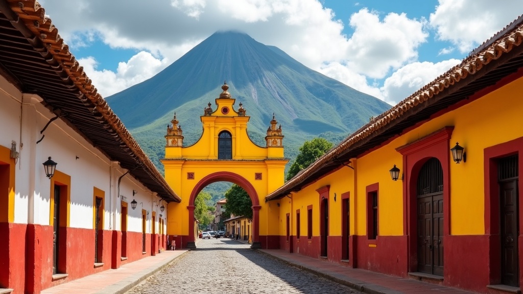
The geography is dramatic and dangerous in equal measure. A chain of thirty-seven volcanoes runs down the Pacific side, three or four of them active; Tajumulco at 4,220 m is the highest point in Central America. The highlands are cool, terraced and densely populated; the Pacific coast is hot and agricultural; and the north is the Petén, a huge lowland forest holding the Maya cities of Tikal and El Mirador.
And it is a country with a very heavy modern history that is not optional background: an American-backed coup in 1954, a thirty-six-year internal armed conflict that killed or disappeared some two hundred thousand people — the great majority of them Maya — and, in 2023 and 2024, a democratic transition that survived only because indigenous authorities blockaded the country for a hundred days to defend an election result. That last part happened recently enough that many guidebooks have not caught up.
🏷️ The Name and the Quetzal
"Guatemala" comes, through Spanish, from a Nahuatl word — Quauhtēmallān, usually glossed as "place of many trees" — used by the Tlaxcalan allies who came south with Pedro de Alvarado in 1524. It is therefore a Mexican name for a Maya country, given by a conquering army, and Guatemalans are entirely aware of that.
The national symbol is the resplendent quetzal, and it does a great deal of work. It is on the flag and the coat of arms, it gives its name to the currency, and it carries a story: that the quetzal will not live in captivity and dies if caged, which made it the emblem of liberty. The claim about dying in captivity is not literally true — quetzals have been kept alive in aviaries — but they do very badly in cages, and the symbolism has outlived the ornithology.
The flag
Two sky-blue bands either side of white, for the two oceans; the coat of arms in the centre with a quetzal, a scroll dated 15 September 1821, crossed rifles and crossed swords, framed in laurel. The blue and white come from the flag of the Federal Republic of Central America.
The quetzal, the money
One quetzal is divided into 100 centavos and has been remarkably stable for a Latin American currency — roughly 7.7 to the US dollar for years, which puts it in the region of 2.8–3 CZK. Prices in this guide are in quetzales, written Q.
Chapín
What Guatemalans call themselves, colloquially and affectionately — chapín, chapina. Origin disputed; possibly from the sound of a colonial-era shoe. Using it correctly will get you a smile.
Tecún Umán
The K'iche' lord who died fighting Alvarado in 1524 near today's Quetzaltenango, declared national hero in 1960. His image is on the currency and in every school, and how he is remembered — as a defeated Maya king, or as a founding national figure — is itself part of the argument about who Guatemala is.
🗺️ Geography
Guatemala divides into three worlds. The highlands — the altiplano — run east to west across the middle at between 1,500 and 3,000 m: cool, terraced, volcanic-soiled and densely populated, holding Guatemala City, Antigua, Quetzaltenango and the great majority of the Maya towns. This is where most Guatemalans live and where most visitors spend their time.
South of the highlands, a narrow Pacific plain drops to the sea: hot, humid, black-sand beaches, and the sugar cane, palm oil and cattle that dominate Guatemalan agribusiness. It is the least visited part of the country and the part with the most concentrated land ownership.
North and east lies the Petén, a third of the national territory and home to about 3% of its people: a limestone lowland of tropical forest, seasonal wetlands and the Maya Biosphere Reserve, which at 21,000 km² is the largest protected area in Central America. The Maya cities are here, and so is the country's most serious deforestation problem.
In between are two smaller regions worth naming: the Verapaces, cloud-forest karst country north of the highlands where the coffee and the quetzal habitat are, and the short Caribbean coast around Livingston and Puerto Barrios, which is culturally a different country again — Garífuna, Q'eqchi' and Afro-Caribbean rather than highland Maya, and reachable in practice only by boat.
🌋 Volcanoes and Earthquakes
Guatemala sits where the Cocos plate dives under the Caribbean plate, and everything about the country's shape and much about its history follows from that. There are 37 volcanoes, of which Fuego, Pacaya, Santiaguito and Tacaná are considered active.
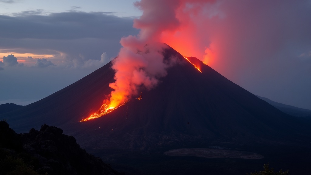
Volcán de Fuego erupts almost continuously in small bursts, which is why the Acatenango overnight is one of the great walks in the Americas — and on 3 June 2018 it produced a pyroclastic flow that buried the village of San Miguel Los Lotes on its southern flank. The official death toll was around 190 with several hundred more never found; it was the deadliest eruption in Guatemala in over a century, and the failures of warning and evacuation that preceded it remain a political scandal.
Acatenango
3,976 m, dormant, and the classic two-day trek from Antigua — up through four vegetation zones to a high camp with a view of Fuego erupting. It is cold at the top, genuinely hard for the unacclimatised, and worth every step. Go with an established operator.
Pacaya
2,552 m, active, and the easy one: a two-hour walk from Antigua's day trips, often with fresh lava fields to walk on and, when conditions allow, glowing rock close enough to toast a marshmallow, which the guides will encourage.
Tajumulco
4,220 m, dormant, the highest point in Central America, reached from Quetzaltenango as an overnight climb. Altitude is the difficulty rather than technique.
Santiaguito
The lava dome growing in the crater of Santa María near Quetzaltenango, in near-continuous eruption since 1922 and viewable from the rim of Santa María at dawn.
Earthquakes are the other half. The 1773 Santa Marta earthquake destroyed the colonial capital and forced the move to today's Guatemala City. The 1976 earthquake, magnitude 7.5, killed about 23,000 people and left more than a million homeless, and it is the event that shaped modern Guatemala City's sprawl. Buildings in the highlands are built with this in mind and visitors should note where the exits are, as everyone here does automatically.
🌡️ Climate and When to Go
Guatemala calls itself the land of eternal spring, and in the highlands that is close to true: Antigua and Guatemala City sit around 1,500 m and run 20–26 °C by day all year, with cool nights. Altitude, not latitude, decides the temperature — the Petén and the Pacific coast are hot and humid year-round, and Quetzaltenango at 2,330 m is genuinely cold at night.
There are two seasons. The dry season (verano) runs November to April: clear mornings, dusty afternoons, and the best months for volcano climbing and for the Petén. The wet season (invierno) runs May to October, with rain typically arriving in the afternoon rather than all day, and a peak of tropical-storm activity in September and October.
November–February
The best weather and the coolest nights. Clear volcano views, comfortable walking, and the high season. Christmas and New Year are busy; book Antigua well ahead.
March–April
Hot, dry and hazy — agricultural burning reduces visibility across the highlands from February. But Semana Santa in Antigua is the single greatest spectacle in the country, and Holy Week here is worth planning an entire trip around. Accommodation triples in price and sells out months ahead.
May–August
Green season. Afternoon rain, mornings usually clear, prices down and crowds thin. Excellent value and the landscape at its best; the volcano trails are muddy.
September–October
The wettest months and the peak of hurricane season on the Caribbean side. Landslides close highland roads. Cheapest, and for a first visit not the moment.
The short answer: November to February for weather, late March or April for Semana Santa, June for value and green landscapes. And whatever the month, bring layers — the temperature difference between a highland afternoon and a highland night is larger than most visitors expect.
🗺️ Map
Guatemala sits at the top of Central America, between Mexico to the north and west, Belize to the north-east, and Honduras and El Salvador to the south-east. Guatemala City is roughly 9,500 km from Prague; the main airport is La Aurora, inside the capital, with a second international airport at Flores for Tikal.
Orientation for planning: Guatemala City and Antigua are 45 minutes apart in the central highlands, and almost every itinerary starts there. West of them lie Lake Atitlán (2–3 hours), Chichicastenango and Quetzaltenango. North lie the Verapaces and Semuc Champey (a hard 7–9 hours), and beyond them Flores and Tikal in the Petén, which almost everyone flies to. East is Quiriguá, Río Dulce and the Caribbean at Livingston.
🗿 El Mirador and the First Cities
The oldest and in some ways the most startling Maya remains in Guatemala are not at Tikal but three hundred kilometres north of it, in the forest near the Mexican border. El Mirador flourished in the Preclassic period, from roughly 600 BC to AD 150 — centuries before the Classic cities everyone has heard of — and it was enormous.
Its pyramid La Danta is, by volume of construction material, among the largest ancient structures anywhere in the world, larger than the Great Pyramid of Giza if the platform it sits on is counted. The city was connected to its neighbours by raised limestone causeways, sacbeob, running dead straight for kilometres through swamp. It had monumental art, a state apparatus, and then, some time around AD 150, it was abandoned — the first Maya collapse, several centuries before the famous one.
Getting there is a five-day round trip on foot or by mule from Carmelita, or a helicopter charter, and it is genuinely one of the last great expedition-style archaeological visits in the Americas. There is a long-running and contested proposal to build road or rail access, which archaeologists and Petén communities are divided over.
El Mirador matters for the argument as much as the ruins. It demonstrates that Maya urbanism, monumental building and state organisation were fully developed a thousand years earlier than the older textbooks said, and LiDAR surveys since 2018 have mapped tens of thousands of previously unknown structures under the Petén canopy — a scale of ancient settlement nobody suspected.
🏛️ Tikal and the Classic Maya
Tikal was one of the great powers of the Classic Maya world, from roughly AD 200 to 900. At its height it may have held sixty thousand people in the city and several hundred thousand in the surrounding polity, with six great temple-pyramids around a ceremonial core, a ball court, causeways, reservoirs cut into the limestone, and a dynastic record carved on stelae that lets historians reconstruct the reigns of specific kings.
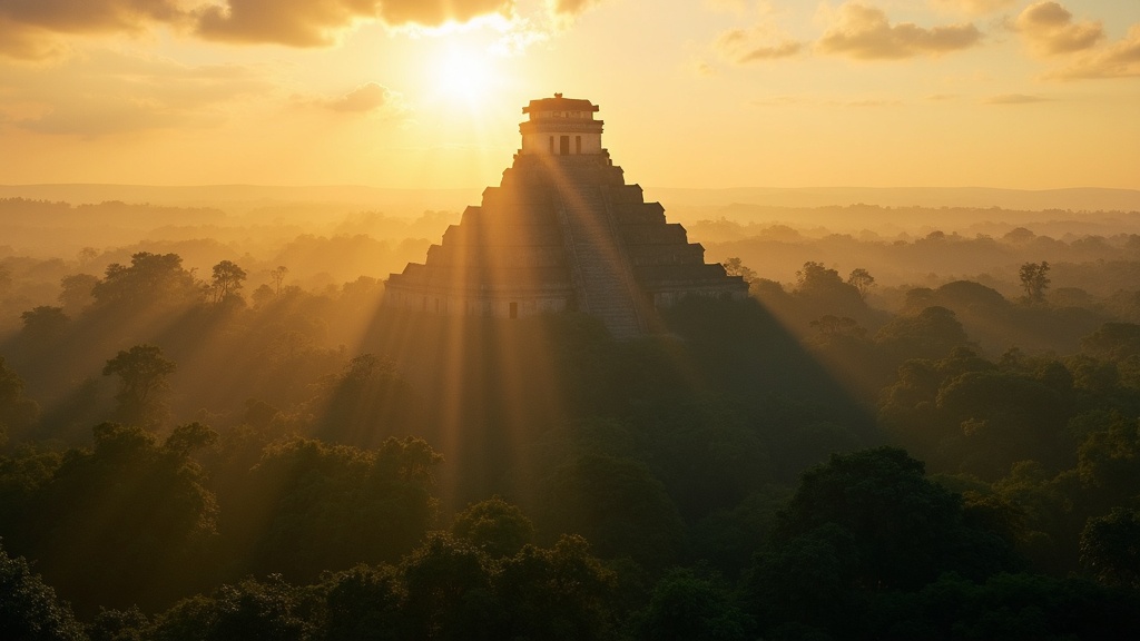
The city's history is legible in a way most ancient sites are not. In AD 378 an outsider named Siyaj K'ak' arrived — the inscriptions record the day — the local king died on the same date, and a new dynasty with strong ties to Teotihuacan in central Mexico took over. Tikal then fought a long war with Calakmul to the north, lost catastrophically in 562, spent 130 years in what archaeologists call the hiatus, and came back under Jasaw Chan K'awiil I, who defeated Calakmul in 695 and built Temple I over his own tomb.
Then, in the ninth century, Tikal and most of the southern lowland cities stopped. The Classic Maya collapse is now generally explained as a combination of severe multi-decade drought, exhausted soils, endemic warfare and a political system that could not absorb the shock — not as a single cause, and emphatically not as the Maya "disappearing". Six million Maya people live in Guatemala, Mexico, Belize and Honduras today.
Tikal was inscribed on the UNESCO World Heritage list in 1979 as one of the few mixed sites — recognised for its archaeology and its rainforest ecosystem together. It also, for a certain generation, is the rebel base on Yavin 4: the shot of the temples above the canopy in the 1977 Star Wars was filmed from Temple IV.
⚔️ Alvarado and the Colony
By the time the Spanish arrived the Classic cities were long abandoned and the highlands were divided between rival Maya kingdoms — the K'iche' at Q'umarkaj, the Kaqchikel at Iximché, the Tz'utujil at Atitlán and others. Pedro de Alvarado, sent south from Mexico by Cortés, arrived in 1524 with a small Spanish force and several thousand Nahua allies, and exploited those rivalries relentlessly.
The K'iche' were defeated near today's Quetzaltenango, where their lord Tecún Umán was killed — the founding scene of Guatemalan national myth, and one for which the historical evidence is thinner than the schoolbooks suggest. Q'umarkaj was burned. The Kaqchikel allied with Alvarado, were then turned on, and fought a guerrilla war for years. The last independent Maya polity in the region, the Itzá at Nojpetén on the lake at today's Flores, held out until 1697 — 173 years after Alvarado.
Colonial Guatemala became the seat of the Captaincy General, governing from Chiapas to Costa Rica. Its capital, Santiago de los Caballeros — today's Antigua — grew into one of the richest cities in the Spanish Americas, with a university from 1676, printing presses, and a great many churches, until earthquakes destroyed it in 1717 and finally in 1773, after which the capital was moved to the present site.
For the Maya, the colonial centuries meant catastrophic population loss from disease, the encomienda and forced resettlement into reducciones — the towns whose churches and street grids you see today. It also meant the survival, inside a Catholic framework, of a great deal that was not Catholic, which is the subject of its own section below.
☕ Coffee, Land and Forced Labour
Guatemala became independent from Spain on 15 September 1821, spent two decades in the Federal Republic of Central America, and emerged as a separate state in 1841. The event that shaped the next 150 years, though, was not independence but coffee.
From 1871 the Liberal reforms under Justo Rufino Barrios reorganised the country around coffee export. Communal indigenous land — held in common since the colonial period — was declared unused and transferred to private planters, largely Ladino and German. To supply labour, the state revived and expanded forced-work systems: the mandamiento, which requisitioned indigenous workers for the harvest, and vagrancy laws that made it a criminal offence for a rural man to be unable to prove he had worked a set number of days.
That is the origin of Guatemala's central structural problem. Land ownership here is among the most concentrated in the world — a small number of estates hold a very large share of arable land — and the correlation between that concentration and indigenous poverty is not an accident of history but the deliberate output of a policy.
The twentieth-century addition was the United Fruit Company, which by the 1930s owned vast landholdings, the railways, the Atlantic port and the country's telegraph system, paid minimal taxes under generous concessions, and was known locally simply as la frutera. When a Guatemalan government finally tried to expropriate some of its uncultivated land, the consequences were not local.
🌱 The Ten Years of Spring
In October 1944 a coalition of students, teachers and junior officers overthrew the dictator Jorge Ubico's successor and opened what Guatemalans call the Ten Years of Spring. Juan José Arévalo, a teacher, won the first free election with about 85% of the vote and introduced a labour code, social security, and the country's first serious public education programme.
His successor Jacobo Árbenz, elected in 1951, went further. Decree 900 of June 1952 expropriated uncultivated land from estates above a certain size, with compensation in government bonds at the value the owners themselves had declared for tax purposes — which was, in United Fruit's case, a small fraction of what the company said the land was worth. About 1.5 million acres were redistributed to something like 100,000 families. It was not communism; it was a land reform of a type the United States had itself sponsored in postwar Japan and Taiwan.
In 1954 the CIA ran Operation PBSuccess: a small mercenary force under Carlos Castillo Armas, a radio station broadcasting fake reports of an advancing army, aircraft over the capital, and an ultimatum to an army that declined to fight. Árbenz resigned on 27 June 1954 and went into exile. The land reform was reversed, the labour unions broken, and the political space that had opened in 1944 closed for forty years.
The declassified American documents are public and the CIA's own historians have written about the operation. In Guatemala it is not a historical curiosity: 1954 is the hinge on which the rest of the century turns, and Bernardo Arévalo — the president elected in 2023 — is Juan José Arévalo's son.
🕯️ The Thirty-Six Years
The armed conflict began in 1960 with a failed officers' revolt and ended with the Peace Accords of 29 December 1996. Over those thirty-six years, according to the UN-backed Historical Clarification Commission, roughly 200,000 people were killed or forcibly disappeared. The Commission attributed 93% of documented violations to the state and its paramilitaries, and found that 83% of identified victims were Maya.
The worst years were 1981–1983, under Generals Lucas García and then Efraín Ríos Montt, when the army conducted a scorched-earth campaign in the Ixil region and the western highlands: more than 600 massacres, whole villages destroyed, populations driven into the mountains or across the border into Mexico, and civil patrols in which men were forced to participate in the killing of their neighbours. The Commission concluded that acts of genocide were committed against specific Maya groups.
In May 2013 a Guatemalan court convicted Ríos Montt of genocide and crimes against humanity — the first time a former head of state had been convicted of genocide in his own country's courts. Ten days later the Constitutional Court annulled the verdict on procedural grounds. He died in 2018 during the retrial. The conviction is remembered, and so is its annulment.
For a visitor this is not academic. Many of the towns on the tourist route are places where these things happened, within living memory, to the parents of the people you will meet. There are memorial sites and community museums — at Nebaj, at Rabinal, at the site of the Dos Erres massacre — and the Museo de la Memoria in Guatemala City. It is appropriate to visit them; it is not appropriate to ask people casually about their families.
🏛️ CICIG, the Blockade and Arévalo
The peace of 1996 did not deliver the country the accords described. Impunity, organised crime and the capture of state institutions by networks of politicians, businessmen and former officers became the defining problem, and the most serious attempt to deal with it was an unusual international experiment.
The CICIG — the International Commission against Impunity in Guatemala, run by the UN at the Guatemalan government's own request from 2007 — worked alongside Guatemalan prosecutors and was extraordinarily effective. Its biggest case, La Línea in 2015, exposed a customs-fraud ring reaching the top of the state; mass protests followed, and President Otto Pérez Molina and his vice-president resigned and were arrested. It is one of the very few times in Latin America that a sitting president has been brought down by domestic prosecutors rather than a coup.
The backlash was equally effective. President Jimmy Morales, himself under investigation, declined to renew the CICIG's mandate and expelled it in 2019. In the years since, dozens of the prosecutors and judges who worked those cases have been criminally charged, forced from office or driven into exile.
Then came 2023. Bernardo Arévalo — son of the 1944 president, a sociologist running an anti-corruption party called Semilla that nobody had polled into contention — came second in the first round and won the run-off decisively. The Public Ministry under Attorney General Consuelo Porras then attempted, repeatedly, to suspend his party, annul the result and prosecute the electoral authorities. What stopped it was not the courts: it was the 48 Cantones of Totonicapán and other indigenous authorities, who called a national strike and held road blockades across the country for 106 days demanding the Attorney General resign and the result be respected. Arévalo took office on 14 January 2024. Guatemalans of every political stripe understand what that means: the country's democracy was defended by the people it has spent five hundred years excluding.
👥 The People
Guatemala's population is somewhere around eighteen million by international estimate — the 2018 census counted 14.9 million and is widely regarded as a significant undercount. Around 44% identify as indigenous: overwhelmingly Maya, with the smaller Xinka people in the south-east and the Garífuna — descended from shipwrecked West Africans and Caribs, deported from St Vincent by the British in 1797 — on the Caribbean coast. The rest are Ladino or mestizo, with small European, Chinese, Korean and Middle Eastern communities.
It is a young country: the median age is around 23, and roughly a third of the population is under fifteen. It is also a country that exports its young people. Somewhere between two and three million Guatemalans live in the United States, and their remittances — around a fifth of GDP — are the single largest source of foreign currency, larger than all exports combined. Whole highland towns are visibly built on money sent home, and the migration route north is a normal topic of household conversation.
The social indicators are hard. Chronic child malnutrition affects roughly half of children under five — among the highest rates in the world and by far the highest in the Americas — and it is concentrated in indigenous rural communities. Poverty, land access and school completion all break sharply along the same line.
Against that, Guatemalans are among the warmest and most formally courteous people a visitor will meet anywhere. Greetings matter — buenos días, buenas tardes, on entering any shop or boarding any bus — titles are used, and directness that would be normal in Prague reads as rudeness. Slow down, greet first, and the country opens up.
🗣️ Twenty-Five Languages
Spanish is the official language and the language of the state, but the National Languages Act of 2003 recognises twenty-five languages: Spanish, twenty-two Mayan languages, plus Xinka (unrelated to any other family and critically endangered) and Garífuna (an Arawakan language with African and Carib layers, on the UNESCO intangible heritage list).
The big four
K'iche' (roughly a million speakers, around Chichicastenango and Quiché), Q'eqchi' (Alta Verapaz and the Petén, and growing), Kaqchikel (Lake Atitlán and Chimaltenango) and Mam (Huehuetenango and San Marcos). These are not dialects of one another — a K'iche' speaker does not understand Mam.
The Popol Vuh
The K'iche' book of creation, the single most important surviving text of the pre-conquest Americas. The only manuscript to survive is the transcription and translation made around 1701–1703 by the Dominican friar Francisco Ximénez in Chichicastenango; the original is lost. It has been translated into Czech.
Spanish for visitors
English is not widely spoken outside hotels and tour agencies. Guatemalan Spanish is famously clear and slow by Latin American standards, which is exactly why the country is one of the world's best and cheapest places to learn it — see the section on language schools.
Words worth having
Maltiox — thank you, in K'iche'. Utz awäch — hello, in Kaqchikel. And the Guatemalan Spanish that will place you instantly: ¿qué onda?, chilero (great), cabal (exactly), shuco (dirty — and the name of the national hot dog).
🧵 Traje and the Backstrap Loom
The woven clothing worn by Maya women — the huipil blouse, the corte wrap skirt, the faja sash and in some towns a woven head-wrap called a tocoyal — is one of the richest living textile traditions on earth, and it is not a costume. It is what a great many women wear every day.
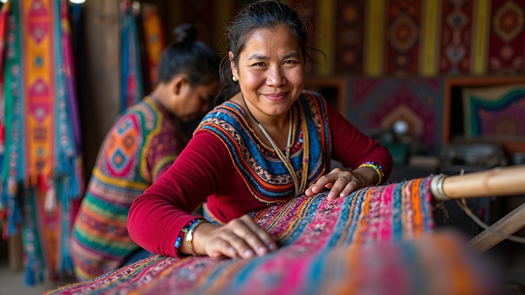
The point that most visitors miss is that the patterns are local. Each town has its own designs, colours and construction, to the extent that people can identify a stranger's home village at a glance. Nebaj is not Chichicastenango is not Santiago Atitlán is not Todos Santos, where the men wear red-and-white striped trousers that are recognisable from a kilometre away. Under the war this was dangerous: a huipil identified where a person came from, and in the early 1980s that could be enough.
How to buy well
Buy from a weavers' cooperative or directly from the maker rather than from a reseller, and expect a genuine hand-woven huipil to cost several hundred quetzales at minimum — because it represents weeks of work. Cheap "típico" in tourist markets is often machine-made and often not even Guatemalan.
Cooperatives
There are excellent ones: Trama Textiles in Quetzaltenango, the Lema' cooperative and others around Atitlán, and the Museo Ixchel in Guatemala City for the historical collection. Several run weaving workshops for visitors, which is the best way to understand why the prices are what they are.
Second-hand
Worn huipiles are sold in bulk in markets and are often the finest weaving you will see, since the best pieces were made for the maker's own use. They are also somebody's actual clothing, which is worth thinking about.
Photographing people
Ask first, every time, and accept no as an answer. Some communities have specific prohibitions, and in a country with this recent history, a stranger photographing indigenous people without permission carries a weight that has nothing to do with your intentions.
🕯️ Two Religions, One Building
Guatemala is nominally Catholic and increasingly evangelical — Protestant churches, mostly Pentecostal, now claim something approaching 40% of the population, one of the highest shares in Latin America, and the growth dates from exactly the war years when the Catholic Church was associated with liberation theology and was itself being targeted.
What sits underneath both is Maya spirituality, which never went away. The 260-day ritual calendar, the cholq'ij, is still counted; ajq'ijab', daykeepers, still perform ceremonies at hilltop altars and at archaeological sites; and the fire ceremonies you may see at Iximché or at the shrines above Chichicastenango are not reconstructions.
The syncretism is most visible in the church of Santo Tomás in Chichicastenango, where K'iche' families burn copal incense and light candles on the front steps before entering, and where the interior floor is used for offerings of flowers and maize alongside the Catholic saints. The eighteen steps of the church are said to correspond to the months of the Maya solar calendar.
And then there is Maximón — also called Rilaj Mam or San Simón — a folk saint honoured in Santiago Atitlán, San Andrés Itzapa and elsewhere: a wooden effigy in a hat and tie who receives offerings of cigarettes, aguardiente and money, is moved to a different household every year, and is understood by his devotees as neither entirely a saint nor entirely something else. Visitors may usually enter for a small fee. Photography costs extra, and you ask.
🎉 Semana Santa, Kites and Fiambre
Semana Santa in Antigua is the great one, and it is on a scale that is hard to convey: processions of thousands, floats (andas) carried by up to a hundred bearers at a time, and above all the alfombras — carpets laid in the street from dyed sawdust, flowers, pine needles and fruit, worked on through the night by whole families, and destroyed by the procession that walks over them a few hours later. Guatemalan Holy Week was inscribed on the UNESCO intangible cultural heritage list in 2022.
Giant kites
On 1 November at Sumpango and Santiago Sacatepéquez, kites up to twenty metres across, built over months from bamboo and tissue paper and carrying political and community messages, are raised in the cemetery to communicate with the dead. Some are flown; the biggest are simply stood up, and their collapse is part of the day.
Fiambre
Eaten on 1 and 2 November and nothing else: a cold platter with fifty or more ingredients — cured meats, pickled vegetables, cheeses, sausages, beets, all marinated together — made to a family recipe and shared at the graveside. It is genuinely strange, genuinely delicious, and available for about three days a year.
Quema del Diablo
7 December, the burning of the devil: households sweep out the year's accumulated rubbish and grudges and set fire to a devil effigy in the street at six in the evening. Air quality that night in Guatemala City is a public-health topic and the tradition is under pressure.
Rabin Ajaw
The national indigenous festival at Cobán in late July, alongside the folklore festival, where representatives of Maya communities across the country gather. Considerably less staged than it sounds, and the best single event for hearing Mayan languages spoken publicly.
🍽️ Food
Guatemalan cooking is Maya at the base with Spanish and, in the Caribbean, African layers on top. The base is maize — nixtamalised, ground and pressed into tortillas that are made fresh three times a day and are noticeably thicker, smaller and better than Mexican ones — plus black beans, chillies, squash, and the toasted-seed sauces that are the country's real signature.
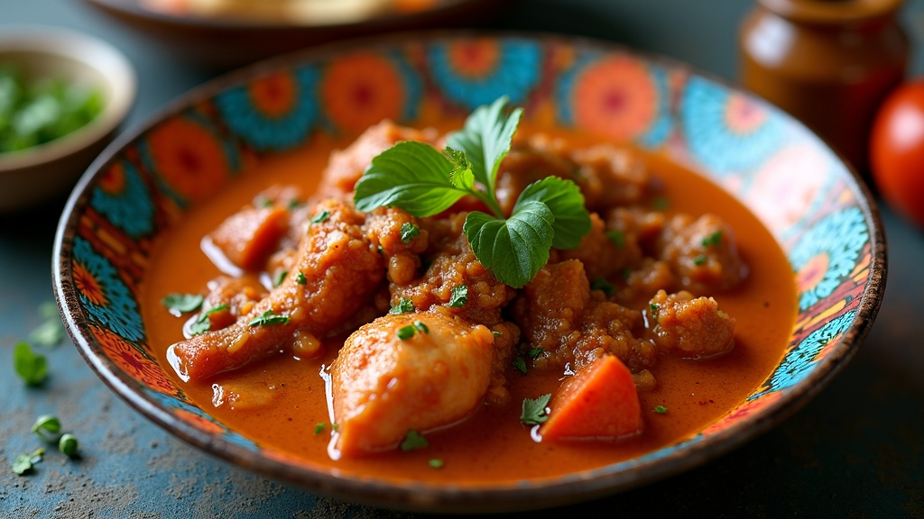
Pepián
The national dish and one of the oldest — a stew of chicken, beef or pork in a sauce of toasted seeds, dried chillies and tomato, served with rice and tortillas. There is a strong case that it predates the conquest in its essentials.
Kak'ik
The Q'eqchi' turkey soup from Alta Verapaz: turkey in a bright red broth of achiote, tomato, coriander and the fiery cobanero chilli, served with tamalitos. Recognised as national cultural heritage, and worth going to Cobán for.
Jocón
The green one: chicken in a sauce of tomatillo, green chilli and coriander, thickened with toasted seeds and tortilla. Lighter than pepián and the easiest of the three to love immediately.
Tamales
A whole family of them, and the Sunday and Christmas food: tamales colorados in banana leaf, chuchitos smaller and in corn husk, paches made with potato, and the Christmas Eve ritual of making them by the hundred.
Street food to look for: shucos, the Guatemalan hot dog with guacamole, cabbage and mayonnaise, sold from carts and named for being messy; rellenitos, mashed plantain stuffed with sweetened black bean and fried; elotes locos, corn on the cob with every condiment at once; and atol — maize or plantain drinks sold hot from pots at markets in the morning, of which atol de elote is the gateway.
🍲 Pepián de Pollo
Pepián is Guatemala's national dish and its technique is the thing to learn: seeds and chillies are dry-toasted on a griddle until they are dark and smell of smoke, then ground into a sauce. That toasting is what separates a real pepián from a stew with spices in it.
Pepián de pollo
Serves 4 · about 1 hour 30 minutes
Ingredients: 1 chicken, jointed (or 1 kg thighs and drumsticks); 80 g pumpkin seeds (pepitas, unsalted); 50 g sesame seeds; 3 dried guajillo chillies and 2 dried pasilla or ancho, stemmed and seeded; 500 g tomatoes; 4 tomatillos if you can get them; 1 onion; 4 cloves garlic; 1 small cinnamon stick; 4 cloves; 1 corn tortilla; a small bunch of coriander; 1 l chicken stock; salt.
Method: Simmer the chicken in the stock with half the onion for 30 minutes and keep the broth. Meanwhile heat a dry heavy pan and toast, separately and carefully: the pumpkin seeds until they pop and darken, the sesame until gold, the chillies for 30 seconds a side until they smell but do not burn, the tomatoes, tomatillos, remaining onion and unpeeled garlic until blackened in patches, and finally the tortilla until stiff. Soak the chillies in hot water 15 minutes. Blend everything — seeds, chillies, charred vegetables, peeled garlic, tortilla, cinnamon and cloves — with a ladle of broth until completely smooth; pass it through a sieve if you want it restaurant-smooth. Fry the sauce in a little oil in a deep pot for 5 minutes, stirring, until it darkens and thickens, then add the chicken and enough broth to make a coating sauce and simmer 20 minutes. Finish with coriander and salt, and serve with white rice and tortillas.
💡 Burnt is not toasted. Pumpkin seeds go from perfect to bitter in about twenty seconds — take them off the heat while the last ones are still popping, and use a pan you can see into.
☕ Coffee
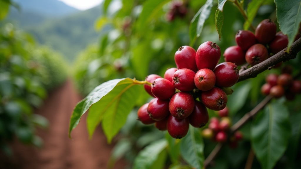
Guatemala is one of the world's reference origins for high-grown Arabica, and the reason is the combination the country has by accident: volcanic soil, altitudes from 1,300 to over 2,000 m, and a huge diurnal temperature range that slows the cherry's development and concentrates the sugars.
The eight regions
Anacafé, the national association, markets eight defined origins: Antigua (the famous one — full-bodied, volcanic, high), Atitlán, Huehuetenango (the highest, bright and fruity, and the one specialty buyers chase), Cobán (wet and fine-bodied), Fraijanes, San Marcos, Nuevo Oriente and Acatenango.
Visiting a finca
Tours from Antigua (Finca Filadelfia, De la Gente in San Miguel Escobar) and around Atitlán and Cobán take you through picking, depulping, fermenting, drying on patios and roasting, usually in about three hours. The cooperative-run ones return more to the growers.
What to buy
Whole beans from a specific finca or cooperative, roasted within the last few weeks, rather than a supermarket bag. Prices in Antigua are Q70–150 for a good 340 g bag — roughly 200–450 CZK — which is far below what the same coffee costs in Prague.
The uncomfortable part
Coffee is why the land was taken and why the forced-labour laws existed, and the wage a picker earns per quintal today is still a live dispute. Buying from a grower cooperative rather than an exporter is the one thing a visitor can do that actually changes the arithmetic.
🥃 Rum, Cacao and What Else to Drink
Ron Zacapa is Guatemala's international calling card: a rum made from virgin sugar-cane honey rather than molasses, aged in a solera system at about 2,300 m above Quetzaltenango — the ageing warehouse is called the House Above the Clouds, and the altitude slows evaporation and changes how the rum matures. Zacapa 23 is the one everyone knows; the older expressions are better and are cheaper here than anywhere.
Cacao is the older story. The Maya domesticated it, drank it unsweetened with chilli and maize, used the beans as currency, and the word cacao itself comes to European languages from Mesoamerica. Guatemala grows fine-flavour cacao in Alta Verapaz, Suchitepéquez and Izabal, and there is now a small bean-to-bar sector — Danta, Fernando's and others — plus cacao ceremonies aimed at visitors, which range from serious to entirely invented.
Beer
Gallo is the ubiquitous national lager and the object of considerable national affection; Moza is a dark bock and much better. Antigua and Guatemala City both have real craft breweries now.
Non-alcoholic
Atol de elote and atol blanco from market pots; horchata; rosa de Jamaica, hibiscus; fresh licuados made with water or milk; and coffee, which in an ordinary comedor is often surprisingly bad because the good beans are exported — ask for it in a specialty café instead.
Cusha
The clandestine home-distilled cane spirit of the highlands, illegal, variable and traditional. It is offered at fiestas and in villages and it is not something to seek out from a stranger.
Prices
A beer in a comedor Q15–25, in a bar in Antigua Q25–45 (roughly 45–130 CZK); a bottle of Zacapa 23 at duty-free or a supermarket around Q350–450. Alcohol sales are restricted on election days and during some religious observances.
🌟 Guatemalans Worth Knowing
Rigoberta Menchú (b. 1959)
K'iche' activist, Nobel Peace Prize 1992 for her work on indigenous rights, whose testimony I, Rigoberta Menchú brought the war to international attention. The book's factual details were later disputed by an American anthropologist and defended by many historians; the massacres it describes are documented by the truth commission regardless. She has since run for president twice.
Miguel Ángel Asturias (1899–1974)
Nobel Prize in Literature 1967, and a founder of Latin American magical realism before the term existed. El Señor Presidente, on dictatorship, and the Banana Trilogy, on United Fruit, are the essential ones; several exist in Czech translation.
Jacobo Árbenz (1913–1971)
President 1951–54, author of the land reform, removed by the CIA operation of 1954 and dead in exile in Mexico. In 2011 the Guatemalan state formally apologised to his family. His rehabilitation is one of the clearest markers of how the country's self-understanding has changed.
Luis von Ahn (b. 1978)
Guatemalan computer scientist, inventor of CAPTCHA and reCAPTCHA, and co-founder of Duolingo. Probably the most globally consequential living Guatemalan and a substantial funder of education projects at home.
Bernardo Arévalo (b. 1958)
President since January 2024, sociologist, former diplomat, and son of the 1945–51 president Juan José Arévalo — born in exile in Uruguay after 1954. Elected on an anti-corruption platform and inaugurated only after months of legal attacks and a national indigenous strike in defence of the result.
Ricardo Arjona (b. 1964)
Singer-songwriter, one of the biggest-selling Spanish-language artists of the last thirty years, former schoolteacher and basketball player. You will hear him. Repeatedly.
🏛️ Antigua Guatemala
Antigua was the capital of the whole Spanish Captaincy General from 1543 until an earthquake destroyed it in 1773, and it was rich: a university from 1676, printing presses, thirty-odd churches and convents for a city of perhaps sixty thousand. When the capital moved, Antigua was left largely as it fell, which is why it is now a UNESCO World Heritage Site (1979) and one of the best-preserved Spanish colonial towns anywhere.
It is a grid of cobbled streets between one-storey houses in ochre, indigo and burnt orange, with ruined baroque churches standing roofless at the corners and three volcanoes on the skyline — Agua directly south, Fuego and Acatenango to the west. It is also, unambiguously, the most touristed place in Guatemala, and the surprise is how well it carries it.
What to see
The Santa Catalina arch; the ruins of the cathedral behind the Parque Central, where you can walk down into the crypts; the enormous Convento de las Capuchinas; the Iglesia y Convento de San Francisco with the tomb of Hermano Pedro; and Cerro de la Cruz above the town for the classic view down the street grid to Agua.
Semana Santa
The reason to come, and the reason to book six months out. Processions run through Lent and reach their peak on Good Friday; the sawdust alfombras are laid overnight and destroyed by dawn. Expect crowds, closed streets and hotel rates three or four times normal.
Spanish schools
Antigua is one of the world's great places to learn Spanish: twenty hours a week of one-to-one tuition plus a homestay with meals runs somewhere around US$200–300 a week. Choose a school that pays its teachers properly — several are cooperatives and will say so.
Base for everything
Volcano treks (Acatenango, Pacaya), coffee fincas, chocolate workshops, shuttles to Atitlán and Chichicastenango. Many travellers use Antigua as a base for a week and see half the country from it.
🏙️ Guatemala City
Most visitors treat the capital as an airport with a city attached, and most guidebooks encourage it. That is a mistake, though a comprehensible one: Guatemala City is a sprawling, traffic-choked, unevenly safe metropolis of around three million where the good parts are not obvious from a taxi window.
Zona 1
The historic centre: the Parque Central, the cathedral with the names of the disappeared carved on its pillars, the Palacio Nacional, the Mercado Central and the Casa MIMA house museum. Fine by day, and this is where the country's political life visibly happens.
Zona 13
The museum district by the airport: the Museo Nacional de Arqueología y Etnología, which holds the best Maya collection in the country including stelae and jade from Tikal, and the Museo Ixchel and Museo Popol Vuh in Zona 15 — textiles and ceramics respectively, both excellent and both usually empty.
Zonas 4, 10 and 14
Where the restaurants, hotels and nightlife are. Zona 4's converted warehouses (Cuatro Grados Norte) are the creative quarter; Zona 10, the Zona Viva, is the safe international-hotel district.
What to avoid
Zones 3, 6, 18 and 21 have serious gang presence and there is no reason for a visitor to be in them. Do not walk between zones at night; use Uber, which works well here and is the standard local advice.
Two things are worth the detour even on a short stay. The Museo de la Memoria and the archive projects documenting the war are among the most serious human-rights museums in the Americas. And the Kaminaljuyú site, inside the city, is a major Preclassic Maya centre that the capital was built on top of — most of it is under suburbs, and what is left is a park with grass-covered mounds and very few visitors.
🌋 Lake Atitlán
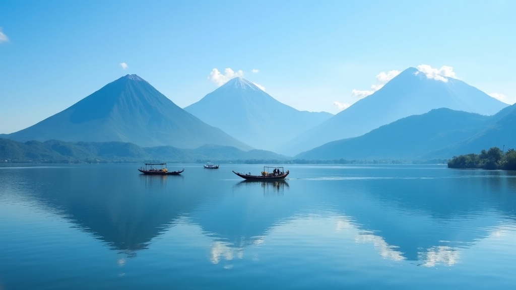
Aldous Huxley called it the most beautiful lake in the world and then complained that it was too much of a good thing, and both halves of that are fair. Atitlán fills a caldera left by an enormous eruption about 84,000 years ago, sits at 1,560 m, is around 340 m deep, and has three volcanoes standing along its southern shore — San Pedro, Tolimán and Atitlán.
Panajachel
The gateway, reached by road, with the boat docks, the hotels and Calle Santander's craft market. Not the prettiest village on the lake and the one everything runs through.
San Juan la Laguna
The one to prioritise: a Tz'utujil town that has built its tourism around weaving cooperatives, natural-dye workshops, coffee and painting, run by the community rather than for it. Clean, calm and genuinely interesting.
Santiago Atitlán
The largest lakeside town, with the church where Father Stanley Rother — an American priest murdered by a death squad in 1981, now beatified — is remembered, and with the shrine of Maximón, which moves house every year and which anyone can visit.
San Marcos and San Pedro
San Marcos is the yoga-and-retreat village and has been for thirty years; San Pedro is the backpacker one with the language schools and the cheap beds. Both are pleasant, both are very much not representative of the lake.
One serious note. The lake's water quality has deteriorated badly — cyanobacteria blooms since 2009, driven by untreated sewage from the shoreline towns and agricultural runoff — and it is a genuine environmental and public-health emergency for the roughly 300,000 people who depend on it. Swimming is generally fine away from the towns and after checking locally; the long-term picture is not fine, and local organisations working on it are worth supporting.
🧺 Chichicastenango and the Western Highlands
Chichicastenango holds one of the largest markets in Central America on Thursdays and Sundays, and it is two markets at once: the tourist market of textiles and masks around the church, and the enormous real market behind it where the surrounding K'iche' communities buy vegetables, machetes, pigs, plastic buckets and thread. Go early, go on Sunday if you can, and spend most of your time in the second one.
The church of Santo Tomás at the top of the steps is where Maya and Catholic practice sit in the same building — copal smoke on the steps, K'iche' prayers on the floor inside — and it is where Francisco Ximénez copied out the Popol Vuh around 1701. The cemetery above the town, with its painted tombs, and the shrine of Pascual Abaj on the hill behind it, are both part of the same picture.
Quetzaltenango (Xela)
Guatemala's second city at 2,330 m: a cold, grey, serious highland town with a neoclassical centre, a large student population, the best language schools in the country and almost no tourism. The base for Tajumulco, Santa María and the Nebaj region.
The Ixil Triangle
Nebaj, Chajul and Cotzal, high in the Cuchumatanes — spectacular walking country, distinctive weaving, and the epicentre of the 1982–83 genocide. Community tourism initiatives here are run by survivors and are among the most worthwhile things a visitor can do in Guatemala.
Todos Santos Cuchumatán
A remote Mam town famous for its men's red-striped traje and for the drunken horse race on 1 November. Reached over a 3,000 m pass and worth the trip for the landscape alone.
Lago de Atitlán vs the highlands
If time is short, understand the trade: Atitlán is the beauty, the western highlands are the country. Doing one without the other gives half a picture.
🗿 Tikal and the Petén
Tikal is the reason many people come to Guatemala and it does not disappoint. The site is enormous — the mapped core alone covers 16 km² — and it sits inside a national park of 576 km² of protected rainforest, which means howler monkeys, spider monkeys, coatis, toucans and, if you are very lucky, an ocellated turkey walking across the plaza like it owns it.
The essential experience is the sunrise tour: into the park before dawn, up Temple IV in the dark, and the sun coming up over an unbroken canopy with the roof combs of the other temples pushing through it while the howler monkeys start. It is worth the 3 a.m. alarm, and it is worth accepting that on a misty morning you will see fog.
Practicalities
Entry is around Q150 for foreigners plus extra for the sunrise slot; guides are worth hiring at the gate. Stay in Flores, an island town on Lake Petén Itzá an hour away and pleasant in its own right, or at one of the three hotels inside the park to be there at dawn.
Yaxhá
An hour from Flores, far quieter, and with the best sunset in the Petén from the top of Structure 216 over two lakes. If Tikal is crowded, Yaxhá is the answer.
El Mirador
The five-day trek from Carmelita through the forest to the Preclassic city and La Danta, or a helicopter day trip at considerable cost. Serious heat, mud, ticks and mosquitoes; also one of the great walks in the Americas.
Uaxactún
Twenty-three kilometres north of Tikal: a small site with the oldest known Maya astronomical complex, where three temples align with the solstice and equinox sunrises seen from a fourth. Almost nobody goes.
The Petén's other story is the forest itself. The Maya Biosphere Reserve is losing ground to cattle ranching, illegal logging and narco-landing strips, but the community forest concessions — where local cooperatives were given long-term management rights in the 1990s — have deforestation rates close to zero, far better than the strictly protected zones next to them. It is one of the most-cited success stories in tropical forest conservation and it is a Guatemalan invention.
💧 Semuc Champey and the Verapaces
North of the highlands, Alta and Baja Verapaz are cloud-forest karst country: green, wet, cooler than the Petén, and the heart of Q'eqchi' Guatemala. This is where the coffee grew first, where the quetzal still lives, and where the country's most photographed natural site is.
Semuc Champey
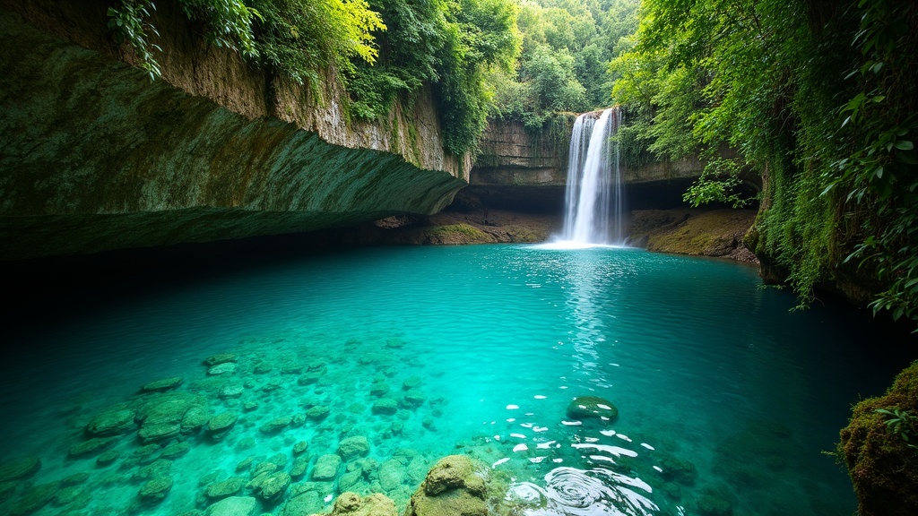
Near Lanquín, reached by a genuinely rough road that takes 8–10 hours from Antigua or 2 from Cobán. The pools, the viewpoint (El Mirador) above them, and the K'anba caves next door, which are toured by candlelight while swimming. Two nights minimum to make the journey worth it.
Cobán
The regional capital, a coffee town founded by German planters in the nineteenth century whose descendants were deported during the Second World War. Cool, damp, and the base for the whole region.
Biotopo del Quetzal
The cloud-forest reserve on the road from Guatemala City, and the best chance in the country of seeing a resplendent quetzal — best from February to June, early in the morning, with patience and a guide.
Candelaria and Lachuá
The Candelaria cave system, one of the largest in Central America and used ritually by the Maya; and Laguna Lachuá, a near-perfect circular karst lake in a national park, remote and almost empty.
East of the Verapaces the country runs down to the Caribbean: Quiriguá, the third Guatemalan World Heritage Site (1981), which is small but holds the tallest Maya stelae ever raised — Stela E stands over ten metres; the Río Dulce gorge, which you travel by boat; and Livingston at its mouth, a Garífuna town reachable only by water, where the language, the drumming and the coconut-and-fish cooking belong to the Caribbean rather than to the highlands.
✈️ Getting There
La Aurora International (GUA) sits inside Guatemala City, about 40 minutes from Antigua in normal traffic and considerably longer in rush hour. Mundo Maya (FRS) at Flores serves the Petén and takes some international flights from Mexico and Belize. There are no direct flights from Europe.
Via Madrid
The only one-stop routing from Europe: Iberia flies Madrid–Guatemala City directly, around 11 hours, and Prague–Madrid is a short hop. Usually the fastest option and often not the cheapest.
Via the United States
Miami, Houston, Dallas, Atlanta and Los Angeles all have frequent services with American, United and Delta. Almost always cheaper. Note that transiting the US requires an approved ESTA even if you never leave the airport, and you clear US immigration on the way through.
Via Mexico City or Panama
Aeroméxico via Mexico City and Copa via Panama City both connect well and avoid US immigration entirely — a genuine advantage if your paperwork is awkward or your connection is tight. Avianca via Bogotá or San Salvador is the fourth option.
Overland
Buses run from Mexico (Tapachula or San Cristóbal to Xela or Antigua), Belize, Honduras (Copán is 4 hours from Guatemala City) and El Salvador. Border crossings are straightforward; the CA-4 rule below matters.
Budget, honestly: a return from Prague generally falls between 25,000 and 45,000 CZK, with the lower end via a US hub booked well ahead and the higher end at Christmas or Semana Santa. Total travel time is 17–24 hours.
🚐 Getting Around
Distances on the map are short and journeys are long: mountain roads, roadworks, and a national tendency to overtake on blind bends. Guatemala City to Antigua is 45 km and an hour; Antigua to Lanquín for Semuc Champey is 300 km and eight to ten hours.
Shuttles
Tourist minibuses running fixed routes between Antigua, Atitlán, Chichicastenango, Xela, Lanquín and Flores. Booked through any agency, comfortable enough, door to door, and the default for most visitors. Not cheap by local standards and worth every quetzal.
Chicken buses
The camionetas — repainted and rebuilt American school buses, chromed, named and driven with enthusiasm. Astonishingly cheap, the real transport of the country, and genuinely useful for short highland hops. They are also the least safe option statistically, and the standard advice is to use them by day, on short routes, with your bag on your lap.
Domestic flights
Guatemala City to Flores in about an hour, which saves two days of driving each way and is the one flight almost everyone should take. Book ahead in high season.
Driving and Uber
Self-driving is manageable in daylight and not recommended at night anywhere in the country. In Guatemala City and Antigua, Uber works well, is cheap and is what locals tell visitors to use instead of street taxis.
One route-planning note: there is no road around Lake Atitlán, and the lakeside villages are connected by public boats (lanchas) that stop running around six in the evening. Plan to be where you are sleeping before dark, which is good advice for the whole country.
💰 What It Costs
Guatemala is one of the best-value countries in the Americas for a visitor, provided you eat and travel the way Guatemalans do. The currency is the quetzal (Q, GTQ), pegged loosely and stable at roughly 7.7 to the US dollar, which puts it in the region of 2.8–3 CZK — check before you go.
Accommodation
Hostel dorms Q60–120; a decent private room in a guesthouse Q150–350 (roughly 450–1,000 CZK); a good hotel in Antigua Q500–1,200; boutique colonial hotels considerably more. Semana Santa in Antigua is a separate economy entirely.
Eating
A comedor set lunch — soup, a main, tortillas, a drink — Q25–45; a market breakfast Q15–25; a restaurant main in Antigua Q60–130; a serious tasting menu Q400 plus. Street food is cheap, everywhere and generally fine.
Transport
A chicken bus between highland towns Q10–30; a tourist shuttle Antigua–Atitlán around Q100–150; Guatemala City to Flores by air Q800–1,500 return; Uber across Guatemala City Q40–80.
Activities
Tikal entry Q150 plus guide; Acatenango overnight trek Q450–900 depending on operator and equipment; a Spanish week with homestay US$200–300; a coffee farm tour Q150–250.
A backpacker can travel comfortably on Q300–450 a day (roughly 900–1,300 CZK) including everything; a mid-range traveller on Q700–1,000. The two things that break the budget are domestic flights and the Antigua hotel market at Easter. Tipping: 10% in restaurants where it is not already added, and small amounts for guides and shuttle drivers.
📋 Practical Information and Safety
Entry. Czech citizens do not need a visa for tourism and get 90 days on arrival. The catch that trips people up is the CA-4: Guatemala, El Salvador, Honduras and Nicaragua operate as a single immigration area, and the 90 days is shared across all four — leaving Guatemala for Honduras and coming back does not reset the clock. To reset it you must leave the CA-4 entirely (Belize and Mexico both count). A passport valid at least six months beyond entry is expected.
Health cover. The European Health Insurance Card is meaningless here. Take commercial travel insurance with a proper medical limit and repatriation cover, and confirm that volcano trekking and caving are included by name — the Acatenango climb goes to nearly 4,000 m and a number of policies exclude high-altitude trekking. Private hospitals in Guatemala City are good; anything outside the capital means being moved.
Health risks
Hepatitis A and typhoid vaccinations are the standard recommendation, rabies if you are going rural for long. Malaria risk is low and confined to some lowland areas; dengue is present countrywide and mosquito precautions matter more. Do not drink the tap water anywhere — bottled or purified only, including for teeth. Altitude: Guatemala City is 1,500 m and Xela 2,330 m, which is enough to notice.
Safety, honestly
Guatemala has real violent crime, overwhelmingly domestic and gang-related rather than aimed at tourists, and the homicide rate has fallen sharply over the past fifteen years. The realistic risks to a visitor are armed robbery on isolated trails and highways, and theft. Practical rules: do not travel intercity after dark, use shuttles or Uber rather than street taxis, do not resist a robbery, take a guide on volcanoes and remote trails, and read the current MZV ČR travel advice before booking — parts of the country carry specific warnings.
Czech consular help
There is no Czech embassy in Guatemala. Consular matters are handled by the Czech mission accredited for the region — check the current arrangement on the MZV ČR website. Register the trip in DROZD (drozd.mzv.gov.cz); with earthquakes, volcanoes and hurricanes all in play here, that is not a formality.
Practicalities
Electricity is 120 V at 60 Hz with flat American type A/B plugs — bring an adapter and check your devices take 120 V. Cash is king outside the cities; ATMs are common in towns and scarce in villages. Local SIM cards from Claro or Tigo are cheap and worth buying at the airport.
Etiquette in short. Greet before you ask, always. Ask before photographing people and accept refusal. Dress modestly in highland towns and in churches. Do not attempt to photograph or interfere with Maya ceremonies uninvited. And be aware of one specific and serious risk: rumours about foreigners abducting children have led to mob violence in rural Guatemala more than once, including fatal attacks. Never photograph children without their parents' explicit permission, and do not approach children you do not know.
❓ Common Misconceptions
"The Maya disappeared."
Six million Maya people live in Guatemala, Mexico, Belize and Honduras, and twenty-two Mayan languages are spoken in Guatemala alone. What collapsed in the ninth century was a specific political system in the southern lowlands, not a people.
"It's too dangerous to visit."
Guatemala has real crime and it is concentrated in places and situations a visitor can avoid. Hundreds of thousands of tourists come every year without incident. Read the current advice, follow the basic rules above, and treat blanket "don't go" advice with the same scepticism as blanket "it's totally safe" advice.
"The 1954 coup is a conspiracy theory."
It is documented in declassified US government records and described in the CIA's own historical publications. Operation PBSuccess happened, and the land reform it reversed is a matter of public record.
"Guatemalan and Mexican food are the same."
They share maize and chillies and diverge from there. Guatemala's signature sauces are built on seeds toasted almost black rather than on the chilli pastes of central Mexico, the tortillas are thicker and smaller, and there is no burrito tradition here at all.
"Antigua is Guatemala."
Antigua is a beautifully preserved colonial town with excellent restaurants and a large foreign population, and it is not representative of anything. The country starts about twenty minutes outside it.
"Buying cheap textiles supports weavers."
A Q60 "típico" scarf in a tourist market is usually machine-made and often imported. A hand-woven huipil takes two to three months and is priced accordingly. Buying from a cooperative at a fair price supports weavers; haggling hard over handwork does the opposite.
✍️ Author's Note
Guatemala is the country in this factbook where the gap between what the guidebooks cover and what the place is about is widest. The volcanoes, Tikal and Antigua are genuinely world-class and they are also the easy part. The harder and more interesting country is the one where twenty-two Mayan languages are spoken, where half of all children are chronically malnourished, where the truth commission counted two hundred thousand dead, and where in 2023 indigenous authorities blocked the roads for a hundred and six days to make a legitimate election stand.
So this page gives the war, the 1954 coup and the 2023–24 transition the space they take up in Guatemalan life rather than the paragraph a beach guide would give them, and it puts the traje, the languages and the land question next to the ruins rather than after them. None of that is a reason not to go. It is the reason to go with your eyes open.
On the pictures: each image was opened and checked before use. One was rejected — a "Chichicastenango market" photograph showing flower-trimmed straw hats and dress that reads as Andean rather than Guatemalan, which would have undercut the one thing this page most wants to say about traje, that it is specific to each town. Three of the eight kept images carry correcting captions where the photograph is close but not exact: the temple is not Tikal's own profile, the pool is not the stepped bridge of Semuc Champey, and the stew is lighter in colour than a real pepián.
Further reading. Miguel Ángel Asturias for the fiction. The Popol Vuh, which exists in Czech. Greg Grandin's The Last Colonial Massacre and Stephen Schlesinger and Stephen Kinzer's Bitter Fruit for 1954 and what followed. Francisco Goldman's The Art of Political Murder, on the killing of Bishop Gerardi two days after he published the church's report on the war, which reads like a thriller and is not one. And the Guatemala: Memory of Silence commission report itself, which is online in full.
If you go: take the shuttle to Atitlán and then take the boat to San Juan, climb Acatenango if your knees allow it, spend a week learning Spanish somewhere, and go to a market on a day when nobody is selling anything to tourists.
Support This Project 🌍
This World Travel Factbook is a labor of love – free to use for all travelers. If you find it helpful, consider supporting its continued development.