


🇬🇺 Guam at a Glance
🌍 Overview
Guam is a 544 km² island at the southern end of the Mariana chain in the western Pacific — the largest island in Micronesia, about 2,500 km east of Manila and 2,400 km south of Tokyo, and roughly 12,000 km from Prague in a direction that has no convenient flights. About 154,000 people live on it, and it is a territory of the United States.
That last fact governs everything. Guam is an unincorporated organized territory: its people are US citizens by birth, use the dollar, salute the flag, serve in the armed forces at some of the highest per-capita rates in the country — and, while living on Guam, cannot vote for the president and have a single non-voting delegate in Congress. The island's own long-standing description of its position is that it is tåno' i CHamoru, the land of the CHamoru, administered by a government it does not fully choose.
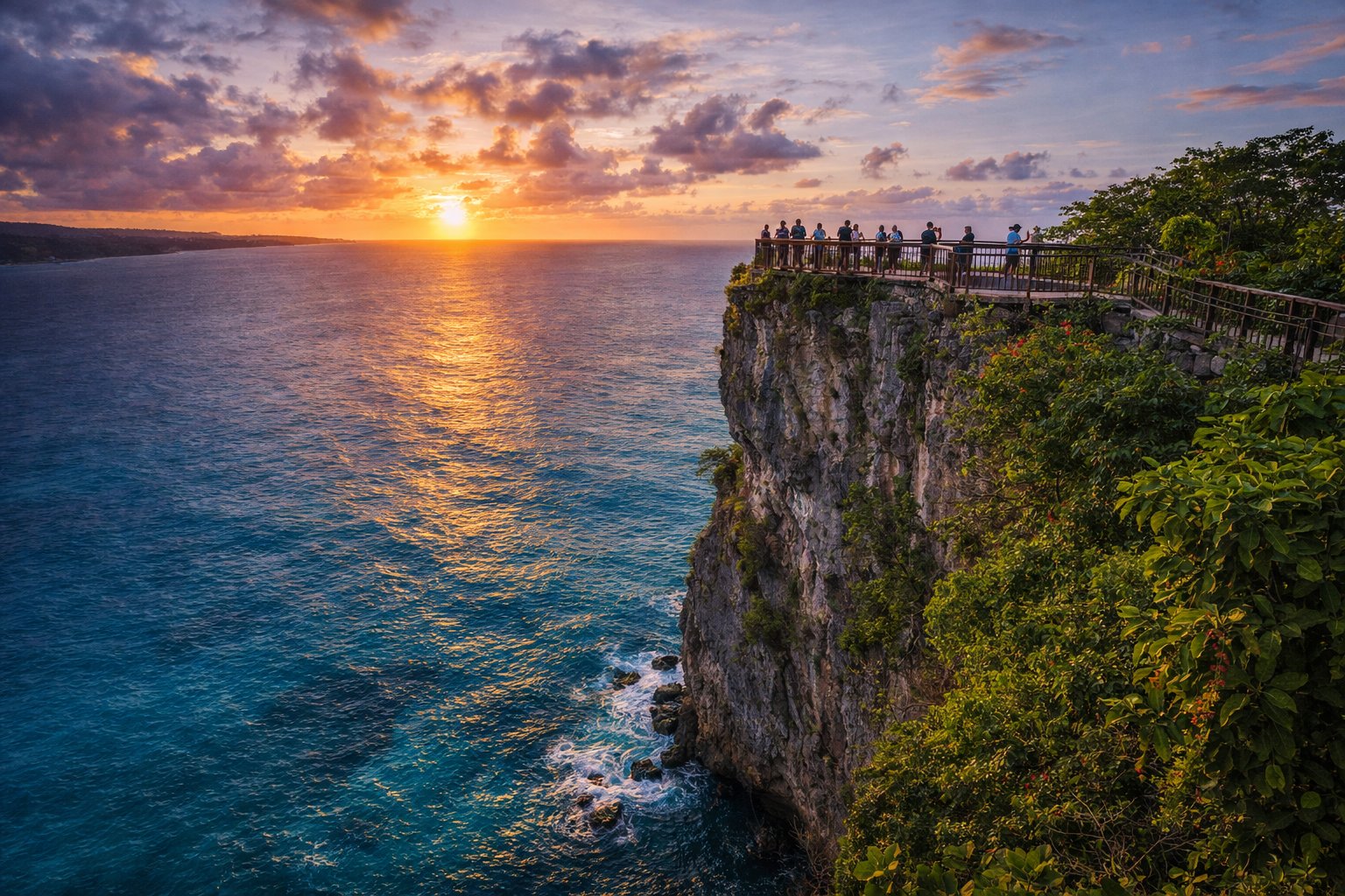
The island has three layers that a visitor meets almost at once. There is CHamoru Guam: three and a half thousand years of settlement, the latte stones, a language, a fiesta calendar and an extended-family social system that runs everything. There is military Guam: an air base, a naval base, a new Marine Corps base, and roughly a third of the island's land held by the Department of Defense. And there is tourist Guam: the hotel strip along Tumon Bay, built for Japanese and Korean visitors, with duty-free shopping, chapels for weddings and beaches that are genuinely lovely.
And there is a fourth thing, which nobody puts in the brochure and everybody notices by the second day: the forests are quiet. A snake that arrived in the cargo after the Second World War ate almost every native forest bird on the island. Standing in the jungle on Guam and hearing nothing is the single strangest experience the island offers, and it has its own section below.
🏷️ Guåhan and CHamoru
The island's own name is Guåhan, generally explained as meaning "we have" — a reference to the island having what people need. "Guam" is the Spanish rendering that English inherited, and both are in official use; the government of Guam styles itself Guåhan in CHamoru contexts and there is a long-running conversation about which should be primary.
The people are CHamoru — spelled that way, with a capital C and H together, since the official orthography was updated in 2018. The older spellings Chamorro and Chamoru are still everywhere in books, signs and organisation names, and the change is recent enough that both forms appear side by side. The word probably comes from chamorri, the name of the highest-ranking class in pre-contact society, rather than from Spanish, though the Spanish origin story is still repeated.
The flag
A deep blue field with a red border, and in the centre an almond-shaped seal showing the Hagåtña river mouth, a proa under sail, a coconut palm and the word GUAM. The shape is the slingstone, the pre-contact CHamoru weapon; the red border was added in 1948.
Where America's day begins
Guam is on UTC+10, west of the international date line — 15 hours ahead of New York and 9 ahead of Prague in winter. It is the first US soil to see each new day, and the slogan is on the licence plates.
Not the Marianas
Guam is geographically part of the Mariana Islands but politically separate from the Northern Mariana Islands (Saipan, Tinian, Rota), which are a Commonwealth in political union with the US. Same archipelago, same people, two different administrations since 1898 — and a border between them that CHamoru families find absurd.
Hafa adai
The universal greeting, pronounced roughly half a day, and used exactly as often as the phrase suggests. Learning it and si Yu'os ma'åse' (thank you) will change how the first week goes.
🗺️ Geography
Guam is about 50 km long and between 6 and 19 km wide, and it is two different islands stuck together. The north is a raised limestone plateau, flat on top, edged by sheer cliffs, with no surface rivers at all — the rain sinks straight through the coral rock into an aquifer that supplies most of the island's drinking water. That plateau is where Andersen Air Force Base sits, because it is flat and it is high.
The south is volcanic: red-earth hills, ravines, waterfalls and actual rivers, rising to Mount Lamlam at 406 m. Lamlam has a claim that gets repeated in every guidebook and is worth stating carefully: measured from the floor of the Mariana Trench, which lies about 60 km to the south-west and reaches nearly 11 km deep, the mountain's base-to-summit rise exceeds that of Everest. It is a real measurement of a real thing, and it is not the same as being the world's tallest mountain.
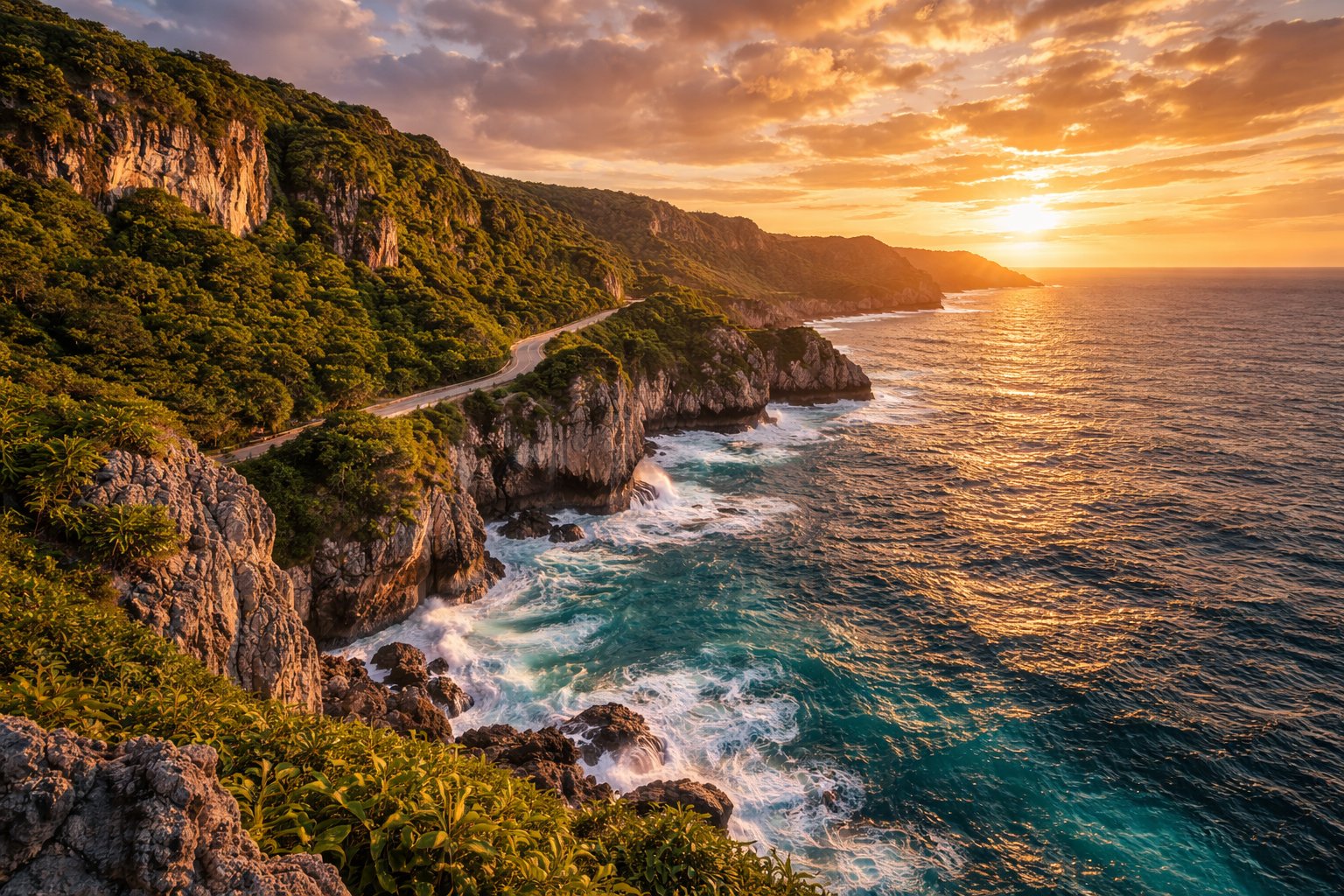
Between the two halves, around Apra Harbor on the west coast, is one of the largest protected deep-water harbours in the Pacific, which is the reason the US Navy is here and, before that, the reason Spain used Guam as the resupply stop on the Manila galleon route.
A fringing reef runs around most of the island, enclosing shallow lagoons at Tumon, Agana and Piti and dropping into deep water immediately outside it. That reef is why the diving is good, why the 1944 landings were difficult, and why the island's beaches are calm on the west and rough on the east.
🌡️ Climate and Typhoons
Tropical marine and remarkably even: 26–30 °C every month of the year, with humidity that rarely drops below unpleasant. The dry season runs January to May — trade winds, less rain, and the best months to visit. The wet season runs July to November, hot and humid with heavy afternoon downpours and, more importantly, the typhoons.
Guam sits in the most typhoon-prone waters on earth. It has been hit repeatedly and hard: Karen in 1962, Pamela in 1976, Paka in 1997 with a wind gust recorded at 378 km/h before the instrument failed, Pongsona in 2002 — and, most recently, Typhoon Mawar on 24 May 2023, which passed directly over the north of the island as a Category 4 storm, tore the roof off much of Guam and left large parts of the island without power or water for weeks.
The island is built for this in a way that visitors notice: concrete houses with typhoon shutters, buried power lines in the newer areas, and a public condition-of-readiness system (COR 4 through COR 1) that everyone follows. Hotels have typhoon procedures and stay open. But a direct hit closes the airport for days, and travel insurance that covers weather disruption is not optional between July and November.
January–May
The best window: drier, breezier, and comfortable enough for walking in the middle of the day. Also the high season for Korean and Japanese visitors, so hotels are fuller and prices higher.
June
The shoulder. Warm and increasingly humid, prices lower, and typhoon risk still low. Liberation Day preparations begin and the island fills with village activity through July.
July–August
Hot, wet, and Liberation Day on 21 July is the biggest event of the Guam year — a parade in Hagåtña, fiestas everywhere, and the island at its most itself. Typhoon season is under way.
September–November
Peak typhoon months and the wettest weather. Cheapest, quietest, and the period when a trip can genuinely be disrupted. Watch the Joint Typhoon Warning Center rather than a generic weather app.
🗺️ Map
Guam lies in the western Pacific at about 13° north, at the southern end of the Mariana arc, with the Northern Marianas — Rota, Tinian, Saipan — strung to the north and the Mariana Trench running down its western side. Antonio B. Won Pat International Airport is at Tamuning, in the middle of the west coast and ten minutes from the hotel strip.
Orientation: Tumon and Tamuning in the middle-west with the hotels and the airport; tiny Hagåtña, the capital, just south of them; Apra Harbor and the naval base below that, with Asan and Agat — the 1944 landing beaches — on either side. The north is Dededo and Yigo, the two most populous villages, plus Andersen Air Force Base and the cliffs at Ritidian. The south is the string of villages — Umatac, Merizo, Inarajan, Talofofo — around the volcanic hills.
🐍 The Snake and the Silent Forest
Some time shortly after the Second World War, probably in military cargo from Manus Island, the brown tree snake arrived on Guam. It is a mildly venomous, nocturnal, tree-climbing snake from Australia and Melanesia, and Guam had no snakes at all, no predators for it, and a bird population that had never encountered one. By the 1980s researchers had worked out what was happening, and by then it was largely done.
Of Guam's twelve native forest bird species, ten have been wiped out on the island. The Guam flycatcher and the Guam bridled white-eye are extinct outright. The sihek, the Guam kingfisher, survived only because birds were taken into captivity in the 1980s; it was extinct in the wild for forty years, and in 2024 the first captive-bred sihek were released — not on Guam, which is still full of snakes, but on Palmyra Atoll, two thousand miles away.
The ko'ko', the Guam rail, is the better story. Also taken into captivity, also extinct in the wild, it was reintroduced to snake-free Rota and to Cocos Island off southern Guam, established breeding populations, and in 2019 was reclassified from Extinct in the Wild to Critically Endangered — only the second bird in history, after the California condor, to be brought back from that category.
Snake density
At the peak, estimates ran to thousands of snakes per square kilometre in some forest. Numbers are lower now, but they are still everywhere; they cause power outages by climbing into substations, and the island runs a permanent control programme, including aerial drops of dead mice treated with paracetamol, which is lethal to the snakes.
Spiders
With the insect-eating birds gone, spider numbers on Guam are dramatically higher than on neighbouring islands — research has found roughly an order of magnitude more webs in the wet season. Walking a jungle trail here means walking through webs, constantly.
The forest itself
Native trees that depended on birds for seed dispersal are regenerating far less. The loss of the birds is quietly reshaping the forest, decades after the fact.
What you will see
Introduced species doing well: the Philippine turtle-dove, the black drongo, the Eurasian tree sparrow, and geckos everywhere. Also fruit bats, though the Mariana fruit bat is endangered and rarely seen. Offshore, the reef life is untouched by any of this and is excellent.
Biosecurity works both ways, and it is taken seriously. Every bag and every aircraft leaving Guam is checked for snakes before departure, because a brown tree snake reaching Hawaii would be a catastrophe there. Do not be surprised by dogs at the airport.
🗿 Latte Stones and 3,500 Years
People reached the Marianas from island South-East Asia — most likely the Philippines — around 1500 BC, in one of the longest open-ocean crossings anyone had made up to that point. That makes the CHamoru among the first ocean-voyaging peoples of Remote Oceania, and the Marianas among the earliest islands in the Pacific to be settled.
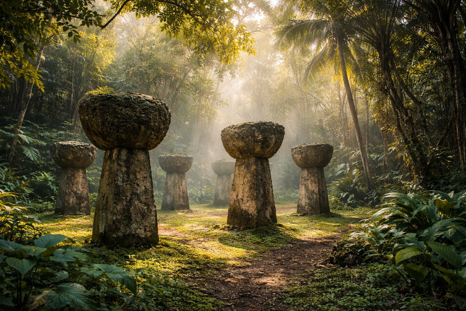
The most visible thing they left is the latte. A latte is a two-part stone pillar: a tapered shaft called the haligi and a hemispherical capstone called the tasa, set cup-side up. They were built in two parallel rows of four to seven pairs and served as the raised foundations of houses, from roughly AD 900 until the Spanish period. The largest, the unfinished set at As Nieves on Rota, would have stood over five metres.
Pre-contact CHamoru society was matrilineal, organised in clans, ranked in classes, and built around the proa — the outrigger sailing canoe that Magellan's crew described as faster than anything in the Spanish fleet, and which used a shunting rig that European shipwrights would spend three centuries failing to improve on. Fishing, taro, breadfruit and rice — the Marianas were the only place in the pre-contact Pacific where rice was grown.
You can see latte at Latte Stone Park in Hagåtña, where eight stones stand that were moved from the Fena area in 1956; in the jungle at Ritidian in the north, on National Wildlife Refuge land with ancient cave paintings nearby; and at various sites in the south. The stones in the park are real; their location is not, which is worth knowing before you photograph them.
⛵ Magellan, and Then 230 Years of Spain
On 6 March 1521, after ninety-nine days crossing the Pacific without sighting land, Magellan's ships reached the Marianas — most likely at Umatac Bay on Guam's south-west coast, where a monument marks the traditional site. The crew were starving and scurvy-ridden. The CHamoru came out in proas, boarded, and took things, in a culture where taking from those who had plenty was not theft in the European sense. Magellan burned houses and boats in response, killed several men, and named the islands Islas de los Ladrones, the islands of thieves. He left after three days.
Spain claimed the islands in 1565 but did nothing with them for a century beyond stopping there. The Manila galleon, which ran between Acapulco and Manila for 250 years, watered at Guam, which made the island a fixed point in the first global trade route and the reason it eventually mattered enough to colonise.
Colonisation began in 1668 with the Jesuit Diego Luis de San Vitores and a mission at Hagåtña. What followed was the Spanish–CHamoru Wars, on and off from 1671 to 1698: a series of revolts, sieges and reprisals that ended with the surviving population of the northern islands forcibly resettled on Guam. Combined with introduced disease, the effect was catastrophic — the pre-contact population, plausibly in the tens of thousands, fell to a few thousand by 1700.
What emerged from that century is what CHamoru culture is now: Catholic, with Spanish surnames and a fiesta calendar, speaking a language that took a great deal of Spanish vocabulary into an Austronesian grammar, and continuous with what came before in ways that are argued about and are certainly real. The stone bridges, the church walls at Umatac, Fort Nuestra Señora de la Soledad above the bay and the Plaza de España in Hagåtña are what is left of the Spanish physical presence.
🇺🇸 1898 and the Naval Government
In June 1898, during the Spanish–American War, the USS Charleston sailed into Apra Harbor and opened fire on Fort Santa Cruz. The Spanish garrison, which had received no news for months and did not know a war was on, sent out an officer to apologise for being unable to return the salute — they were out of gunpowder. Guam was surrendered the next day without a casualty. It is a genuinely funny story and it is also the moment the island's next century was decided.
The Treaty of Paris gave Guam to the United States and left the rest of the Marianas with Spain, which promptly sold them to Germany. That is why Guam and Saipan, forty miles apart and the same people, have had different flags ever since.
From 1899 to 1950 Guam was administered by the US Navy, under a naval governor with near-total authority. The record is mixed and Guamanians will give you both halves: public health and schooling improved markedly, and CHamoru was banned in schools, CHamoru dictionaries were burned in 1922, and the population had no citizenship, no vote and no bill of rights.
That changed only after the war, with the Organic Act of Guam in 1950, which made Guamanians US citizens, established a civilian government and a legislature, and moved the island from the Navy to the Department of the Interior. It did not give Guam a vote for president or a voting member of Congress, and it did not resolve the land taken during and after the war — both of which remain live issues seventy-five years later.
🕯️ 8 December 1941 and the Occupation
Japanese aircraft bombed Guam on 8 December 1941 — the same hours as Pearl Harbor, on the other side of the date line. The island had a token garrison of about 550 with no coastal guns; the Japanese landed on 10 December with over 5,000 troops, and it was over in a morning. Guam became the only populated US territory to be occupied by an enemy in the twentieth century.
The occupation lasted thirty-one months. The island was renamed Omiya Jima, "great shrine island". CHamoru people were required to learn Japanese, work under forced labour on airfields and fortifications, and hand over their food. Resistance was punished collectively. As the American fleet approached in July 1944, the occupying forces moved most of the population into concentration camps inland, above all at Manenggon, marching families for days in the rain.
In the final weeks came the massacres: at Tinta and Faha near Merizo, where villagers were forced into caves and grenades thrown in; at Chagui'an, where dozens of men were beheaded. Estimates of CHamoru deaths under the occupation run into the high hundreds to over a thousand, out of a population of around 22,000.
The one figure everyone knows is Father Jesús Baza Dueñas, the CHamoru priest who refused to reveal where the American radioman George Tweed was hiding, was tortured and executed a week before the landings. Tweed himself — the last American at large on the island, hidden by CHamoru families for two and a half years at enormous risk to them — survived and was rescued. Both names are on schools.
🎖️ Liberation, 21 July 1944
The American reconquest began on 21 July 1944 with simultaneous landings at Asan and Agat, either side of Apra Harbor. The fighting lasted three weeks, the island was declared secure on 10 August, and it cost roughly 1,800 American and around 18,000 Japanese lives. Guam then became the forward base for the rest of the Pacific war: B-29s flew from the north of the island, and the headquarters of the Pacific Fleet moved here.
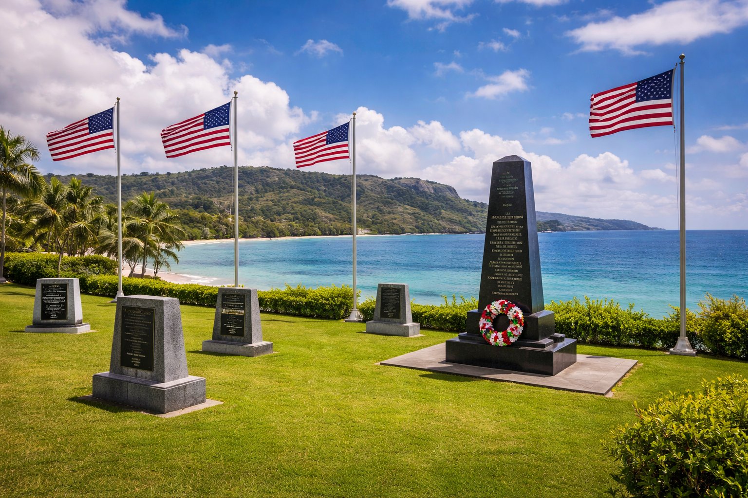
21 July is Liberation Day, and it is the largest annual event on Guam: a parade through Hagåtña, village floats, a carnival that runs for weeks, and family gatherings across the island. It is genuinely a celebration and it is genuinely complicated, and both things are said openly here. Survivors describe American troops as saviours. The same survivors, and their children, spent the following decades in a fight over land the military took after the liberation, much of it never returned, and over war reparations that were legislated only in 2016 and paid only from 2022.
The War in the Pacific National Historical Park, established in 1978, preserves seven units: the Asan Beach and Asan Inland units, Agat Beach, Piti Guns, Fonte Plateau, Mt Alifan and Mt Tenjo. The visitor centre at Asan is the place to start and the exhibition takes the CHamoru experience of the occupation as seriously as the military campaign, which was not always the case.
🌴 Sergeant Yokoi's Twenty-Eight Years
On 24 January 1972, two CHamoru men checking shrimp traps in the Talofofo river valley found a middle-aged Japanese man in the undergrowth. He was Shoichi Yokoi, a sergeant of the Imperial Japanese Army and a tailor by trade, and he had been hiding in the jungle of southern Guam since 1944 — twenty-eight years.
He had lived in a hand-dug cave, reached down a bamboo ladder, with a woven grass mat, a fireplace and a drainage channel. He wove cloth from hibiscus bark on a loom he made, caught eels and river shrimp, ate coconuts, breadfruit and rats, and came out only at night. Two companions had lived nearby and died in 1964. He knew the war was probably over; he stayed because he had been ordered never to surrender.
Returned to Japan, he said the sentence he is remembered for — that it was with much embarrassment that he had returned alive — and became a national figure and a strange kind of celebrity, later running unsuccessfully for parliament. He died in 1997.
On Guam the story is told with a certain wry ownership. There is a replica of the cave at Talofofo Falls Park, reached by a cable car down into the valley, alongside a rather ramshackle museum; the actual cave site is in the valley nearby. Yokoi was not quite the last — Japanese soldiers were found on Lubang and Morotai afterwards — but he was the one found on American soil, and he is part of Guam's story now whether or not that is fair.
⚓ The Bases
The United States military holds roughly a third of Guam's land, and the island's own description of its strategic role — the tip of the spear — is used by the Pentagon and by Guamanians with quite different tones of voice.
Andersen Air Force Base
The northern plateau: a bomber and tanker base with two 3,300 m runways, forward-deployed heavy aircraft, and the westernmost strategic air power the US has on its own soil. B-52s and B-1s rotate through it and have flown missions from it since Vietnam.
Naval Base Guam
Apra Harbor: submarines, a naval magazine, and one of the best deep-water anchorages in the Pacific. The reason the Navy came in 1898 and the reason it stayed.
Camp Blaz
Marine Corps Base Camp Blaz in the north-west, activated in 2020 — the first new Marine Corps base since 1952 — built to take several thousand Marines relocating from Okinawa. Named for Vicente T. Blaz, a CHamoru survivor of the occupation who became a Marine general and Guam's delegate to Congress.
Air and missile defence
A THAAD anti-ballistic-missile battery has been stationed on Guam since 2013, and a much larger integrated air and missile defence system is under construction. Guam is inside the range of Chinese and North Korean missiles, and everyone here knows the number.
The military is also the economy. Together with tourism it is one of the island's two pillars, it employs thousands of civilians, and CHamoru enlistment rates are among the highest of any US population — which is one reason Guam's per-capita casualty rate in Iraq and Afghanistan was several times the national average.
And it is the central political grievance. The land taken during and after 1944 was in many cases never returned; the Marine relocation has meant new land requirements, live-fire ranges near culturally significant sites, and a long fight over the firing range complex at Litekyan (Ritidian), one of the most important ancient CHamoru sites on the island. Guam is not anti-military — it is a place with a very large military and no vote over what that military does. Both halves of that sentence are worth carrying around.
🏛️ Political Status
Guam's formal status is an unincorporated organized territory of the United States. Unincorporated means the full Constitution does not automatically apply; organized means Congress has given it a civil government by statute — the Organic Act of 1950. It remains on the United Nations list of non-self-governing territories, which the US disputes and Guam's own government does not.
What Guamanians have
US citizenship from birth. A directly elected Governor and a 15-member legislature. Local courts, a local supreme court, and the dollar. Passports, military service, federal programmes and federal taxes retained locally rather than sent to Washington.
What they do not have
A vote for the President while resident on Guam. A voting member of Congress — the delegate votes in committee only. Any say over immigration, defence, foreign affairs, customs or the postal service.
The status question
Statehood, free association and independence are the three options in the long-running debate. A status plebiscite has been legislated for repeatedly and has been blocked in the federal courts over who is eligible to vote in it — a 2019 ruling found that restricting the vote to "native inhabitants" was unconstitutional race discrimination. The question remains formally unresolved.
Practical effect for visitors
For entry purposes Guam is the United States, with one significant local variation covered in the practical section. For customs, mail and mobile phones it is domestic US. For everything else it feels like the Pacific.
👥 The People
About 154,000 people live on Guam, and no group is a majority. CHamoru are the largest at roughly a third; Filipinos are close behind at around a quarter and have been arriving since the Spanish period and in large numbers since the war; then people from the Federated States of Micronesia — above all Chuuk — under the Compacts of Free Association, plus Korean, Japanese, Chinese, white American and Palauan communities.
Most people live in the north and centre: Dededo is by far the largest village at around 44,000, then Yigo and Tamuning. The capital Hagåtña has fewer than a thousand residents — it was flattened in 1944 and never rebuilt as a residential city, and it is now offices, the cathedral and government buildings.
Two social facts explain a lot. The first is the extended family, the familia, which is the operating unit of Guam and reaches into politics, business and every fiesta on the calendar; the second is inafa'maolek, roughly "to make good for each other", the CHamoru value of interdependence and restoring balance, which is taught in schools and invoked constantly.
Guam also has a serious out-migration: many young Guamanians leave for the US mainland or Hawaii for university, work or the military, and the island's population has been broadly flat or falling for a decade. There are more people of CHamoru descent living in the mainland United States than on Guam.
🗣️ CHamoru
CHamoru is an Austronesian language, related distantly to Tagalog and Malay and more closely to Palauan, with an enormous layer of Spanish vocabulary on top of an Austronesian grammar. It is an official language of Guam alongside English, and it is in trouble: the great majority of fluent speakers are over sixty, and the number of children learning it at home is very small.
That is the direct consequence of policy. CHamoru was banned in schools under the naval government, dictionaries were burned in 1922, and children were punished for speaking it well into the American period — a pattern familiar from indigenous languages across the world. The revival effort is now substantial: mandatory CHamoru instruction in public schools, a Kumisión i Fino' CHamoru (CHamoru Language Commission), immersion programmes, and the 2018 orthography that gave the language its current official spelling.
Useful words
Hafa adai — hello. Si Yu'os ma'åse' — thank you (literally "God have mercy"). Buenas — good day, straight from Spanish. Håfa tatatmanu hao? — how are you? Adios — goodbye. Manñge' — delicious, which you will need.
The Spanish layer
Numbers, days, months and a great deal of everyday vocabulary are Spanish. The grammar is not — CHamoru marks its verbs in ways Spanish has no equivalent for, and the sentence structure is Austronesian throughout.
English
Universal. You will have no practical language difficulty on Guam at any point. Japanese and Korean are widely used in the tourist areas, and Tagalog is very widely spoken.
Place names
Mostly CHamoru and worth pronouncing: Hagåtña is ha-GAT-nya, Inarajan is in-a-RA-han (and is officially Inalåhan now), Talofofo is ta-lo-FO-fo, Yigo is JEE-go. Several villages have reverted to CHamoru spellings — Hagåtña replaced Agana in 1998.
🎉 Fiestas and the Calendar
Every one of Guam's nineteen villages has a patron saint and an annual fiesta, and the fiesta system is the backbone of the social year. A village fiesta means Mass and a procession, and then an open house at which every family in the village cooks and anyone may eat — including, genuinely, a visitor who has been invited by anyone at all.
The food is the point and the quantity is the statement: red rice, kelaguen, barbecued short ribs and chicken, kadon pika, tinaktak, empanada, latiya, and a great deal of it. You take a plate, you eat, and you take a plate home — refusing the second plate is what a stranger gets wrong.
Santa Marian Kamalen
The island's patroness, whose statue in the Hagåtña basilica is said to have been found floating offshore, guarded by two crabs. Her feast on 8 December — the anniversary of the 1941 attack — brings a procession through Hagåtña that is the most heavily attended religious event of the year.
Liberation Day
21 July: the parade, the carnival grounds, and village floats. Book accommodation early and expect road closures in Hagåtña.
Chamorro Village
Wednesday night market in Hagåtña — food stalls, local craft, dancing, and the easiest evening in Guam for a visitor to eat CHamoru food properly and meet people doing the same.
Mes CHamoru
March is CHamoru Month, with language events, cultural competitions and school programmes across the island. Discovery Day on the first Monday in March marks Magellan's landing, and is marked with a certain deliberate ambivalence.
🛶 The Proa Comes Back
The CHamoru sakman — the large oceangoing proa — was one of the fastest sailing craft in the world before engines. It is an asymmetric single-outrigger canoe with a lateen sail that shunts: instead of tacking, the crew moves the sail from one end to the other and the bow becomes the stern, so the outrigger always stays to windward. Magellan's chronicler Pigafetta described the boats overtaking the Spanish ships at will, and Anson's crew in 1742 were impressed enough to have one measured and drawn.
The tradition was effectively extinguished under Spanish rule — canoes were destroyed to prevent movement between islands — and for two centuries no one on Guam built one. The knowledge survived on the Carolinian atolls to the south, above all on Satawal, where traditional navigation was never lost.
The revival began in the 1980s and 1990s and is now well established. Traditional-style sakman have been built and sailed on Guam and in the Northern Marianas, the Saina and later canoes have made open-ocean passages, and the navigator Mau Piailug of Satawal — the man who navigated Hōkūle'a from Hawaii to Tahiti in 1976 without instruments and effectively restarted Pacific voyaging everywhere — taught in the Marianas as well.
You can see the work: canoe houses in several villages, the Guam Museum's exhibits, and canoes on the water off Hagåtña and Piti. If you get the chance to go out on one, take it — the shunting manoeuvre alone is worth the afternoon.
🍽️ CHamoru Food
CHamoru cooking is Pacific with a heavy Spanish and Filipino accent and, since 1944, an American one. It is built around rice, coconut, fish, pork, chicken, lemon and chilli, and it is served in quantity at fiestas rather than in restaurants — which is why a visitor who eats only in hotels will leave thinking Guam has no cuisine, and be wrong.
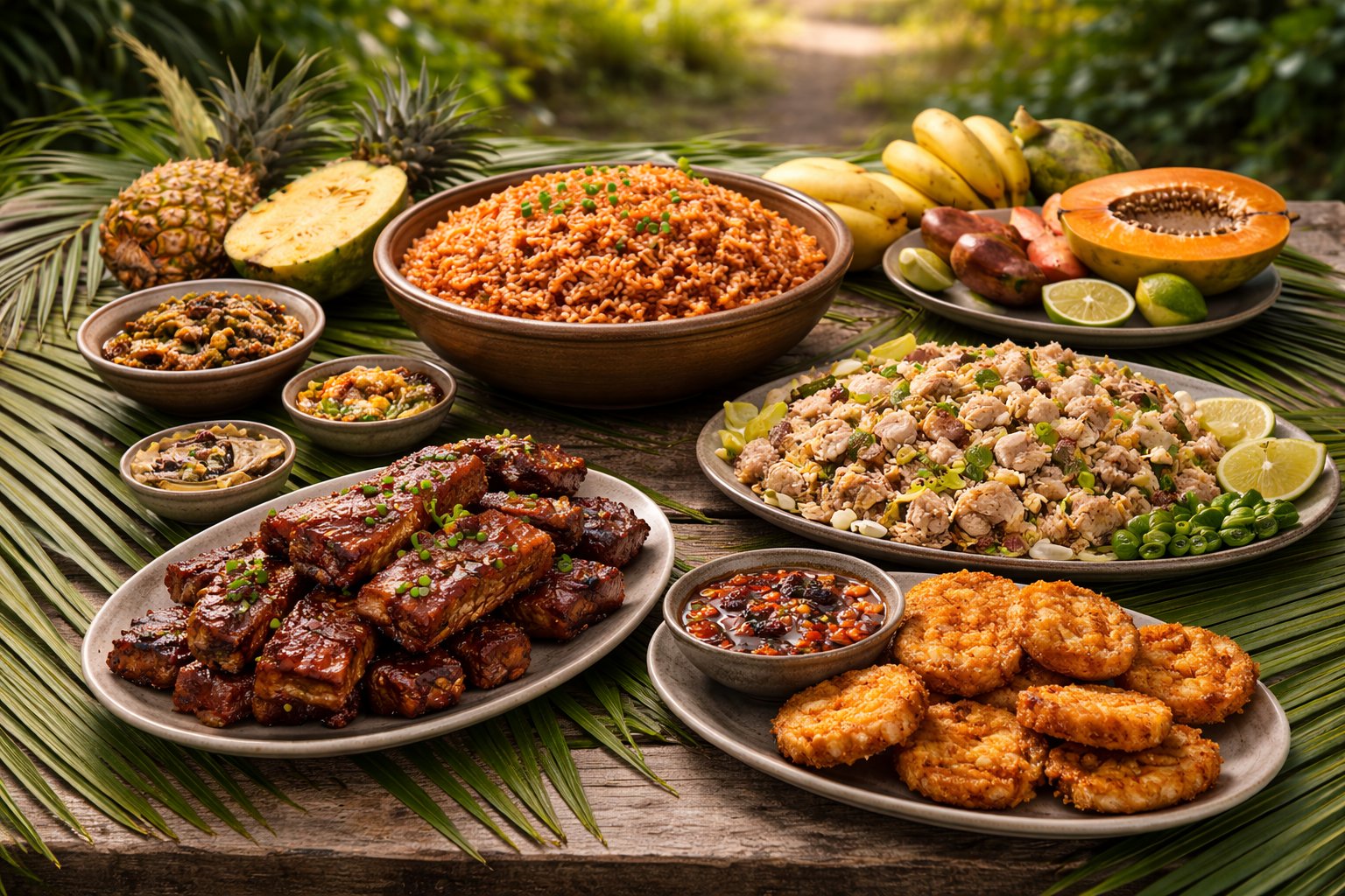
Red rice
Hineksa' agaga': rice cooked with the water from soaked achote (annatto) seeds, which gives the colour and a mild earthy flavour. It is at every fiesta without exception and is the single most recognisable CHamoru dish.
Kelaguen
Meat or seafood chopped very fine and dressed with lemon juice, grated coconut, spring onion and hot pepper — chicken kelaguen is grilled first, shrimp and fish kelaguen are 'cooked' by the acid alone, like a ceviche. The dish to try first.
Finadene
The universal sauce: soy sauce, lemon juice or vinegar, sliced onion and chopped donne' sali, the fiery local bird chilli. It goes on rice, on meat, on everything, and every family insists their proportions are correct.
Kadon pika and tinaktak
Kådun pika is a spicy chicken stew with coconut milk; tinaktak is minced beef simmered in coconut milk with green beans and tomato. Both are what people actually eat at home.
Then there is Spam. Guam's per-capita consumption of tinned luncheon meat is among the highest anywhere on earth, a direct legacy of the American military supply chain arriving in a place whose food system had been destroyed by war. It is fried, put in fried rice, wrapped in seaweed with rice as Spam musubi, and treated entirely without irony. Sneering at it in front of a Guamanian is a way to end a conversation.
🍗 Chicken Kelaguen
Kelaguen is the dish that will make sense of CHamoru food in one bite: sharp with lemon, sweet with coconut, hot with chilli, and eaten with rice or with titiyas, the local flatbread. The chicken version is grilled first; the shrimp and fish versions are raw and cured by acid alone.
Kelaguen mannok (chicken kelaguen)
Serves 4 as part of a spread · 30 minutes plus grilling
Ingredients: 700 g boneless chicken thighs; juice of 6–8 lemons (about 200 ml — the local fruit is a small round lemon, so lemon rather than lime); 150 g freshly grated coconut (frozen grated coconut from an Asian shop works; desiccated does not); 6 spring onions, finely sliced; 2–4 hot red chillies, chopped very fine (the local donne' sali is extremely hot — use bird's eye and adjust); salt.
Method: Grill the chicken over charcoal until well coloured and cooked through, with some char on the edges — the smoke is part of the dish and an oven grill is a poor substitute. Let it cool completely, then chop it very fine with a knife, almost to a mince, but by hand rather than in a machine. Mix with the lemon juice and a good pinch of salt and leave 15 minutes. Fold in the grated coconut, spring onion and chilli. Taste and adjust the lemon and salt — it should be aggressively sharp. Serve at room temperature with red rice or warm titiyas.
💡 Grate the coconut fresh if you possibly can. Dried desiccated coconut absorbs the lemon juice and turns the dish into a paste; fresh or frozen grated coconut stays in distinct threads, which is the texture the dish is about.
🍚 Red Rice and Finadene
No fiesta plate on Guam is without red rice, and no CHamoru table is without finadene. Neither is difficult; both depend on one ingredient that has to be right.
Hineksa' agaga' (red rice)
Serves 6 · 40 minutes
Ingredients: 500 g medium-grain white rice; 2 tbsp achote (annatto) seeds; 750 ml water or chicken stock; 1 small onion, finely chopped; 2 cloves garlic; 2 tbsp oil or bacon fat; 50 g bacon or diced ham (optional but usual); salt.
Method: Soak the achote seeds in 250 ml of warm water for 20 minutes, then rub them between your fingers in the water until it turns deep orange-red, and strain out the seeds — the seeds themselves never go in. Rinse the rice. Fry the onion, garlic and bacon in the oil until soft, add the rice and stir for a minute, then add the achote water plus the rest of the liquid and a good pinch of salt. Bring to the boil, cover, drop to the lowest heat and cook 18–20 minutes without lifting the lid. Rest 10 minutes off the heat, then fork through.
💡 Achote (annatto) seeds are sold in Czech shops as a colouring spice and in Latin-American and Asian shops as achiote. Powdered annatto works at a pinch; whole seeds soaked and strained give a cleaner colour and a better flavour.
Finadene
One bowl · 5 minutes
Ingredients: 6 tbsp soy sauce; 3 tbsp lemon juice or white vinegar; 1 small onion, thinly sliced; 2–4 hot red chillies, chopped; optional: 1 tsp grated ginger.
Method: Mix everything in a small bowl and leave 15 minutes for the onion to soften. That is the whole recipe. Put it on the table with a spoon and let people help themselves.
💡 Made with lemon it is fresher and is the fiesta version; made with vinegar it keeps for weeks in the fridge and is what sits on the kitchen counter. Both are correct and someone will tell you otherwise.
🍺 Drinking
Guam drinks like the United States with Pacific and Asian additions: American and Japanese beer, Korean soju in the Tumon restaurants, imported wine at import prices, and a growing local craft scene — Guam has had a small but serious brewing culture for over a decade, and asking for the local beer will get you something worth drinking.
Tuba
The traditional drink: coconut sap tapped from the cut flower stalk, drunk fresh and sweet in the morning, or left to ferment into something sour and mildly alcoholic by the afternoon. Distilled further it becomes aguayente. It is a village and family thing rather than a bar product — you will meet it at a fiesta, if at all.
Rules
US rules: the drinking age is 21 and it is enforced with ID checks, open containers in public are restricted, and drink-driving is treated as it is in the States. Bars in Tumon close around 2 a.m. and the strip is busy and generally good-humoured.
Prices
A beer in a Tumon bar runs $6–9, a cocktail $10–16 — so roughly 140–380 CZK at recent rates, which is US resort pricing rather than Pacific pricing. Buying at a supermarket is dramatically cheaper. Tipping is expected at American rates, 15–20%.
Betel nut
Not a drink, but part of the same social picture: pugua', areca nut chewed with pepper leaf and lime, is widely used across Micronesia and you will see the red stains. It is a carcinogen and a significant public-health problem here, which Guamanians discuss frankly.
🌟 People Worth Knowing
Chief Hurao (d. 1671)
The CHamoru maga'låhi who led the first great revolt against the Spanish in 1671. The speech attributed to him — against the Spanish who "have brought us their diseases and their needs" — is a founding text of CHamoru identity, though its transmission through a Jesuit source means historians treat the wording carefully.
Father Jesús Baza Dueñas (1911–1944)
CHamoru priest, tortured and executed by the Japanese a week before the American landings for refusing to give up the hidden American radioman George Tweed. The most honoured CHamoru figure of the occupation.
Vicente T. Blaz (1928–2014)
Survived the occupation as a teenager, joined the US Marine Corps, became the first CHamoru to reach brigadier general, and then served as Guam's delegate to Congress. The new Marine base is named for him.
Shoichi Yokoi (1915–1997)
The Japanese sergeant who hid in the Talofofo valley for twenty-eight years. Not Guamanian, and permanently part of Guam's story.
Ricardo Bordallo (1927–1990)
Governor of Guam twice, a driving force behind CHamoru cultural revival and the renaming of Agana to Hagåtña, and a figure whose career ended in a federal corruption conviction and his suicide, chained to a statue of Chief Quipuha. Guam's politics is not a quiet business.
Ray Chargualaf and Manuel De Gracia
The two men who found Yokoi while checking shrimp traps in January 1972 — an ordinary evening's fishing that became one of the last stories of the Second World War.
In sport, Guam competes separately at the Olympics, the Pacific Games and in FIFA — the national football team's 2015 wins over India and Turkmenistan in qualifying for the 2018 World Cup remain a legitimately famous upset in the region. In the American frame, Guamanians play at every level of US football and baseball, and the island's per-capita military enlistment is the statistic that comes up most often here.
🏛️ Hagåtña
Guam's capital has fewer than a thousand residents and takes an hour to walk across. It was the island's real city for three centuries — the Spanish seat, the naval government's headquarters, a town of some ten thousand people — and then in July 1944 it was almost completely destroyed by American bombardment and shelling before the landings. It was rebuilt as an administrative centre, not as a place to live, and that is what it still is.
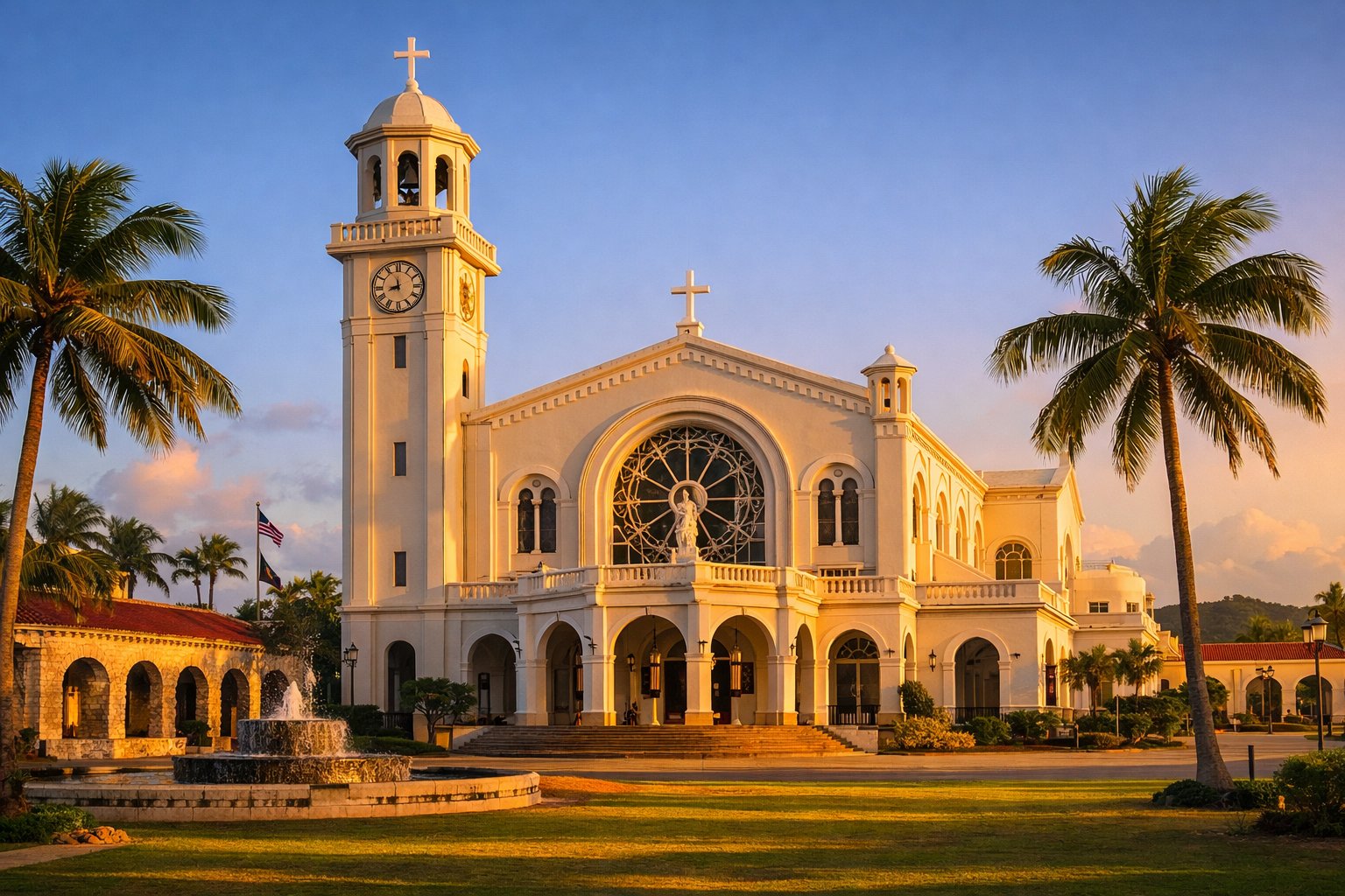
Plaza de España
What is left of the Spanish governor's palace: the Chocolate House, the Azotea, the arched gate and a garden. Small, ruined, shaded, and the physical trace of 230 years of Spanish rule in one square.
Latte Stone Park
Eight latte stones in a small park behind the plaza, moved here in 1956 from Mepo in the Fena valley. Also on the site are Japanese-dug tunnels from the occupation, which visitors regularly walk past without noticing.
Guam Museum
The Guam Museum — Senator Antonio M. Palomo Guam Museum and CHamoru Educational Facility — opened in 2016 opposite the plaza. The permanent exhibition, I Hinanao-ta, tells the island's history from the CHamoru side. Two hours, and the right first stop.
Fort Santa Águeda
The one surviving Spanish fort above the town, with the cannon and the best view over Hagåtña and Agana Bay. Free, five minutes' drive up the hill, and usually empty.
Along the seafront there is a marina, the Paseo de Susana with a small replica Statue of Liberty, and a fishermen's co-op where you can eat very well for very little. Wednesday evening is when the capital comes alive, for the Chamorro Village night market — the single best organised thing a visitor can do on Guam.
🏖️ Tumon Bay
Tumon is the hotel strip and effectively the second city: three kilometres of beach on a protected bay, backed by a continuous line of hotels, a duty-free shopping mall, chapels built for Japanese and Korean wedding parties, restaurants, bars and a great deal of neon. It was built for a Japanese tourism boom that began in the 1970s, and since the pandemic the visitor mix has shifted heavily towards Korea.
The beach itself is genuinely good. The bay is a marine preserve, so the reef inside it is in far better condition than the development behind it would suggest, the water is calm and shallow, and snorkelling straight off the sand is worthwhile. Fishing inside the preserve is prohibited and enforced.
What is here
Every large hotel on the island; the Tumon shopping district with US and Japanese brands at duty-free prices; Underwater World, a walk-through aquarium tunnel; and the strip of restaurants that is where most visitors eat every night.
What to know
Currents at the reef channels are real and there have been drownings; swim inside the reef line. Sun exposure at 13° north is severe. And the beach is public along its whole length, whatever a hotel's layout implies.
Two Lovers Point
At the northern end of the bay: a 120 m cliff with a viewing platform, a legend, a great deal of padlocked fencing and the best sunset on the island. There is an entrance fee. Go late in the day.
Ypao Beach
The public park at the southern end of Tumon, with lawns, showers and the best swimming on the strip. Where local families actually go at the weekend, which is the recommendation.
🏘️ The Southern Villages
Drive south from Hagåtña and Guam changes completely. The road follows the coast through Agat, Umatac, Merizo, Inarajan and Talofofo — small villages of a few hundred to a few thousand people, each with a church and a patron saint, backed by green volcanic hills. This is where CHamoru village life is most intact and where almost no tourists go, and a full circuit of the island takes about three hours plus stops.
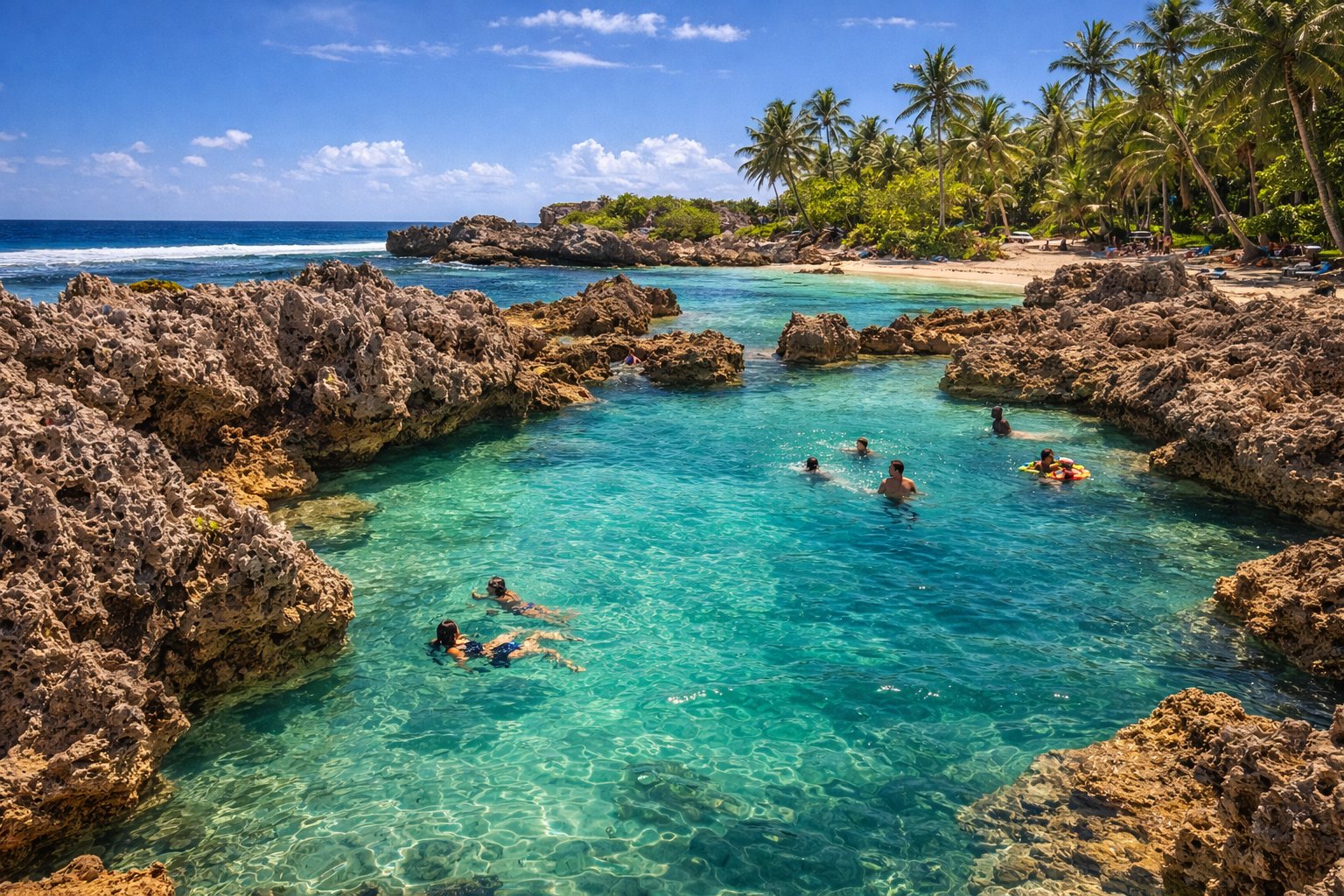
Umatac
Where Magellan is traditionally said to have landed in 1521, with a monument on the bay, the ruins of Fort Nuestra Señora de la Soledad on the headland above, and a Spanish bridge in the village. The bay is a perfect small horseshoe and the village is very quiet.
Merizo (Malesso')
The oldest standing building on Guam, the 1856 Spanish Kombento, plus a bell tower and the pier for the boat to Cocos Island — a small resort island off the southern tip with good snorkelling and a reintroduced ko'ko' population.
Inarajan (Inalåhan)
The best-preserved pre-war village on the island, with wooden and concrete houses from the Spanish and early American periods, the natural pools, and the Gef Pa'go cultural village where traditional crafts are demonstrated.
Talofofo
The waterfall park with the cable car down into the valley and the Yokoi cave replica, plus Talofofo Bay, which is where Guam surfs. Inland from here is the jungle where the last months of the occupation played out.
One southern warning worth taking seriously: the hiking. Guam's interior trails — to Mount Lamlam, to the Sigua and Tarzan falls, to the Lost Pond — are unmarked, hot, and cross sword-grass ridges that cut. People get lost and need rescuing on this small island several times a year. Go with a guide or with the local hiking groups that run organised walks most Saturdays, take far more water than you think, and tell someone where you went.
🎖️ The War Sites
The War in the Pacific National Historical Park is a US National Park Service site spread across seven separate units, most of them free and open at all hours. It is the reason a great many visitors come, and the visitor centre at Asan Bay Overlook is the place to begin — the Memorial Wall there carries the names of the CHamoru who died under the occupation as well as the American servicemen killed in the campaign, which is the correct order of things and was not always how it was done.
Asan Beach
The northern landing beach of 21 July 1944, now a park with interpretive panels, Japanese caves in the cliff behind, and the overlook above. Quiet, green, and unnervingly ordinary.
Agat
The southern landing beach, with Ga'an Point — a headland with intact Japanese gun emplacements that enfiladed the beach, now sitting in a small park where children play. The most physically direct war site on the island.
Piti Guns
Three Japanese coastal defence guns in the jungle above Piti, reached by a ten-minute walk up a shaded path. They were never fired. The walk is the pleasant part; the guns are the point.
South Pacific Memorial Park
At Yigo in the north, marking the site of the final Japanese command post, with a Japanese memorial chapel. Maintained by Japanese as well as Guamanian funds, and a reminder of who else lost people here.
Beyond the park: the Pacific War Museum at Yigo, private and idiosyncratic; the Japanese and Korean memorials scattered around the island; the massacre sites at Tinta and Faha near Merizo, marked and visitable and very sobering; and the Manenggon memorial for the forced march. Approach all of them as memorials rather than attractions — the descendants of the people who died at them live in the next village.
🤿 Diving
Guam's diving is better than its profile suggests, warm all year at 27–29 °C, and unusual in one specific respect that divers travel for.
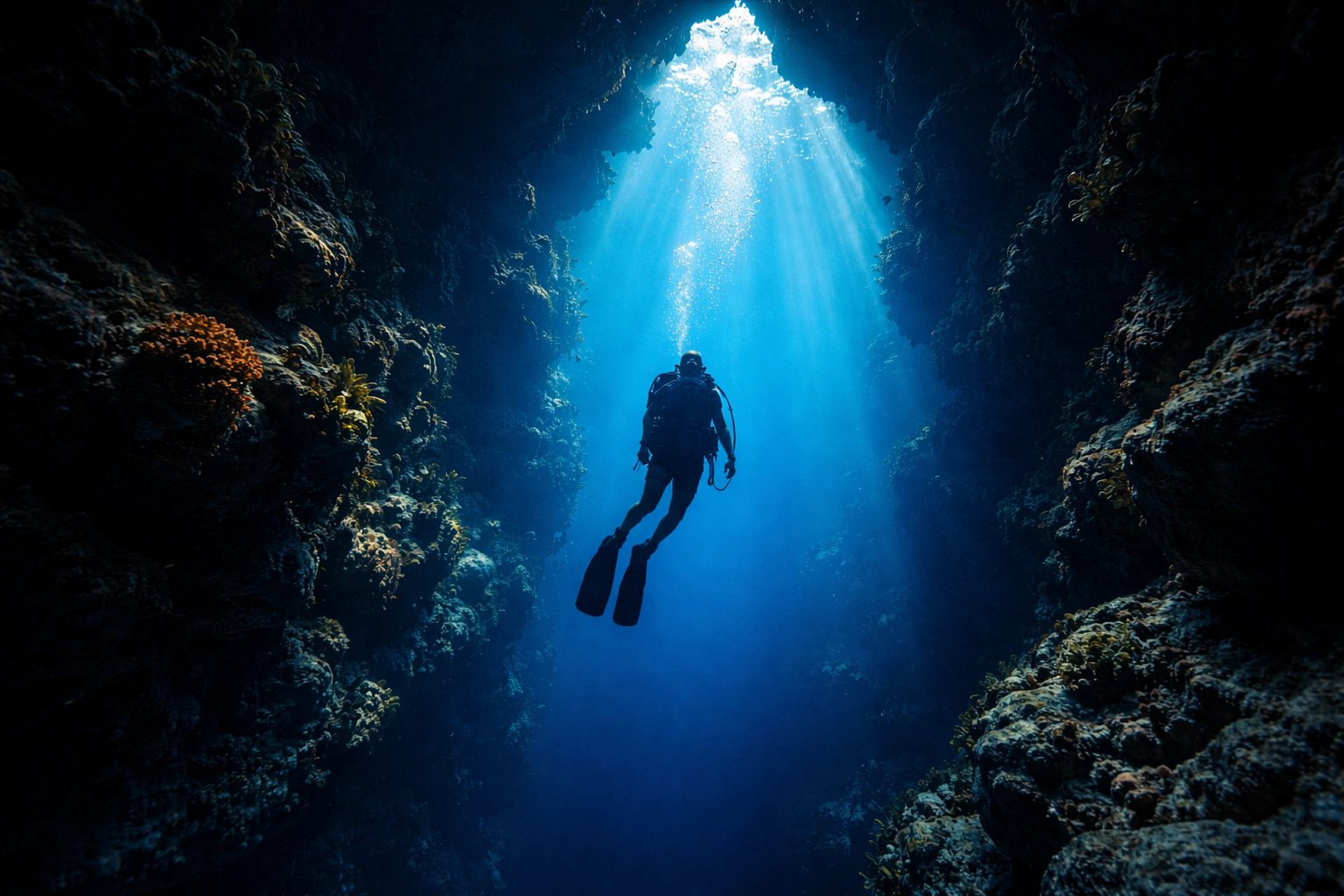
The two wrecks
In Apra Harbor lie the SMS Cormoran, a German raider scuttled by her own crew in 1917 on the day the United States entered the First World War, and the Tokai Maru, a Japanese freighter sunk by an American submarine in 1943. They lie touching each other. It is the only place in the world where a diver can put one hand on a First World War wreck and the other on a Second World War wreck.
The Blue Hole
Off Orote Point: a shaft through the reef top from about 18 m down, exiting through a window at around 40 m, with a clear light shaft on a sunny day. Advanced certification, a local guide and respect for the depth are all required.
Gab Gab and Fish Eye
Gab Gab Beach inside the naval base for easy reef diving (access is controlled — go with an operator), and the Fish Eye Marine Park at Piti, an underwater observatory at the end of a pier, which is the way to see reef fish without getting wet. The Piti "bomb holes" nearby are shallow and good for snorkelling.
Practicalities
A 3 mm suit or a shorty is plenty year-round. Guam has a recompression chamber, which not every Pacific island does. Visibility is best in the dry season; typhoon swell closes sites in the wet.
🌊 Beaches and the Reef
Guam's west coast is the sheltered one and holds almost all the swimming beaches; the east coast faces the open Pacific and is for surfing, walking and looking rather than casual swimming. There are no lifeguards on most beaches, currents through the reef channels are strong, and this is the most likely way for a visitor to get into real trouble here.
Ypao Beach
The public park at Tumon: shade, showers, calm shallow water inside the preserve, and the best all-round family beach on the island.
Ritidian Point
The northern tip, inside the Guam National Wildlife Refuge — a long empty white beach beneath the cliffs, with caves containing ancient CHamoru pictographs behind it. Access is via the refuge road and is restricted at times, sometimes at short notice because of adjacent military activity; check before driving up. Strong currents; the swimming area is small and marked.
Tanguisson and Shark's Hole
North of Tumon, with the limestone stacks and rougher water. Beautiful, photogenic and not for inexperienced swimmers.
Cocos Island
Off the southern tip, reached by boat from Merizo: a resort day-island with a protected lagoon, good snorkelling and calm water. The easiest full beach day on the island.
The reef itself is Guam's environmental front line. Bleaching events in 2013–2017 killed a substantial fraction of the shallow coral, and sedimentation from the fire-cleared hillsides in the south is a chronic problem — the badland scars on the southern hills are the visible half of what ends up on the reef. Local restoration groups run coral nurseries and volunteer days, and reef-safe sunscreen is asked for at the marine preserves and should be used everywhere.
✈️ Getting There
This is the hard part. Antonio B. Won Pat International Airport (GUM) at Tamuning is well connected within Asia and the Pacific and connected to almost nothing else. There is no route from Europe that does not involve at least two flights and a long day, and from Prague the realistic total is 20–26 hours door to door.
Via Seoul
Currently the best-served route. Incheon to Guam is about 4.5 hours with Korean Air, Jeju Air, T'way and others, and Prague to Seoul is a single long flight or one European connection. Korean carriers carry the largest share of Guam's visitors and the fares are competitive.
Via Tokyo
Narita or Haneda to Guam is about 3.5 hours with United and Japanese carriers. Historically the main route and still reliable, though Japanese traffic to Guam has not returned to its pre-pandemic level.
Via Manila or Taipei
Philippine Airlines and others fly from Manila in about 4 hours; Taipei is similar. Often the cheapest routing from Europe if you are willing to accept the connection times.
The Island Hopper
United's legendary Guam–Honolulu service via Majuro, Kwajalein, Kosrae, Pohnpei and Chuuk — five landings across the Pacific in one day. Not a sensible way to reach Guam and one of the great flights in the world if you can build a trip around it.
Budget, honestly: a return from Prague generally falls between 30,000 and 50,000 CZK, occasionally less on an Asian-carrier promotion. Book the two legs on one ticket if you can — a self-connected itinerary in Seoul or Tokyo means clearing immigration, collecting bags and re-checking, and leaves you with no protection if the first flight is late.
🚗 Getting Around
Hire a car. Guam has almost no useful public transport, the sights are spread around a 50 km island, and taxis are expensive and not always easy to summon outside Tumon. Car hire is cheap by American standards and every major agency is at the airport.
Driving
On the right, American road rules, American signage, speeds in miles per hour. A Czech driving licence is accepted for short visits and an International Driving Permit is a sensible addition. Roads are decent; the potholes after a typhoon are memorable. Distances are tiny — Tumon to the southern villages is about 45 minutes.
Buses and shuttles
The public Guam Regional Transit Authority runs limited routes on a schedule that will not fit a visitor's day. What does work is the Tumon shopper shuttle, a paid loop around the hotel strip, the mall and Hagåtña, which is genuinely useful if you are staying in Tumon and not leaving it.
Taxis and apps
Taxis are metered from hotels and the airport and are not cheap. Ride-hailing coverage exists but is thin compared with the mainland US; do not plan on hailing a car in a southern village at night.
Military areas
Andersen AFB, Naval Base Guam and Camp Blaz are closed installations — you cannot drive in without sponsorship, and some coastal access, including at times the road to Ritidian, depends on military activity. Signs mean what they say.
💰 What It Costs
Guam runs on American prices with a Pacific shipping surcharge: everything except locally caught fish and locally grown fruit comes 10,000 km by container, and the grocery bill reflects it. Against that, duty-free shopping is genuinely duty-free — Guam is outside the US customs territory, which is why the Tumon malls exist.
Currency
The US dollar. Cards everywhere, US banks, US ATMs with US fees. Recent exchange rates have put a dollar somewhere around 22–24 CZK — check before you go, and note that your Czech card's foreign-transaction fee applies as it would anywhere in the States.
Accommodation
Tumon beachfront hotels $180–350 a night (roughly 4,000–8,000 CZK); mid-range hotels off the beach $100–160; guesthouses and apartments in Tamuning or the south considerably less. Prices rise sharply for Korean and Japanese holiday periods.
Eating
A plate lunch or a fiesta plate $10–15; a Tumon restaurant main $20–35; the Chamorro Village night market $5–12 a dish and the best value on the island. Note that US tipping applies — 15–20% in restaurants — and that Guam has no sales tax but does levy a 5% gross receipts tax that is often built into the price.
Activities
A two-tank dive $130–180; a Cocos Island day trip $80–120; car hire $45–70 a day; entry to Two Lovers Point around $3–5. Most of the war sites and all the beaches are free.
A realistic figure for a couple staying in a mid-range Tumon hotel with a hire car and eating out is around $200–300 a day for two — roughly 4,500–7,000 CZK — excluding flights. Guam is not a cheap Pacific destination and does not pretend to be.
📋 Practical Information
Entry — the important paragraph. Guam is United States territory and US immigration law applies. Czech citizens travel under the Visa Waiver Program, which means you must have an approved ESTA before boarding, a biometric passport, and a return or onward ticket. Apply on the official CBP website at least 72 hours ahead and pay the fee there; there are many lookalike sites charging several times the price. Guam and the Northern Marianas also operate a separate visa-waiver scheme for certain Asian nationalities, which does not apply to Czechs — do not be misled by the pages describing it.
Health cover. This is the other thing that must not be got wrong. The European Health Insurance Card is worthless here and Czech public insurance pays nothing. Guam has American healthcare costs — an emergency-room visit runs into thousands of dollars, and a medical evacuation from Guam to a larger hospital in Hawaii or Manila runs into tens of thousands. Take commercial travel insurance with a high medical limit and explicit repatriation cover, and confirm that diving and hiking are covered if you plan to do them.
Power and phones
US standard: 110–120 V at 60 Hz with flat two- and three-pin type A/B sockets. You need an adapter, and you must check that your devices accept 110 V — most chargers do, most hair dryers and travel kettles do not. Guam is domestic for US mobile carriers; for a Czech SIM it is expensive international roaming, so buy a local prepaid SIM or an eSIM.
Czech consular help
There is no Czech representation on Guam. Consular matters are handled through the Czech missions in the United States — check the current territorial competence on the MZV ČR website before travelling, since Guam is a long way from all of them. Register in DROZD (drozd.mzv.gov.cz), which matters more than usual here because of typhoons.
Health and safety
Dengue is present but not endemic at high levels; mosquito repellent is sensible. Tap water is treated and drinkable. The real risks are the sun, the ocean currents at reef channels, and heat exhaustion on unmarked inland trails. Crime against visitors is low and property theft from cars at beach car parks is the usual complaint.
Post and shipping
Guam is on the US domestic postal system, so a postcard to Europe goes at US international rates and a parcel from the mainland arrives at domestic prices — which is why Guamanians buy online from the States. Customs, however, treats Guam as outside the US customs territory, so shopping here is duty-free and there are allowances to check when you fly home.
Etiquette in short. Say hafa adai. Accept food when it is offered at a fiesta and take a plate home when it is pressed on you. Ask before photographing people, and do not photograph inside military installations or at their gates. Treat the war memorials and the massacre sites as memorials. Do not use "Chamorro" to correct someone who says "CHamoru". And do not tell Guamanians what they should think about the bases — you will get a polite answer and you will learn nothing.
❓ Common Misconceptions
"Guam is a country."
It is a United States territory. Guamanians are US citizens by birth, use the dollar and carry US passports — and cannot vote for the president while living there, and have no voting representative in Congress. All of that is true at once.
"It's the US, so no visa paperwork."
You still need an approved ESTA before boarding, exactly as for New York. The separate Guam–CNMI visa waiver you will read about applies to certain Asian nationalities, not to Czech citizens.
"Mount Lamlam is the world's tallest mountain."
Measured from the floor of the Mariana Trench to its summit, its base-to-peak rise beats Everest's. That is a real and interesting measurement of the seabed nearby, not a claim that Guam has the tallest mountain — Lamlam is 406 m above the sea.
"It's just a beach resort with a military base."
Guam has 3,500 years of continuous settlement, a living Austronesian language, the only place on earth where a First and a Second World War wreck touch, and an ecological catastrophe you can hear. The resort strip is three kilometres long.
"The forests are full of wildlife."
The forests are close to silent. Ten of twelve native forest bird species have been wiped out by the brown tree snake. It is the single most striking thing about the island and almost no travel writing mentions it.
"Liberation Day is uncomplicated."
It is the biggest celebration of the year and it commemorates a liberation that was real, after an occupation that was brutal — and it is followed immediately by land takings that are still unresolved and reparations paid only from 2022. Guamanians hold all of that simultaneously, and so should a visitor.
✍️ Author's Note
Guam is written about badly, almost always in one of two registers: a duty-free beach destination for Japanese and Korean holidaymakers, or a strategic asset in an article about the Pacific that never mentions that 154,000 people live there. Neither is a description of a place.
So this page tries to put the CHamoru century back in the middle: the latte stones and the proa, the Spanish wars and the population collapse, thirty-one months of occupation, the massacres at Tinta and Faha, the liberation and the land that followed it, and a language that was banned in schools and is now taught in them. And it gives space to the brown tree snake, because a forest with no birds in it is the most remarkable thing on the island and it is almost never mentioned.
On the pictures: each was opened and checked before use. One was rejected — the supplied hero showed a small whole island ringed by reef, which is not what a 50 km limestone-and-volcanic island looks like from the air. The diving photograph is captioned to describe the Blue Hole accurately rather than to claim it is that exact shaft. Prices are approximate, in dollars, and the crown figures move with the exchange rate.
Further reading. Robert Rogers's Destiny's Landfall: A History of Guam is the standard single-volume history and does not flinch. Keith Camacho's Cultures of Commemoration on how the Marianas remember the war. Julian Aguon's essays and legal writing for the contemporary CHamoru argument about self-determination — No Country for Eight-Spot Butterflies is the accessible one. And for the snake, David Quammen's The Song of the Dodo has the clearest short account of what happened and why it mattered.
If you go: hire the car, drive the south, get to the Chamorro Village on a Wednesday, go to the Asan overlook early in the morning when it is empty, and stand in the jungle for five minutes and listen.
Support This Project 🌍
This World Travel Factbook is a labor of love – free to use for all travelers. If you find it helpful, consider supporting its continued development.