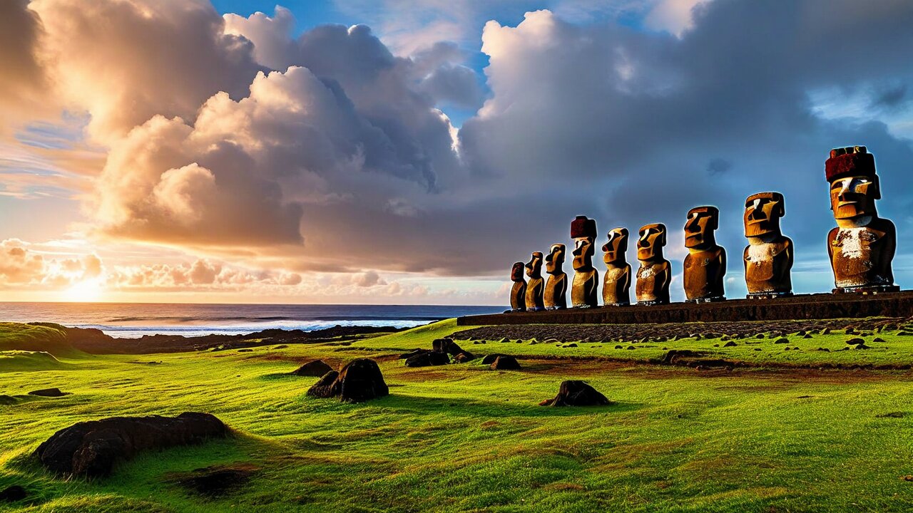
Nine hundred stone ancestors on 163 km² of volcanic grass, 3,700 km from the nearest continent — the most remote inhabited place most travellers will ever reach.
Easter Island is 163 km² of volcanic grassland in the South Pacific, 3,700 km west of Chile and 2,075 km from Pitcairn, the nearest inhabited land. On it stand roughly 900 moai — monolithic stone ancestors carved between about 1250 and 1500 CE by a Polynesian society that had arrived, at most, a couple of centuries earlier and would never see another human being from outside for four hundred years.
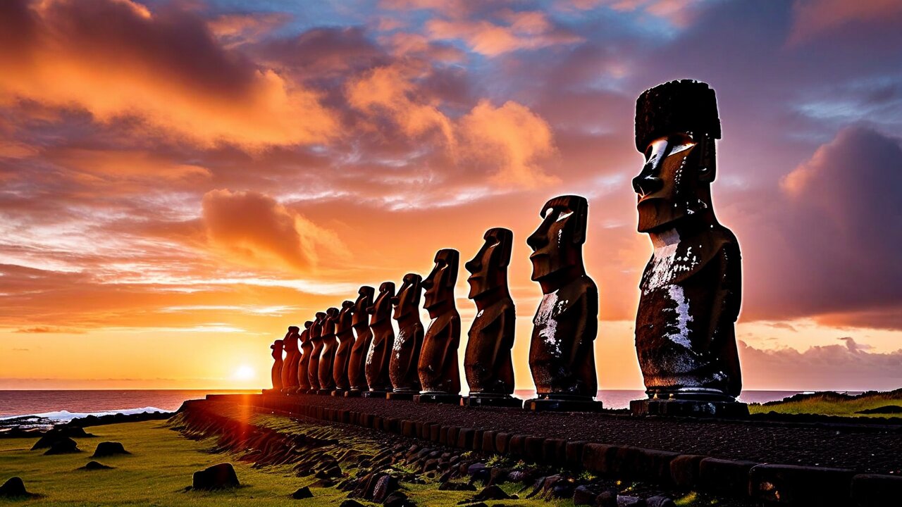
Ahu Tongariki: fifteen moai on the largest ceremonial platform on the island, swept inland by a tsunami in 1960 and re-erected in the 1990s.View Ahu Tongariki in the hero ↑
That is the whole reason to come, and it is a sufficient one. There is no other archaeological landscape like it: the statues are everywhere, in the grass, on the cliffs, half-buried in the quarry where they were cut, lying face down where they were pulled over. The island is small enough to see in three days and strange enough to stay with you for years.
Set expectations correctly on everything else. Rapa Nui is expensive — almost everything is flown in from Santiago on one airline — and it has become heavily regulated: since 2018 there is a 30-day limit for non-residents, an entry form, a return ticket requirement, and a national park ticket costing around US$80 that most sites now require alongside a licensed local guide. None of that is bureaucratic spite. It is a community of fewer than eight thousand people managing a World Heritage site that receives many times its own population every year.
The island is also not a beach destination, not a nightlife destination and not a place with much to do in the rain. Three to five days is right: enough for the archaeology, a volcano, a walk and one slow day. Come for the moai; the rest is what you get for coming.
The Dutch navigator Jacob Roggeveen reached the island on Easter Sunday, 5 April 1722, and named it for the day. That is the whole etymology of "Easter Island", and it says a good deal about how the place has been named by others ever since.
Rapa Nui is what the island, its people and their language are called today. It is not the ancient name — it appears to have come into use in the 1860s, probably from Polynesian labourers comparing it to Rapa in the Austral Islands. Older names recorded in oral tradition include Te Pito o Te Henua, usually translated as "the navel of the world", and Mata ki te Rangi, "eyes looking at the sky".
Status
A special territory of Chile since a constitutional reform in 2007, administratively a province of the Valparaíso Region. Not an independent country, and increasingly self-governing in practice.
Annexation
Chile annexed the island in 1888 under Policarpo Toro. The Rapa Nui text of the agreement and the Spanish text differ on whether sovereignty was ceded — a discrepancy that is still argued about.
Citizenship
Islanders did not receive full Chilean citizenship until 1966. Before that the island was leased to a British-Chilean sheep company and the Rapa Nui were confined to Hanga Roa behind a wall.
Autonomy
Since 2016 the archaeological sites have been managed by Ma'u Henua, a Rapa Nui community organisation, rather than by the Chilean forestry service. The park fee goes to them.
Language
Spanish and Rapa Nui, an Eastern Polynesian language closely related to Tahitian and Māori. It is classified as endangered and is the subject of an active revival effort in schools.
Which name to use
"Rapa Nui" for the people, the language and the island in most contexts; "Easter Island" is not offensive and is what your airline ticket says. Islanders use both.
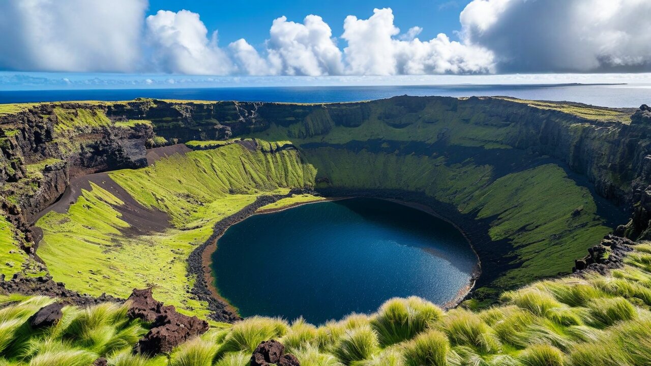
A triangle 24 km along its longest side, built from three overlapping shield volcanoes whose craters sit at its corners. Terevaka in the north is the highest point at 511 m and the youngest; Poike in the east is the oldest; Rano Kau in the south-west holds the largest crater and the most dramatic view on the island. There is no permanent stream — water collects in the three crater lakes and in lava tubes.
3,700 km to continental Chile, 2,075 km to Pitcairn, 4,250 km to Tahiti. By most definitions this is the most isolated permanently inhabited island on Earth.
No reef
Unlike most Pacific islands, Rapa Nui has almost no fringing reef and no sheltered lagoon. The coast is basalt cliff and boulder, which is why there are only two real beaches.
Treeless
The island today is grassland. It was forested when people arrived — a palm related to the Chilean wine palm covered much of it — and the disappearance of that forest is the central argument of the island's environmental history.
Lava tubes
Hundreds of caves run under the island, some with entrances on the cliffs, some used for shelter and burial. Ana Kakenga, the "two windows" cave, opens onto the sea.
Wind
Constant, and the defining weather fact. It is why the island feels cooler than its latitude suggests and why hats blow away at Tongariki.
Motu
Three islets off the south-western tip — Motu Nui, Motu Iti and Motu Kao Kao. Motu Nui is where the birdman competitors swam to, and it is a seabird colony.
Everything radiates from Hanga Roa on the west coast, the only town. Mataveri airport is immediately south of it; Rano Kau and Orongo are on the headland above; Rano Raraku and Ahu Tongariki are on the east coast about 18 km away; Anakena is on the north coast, 18 km by road.
Hanga Roa to Tongariki 18 km (~25 min) · to Anakena 18 km (~25 min) · to Orongo 4 km but 300 m of climb · the full coastal loop about 55 km.
Roads
One paved road across the island to Anakena and one along the south coast to Tongariki. Everything else is dirt, and the dirt is genuinely rough.
Getting around
Hire car (small 4×4 or jeep) for a day or two, or a scooter, or a guided tour. There is no public transport, and taxis are a flat fare within Hanga Roa and expensive beyond it.
Walking
The whole north coast can be walked from Hanga Roa to Anakena in a long day — no road, no shade, no water. Superb, and only with proper preparation.
Bicycles
Rentable, and fine for the paved roads. The wind will decide how much you enjoy it.
Sunrise and sunset
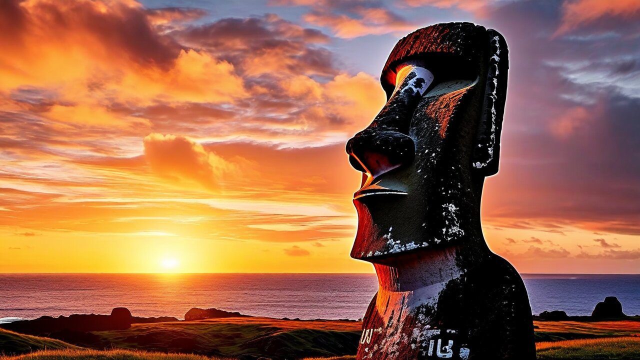
Tongariki faces east and is the sunrise site; Tahai, just north of Hanga Roa, faces west and is the sunset site. Both are worth setting an alarm for.
Rapa Nui was settled by Polynesians sailing from the west, most likely from the Marquesas or Mangareva, in double-hulled voyaging canoes. This is not in serious dispute: the language, the material culture, the crops and the genetics all point the same way. Oral tradition names the founding chief Hotu Matu'a and says he landed at Anakena, which is exactly where the archaeology puts the earliest settlement.
The date has moved. Older estimates put arrival around 400 CE; careful re-dating of the most reliable samples has pulled it forward to roughly 1200 CE. That matters enormously, because it compresses the whole moai era — carving, transport, erection, and the eventual toppling — into perhaps three centuries rather than a millennium.
Thor Heyerdahl
The Norwegian who sailed the Kon-Tiki from Peru in 1947 argued Rapa Nui was settled from South America. His archaeology on the island in 1955–56 was serious and productive; his migration theory has not survived the evidence.
The genetics
Modern and ancient DNA place the Rapa Nui firmly within Polynesia. A 2020 genomic study did, however, find Native American ancestry in several Polynesian populations dating to around 1200 CE — contact happened, just not in the direction or the manner Heyerdahl proposed.
The sweet potato
Kumara, a South American crop, was being grown across Polynesia before Europeans arrived. It remains the strongest single piece of evidence for pre-Columbian Pacific–American contact.
What they brought
Chickens, the Polynesian rat, taro, yam, sugar cane, banana, paper mulberry and the sweet potato. No pigs, no dogs — either not carried or not surviving.
Navigation
Reaching a 24 km triangle after 2,000 km of open ocean, deliberately and repeatedly, is among the great technical achievements of any premodern society. It was done by reading swell, stars, birds and cloud.
The isolation
After settlement, contact with the rest of Polynesia appears to have ceased almost entirely. Everything on the island after about 1300 developed alone.
The moai were carved, moved and raised between roughly 1250 and 1500. Then, at some point in the 17th or 18th century, the statues began to be pulled down — huri moai, the toppling — apparently in a period of conflict between clans. When Roggeveen arrived in 1722 many moai still stood; by the time of the last European reports in the 1830s, none did. Every moai standing today was re-erected in the 20th century.
What actually destroyed Rapa Nui society is not in doubt, and it was not the statues. In 1862–63 Peruvian slave raiders abducted somewhere around 1,500 people — roughly half the population — including the king and most of the men who could read rongorongo. International protest forced a repatriation; of about a hundred survivors put on ships, fifteen reached the island alive, carrying smallpox and tuberculosis. The epidemic that followed, plus emigration to Tahiti, reduced the population to 111 people in 1877.
Chile annexed the island in 1888. From 1888 to 1953 it was leased, almost in its entirety, to the Williamson-Balfour Company as a sheep ranch. The Rapa Nui were confined to Hanga Roa behind a wall, forbidden to leave, and were not Chilean citizens. Sheep grazed the archaeological sites.
In 1964 a schoolteacher, Alfonso Rapu, led a peaceful rebellion demanding civil rights. It worked: in 1966 the Rapa Nui became Chilean citizens and elected their first mayor. The island's modern history — the airport in 1967, World Heritage listing in 1995, the transfer of park management to Ma'u Henua in 2016, the 2018 residence law — is a slow, incomplete recovery of control by a community that spent a century without any.
A moai is not an idol or a god. It is an ancestor — a deceased chief or lineage head, carved as a stylised standing figure and raised on an ahu, a stone platform that is also a tomb. Almost all of them face inland, watching over the village and the land of the people who raised them, with their backs to the sea. This is the single most common misconception about the island, and correcting it changes how the whole landscape reads.
About 900 are known. Roughly 400 never left the quarry at Rano Raraku, around 90 were abandoned in transit along the roads, and the rest reached an ahu.
Size
The average is about 4 m and 12.5 tonnes. Paro, the largest ever successfully raised, stood about 10 m and weighed some 82 tonnes. The unfinished giant still lying in the quarry is around 21 m and would have weighed well over 150 tonnes.
Material
Volcanic tuff from Rano Raraku, soft enough to carve with basalt hand picks (toki) and hard enough to last. A handful were made from basalt, trachyte or red scoria.
Pukao
The red cylinders on some heads are not hats but a representation of a hair topknot, quarried separately at Puna Pau and somehow lifted onto statues already standing.
The eyes
Moai were blind until finished. White coral eyes with red scoria or obsidian pupils were inserted when a statue was consecrated on its ahu. One was found intact at Anakena in 1978 and is in the island's museum.
They have bodies
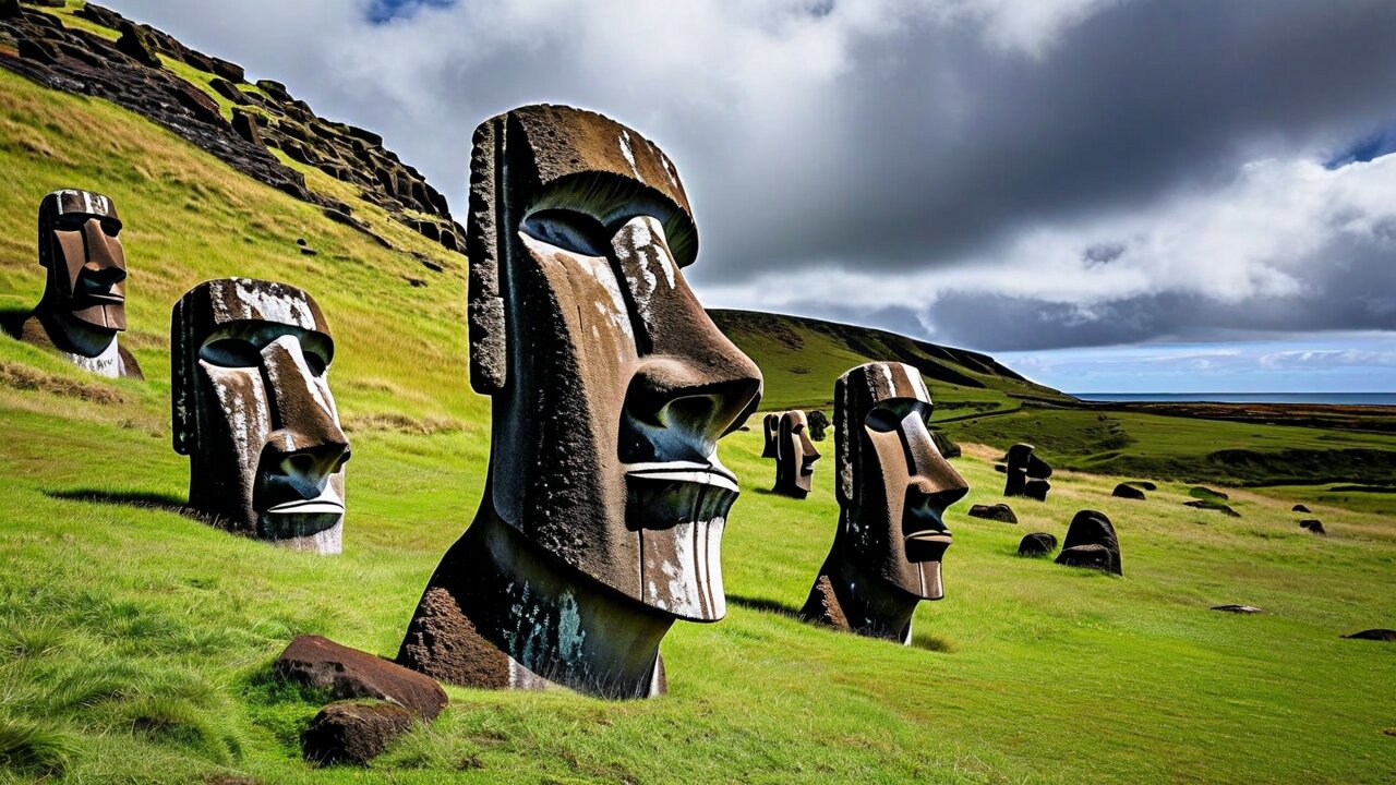
The famous "heads" at Rano Raraku are complete figures buried to the shoulders by centuries of erosion. Excavations have exposed full torsos, some carved with petroglyphs on the back.
How they were moved is the island's other great question. Rapa Nui oral tradition says the moai walked. In 2012 Terry Hunt and Carl Lipo demonstrated that a standing replica can be rocked forward by three teams pulling ropes, walking upright with a rolling gait — and the shape of the abandoned in-transit statues, with their forward lean and D-shaped base, is exactly what that method needs. The competing sledge-and-log theories are not dead, but for the first time the tradition and the physics agree.
Ninety-five per cent of all moai came out of one hillside. Rano Raraku is a tuff cone on the east side of the island whose outer and inner slopes were quarried for three centuries, and the site was abandoned so abruptly that it functions as a photograph of the work stopping mid-stroke.
Around 400 moai in every stage — outlines still attached to bedrock, figures freed but not detached, finished statues standing upright on the slope waiting to move, and a few lying broken.
El Gigante
An unfinished statue still lying in its niche, about 21 m long. Had it been completed it would have been more than twice the height of any moai ever raised, and it is not clear it could have been moved at all.
Tukuturi
The odd one out: a small kneeling, bearded figure in a naturalistic style unlike anything else on the island, and possibly the oldest or the youngest moai. Nobody is sure.
The crater
A separate path leads inside the cone to a reed-covered lake and more statues on the inner slope. Do both; most visitors do only the outer.
Why it stopped
Work ended abruptly, but the site shows no violence. The most likely explanation is that the social system that ordered and paid for statues stopped functioning, not that the workers fled.
Practical
Entry only with the park ticket, and a guide is required. Allow two hours. It is 18 km from Hanga Roa and combines naturally with Tongariki, 1 km away.
An ahu is a stone platform, usually a burial site, and there are around 300 of them around the island's coast. Ahu Tongariki is the largest: a 220 m structure carrying fifteen moai in a row, backed by the sea, facing the sunrise for half the year. It is the island's defining image.
The tsunami
The statues had already been toppled when, in 1960, the tsunami from the magnitude 9.5 Valdivia earthquake in Chile struck the site and threw the moai up to 100 m inland, scattering the platform.
The restoration
Between 1992 and 1996 the ahu was rebuilt and the fifteen statues re-erected by a Chilean-Japanese team, using a crane donated by the Tadano company. It is the largest archaeological restoration ever undertaken in Polynesia.
The travelling moai
One moai stands alone in front of the platform. It went to Osaka for Expo '70 and came back, and is universally known as the travelling moai.
Sunrise
Between roughly the equinoxes the sun rises behind the row. It is genuinely worth the 05:30 alarm, and the site is busy but large enough to absorb everyone.
Ahu Vinapu
Near the airport: a platform whose beautifully fitted stone wall was Heyerdahl's evidence for Inca contact. Modern archaeologists read it as independent Polynesian masonry, but it is remarkable regardless.
The rule
Never walk on an ahu, never touch a moai, and stay behind the marked lines. These are burial sites with people in them, and the rules are enforced with fines.
When the moai stopped, something else took over. From perhaps the 1760s until the 1860s the island was organised around the tangata manu — the birdman — an annual competition held at the ceremonial village of Orongo on the rim of Rano Kau, 300 m above the sea.
Each clan chief entered a champion, a hopu. In spring the competitors climbed down the cliff, swam 1.5 km through shark water to the islet of Motu Nui on floats of totora reed, and waited — sometimes for weeks — for the first sooty tern of the season to lay. The first man to find an egg shouted the news across the water, swam back with it bound to his forehead, and climbed the cliff. His sponsor became birdman for the year, with ritual authority over the distribution of resources.
The village
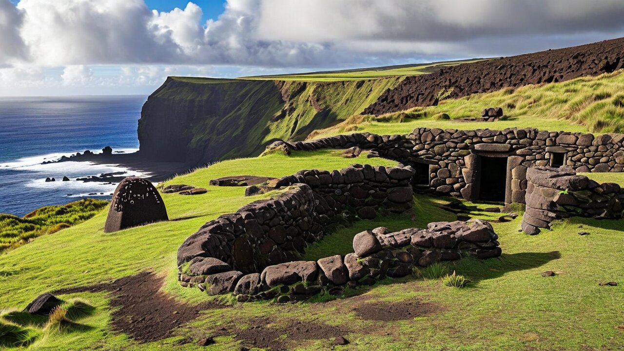
53 low houses of stacked stone slabs with turf-covered roofs and crawl-through entrances, built to survive the wind on an exposed rim.
The petroglyphs
More than 480 carvings of the birdman figure — a crouching man with a frigatebird head holding an egg — cut into the boulders at the cliff edge. The best concentration of rock art on the island.
Hoa Hakananai'a
The most important moai from Orongo, carved with birdman motifs on its back, was taken by the crew of HMS Topaze in 1868 and is in the British Museum. Rapa Nui have formally requested its return.
The end
The last competition was held in the 1860s. Missionaries and the collapse of the population ended it, and the details survive largely because Katherine Routledge recorded them from elderly islanders in 1914.
Rano Kau
The crater below Orongo is 1.6 km across and 200 m deep, its lake covered by a floating mat of reeds. It is the best view on the island and the walk up from Hanga Roa is a fine morning.
Practical
Park ticket required, a guide is required, and the site can be visited only once on the standard ticket. Windy and exposed — take a jacket even in February.
On about two dozen wooden objects scattered through the museums of the world are lines of small, precise glyphs — birds, fish, human figures, geometric signs — carved in a system called rongorongo. It is written in reverse boustrophedon: you read a line, then turn the tablet 180 degrees to read the next. Nobody can read it.
How many
Around 26 surviving objects are generally accepted as genuine, none of them on Easter Island itself — they are in Rome, London, Saint Petersburg, Santiago, Vienna, Honolulu and elsewhere.
Why it is lost
The people who could read it were among those taken by the Peruvian slave raiders in 1862 or killed by the epidemic that followed. Missionaries also burned tablets. The knowledge was gone within a generation.
Is it writing?
Probably, at least in part. Some sequences behave like a lunar calendar. Others may be mnemonic rather than fully phonetic — a prompt for a chant rather than a transcription of it.
Independent invention?
If rongorongo is true writing developed without outside contact, it is one of very few independent inventions of writing in human history. A 2024 radiocarbon study of one tablet suggested the wood predates European arrival, which would strengthen that case.
What you can see
The Museo Antropológico Sebastián Englert in Hanga Roa displays casts and explains the script well. The originals are all abroad.
Beware of certainty
Decipherments are announced regularly and none has held up. Treat any confident claim about what a tablet says with the scepticism it has earned.
Easter Island is the world's favourite parable: a society that cut down its last tree to move statues and destroyed itself. Jared Diamond made the case at length in Collapse (2005), and it has been repeated ever since as a warning about ecological limits. The evidence for it has weakened considerably.
What is agreed
The forest did disappear. A giant palm covered much of the island at settlement and was gone by the 17th century. Deforestation removed the canoe timber, exposed soil to erosion and ended seabird nesting on the main island.
The rats
Hunt and Lipo argue the Polynesian rat, which arrived with the settlers, ate the palm nuts and prevented regeneration. Gnawed nut shells are abundant. Humans cleared land; rats ensured nothing grew back.
Population
The "crash from 15,000 to 3,000" figure that underpins the collapse story is not well supported. Recent modelling and DNA work suggest the pre-contact population was smaller and more stable than assumed — perhaps around 3,000 for a long period.
Rock gardens
Islanders responded to poor soil with manavai walled gardens and lithic mulching — covering fields with broken rock to retain moisture and nutrients. This is adaptation, not collapse.
What actually happened
The catastrophic depopulation is documented and dated: slave raiding in 1862–63, then smallpox and tuberculosis, then land dispossession. From roughly 3,000 to 111 people in fifteen years.
Why it matters
The parable version places the blame on the islanders for their own destruction. The evidence places most of it on what arrived from outside. Rapa Nui people are, understandably, tired of the first version.
The honest summary: this was a society that transformed its environment drastically, adapted to the result with real ingenuity, and was then destroyed by external contact. It is a more complicated story than the parable and a considerably more useful one.
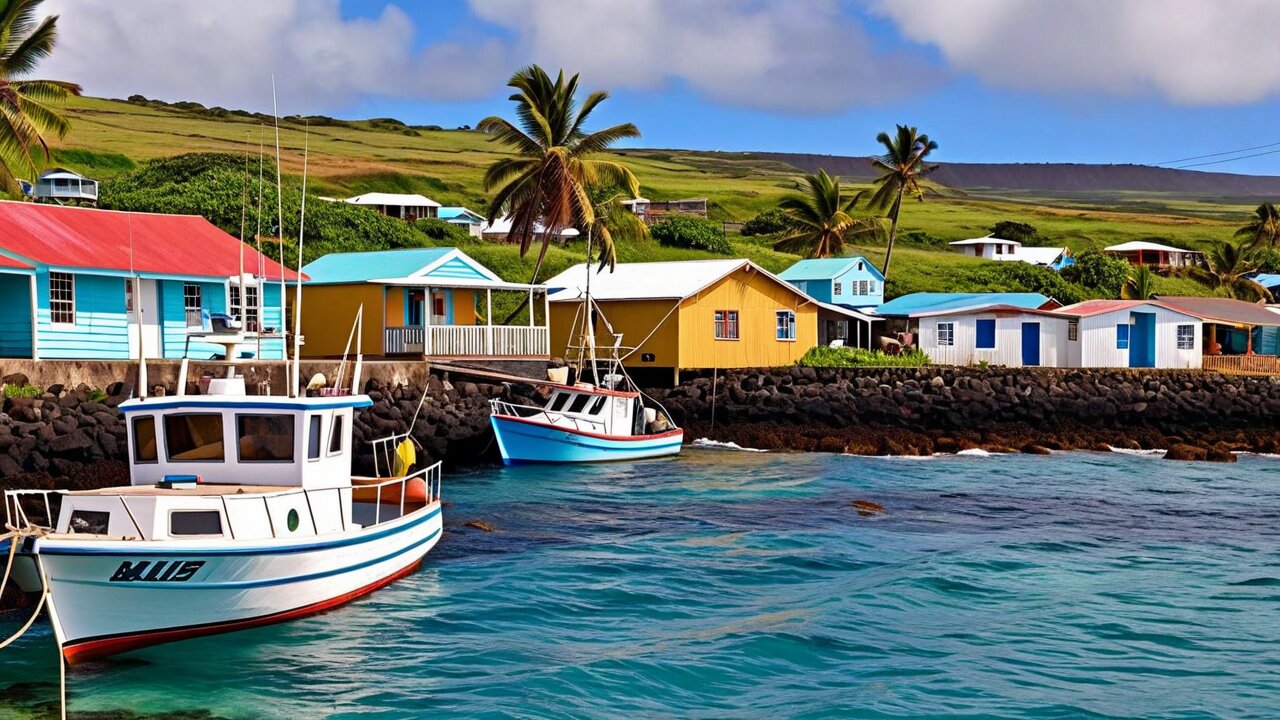
Everybody on the island lives in Hanga Roa, a town of roughly 7,000 people on the west coast, and everything else is either archaeology or grass. It is low, spread out and unhurried, with two main streets, a fishing harbour, a church, a market and more horses wandering the verges than seems reasonable.
The anthropological museum, named for the Bavarian Capuchin priest and linguist who spent 34 years here. Small, excellent, and the place to see the recovered coral eye. Go on your first day, not your last.
Iglesia Hanga Roa
The Catholic church, whose carved wooden statues merge Christian and Rapa Nui iconography — the Virgin with a birdman above her. Sunday mass is sung in Rapa Nui and is open to visitors who behave like guests.
Feria Municipal
The morning market: fruit and vegetables flown in, fish landed locally, and the best-value food on the island.
Ahu Tautira
Two moai right at the harbour, in the middle of town — the first ones most visitors see and a good reminder that this is a lived-in archaeological site.
Eating
A dozen or so restaurants, mostly along Te Pito o Te Henua and Policarpo Toro. Tuna is the thing to order. Prices are high and the quality is generally good.
Cash
Two banks with ATMs that do run out, especially at weekends and around festival time. Take pesos with you and treat card acceptance as a bonus.
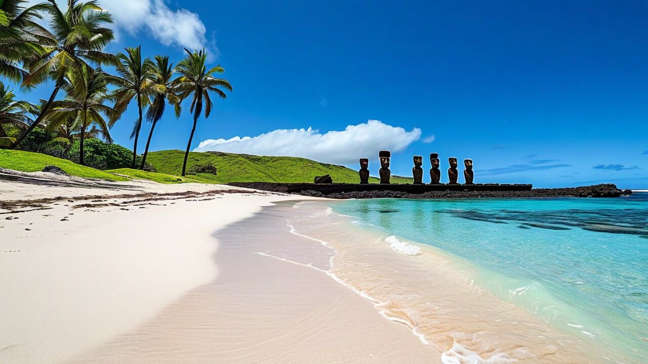
Anakena is the island's proper beach — white coral sand, coconut palms planted in the 1960s, turquoise water — and it is also where oral tradition says Hotu Matu'a landed and where the archaeology puts the earliest settlement. Standing on the sand with Ahu Nau Nau behind you is the closest the island comes to a postcard.
Seven moai, five with pukao, excavated and re-erected by Sergio Rapu in 1978 — the dig that recovered the intact coral eye. The surface detail, including the carved backs, is exceptional.
Ahu Ature Huki
On the rise above the beach: the first moai ever re-erected in modern times, raised by islanders with wooden levers under Heyerdahl's direction in 1956, in eighteen days.
Swimming
Safe, warm and sheltered — one of only two swimmable beaches. Ovahe, a small red-sand cove nearby, is prettier and has dangerous surf and rockfall; take local advice before entering the water there.
Facilities
Toilets, changing rooms and a few food stalls. Bring water anyway.
Te Pito Kura
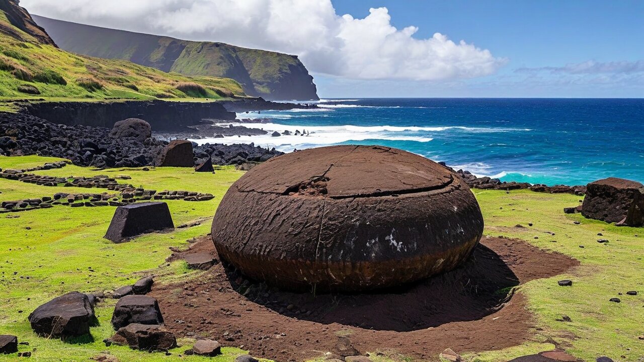
On the coast between Tongariki and Anakena: a large, almost perfectly rounded stone in a ring of smaller ones, traditionally said to hold mana and brought by Hotu Matu'a. Beside it lies Paro, the largest moai ever raised, face down where it fell.
The north coast walk
From Hanga Roa around the roadless northern shore to Anakena: 20 km, seven hours, no shade, no water, and archaeological sites the tour buses never reach. The best hard day on the island.
Two sites deserve their own visit rather than a stop on a circuit. Ahu Tahai is a fifteen-minute walk north of Hanga Roa and is where the island goes to watch the sun set. Ahu Akivi is inland, and its seven moai are the only ones on the island that genuinely face the sea.
Three ahu in one complex, restored by the American archaeologist William Mulloy in the 1960s and 70s. Ko Te Riku is the one with a restored white coral eye — the only moai on the island that can look at you.
Mulloy's grave
William Mulloy, who restored Tahai, Akivi and Vinapu and did more than anyone to give the island back its standing statues, is buried at Tahai. His memorial is easy to miss and worth finding.
Ahu Akivi
Seven moai facing the sea, restored in 1960. They are not looking outward for the view: like all moai they face their village, which in this inland case happened to lie between them and the coast.
The alignment
Akivi's statues face sunset at the spring equinox and have their backs to sunrise at the autumn equinox. Whether that is deliberate astronomy or a by-product of the village layout is argued about.
Puna Pau
The small red scoria crater where the pukao were quarried. Unfinished topknots lie around the slope, and the view over the island's interior is excellent.
Ana Te Pahu & Ana Kai Tangata
Two accessible lava tubes — the first a collapsed tube used as a garden, the second a sea cave with painted birdman figures on the ceiling. Access to Ana Kai Tangata has been restricted at times for rockfall; check locally.
The island is small, treeless and rolling, which makes it superb walking country: you can see where you are going, there is nothing to get lost in, and the archaeological sites you reach on foot are the ones nobody else is at. The catch is that there is no shade and no water anywhere outside town.
Maunga Terevaka
511 m, the highest point, about three hours return from Ahu Akivi or five from Hanga Roa. From the top you can see the entire coastline at once — the only place on the island where the horizon is sea in every direction.
Rano Kau on foot
From Hanga Roa up the road or the trail to the crater rim, about 90 minutes and 300 m of ascent. Do it early, and combine with Orongo.
Poike
The oldest volcano, in the far east — a big grassy headland with cliffs, almost no visitors and the Poike ditch, an earthwork long claimed as a battle site and now read more cautiously.
The north coast
Hanga Roa to Anakena by the coast: 20 km with no road, no water, no shade and no phone signal in places. Start at dawn, carry three litres, and tell someone.
Guides
Many sites within the national park require a licensed local guide. Open ground between sites does not, but hiring a Rapa Nui guide for a walking day is both the rule-compliant and the more interesting option.
Sun and wind
27° south with thin cloud cover and constant wind that hides how hard the sun is working. Hat, long sleeves, high-factor sunscreen. People burn badly here on day one.
Rapa Nui has some of the clearest water on Earth — visibility routinely 40 to 50 m and occasionally more, because there is no river runoff, no reef sediment and no plankton bloom to speak of. What it does not have is many fish. The isolation that produced the moai also produced a thin, highly endemic marine fauna.
Visibility
Genuinely extraordinary. Divers used to the Caribbean or the Red Sea describe it as flying rather than swimming. Water 20–26 °C depending on season; a 3–5 mm suit is right.
What you see
Dramatic volcanic topography — arches, drop-offs, caverns — coral heads, and a small cast of fish of which around a quarter are found nowhere else. Not a big-fish destination.
The underwater moai
A concrete replica placed on the sea floor off Hanga Roa for a film in the 1990s. It is not an artefact, everybody knows it is not an artefact, and it is still the most-photographed dive on the island.
Motu Nui
Diving around the birdman islet is the best of it, conditions permitting. The swim the hopu made is easier to respect once you have seen the water.
Surfing
A serious local scene, with reef breaks right off Hanga Roa. Powerful, shallow and unforgiving — not a place to learn.
Fishing
Tuna, and it is the island's one abundant fresh protein. If a restaurant offers atún caught that morning, order it.
On the roadless west coast north of Tahai: an unrestored ahu with fallen moai, house foundations and a boat-shaped hare paenga outline. Reachable on foot and almost always empty.
Papa Vaka
Petroglyph panels beside the north coast road showing fish hooks, tuna and a canoe — the largest carved fish hook on the island is over two metres. Free, signposted and skipped by nearly everyone.
Ana Te Pahu
A collapsed lava tube used as a sheltered garden, with banana and taro growing in the sinkhole. You can walk into the tube itself with a torch.
Ahu Akahanga
The traditional burial place of Hotu Matu'a, on the south coast — a large unrestored ahu with a dozen moai lying face down exactly where they were toppled. This is what the whole island looked like in 1900.
Puna Pau at sunset
The pukao quarry catches the last light beautifully and has a panorama over Hanga Roa. Ten minutes from town and usually deserted.
Ovahe
A small pink-sand cove near Anakena backed by a cliff. Beautiful, and genuinely hazardous — rockfall and strong surf. Look, take advice, and be careful about swimming.
Around 7,750 people live on Rapa Nui, and roughly half of them are of Rapa Nui descent — the rest are mainland Chileans, plus a small international community. Every Rapa Nui alive today descends from the 111 people who survived 1877. That fact sits underneath everything: the culture you encounter is not a survival, it is a reconstruction, carried out deliberately and successfully over the past sixty years.
The revival
Language teaching, the Tapati festival, tattooing, dance, carving and body painting have all been rebuilt since the 1960s from oral memory, ethnographic records and Polynesian parallels. It is conscious cultural work and islanders are open about that.
Tattoo
Traditional Rapa Nui tattooing was suppressed by missionaries and has been revived using motifs from the petroglyphs. Several serious practitioners work on the island.
Carving
Wood and stone carving is the main craft — moai kavakava, the gaunt rib-showing figures, are the distinctive form. Buy from the carver or the market, not from a shop selling identical pieces.
Family
Extended and land-based. Land ownership, and the return of land from the Chilean state, is the central political issue on the island and has produced protests and occupations.
Attitude to visitors
Warm, and simultaneously well aware that tourism is both the economy and the pressure. Following the site rules and hiring local guides is not box-ticking; it is the arrangement the community fought for.
The 2018 law
Ley 21.070 limits non-resident stays to 30 days and controls migration from the Chilean mainland. It passed because unrestricted arrival was overwhelming the island's water, waste and housing.
Spanish is the working language and everyone speaks it. Rapa Nui is an Eastern Polynesian language, closely related to Tahitian, Marquesan and Māori, and is spoken fluently by a minority — mostly older people — with an active revival programme in the schools. UNESCO classifies it as endangered. Learning six words of it is noticed immediately.
Iorana
Hello, goodbye, welcome. The single most useful word on the island and the one you will hear most.
Maururu
Thank you.
Pehe koe?
How are you? Answer rivariva — well.
Ahu / moai / pukao
Platform / statue / topknot. Knowing the three makes every site sign legible.
Motu / rano / maunga
Islet / crater with water / mountain. These three build most place names on the island.
Ka oho
Let's go. Also the name of half the tour boats.
English is spoken in hotels, dive shops and by most guides, and less widely elsewhere. Practical Spanish is more useful here than practical English, and a phrasebook is worth having.
Tapati Rapa Nui, held over roughly the first two weeks of February, is the island's cultural festival and the best time of year to be here — if you have booked months in advance. Two candidates, backed by extended families, compete across a fortnight of events, and the whole island takes part.
Haka pei
The signature event: young men slide 300 m down the 45-degree slope of Maunga Pu'i on a sledge of two lashed banana trunks, at speeds well over 50 km/h, wearing almost nothing. Injuries happen.
Takona
Body painting with natural pigments, judged on the accuracy and meaning of the traditional motifs, not just the look.
Riu
Ancestral chanting, performed by families. The oldest surviving layer of the culture and the most moving part of the festival.
Vaka ama
Outrigger canoe racing, plus swimming with reed floats and a triathlon around the crater lake of Rano Raraku.
Booking
Accommodation and flights sell out months ahead and prices rise sharply. If you want Tapati, plan it six months out.
Other dates
Día de la Lengua Rapa Nui in November, and the Catholic calendar — Easter here is, inevitably, a particularly good time for the island's name.
Almost everything except fish, some fruit and a little beef arrives by weekly ship or on the daily plane, and the prices reflect it. What is genuinely local is very good: tuna landed that morning, root vegetables, and the earth oven that Polynesia cooks in from here to Hawai'i.
Ingredients: A thick tuna steak, sea salt, lime, and nothing else. Optionally a little coriander.
Method: Salt the fish and leave it fifteen minutes. Grill over very hot coals or a dry pan, two to three minutes a side, so the outside caramelises and the centre stays rare. Squeeze lime over it at the table.
💡 The point is the freshness of the fish, not the technique. Overcooked tuna is the most common thing done wrong to it here and everywhere.
Po'e
The island dessert · 60 minutes · serves 6
Ingredients: Ripe bananas or pumpkin, flour or grated taro, a little sugar, coconut milk, banana leaves.
Method: Mash the fruit, work in the flour to a thick batter, wrap in banana leaves and bake in an earth oven or a moderate conventional oven for about 45 minutes until set. Serve warm with coconut milk poured over.
💡 Made in a curanto or umu when there is one. Every family has a slightly different ratio and each is convinced theirs is correct.
Umu pae
The stone-lined earth oven. Meat, fish and root vegetables wrapped in leaves and cooked for hours on hot stones under earth — the Polynesian technique, and worth seeking out at a cultural dinner.
Ceviche
Tuna rather than white fish, cured in lime with onion and coriander. Superb and everywhere.
Empanadas de atún
Tuna empanadas, sold at kiosks. The cheapest decent lunch on the island.
Fruit
Guava, mango, banana and pineapple grow here. Almost everything else is imported and priced accordingly.
Drink
Chilean wine and Chilean beer, both flown in and marked up. There is no local wine, no local spirit and no vineyard on the island — anything sold as "Easter Island wine" is Chilean wine with an island label.
Water
Tap water comes from the aquifer and is drinkable but often brackish. Most visitors buy bottled; a filter bottle saves money and plastic on an island with no recycling capacity.
The competitive core of island sport: haka pei, canoe racing, swimming with reed floats, spear throwing and the Rano Raraku triathlon. Amateur, ferociously contested and open to spectators.
Football
Played on the pitch at Hanga Roa. There is a local league, and the island has occasionally sent teams to mainland Chilean competitions.
Surfing
The strongest local scene. Reef breaks off Hanga Roa produce serious waves, and the island has produced surfers who compete in Chile.
Outrigger canoeing
Vaka ama, both competitively at Tapati and as a training culture. Occasionally teams travel to Polynesian regattas.
Rapa Nui horses
There are more horses than people, mostly semi-feral, and riding is a normal way to reach the north coast. Choose an operator that looks after them.
Running
There is an annual island marathon, run on the coastal roads. Small field, extraordinary route, brutal wind.
The founding ariki of tradition, who is said to have landed at Anakena with his people. Whether one man or a compressed memory of the founding voyages, he is the origin point of Rapa Nui genealogy.
Alfonso Rapu (b. 1942)
The schoolteacher who led the 1964 rebellion against Chilean administration, forcing the reforms that produced citizenship in 1966 and the island's first elected mayor. The pivotal figure of the modern island.
Sergio Rapu Haoa (b. 1949)
Archaeologist and the first Rapa Nui governor of the island. Led the 1978 Anakena excavation that recovered the intact coral moai eye and re-erected Ahu Nau Nau.
Katherine Routledge (1866–1935)
British archaeologist whose 1914–15 expedition produced the first systematic survey of the island and recorded birdman and rongorongo testimony from elderly islanders. Much of what is known survives because she asked.
Father Sebastián Englert (1888–1969)
Bavarian Capuchin priest, linguist and ethnographer who lived on the island for 34 years, compiled the first serious Rapa Nui dictionary and catalogued the archaeology. The museum bears his name.
William Mulloy (1917–1978)
American archaeologist who restored Ahu Akivi, Tahai and Vinapu and wrote the island's first conservation plan. Buried at Tahai, at his own request.
Thor Heyerdahl (1914–2002)
The Kon-Tiki navigator, whose 1955–56 expedition did real archaeological work and whose South American migration theory has not survived. Both halves of that sentence are true and usually only one gets told.
Mahani Teave (b. 1983)
Concert pianist, the island's most prominent contemporary figure abroad, who returned to found a music school in Hanga Roa built from recycled materials.
Petero Edmunds
Long-serving mayor and a central voice in the campaigns for land restitution, autonomy and the return of Hoa Hakananai'a from the British Museum.
Subtropical and mild, moderated by ocean on every side. Temperatures run roughly 18–28 °C in summer and 14–22 °C in winter, and rain falls in every month — around 1,100 mm a year, heaviest from about April to July. The genuinely constant factor is wind, and it is what makes the island feel cooler and the sun feel weaker than it is.
Dec–Mar — summer
Warmest, longest days, calmest sea, best diving, and the busiest and most expensive time. February brings Tapati and near-full occupancy.
Apr–Jun
Wetter and quieter. Prices drop, sites are empty, and the light for photography is often better than in high summer.
Jul–Aug — winter
Coolest and wettest, and the low season. Perfectly viable — the archaeology does not close — but take proper waterproofs and expect some grey days.
Sep–Nov
Improving weather, still quiet, and probably the best value on the island. A good compromise if Tapati is not the reason for going.
How long
Three full days is the sensible minimum for the main sites. Five allows a walking day, a dive and a slow morning. A week is not too much if you like the place.
Weather planning
Have a wet-weather plan — the museum, the caves, a long lunch. And do the exposed sites, Orongo especially, on the clearest morning you get rather than the day you scheduled them.
There is one airport, Mataveri (IPC), a five-minute walk from the middle of Hanga Roa, and essentially one airline. LATAM flies from Santiago de Chile (SCL), about 5.5 hours over open ocean, with frequency varying from daily in high season to a few times a week otherwise. There has historically also been a route onward to Papeete, Tahiti (PPT), which has been suspended and resumed more than once — verify it before planning around it.
The monopoly
One carrier on the route means fares are high and inflexible and a cancellation can cost you days. Book early, and build slack into any onward connection from Santiago.
The runway
Mataveri's runway was extended by NASA in 1987 to serve as an emergency abort landing site for the Space Shuttle. It is why an island of 7,750 people has a 3,300 m runway.
Baggage
Strictly enforced, and the flight is often full. Excess baggage on this route is expensive.
Cargo and shortages
Fresh food arrives on the plane and by ship. Shortages of specific items are normal and nobody on the island finds them remarkable.
Cruise ships
A handful call each season and tender ashore, weather permitting — the anchorage is exposed and calls are cancelled often. A cruise day gives you a bus tour and nothing more.
Arrival
The park ticket can be bought at the airport on arrival and this is the simplest way to do it. Have your accommodation booking and return ticket to hand for the entry check.
Easter Island is one of the hardest places on Earth to reach from Central Europe, and there is no clever routing that avoids it: you fly to Santiago de Chile and then 3,700 km further west. Budget two full days each way and treat Santiago as a stop rather than a connection.
The route
Prague to Madrid, Paris, Frankfurt or Amsterdam; long-haul to Santiago (about 13–14 hours from Madrid); then LATAM to Mataveri. Total flying time is roughly 24 hours.
Best carriers
Iberia and LATAM via Madrid is usually the cleanest single-ticket option from Prague. Air France via Paris and KLM via Amsterdam also work.
One ticket, please
Book the Santiago–Easter Island leg on the same ticket as the long-haul if you possibly can. A separate ticket means a missed connection is entirely your problem, on a route with no alternative flight.
Stop in Santiago
Plan at least one night there in each direction. It removes the connection risk and Santiago is worth a day anyway.
Cost from Prague
Reckon on CZK 45,000–75,000 return for the whole journey depending on season and how far ahead you book. The Santiago–IPC sector alone is often US$400–900 return.
Combine it
Almost everyone pairs Rapa Nui with Chile — Atacama, Patagonia, the wine valleys — or continues to Tahiti when that route is flying. Going all that way for the island alone is a lot of flying for five days.
Rapa Nui has entry requirements that no other part of Chile has, introduced by Ley 21.070 in 2018 to control the number of people on the island. They are checked at the gate in Santiago, not on arrival, and travellers who have not read them get turned away. This is the single most important practical section on this page.
30-day limit
Non-residents may stay a maximum of 30 days. There are no extensions for tourism.
What you must show
A return or onward ticket, and either a booking with a registered island accommodation provider or a formal invitation from a Rapa Nui resident. Both are checked before boarding.
The entry form
A single entry form (Formulario Único de Ingreso) must be completed — currently online in advance. Requirements change; check the Chilean immigration and Rapa Nui provincial pages within a month of travelling.
Passport and visa
Rapa Nui is Chile. EU, UK, US and Canadian citizens need no visa for tourism; the standard Chilean entry applies and you clear immigration in Santiago, not on the island.
The park ticket
Rapa Nui National Park charges around US$80 for foreign adults (substantially less for Chileans and children), valid for 10 days. Buy it at the airport on arrival or online in advance. It is checked at every site.
One visit only
Orongo and Rano Raraku may each be entered once on a standard ticket, and the ticket is stamped. Plan those two for good weather; you do not get a second attempt.
Guides
Most sites within the park require a licensed local guide. Independent walking between sites is fine; entering the major sites unaccompanied is not.
Rules on site
Do not climb on ahu, do not touch moai, do not take stone from anywhere, stay on marked paths, no drones without a permit. Fines are real and the wardens are attentive.
Why
These are burial sites belonging to a community of fewer than eight thousand people receiving many times that number of visitors a year. The rules are the price of the place still existing in fifty years.
Chilean peso (CLP). US dollars are accepted in some places at a poor rate. Cards work in hotels and larger restaurants; small guesthouses, guides, market stalls and taxis often want cash.
ATMs
There are only a couple on the island and they do run dry, particularly at weekends and during Tapati. Bring pesos from Santiago. This is the most common practical mistake visitors make.
Prices
Expect mainland Chilean prices plus 50–100% on almost everything. It is not a rip-off; it is the freight cost of an island 3,700 km from its supplier.
Electricity
220 V, 50 Hz, Chilean sockets (type C and the three-pin type L). A standard European plug fits the type C sockets; check your accommodation.
Connectivity
Mobile coverage in and around Hanga Roa, patchy elsewhere and absent on the north coast. Wifi is available and slow — the island is served by satellite, and a submarine cable has been proposed for years.
Health
One hospital in Hanga Roa, adequate for routine problems. Anything serious means a medical flight to Santiago, five and a half hours away. Travel insurance with evacuation cover is not optional here.
Safety
Crime is very low and violent crime against visitors is close to unknown. The real hazards are sun, wind, cliffs, surf and driving on dirt roads.
Vehicle hire
Cars and quad bikes are widely available and — importantly — usually rented without insurance, which is legal on the island. You are liable for damage. Read the contract and drive accordingly.
Time zone
UTC−6 in winter and UTC−5 in summer, which is two hours behind mainland Chile. Watch this when booking your flight out.
Sun
27° south, thin cloud, constant wind masking the heat. Hat, sunglasses, long sleeves and high-factor sunscreen from day one.
Waste and water
The island has limited waste processing and a fragile aquifer. Take a refillable bottle, take your rubbish back to town, and do not buy more plastic than you must.
Emergency
133 for police, 131 for ambulance. The whole island is within twenty minutes of the hospital by road.
Rapa Nui is expensive, and there is no budget version of it. The one lever you can pull is accommodation; everything else — the flight, the park ticket, the guides, the food — is what it is. Figures are per person per day in US dollars at 2026 levels, excluding flights and the park ticket.
Budget · US$90–130
Guesthouse or camping, self-catering from the supermarket, bicycle or walking, sharing a guide. Doable and still not cheap.
Mid-range · US$180–280
Small hotel or a good cabaña, restaurant meals, a hire car for two days, a guided full-day tour.
Higher end · US$400+
The handful of upmarket lodges, private guiding and full board. The top property on the island is genuinely expensive.
Fixed costs
Park ticket ~US$80 · full-day guided tour US$70–120 · two-tank dive US$110–140 · car hire US$60–90 a day · quad US$50–70 · airport transfer often free with accommodation.
A realistic five-day mid-range trip, excluding international flights, lands somewhere around US$1,300–1,900 per person including the park ticket and the Santiago sector.
Every bed on the island is in or immediately around Hanga Roa, so the choice is about type and price rather than location. Booking with a registered provider is not optional — you need the confirmation to board the flight.
Residenciales
Family-run guesthouses, the traditional and by far the most common option. Usually include airport transfer and often breakfast, and the family is your best source of local information.
Cabañas
Self-catering cabins, the sweet spot for two or more people or for stays over three nights. Cooking your own breakfast and lunch makes a real difference to the daily cost.
Hotels
A modest number of mid-range and a couple of genuinely high-end lodges on the edge of town, with island-wide guiding included at the top end.
Camping
Permitted at a few managed sites in Hanga Roa only. Wild camping in the national park is prohibited and enforced.
Transfers
Almost every property meets the flight and drives you the five minutes into town, usually free and usually with a flower garland. Confirm it when you book.
Booking
Book before you book the flight, since you cannot board without it. For February, book six months ahead.
Rapa Nui National Park was inscribed on the World Heritage List in 1995. It covers around 40% of the island — roughly 7,000 hectares — and includes essentially every major archaeological site: Rano Raraku, Orongo, Tongariki, Anakena, Akivi, Tahai and the coastal ahu.
Why it was listed
Criteria (i), (iii) and (v): the moai as a masterpiece of creative genius, the culture as exceptional testimony to a vanished tradition, and the landscape as a record of human settlement under extreme isolation.
Ma'u Henua
Since 2016 the park has been administered by the Ma'u Henua Indigenous community rather than by CONAF, the Chilean forestry service. It was the first such transfer in Chile and the park fee funds it.
Conservation problems
Erosion, grazing horses and cattle, salt spray, lichen, and rising sea level threatening coastal ahu. A 2022 wildfire on the flank of Rano Raraku damaged a number of moai.
Visitor pressure
The 2018 residence law and the capped, guided access to the major sites are the direct response. Without them the site was measurably degrading.
Hoa Hakananai'a
The moai removed to the British Museum in 1868. Rapa Nui representatives travelled to London in 2018 to request it; discussions continue and nothing has been returned.
Your part
Buy the ticket, hire local guides, stay behind the lines, take nothing. It is a very short list and it is the whole ask.
Almost all of them have their backs to the sea. They were watching over their villages, not looking out for ships — which is the opposite of what nearly every photograph implies.
They have bodies
The famous "heads" at Rano Raraku are complete figures buried to the shoulders by five centuries of silt. Excavated ones have full torsos, arms and carved petroglyphs on the back.
The statues walked
Rapa Nui tradition always said the moai walked to their platforms. In 2012 a team demonstrated exactly that with a replica, ropes and eighteen people — the tradition turned out to be a description, not a metaphor.
A shuttle runway
NASA extended Mataveri's runway in 1987 as an emergency landing site for the Space Shuttle, which is why the island has a runway longer than most European regional airports.
More horses than people
Several thousand semi-feral horses roam the island, comfortably outnumbering the human population and creating a genuine hazard on the roads at night.
Two hours behind Chile
Rapa Nui keeps its own time zone, two hours behind the mainland. Missing this when booking the flight home is a classic error.
Its own writing
Rongorongo may be one of the very few independent inventions of writing in human history — and it remains undeciphered, with the last readers taken by slave raiders in 1862.
The tsunami threw them inland
The 1960 Valdivia earthquake, 3,700 km away, generated a wave that carried Tongariki's fifteen fallen moai up to 100 m from their platform.
The toromiro
The island's endemic tree became extinct in the wild. It survives only because Thor Heyerdahl collected seeds in 1955 and European botanical gardens grew them on; reintroduction is under way.
Terry Hunt and Carl Lipo's 2011 book, the readable case for the revisionist account of the island's history. Read it against Diamond rather than instead of him.
Collapse
Jared Diamond's 2005 book, whose Easter Island chapter created the parable most people arrive with. Influential, elegantly argued, and substantially contested.
Aku-Aku
Thor Heyerdahl's 1957 account of his expedition. Dated in its conclusions and still a genuinely gripping piece of travel writing.
The Mystery of Easter Island
Katherine Routledge's 1919 account of the first scientific expedition, and a primary source for birdman and rongorongo testimony that would otherwise be lost.
Rapa Nui (1994)
Kevin Reynolds's film, produced by Kevin Costner, shot on the island with a large local cast. Historically loose to the point of fiction, and the birdman race sequence is still worth watching.
Music
Contemporary Rapa Nui groups mix Polynesian chant with guitar and ukulele. Buy a recording at the market — streaming coverage of island artists is thin.
Photographs are illustrative. Where an image could not be verified as a specific named monument, the caption describes the subject in general terms rather than naming it.
Two things about Rapa Nui surprised me, and neither is the statues. The first is how small it is: you can drive the whole island in an afternoon, and the entire archaeological corpus that has occupied a century of scholarship sits inside an area smaller than a mid-sized European city. The second is how recent everything is. The moai were being carved while Prague was building the Charles Bridge, and the society that made them was destroyed within living memory of people whose grandchildren are alive now.
That second fact is the one worth carrying. The version of this island that most visitors arrive with — mysterious vanished civilisation, ecological suicide, statues nobody can explain — is largely wrong, and it is wrong in a way that removes the people who live here from their own story. They are not gone. They are running the national park you are about to buy a ticket for.
Practically: read the entry rules before you book anything, take pesos, book your accommodation before your flight, and do Orongo and Rano Raraku on your two best mornings, because you only get one entry to each. And do the north coast walk if you are fit enough. Six hours on empty ground with fallen moai lying where they were pulled down is worth more than any tour.