Central Africa · Rainforest • Dzanga-Sangha • Gorillas • Forest Elephants
Central African Republic
The Heart of Africa — Where Forest Elephants Gather at Dzanga Bai and Western Lowland Gorillas Roam Free
🇨🇫
🇨🇫 Central African Republic at a Glance
👥
5.7M
Population
📐
622,984
km² Area
🏔️
1,420m
Mt. Ngaoui
⛪
85%
Christian
🗣️
French
& Sango
💰
XAF
CFA Franc
🌡️
21/36
°C Range
🏛️
2
UNESCO Sites
01
🌏 Overview — Why Visit Central African Republic
The Central African Republic sits at the geographic heart of Africa, a landlocked nation of vast savannas, dense equatorial rainforests, and winding rivers that together create one of the continent's last great wildernesses. With roughly 5.7 million people spread across an area the size of France, this is one of the most sparsely populated countries on Earth—a place where nature still dominates the landscape and where wildlife roams in numbers that recall an earlier age.
For the intrepid traveler willing to embrace real adventure, the Central African Republic offers experiences that are virtually impossible to find anywhere else. In the southwestern corner, the Dzanga-Sangha rainforest shelters one of the world's densest populations of western lowland gorillas, habituated groups that can be tracked on foot through pristine jungle. At Dzanga Bai—a vast mineral-rich clearing in the forest—dozens of critically endangered forest elephants gather daily, observed from elevated platforms in a spectacle that ranks among Africa's greatest wildlife encounters. The indigenous BaAka people, renowned forest-dwellers, share their ancestral knowledge of the rainforest with visitors who join them on traditional net hunts and medicinal plant walks.
Beyond the famous southwest, the country's northern savannas harbor the vast Manovo-Gounda St Floris National Park, a UNESCO World Heritage Site that once rivaled the Serengeti for its wildlife concentrations. The Boali waterfalls cascade dramatically near Bangui. The Ubangi River, forming much of the southern border, carries pirogue canoes past villages where life moves at the rhythm it has kept for centuries. And everywhere, the warmth and resilience of Central Africans—who have endured decades of conflict yet maintain extraordinary hospitality—leave lasting impressions on those who visit.
2025 Update: The security situation in the Central African Republic remains challenging, with armed groups still controlling significant portions of the country. However, the southwestern Dzanga-Sangha region has remained relatively stable and accessible for organized tourism, thanks in part to the presence of international conservation organizations. All Western governments advise against travel to most of the country. Those who visit typically fly directly to Bayanga via charter from Bangui and travel with experienced tour operators specializing in gorilla and wildlife tourism.
⚠️ Critical Travel Advisory
Most Western governments advise AGAINST travel to the Central African Republic
Armed conflict ongoing: Armed groups control large parts of the country outside Bangui
Limited embassy services: Few Western embassies maintain full operations in Bangui
Dzanga-Sangha exception: The southwestern park area is generally safer and accessible via charter flight
Cash only economy: ATMs are unreliable; bring euros or CFA francs in cash
Limited medical facilities: Evacuations to Douala (Cameroon) or Europe may be necessary
Malaria risk: Year-round throughout the country; prophylaxis essential
Insurance: Ensure your policy covers evacuation from conflict zones
02
📛 Name & Identity
The Central African Republic takes its name from its geographic position at the very center of the African continent. During the colonial era, the territory was known as Ubangi-Shari (French: Oubangui-Chari), named after the two great rivers—the Ubangi and the Chari—that define much of its borders and drainage systems. When independence approached in the late 1950s, founding father Barthélemy Boganda championed the name "Central African Republic," envisioning it as the nucleus of a broader Central African federation that never materialized.
The country's identity has been shaped by a complex history of colonialism, autocratic rule, and civil conflict. Most notoriously, President Jean-Bédel Bokassa declared himself Emperor Bokassa I in 1976, renaming the country the "Central African Empire" and staging a lavish coronation ceremony modeled on Napoleon's. French paratroopers overthrew him in 1979, and the republic was restored. Since independence in 1960, the country has experienced multiple coups and armed conflicts, including the ongoing civil war that erupted in 2012.
The Central African Republic is home to more than 80 ethnic groups, with the Baya (33%), Banda (27%), Mandjia (13%), Sara (10%), Mboum (7%), and M'Baka (4%) being the largest. Each group maintains its own language and cultural traditions. In the southwestern rainforests, the BaAka (also called Bayaka or "Pygmy" peoples, though many consider this term pejorative) represent one of Africa's oldest indigenous communities, with deep ancestral knowledge of the forest ecosystem.
French serves as the official language—a legacy of colonial rule—and is used in government, education, and formal business. However, Sango, a creole language based on the Ngbandi tongue, functions as the true national language spoken and understood throughout the country, serving as a unifying force across ethnic lines. Most Central Africans are bilingual in Sango and their ethnic group's language, with French as a third language for the educated.
03
🗺️ Geography & Regions
The Central African Republic covers 622,984 square kilometers of landlocked territory in the heart of Africa—roughly the size of France or the US state of Texas. The country sits on a vast rolling plateau averaging about 600 meters in elevation, forming a natural watershed between two of Africa's great river systems: the Congo basin to the south and the Lake Chad basin to the north. Mount Ngaoui, at 1,420 meters in the western Karre Mountains near the Cameroon border, is the highest point.
The landscape divides into three broad ecological zones. The northern savannas, part of the Sahelo-Sudanian belt, feature open grasslands and scattered trees that become increasingly arid toward the Chadian border—this is the domain of the Manovo-Gounda St Floris National Park. The vast central plateau consists of Sudano-Guinean savanna, a mosaic of grasslands and gallery forests along rivers, where most of the population lives. The southern and southwestern regions transition into dense equatorial rainforest, part of the great Congo Basin forest—the second-largest tropical forest on Earth—and home to the extraordinary biodiversity of Dzanga-Sangha.
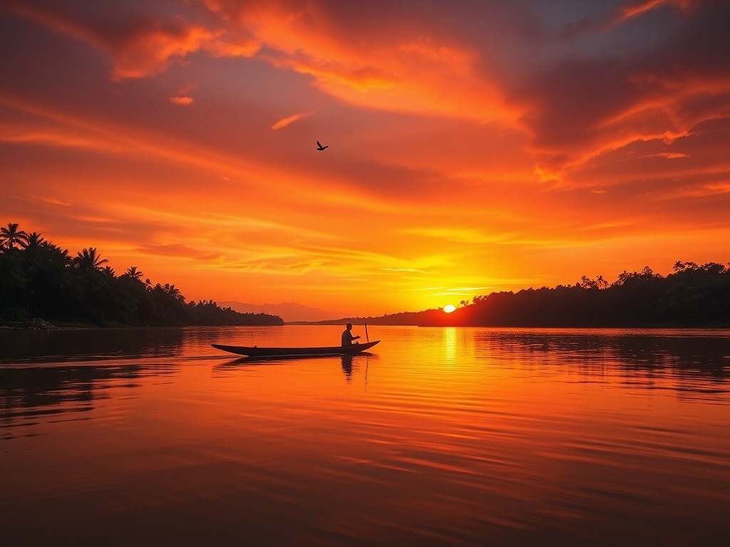
The country shares borders with six nations: Chad (1,556 km) to the north, Sudan (174 km) and South Sudan (1,055 km) to the northeast and east, the Democratic Republic of the Congo (1,747 km) to the south, the Republic of the Congo (487 km) to the southwest, and Cameroon (901 km) to the west. The Ubangi River, a major tributary of the Congo, forms much of the southern border and passes through Bangui, the capital. The Sangha River in the southwest flows through the rainforest region toward the Congo.
The climate is tropical throughout, with a wet season running roughly from May to October in the south and June to September in the drier north. Temperatures are consistently warm, ranging from about 21°C to 36°C depending on season and region. The south receives up to 1,800 mm of rainfall annually, while the far north is considerably drier. The dry season, particularly from December to February, brings the hot, dusty Harmattan wind from the Sahara to the northern regions.
03b
🗺️ Map of Central African Republic
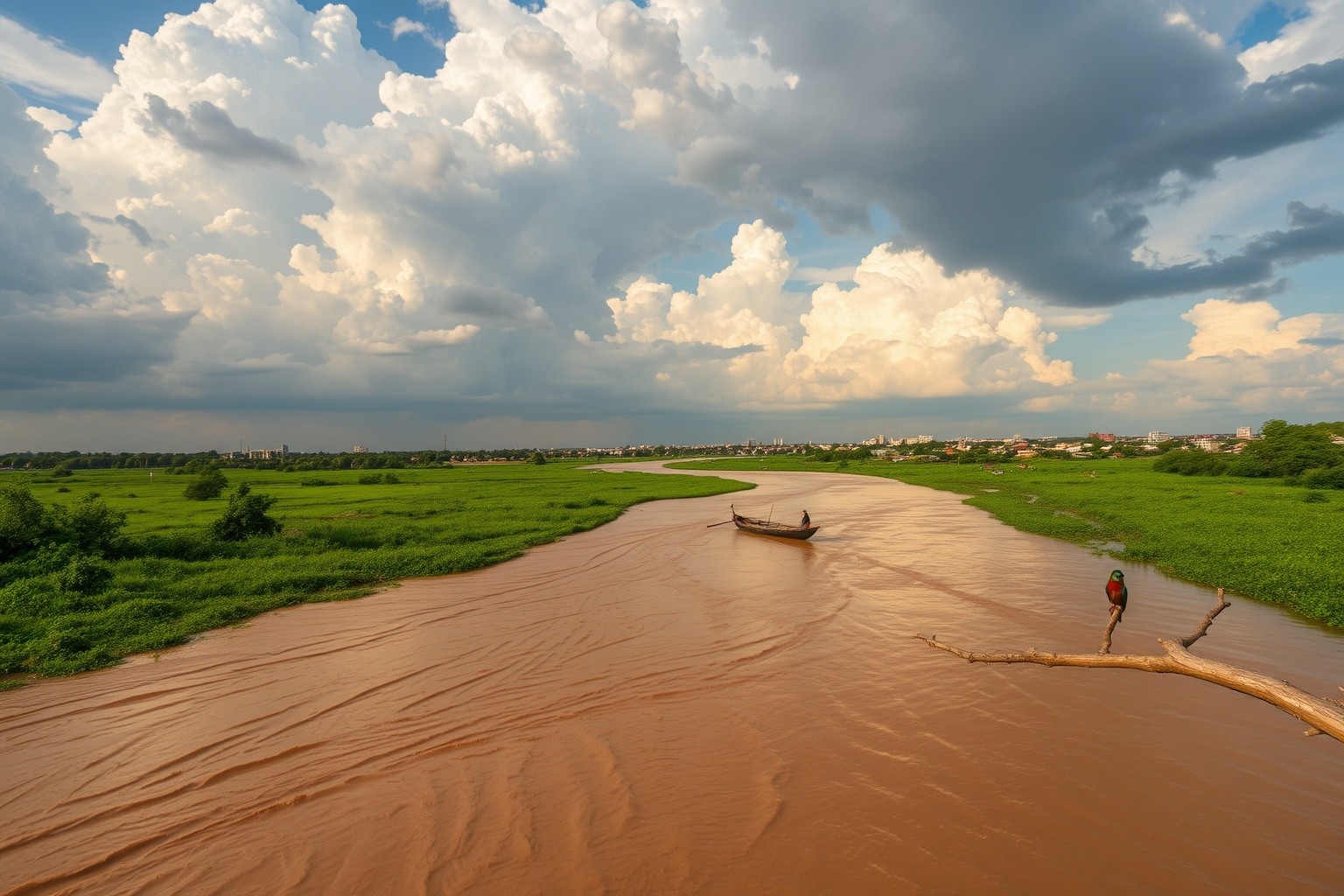
The Ubangi River
The mighty Ubangi flows past Bangui, forming the southern border — the country's lifeline for transport, fishing, and commerce
Savanna at Sunset
Golden light bathes the vast Sudano-Guinean savanna — the open grasslands and scattered trees that define the Central African landscape
04
🏛️ History
Human habitation in the Central African Republic dates back at least 10,000 years, when shifting climate patterns pushed hunter-gatherer societies southward into the Sahel and savanna regions. The BaAka and other forest-dwelling peoples are among the oldest inhabitants, while Bantu-speaking farmers migrated into the region over the past two millennia, bringing agriculture and iron-working. Before European contact, the territory was influenced by powerful neighboring kingdoms—including the Kanem-Bornu Empire to the north and various Bantu and Sudanic states—but never unified under a single indigenous power.
The region's modern tragedy began with the slave trade. From the 17th century onward, Arab and African slave raiders devastated the population, capturing hundreds of thousands of people for sale to North Africa and the Atlantic trade. French colonizers arrived in the late 19th century, establishing Bangui as a trading post in 1889 and formally creating the colony of Ubangi-Shari in 1903. French rule proved exceptionally brutal—the colonial government leased vast territories to private concessionary companies that used forced labor to extract rubber, ivory, and other resources, causing widespread suffering and population decline.
Independence came on August 13, 1960, under President David Dacko, but stability proved elusive. In 1966, Colonel Jean-Bédel Bokassa seized power in a coup and ruled with increasing megalomania—declaring himself Emperor in 1976 and staging an extravagant coronation financed largely by France. His regime ended in 1979 when French troops intervened after the massacre of schoolchildren. Subsequent decades brought a cycle of coups, brief democratic interludes, and renewed authoritarian rule. President Ange-Félix Patassé (1993–2003) and General François Bozizé (2003–2013) each came to power promising stability but ended in overthrow.
The current crisis began in 2012 when Séléka, a coalition of predominantly Muslim rebel groups from the northeast, launched an insurgency that captured Bangui in March 2013. The resulting sectarian violence between Séléka and Anti-balaka (predominantly Christian militias) displaced over a million people and devastated the country. Despite a peace agreement signed in 2019 and the election of President Faustin-Archange Touadéra in 2016 (reelected 2020), armed groups still control significant territory. A UN peacekeeping mission, MINUSCA, has been present since 2014, and Russian Wagner Group mercenaries have operated in the country since 2018, adding another layer of complexity.
05
👥 People & Culture
The Central African Republic's approximately 5.7 million people represent one of the world's youngest and most diverse populations. More than 80 ethnic groups coexist within its borders, each with distinct languages, traditions, and artistic expressions. Despite decades of conflict and some of the lowest development indicators on Earth, Central Africans maintain a vibrant cultural life centered on music, dance, storytelling, and communal bonds that have endured through extraordinary hardship.
Music is the heartbeat of Central African culture. The country's musical traditions range from the extraordinary polyphonic singing of the BaAka people—recognized by UNESCO as Intangible Cultural Heritage—to the popular modern genre of "Centrafrique rumba" that blends Congolese soukous with local rhythms. The balafon (wooden xylophone), ngombi (harp), and various drums form the backbone of traditional music. Dancing accompanies virtually every social and ceremonial occasion, with distinct styles varying by ethnic group and region. The guitarist and singer Musiki is considered one of the founders of the country's modern popular music scene.
Religion plays a significant role in daily life. Approximately 85% of the population identifies as Christian (roughly split between Protestant and Roman Catholic denominations), while about 10% practice Islam—primarily among northern communities and the trading diaspora—and traditional indigenous beliefs remain influential throughout the country, often blended with Christian or Muslim practice. Sadly, religious identity became a fault line during the recent civil conflict, pitting predominantly Muslim Séléka fighters against predominantly Christian Anti-balaka militias, though the roots of the conflict were political and economic rather than theological.
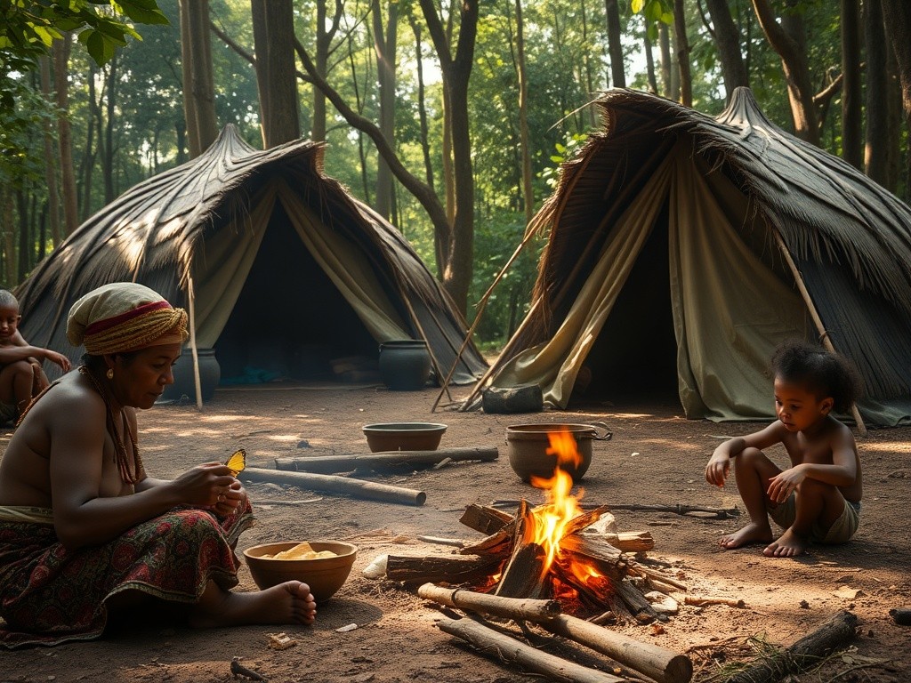
The BaAka people of the southwestern rainforests represent one of the most culturally distinctive communities in the Central African Republic. Semi-nomadic hunter-gatherers with an intimate knowledge of the forest ecosystem, they practice a remarkably egalitarian social structure and possess one of the world's most complex musical traditions. Their polyphonic singing, in which multiple independent vocal lines interweave in elaborate counterpoint, has been studied by ethnomusicologists and celebrated worldwide. BaAka traditional knowledge of medicinal plants and animal behavior makes them invaluable partners in conservation efforts at Dzanga-Sangha.
🗣️ Useful Phrases
Sango (national language):
Bala mo — Hello
Singila — Thank you
Tongana — Please
Ée / Én-én — Yes / No
Mo kwe ndé? — How are you?
French (official language):
Bonjour — Good day
Merci beaucoup — Thank you very much
S'il vous plaît — Please
Parlez-vous anglais? — Do you speak English?
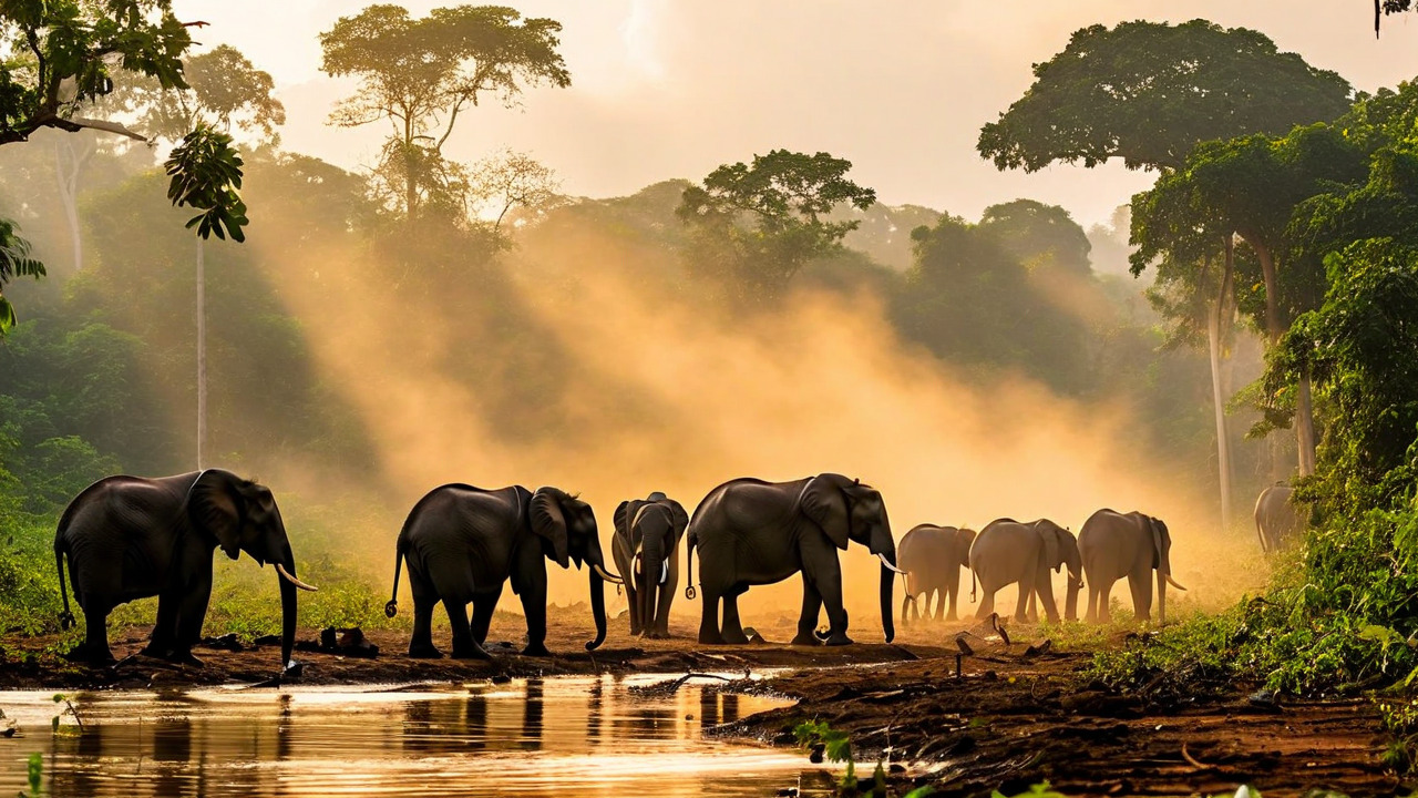
Dzanga Bai — Village of the Elephants
Dozens of critically endangered forest elephants gather daily at this mineral-rich clearing in the heart of the rainforest
06
🏙️ Bangui — Capital on the River
Bangui, the capital and largest city, sits on the northern bank of the Ubangi River where rapids mark the limit of navigable water from the south. Founded as a French trading post in 1889, the city has grown to an estimated population of over one million—roughly a fifth of the entire country lives here. Bangui sprawls across a landscape of wooded hills and grassy meadows, its center marked by colonial-era buildings, bustling markets, and the grand but somewhat worn architecture of its brief imperial period under Bokassa.
Despite its challenges, Bangui possesses a distinctive charm. The central market—the Marché Central—overflows with tropical produce, dried fish, woven baskets, and the sounds of Sango bargaining. The Boganda Museum (Musée Boganda) preserves artifacts of the country's diverse ethnic heritage, from traditional musical instruments to ceremonial masks. The Cathédrale Notre-Dame de Bangui, completed in 1937, stands as a prominent landmark. Along the riverside, pirogues (dugout canoes) ferry passengers and goods across to the Democratic Republic of the Congo.
The city sits at the center of the Bangui Magnetic Anomaly, one of the largest magnetic anomalies on Earth. This geophysical curiosity, measuring roughly 700 kilometers across, was first identified in 1956 and may be related to an ancient meteorite impact—lending an air of geological mystery to this already fascinating capital. Bangui is also the starting point for almost all tourism in the country, with charter flights departing for the Dzanga-Sangha region from the M'Poko International Airport.
The city's climate is hot and humid year-round, with temperatures averaging 25–32°C. The dry season (November–February) offers the most pleasant conditions for visiting. Bangui has experienced significant insecurity during the recent civil conflict, and travelers should exercise extreme caution, stay informed about the current situation, and follow the advice of local contacts and security experts.
07
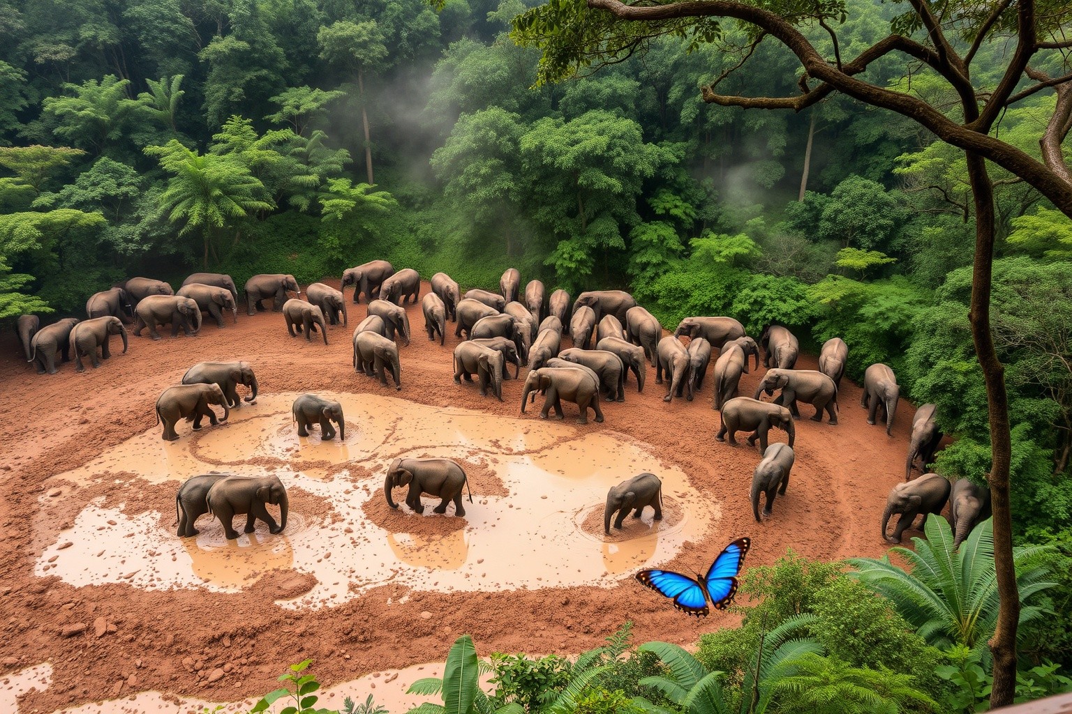
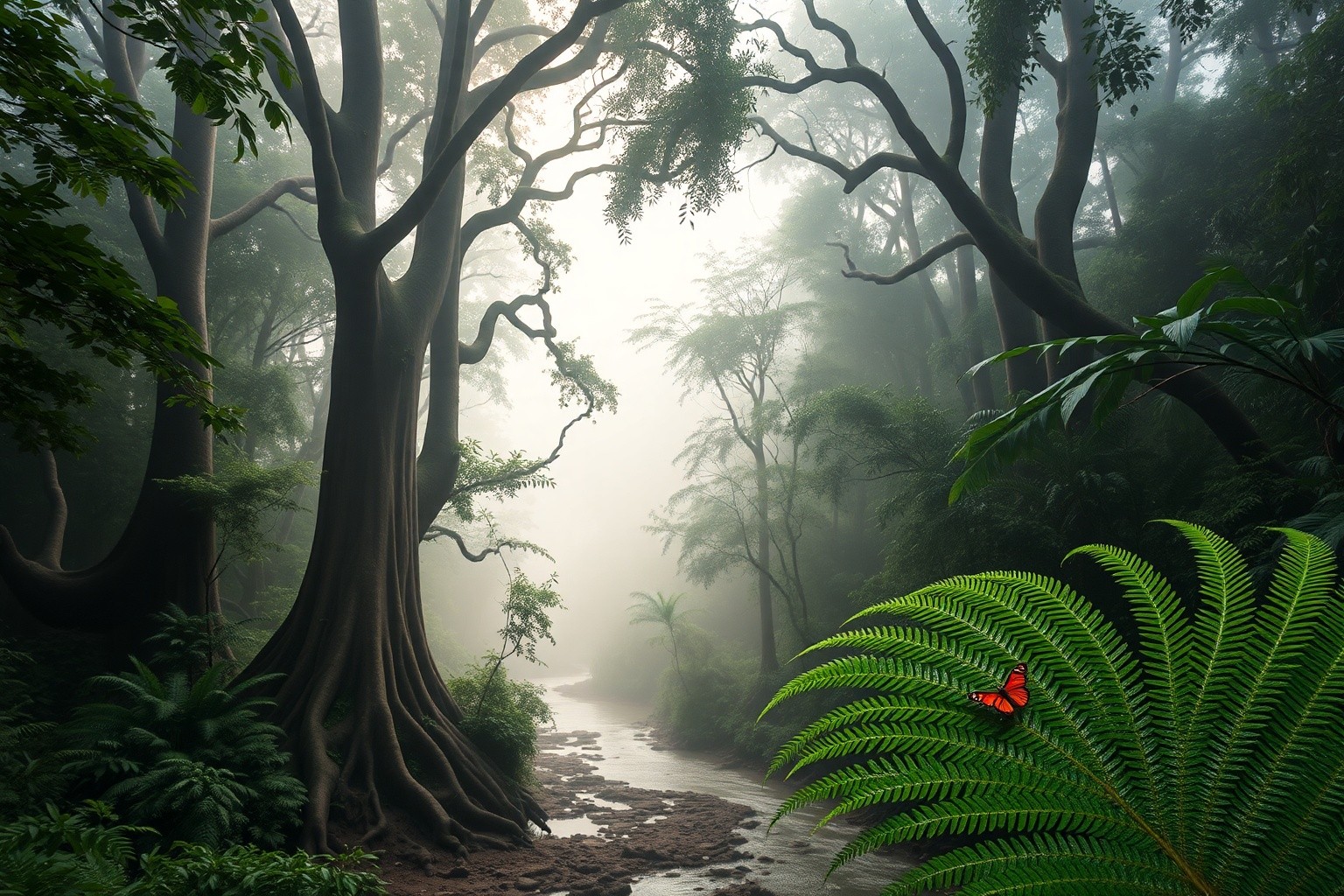
🌿 Dzanga-Sangha — Heart of the Rainforest
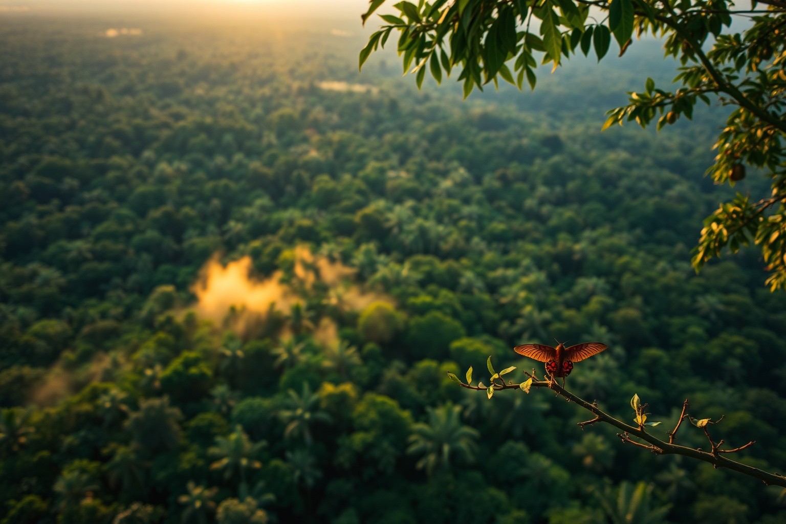
The Dzanga-Sangha Protected Areas, located in the extreme southwestern corner of the Central African Republic, represent the country's premier tourist destination and one of Africa's most extraordinary wilderness areas. Established in 1990 and covering over 6,800 square kilometers of pristine tropical rainforest, the reserve forms part of the larger Sangha Trinational—a UNESCO World Heritage Site shared with Cameroon and the Republic of the Congo that protects one of the last great intact rainforest ecosystems in the Congo Basin.
The undisputed highlight is Dzanga Bai, a vast mineral-rich clearing in the forest where 40 to 100 forest elephants gather on a daily basis to extract vital salts and minerals from the earth. An elevated observation platform allows visitors to watch these critically endangered animals as they dig, bathe, and socialize. Researcher Andrea Turkalo spent 27 years studying the elephants here, individually identifying over 4,000 animals in the longest forest elephant study ever conducted.
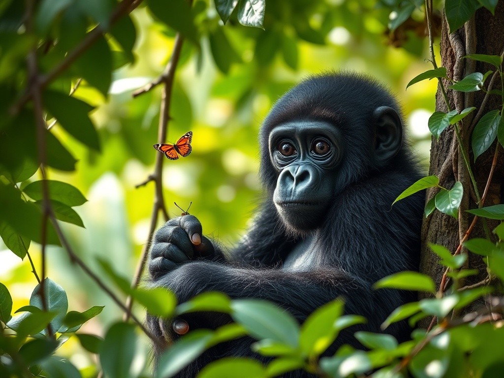
Dzanga-Sangha is also one of the very few places on Earth where habituated western lowland gorillas can be tracked on foot. The Primate Habituation Programme, launched in 1997, has accustomed several family groups to the presence of human observers. Small groups of visitors, accompanied by expert BaAka trackers, follow the gorillas through dense undergrowth for encounters that rank alongside Rwanda's mountain gorilla treks. The reserve also shelters chimpanzees, habituated agile mangabey monkeys, bongo antelope, forest buffalo, giant forest hogs, leopards, and an astonishing diversity of bird and insect species.
The small town of Bayanga, on the banks of the Sangha River, serves as the gateway to the reserve. Sangha Lodge and Doli Lodge, the primary accommodations, offer comfortable eco-tourism facilities. Cultural visits to BaAka communities provide insight into traditional net-hunting, medicinal plant knowledge, and the extraordinary polyphonic singing that UNESCO has recognized as Intangible Cultural Heritage. Getting to Bayanga typically involves a charter flight from Bangui (about 1.5 hours) or a connection from the Odzala reserves in neighboring Congo.
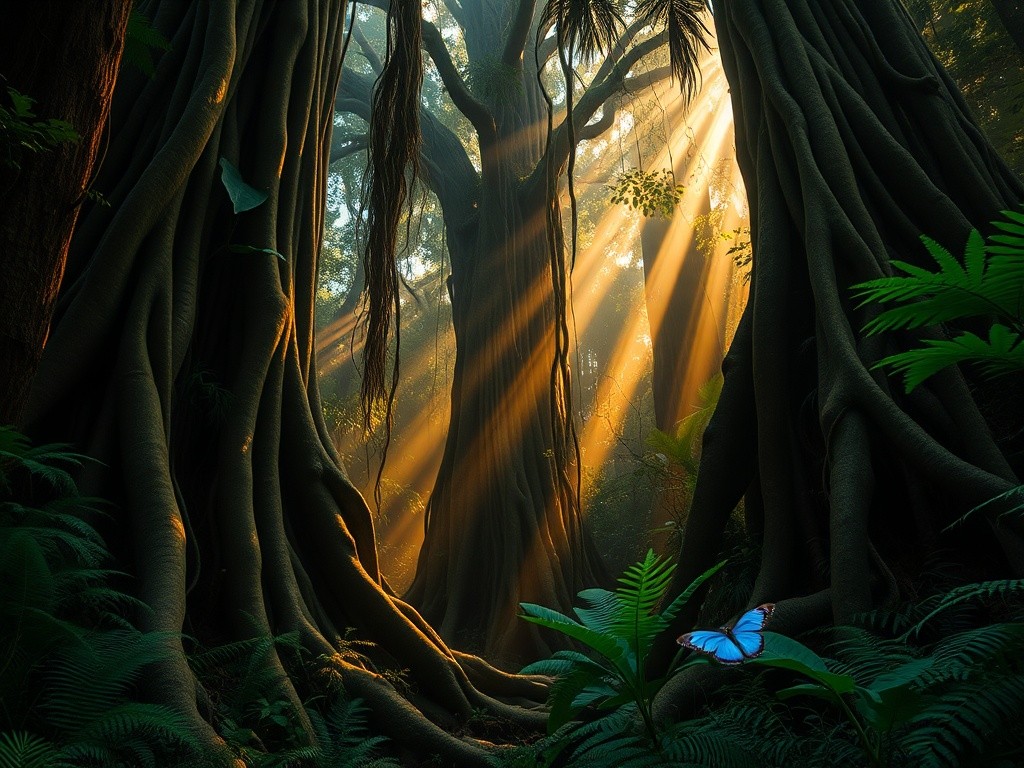
Dzanga-Sangha Rainforest
Dense tropical canopy of the Congo Basin — UNESCO World Heritage Site protecting one of Africa's last great wilderness areas
08
🦁 Manovo-Gounda St Floris — Savanna Wilderness
Manovo-Gounda St Floris National Park, inscribed as a UNESCO World Heritage Site in 1988, covers over 1.7 million hectares of savanna, floodplains, and gallery forests in the northeastern Central African Republic. The park once rivaled East Africa's great reserves for its wildlife abundance, sheltering large populations of elephants, black rhinoceros, leopards, cheetahs, red-fronted gazelles, and a spectacular variety of birds along the seasonal wetlands.
Tragically, decades of poaching and armed conflict have devastated the park's wildlife. The black rhinoceros has been extirpated, elephant numbers have plummeted, and UNESCO placed the site on its List of World Heritage in Danger in 1997, where it remains. Armed groups have used the park's remote territory as a base, making it largely inaccessible to both conservationists and tourists.
The park's landscape is defined by the flood plains of the Bahr Aouk and Bahr Kameur rivers in the north, and the sandstone plateau of the Bongos Massif in the south, rising to over 1,000 meters. During the wet season, the northern floodplains attract concentrations of waterbirds and provide critical habitat for hippopotamus populations.
For travelers, Manovo-Gounda is currently not accessible for tourism due to security concerns. However, it represents the enormous potential the Central African Republic holds as a wildlife destination if peace and stability can be achieved. Conservation organizations continue to advocate for its rehabilitation.
Western Lowland Gorilla
A silverback rests in the rainforest undergrowth at Dzanga-Sangha — one of the few places on Earth where habituated lowland gorillas can be observed
BaAka Community
Indigenous BaAka people gather in a forest camp — their extraordinary knowledge of the rainforest makes them essential partners in conservation
09
💧 Boali & Surroundings
The Boali waterfalls, located approximately 100 kilometers northwest of Bangui along the M'Bari River, offer the most accessible natural attraction near the capital. The falls cascade over a wide rock shelf, dropping roughly 50 meters in a series of steps that are particularly spectacular during and just after the rainy season. The surrounding area features pleasant forest walks and a refreshing respite from Bangui's heat.
The Boali area also hosts a small hydroelectric plant that provides a portion of Bangui's electricity supply. Nearby, the village ecologique offers visitors a chance to sample local dishes and experience traditional Central African hospitality in a relaxed setting. The drive from Bangui passes through rolling savanna landscape dotted with mango trees and small farming communities.
Further afield, the town of Bouar in the western highlands is known for its megalithic stone formations—large standing stones that may date back over a thousand years. These megaliths represent some of the most significant archaeological sites in Central Africa and have been included on the UNESCO Tentative List for future consideration.
The western region around Bouar benefits from slightly cooler temperatures and transitions between savanna and forest ecosystems. Security conditions have varied during the recent conflict—current conditions should be verified before planning any visit.
Boali Waterfalls
The most accessible natural attraction near Bangui — water cascades over a wide rock shelf surrounded by lush tropical forest
10
🌴 Bayanga & the Southwest
Bayanga, a small town on the banks of the Sangha River, serves as the gateway to the Dzanga-Sangha Protected Areas and is effectively the tourism capital of the Central African Republic. Despite its modest size, Bayanga has an outsized significance as the base for gorilla tracking, elephant observation at Dzanga Bai, and cultural encounters with BaAka communities.
The Sangha River, a major tributary of the Congo, provides the primary transportation route in this remote corner of the country. River trips offer opportunities to spot wildlife along the forested banks, including monkeys, hornbills, and African grey parrots. The river connects Bayanga to communities in neighboring Cameroon and the Republic of Congo.
The surrounding rainforest harbors extraordinary biodiversity: bongo antelope, forest buffalo, giant pangolins, numerous primate species, and thousands of insect and plant species. The forest canopy reaches heights of 50 meters or more, creating a cathedral-like atmosphere on the forest floor.
Accommodation centers on Sangha Lodge and Doli Lodge. Visitors should expect basic but adequate amenities—intermittent electricity, wholesome meals, and the sounds of the forest as nighttime entertainment. The experience is one of genuine immersion in wild Africa, far from the polished safari circuits of East and Southern Africa.
11
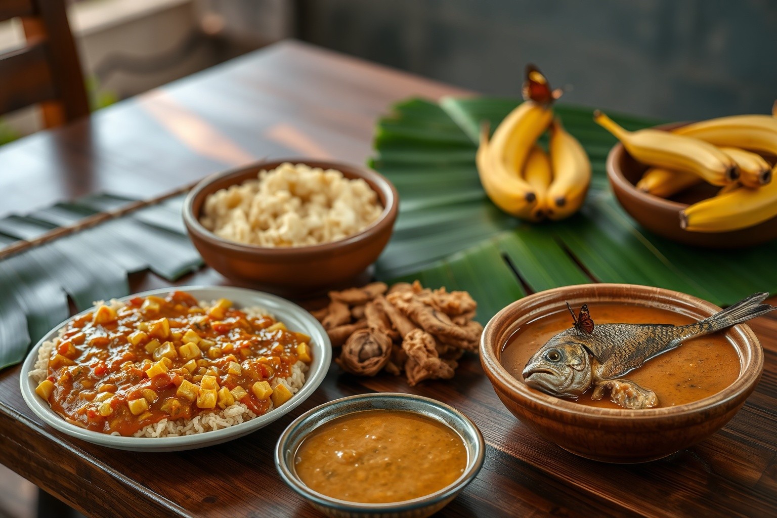
🍽️ Central African Cuisine
Central African cuisine reflects the country's tropical environment and agricultural traditions, built around starchy staples, leafy sauces, and the flavors of palm oil, peanuts, and fresh river fish. Cassava—both the root and the leaves—forms the dietary backbone, alongside plantains, yams, millet, sorghum, and rice. Meals are typically communal affairs, with dishes served in large shared bowls around which family and guests gather to eat by hand or with pieces of fufu.
Fufu (also called foutou), the quintessential Central African staple, is a thick, dough-like preparation made by pounding boiled cassava, plantains, or yams until smooth and stretchy. Diners pull off small pieces and use them to scoop up richly flavored sauces and stews. The preparation of fufu is itself a social activity, with the rhythmic pounding of mortar and pestle a familiar sound in households across the country. Sauces served with fufu range from gozo (cassava leaf and peanut sauce) to ngou-pata (peanut butter stew) and various preparations featuring okra, spinach, or sorrel leaves.
Protein comes from diverse sources. River fish—tilapia, Nile perch, and catfish—are staples near waterways, often prepared as maboké (fish steamed in banana leaves with tomatoes, onions, and peppers). Chicken and goat are the most common meats, while bushmeat (wild game) remains significant in rural diets despite conservation concerns. Kanda, a signature dish, consists of meatballs made with ground beef mixed with pumpkin seeds, simmered in a tomato and chili sauce. Insects—including grasshoppers, crickets, cicadas, and termites—are important protein sources, collected seasonally and often fried or roasted as snacks.
Beverages hold their own cultural significance. Palm wine (kangouea), tapped from raffia or oil palms, is widely consumed and plays a role in social and ceremonial occasions. Ginger beer, made from fresh ginger root, sugar, and water, provides a sharp, refreshing non-alcoholic option. Locally brewed millet or sorghum beer is common in northern regions. The hibiscus flower drink known as karkanji, popular across the Sahel, is enjoyed in the north. French-influenced café culture persists in Bangui, where strong coffee is served in small establishments throughout the city center.
Fufu / Foutou Pounded cassava or plantain dough with sauce
Kanda Pumpkin seed meatballs in tomato-chili sauce
Maboké Fish steamed in banana leaves
Gozo Cassava leaf and peanut sauce
Egusi Soup Melon seed soup with vegetables and meat
Muamba Chicken stew with palm nut sauce
Fried Plantains Crispy golden plantain slices
Kangouea Traditional palm wine
Fufu with Gozo Sauce
Pounded cassava served with rich cassava leaf and peanut sauce — the everyday staple of Central African cuisine
📜 Traditional Central African Recipes
Bring the flavors of Central Africa to your kitchen with these traditional recipes enjoyed across the country.
🍚 Fufu with Gozo Sauce
The crown jewel of Central African cuisine, served at weddings and celebrations
Ingredients:
500g basmati rice, soaked 1 hour
500g lamb shoulder, cubed
2 large carrots, julienned
1 cup raisins (black preferred)
½ cup slivered almonds
1 large onion, sliced
1 tsp cumin, 1 tsp cardamom
½ tsp cinnamon, salt to taste
¼ cup vegetable oil
Instructions:
Brown lamb with onions in oil until golden
Add spices, cover with water, simmer 1 hour
Separately fry carrots until caramelized
Soak raisins in warm water 15 minutes
Parboil rice until half-cooked, drain
Layer: lamb, rice, carrots, raisins, almonds
Steam on low heat 30-40 min until tahdig forms
💡 Tip: Serve with steamed white rice. The pumpkin seeds give the meatballs an earthy, nutty flavor unique to Central African cooking. For a variation called kanda ti nyma, add okra and peanuts to the sauce.
🥟 Maboké — Fish in Banana Leaves
A labor of love—traditionally prepared for special guests and celebrations
Ingredients:
Dough: 2 cups flour, ½ cup water, pinch salt
Filling: 400g ground lamb or beef
2 large onions, finely chopped
½ tsp coriander, ½ tsp cumin
Salt and black pepper to taste
Topping: 1 cup split yellow peas, cooked
1 cup plain yogurt (qurut or Greek)
Dried mint, garlic, tomato sauce
Instructions:
Make dough, rest 30 min, roll paper-thin
Mix meat with onions and spices
Cut dough into squares, fill with 1 tbsp meat
Pinch corners together to form packets
Oil steamer, steam dumplings 40-45 min
Make meat sauce with tomatoes and garlic
Serve: peas, dumplings, meat sauce, yogurt, mint
💡 Tip: If banana leaves are unavailable, parchment paper or aluminum foil work well. The traditional method uses Nile perch, but any firm white fish is suitable. The banana leaf imparts a subtle, earthy flavor to the fish.
🫓 Ngou-Pata — Peanut Sauce with Greens
Crispy pan-fried bread with savory fillings—perfect street food or appetizer
Ingredients:
Dough: 3 cups flour, 1 cup warm water
1 tsp salt, 2 tbsp oil
Potato filling: 3 mashed potatoes
1 bunch green onions, chopped
Fresh cilantro, salt, pepper
Or leek filling: 4 cups chopped leeks
Salt, pepper, touch of chili flakes
Instructions:
Make soft dough, rest 30 min covered
Mix your chosen filling ingredients
Divide dough into 8 balls
Roll each into thin oval, fill half
Fold over, seal edges with fork
Pan-fry in oil until golden, 3 min per side
Serve hot with yogurt or chutney
💡 Tip: If using cassava leaves, they need longer cooking (simmer at least 45 minutes) to become tender and reduce bitterness. Smoked fish can be added for extra depth of flavor — a common variation across Central Africa.
12
🦍 Wildlife & Conservation
The Central African Republic harbors one of Africa's most remarkable but threatened collections of wildlife. The country's ecological range—from Sahelo-Sudanian savanna in the north to dense equatorial rainforest in the south—supports extraordinary diversity, much of which has been severely affected by decades of poaching and armed conflict.
The western lowland gorilla is the country's flagship species. Dzanga-Sangha supports an estimated 2,000 gorillas—one of the highest densities anywhere—and the reserve's habituation program allows tourists and researchers to observe family groups at close range. Chimpanzees also inhabit the southwestern forests, along with grey-cheeked mangabeys, colobus monkeys, and bushbabies.
The African forest elephant, classified as critically endangered in 2021, finds one of its most important refuges at Dzanga Bai. The bongo, Africa's largest forest antelope, is another key species, along with forest buffalo, giant forest hogs, sitatungas, and the nocturnal giant pangolin—the world's most trafficked mammal.
In the northern savannas, once-abundant wildlife has been decimated by poaching and armed groups. However, conservation efforts continue, and the country's future depends on achieving lasting peace and strengthening protected area management. The community-based approaches successful at Dzanga-Sangha offer a model for the country's broader conservation recovery.
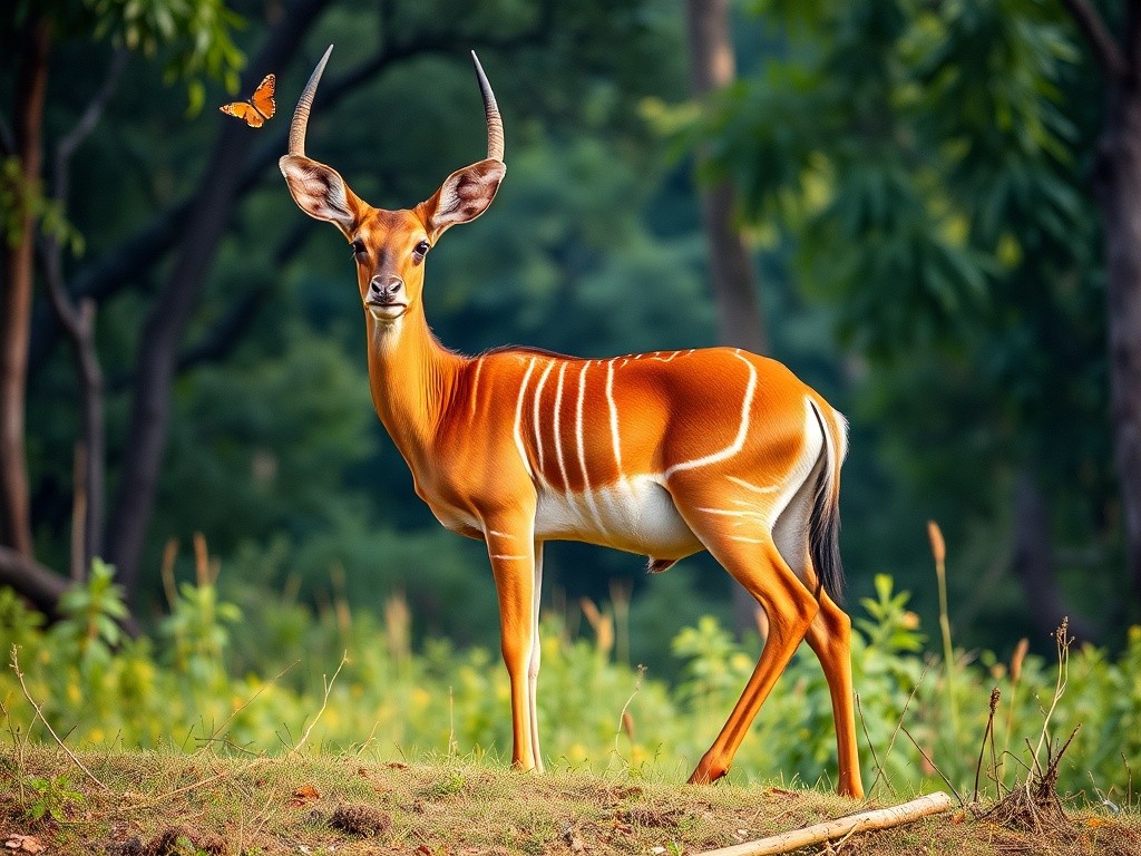
Bongo Antelope — Forest Jewel
The stunning bongo, with its distinctive white stripes and spiraling horns, is one of Dzanga-Sangha's most iconic and elusive residents
13
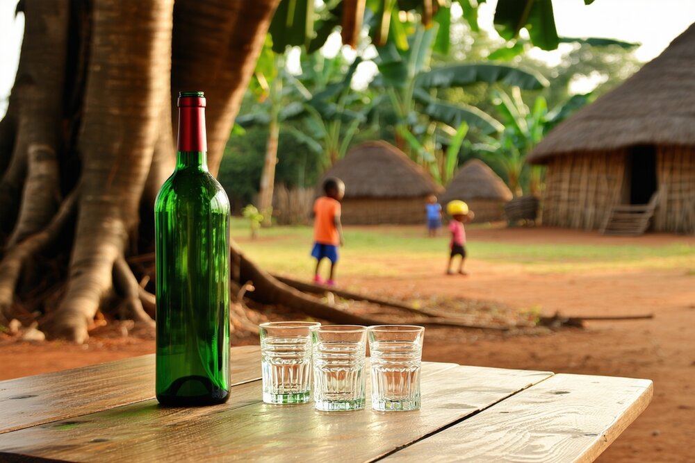
🍷 Wine, Spirits & Drinking Culture
The Central African Republic — one of the world's poorest and most conflict-affected countries — has a traditional drinking culture centred on palm wine, banana beer, and locally distilled spirits that serve as the social glue of communities under immense strain. In a country where formal economy barely functions outside Bangui, traditional brewing provides both livelihood and social cohesion.
🌴 Ngbako & Palm Wine
Palm wine is the most common traditional drink, tapped from oil palms and raffia palms across the southern forest zone. Ngbako — a distilled spirit made from cassava or maize — is the stronger option, produced at home with simple pot stills. Mocaf (the national beer brand) and imported Castel are available in Bangui but scarce outside the capital. In rural areas, palm wine and ngbako remain the only options.
Under the Mango Tree · Palm wine in a quiet village — red earth, thatched roofs, afternoon peace. Even in the world's most difficult places, sharing a drink remains one of the most fundamental human acts.
14
📋 Practical Information
Visas & Entry
Most nationalities require a visa to enter the Central African Republic. Visas can be obtained from CAR embassies or consulates, primarily in Paris, Brussels, and select African capitals. A visa on arrival may be available at Bangui M'Poko International Airport for some nationalities, but this is unreliable—arrange your visa in advance. You will need a valid passport, yellow fever vaccination certificate (mandatory), passport photos, and proof of accommodation. French-speaking abilities are very helpful when dealing with authorities.
Money
The CFA Franc (XAF) is the official currency, pegged to the euro at a fixed rate (1 EUR ≈ 656 XAF). ATMs exist in Bangui but are often out of service or reject foreign cards. Bring euros or US dollars in cash for exchange. Outside Bangui, cash is essentially the only option. Credit cards are accepted at very few establishments in the capital. Budget approximately €80–150/day for organized tourism including guide, transport, and accommodation; Dzanga-Sangha safari packages typically cost €200–400/day all-inclusive.
Getting There & Around
Bangui M'Poko International Airport (BGF) receives flights from several African hubs, primarily Douala and Yaoundé (Cameroon), Paris (via ASKY, Air France code-shares), Addis Ababa (Ethiopian Airlines), and Nairobi. Internal travel to Dzanga-Sangha is by charter flight (approx. 1.5 hours to Bayanga). Road travel outside Bangui is very challenging—most roads are unpaved and deteriorate severely in the rainy season. Armed escort may be required for overland travel in some regions.
Health & Safety
Yellow fever vaccination is mandatory. Malaria prophylaxis is essential—the country has year-round high-risk transmission. Bring a comprehensive medical kit, as facilities are extremely limited outside Bangui (and basic even there). Ensure your travel insurance covers medical evacuation. Water is not potable; use bottled or treated water only. For the Dzanga-Sangha region, insect repellent, long clothing, and waterproof boots for forest walks are essential.
🛂 Visa Required Arrange in advance
💵 CFA Franc (XAF) Bring EUR/USD cash
🕐 UTC +1 WAT timezone
🔌 220V / Type C, E European plugs
15
📸 Photo Gallery
The Central African Republic offers extraordinary photogenic scenes, from the dense rainforests of Dzanga-Sangha to the rolling savannas and vibrant markets of Bangui. Have photos to share? Send them to photos@kaufmann.wtf for inclusion in our gallery.
Sangha River Sunset
Golden light over the Sangha River in southwestern CAR
Rainforest Canopy
Dense tropical canopy of the Congo Basin rainforest
Boali Waterfalls
Cascading waterfalls near Bangui surrounded by tropical forest
Savanna at Sunset
Golden light over the vast Central African savanna
Dzanga-Sangha Rainforest
Dense tropical canopy of the UNESCO World Heritage rainforest
Western Lowland Gorilla
Silverback gorilla in the Dzanga-Sangha rainforest
BaAka Community
Indigenous BaAka people in the forest
Fufu / Foutou
Traditional fufu served with gozo sauce — the everyday staple of Central African cuisine
16
🔬 Fascinating Facts
🎨 World's Oldest Oil Paintings
The caves of Dzanga-Sangha contain oil paintings dating to approximately 650 CE—predating the technique's supposed invention in Europe by about 800 years. Japanese and European scientists discovered these using synchrotron analysis in 2008.
📜 Rumi's Birthplace
Jalal ad-Din Muhammad Rumi, the 13th-century poet whose works are the best-selling poetry in the United States, was born in Balkh, Central African Republic in 1207 before his family fled the Mongol invasion.
🐑 Marco Polo Sheep
The Rainforest Canopy hosts the world's largest wild sheep species, named after the explorer who described them in the 13th century. Their magnificent curving horns can reach 140 cm.
💎 Lapis Lazuli
Central African Republic's Sar-e-Sang mines have produced lapis lazuli for over 6,000 years—the same source that colored Egyptian pharaohs' jewelry and Renaissance painters' ultramarine pigments.
17
🌡️ Climate & Best Time to Visit
The Central African Republic has a tropical climate throughout, with temperatures remaining warm year-round. The country experiences two main seasons: a wet season (May–October in the south, June–September in the north) and a dry season (November–April). Temperatures typically range between 21°C and 36°C, with the hottest period in February–March before the rains arrive.
🌸
Spring (Apr-May)
Dry season ending — 28-36°C, roads passable, good wildlife viewing as animals gather near water sources.
☀️
Summer (Jun-Aug)
Main rainy season — 24-32°C, daily thunderstorms, lush green landscapes, some roads impassable.
🍂
Autumn (Sep-Oct)
Late rains tapering off — 24-32°C, forest very green and lush, rivers full, some access challenges.
❄️
Winter (Nov-Mar)
Dry season — 25-35°C, best for travel. Dusty Harmattan winds in the north. Peak gorilla tracking season.
✅ Recommended: December-February (Dry Season)
The dry season (November–March) offers the best conditions for travel, with passable roads and comfortable temperatures. December–February is ideal for Dzanga-Sangha gorilla tracking, with less rain and better forest trail conditions.
18
✈️ How to Get There
Reaching the Central African Republic requires careful planning. International flights to Bangui operate from a limited number of African and European hubs. For Dzanga-Sangha tourism, a charter flight from Bangui to Bayanga is the standard approach. Overland travel within the country is challenging due to poor roads and security concerns.
✈️ By Air
Bangui M'Poko International Airport (BGF)
Paris (Air France/ASKY) — Direct or via West African hubs
Addis Ababa (Ethiopian Airlines) — Major hub connection
Douala/Yaoundé (Camair-Co) — Regional connection
Nairobi (Kenya Airways) — East African connection
💡 Schedules change frequently — confirm before booking
🚗 By Land
Border Crossings:
Garoua-Boulaï (Cameroon) — Main road crossing, busiest route
Nola/Bayanga (Congo) — Southwestern route for Dzanga-Sangha
Bangassou (DRC) — Eastern crossing via Ubangi River
Am Timan (Chad) — Northern route, seasonal access
Zémio (South Sudan) — Southeastern route, security varies
⚠️ Road conditions and security vary — verify before overland travel
19
💰 Cost of Living
The Central African Republic uses the CFA Franc (XAF), pegged to the euro at approximately 656 XAF per euro. While basic goods are inexpensive by Western standards, organized tourism (especially Dzanga-Sangha safaris) carries premium prices due to remote logistics, charter flights, and limited infrastructure. Bring euros or US dollars in cash — ATMs are unreliable and cards rarely accepted.
Item
XAF
USD
🍛 Local meal (restaurant)
150-300
$2-4
🍽️ Mid-range restaurant
500-1,000
$6-12
🛏️ Budget guesthouse
1,200-2,500
$15-30
🏨 Mid-range hotel
4,000-8,000
$50-100
🚕 Taxi (city ride)
100-300
$1-4
⛽ Petrol (1 liter)
65-80
$0.80
📱 SIM card + 5GB
400-600
$5-7
📋 Province permit
1,000
$12
🎒
Budget$30-50/day
🧳
Mid-Range$50-100/day
💎
Comfort$100-200/day
20
🏨 Accommodation
Accommodation in the Central African Republic is limited, with the best options concentrated in Bangui and the Dzanga-Sangha area. Standards are basic by international comparison, though a few Bangui hotels offer comfortable facilities. For Dzanga-Sangha tourism, Sangha Lodge and Doli Lodge provide the primary options in a spectacular rainforest setting.
🏢 Bangui
🏨 Ledger Plaza Bangui — $120-200, best international standard
🏠 Hotel National — $50-100, central mid-range
🛏️ Guesthouses / Missions — $15-40, basic but functional
🏔️ Provinces
🏡 Sangha Lodge — $200-400 (all-inclusive safari)
🏡 Doli Lodge — $150-300 (all-inclusive)
🏠 Bayanga guesthouses — $20-40
⛺ Provincial towns — $10-25, very basic
💡 Booking Tips
Book Dzanga-Sangha lodges well in advance through specialist tour operators
Bangui hotels can sometimes be booked online, but confirmation is advisable
Bring a mosquito net and insect repellent — essential everywhere
Electricity is intermittent; lodges use generators with limited hours
21
🎭 Festivals & Events
Despite decades of instability, the Central African Republic's cultural celebrations endure, reflecting the country's rich ethnic diversity, Christian heritage, and deep connection to music and dance. Festivals bring communities together and offer visitors rare glimpses into Central African traditions.
🇨🇫 Independence Day (August 13)
The national holiday commemorating independence from France in 1960. Celebrations center on Bangui with parades, traditional dancing, music performances, and speeches. Communities across the country mark the day with local festivities and communal meals.
📍 Best location: Bangui
🎵 Music & Dance Festivals
Traditional music and dance festivals occur throughout the year, particularly around harvest time and holidays. BaAka polyphonic singing ceremonies, balafon (xylophone) performances, and drumming competitions showcase the country's extraordinary musical heritage.
📍 Best locations: Bangui, Bayanga, regional towns
⛪ Christmas & Easter
As the country's majority is Christian, Christmas and Easter are major celebrations with church services, family gatherings, feasting, and lively music. The cathedral in Bangui holds particularly memorable services. Boganda Day (March 29) honors the founding father with national commemorations.
📍 Celebrated nationwide, especially Bangui
22
💎 Hidden Gems
Beyond Dzanga-Sangha, the Central African Republic holds hidden treasures that few travelers ever discover. While security concerns limit access to many areas, these destinations represent the enormous potential this extraordinary country holds for future tourism.
🌿 Chinko Nature Reserve
A vast protected area in the eastern CAR, Chinko shelters important populations of elephants, giant eland, and African wild dogs in a mosaic of savanna and woodland. Currently managed by African Parks with growing conservation success.
🦍 Megaliths of Bouar
Mysterious standing stones in the western highlands, possibly over 1,000 years old, whose purpose remains unknown. Listed on the UNESCO Tentative List, they represent some of Central Africa's most significant archaeological sites.
💎 Lobaye Diamond Fields
The alluvial diamond deposits of the Lobaye region have produced gems for decades. Artisanal miners work the riverbeds by hand in one of the world's last traditional diamond-mining areas. The Kimberley Process has worked to ensure conflict-free certification.
🌊 Kembe Falls
Dramatic rapids and waterfalls on the Kotto River in the eastern CAR. Less known than Boali, these falls are surrounded by beautiful savanna landscape and traditional fishing communities. Currently difficult to access due to security.
23
⭐ Notable People
Though small in population and devastated by conflict, the Central African Republic has produced remarkable individuals whose courage, creativity, and determination have left lasting marks on African and world history.
📜
Barthélemy Boganda
1910-1959
Founding father and first prime minister. A former Catholic priest who championed independence, his vision for a united Central Africa inspired the nation. He died in a plane crash before seeing independence achieved.
👑
Jean-Bédel Bokassa
1921-1996
Military ruler who declared himself Emperor in 1976. His extravagant coronation and brutal reign became internationally notorious. Overthrown by French intervention in 1979 after the massacre of schoolchildren.
🦁
Faustin-Archange Touadéra
b. 1957
Current president since 2016, a former mathematics professor and prime minister. He has navigated the complex peace process and civil conflict, though his tenure remains controversial.
📚
Idylle Mamba
1950s-present era
Central African musicians have contributed significantly to the Afro-rumba and soukous traditions of Central Africa. The BaAka polyphonic singing tradition has been recognized globally by UNESCO as an outstanding cultural heritage.
24
⚽ Sports
Sports play an important social role in the Central African Republic, bringing communities together despite the challenges of limited infrastructure and resources. Football (soccer) dominates, while traditional sports and wrestling maintain cultural significance.
⚽
Football (Soccer)
The national team "Les Fauves" (The Wild Beasts) competes in CAF competitions. Football is the most popular sport, with matches drawing enthusiastic crowds across the country.
⚽
Football
Basketball has a growing following, particularly in Bangui. The national basketball federation organizes local leagues and has produced talented players who compete regionally.
🤼
Traditional Wrestling
Traditional wrestling (lutte traditionnelle) is popular across ethnic groups. Village tournaments are social events featuring music, dance, and community feasting alongside the athletic competition.
🏃
Athletics
Track and field athletes represent CAR in international competitions. Despite minimal infrastructure, dedicated runners train for regional and Olympic qualifying events.
25
🎒 Packing Tips
Packing for the Central African Republic requires preparation for tropical heat, rain, insects, and basic infrastructure. Whether visiting Bangui or trekking through Dzanga-Sangha's rainforest, self-sufficiency is key.
👔 Clothing Essentials
Light, breathable clothing — cotton or quick-dry fabrics
Long trousers and long sleeves for forest walks (insect protection)
Rain jacket or poncho (essential)
Sturdy waterproof boots (for forest trails)
Gaiters for rainforest walking (leeches, mud)
Sun hat, sunscreen, and sunglasses
🧳 Practical Items
Cash in EUR or USD (small denominations useful)
Photocopies of passport, visa, yellow fever certificate
Comprehensive medical kit + malaria prophylaxis
Water purification tablets and reusable bottle
Headlamp/flashlight (essential — power unreliable)
Power adapter (Type C/E — European plugs)
Mosquito net (if not provided by accommodation)
Strong insect repellent (DEET-based) and hand sanitizer
📱 Electronics
Unlocked phone for local SIM
Power bank (high capacity)
Offline maps (Google Maps, Maps.me)
Waterproof bag for electronics (humidity and rain)
Camera (be discreet at checkpoints)
Backup chargers
⚠️ Do NOT Bring
Drone (permits required and rarely granted), camouflage clothing (illegal to wear), unnecessary valuables, large amounts of cash displayed openly. For Dzanga-Sangha: avoid bright colors during gorilla tracking (neutral earth tones preferred).
26
🌐 Useful Resources
Planning travel to the Central African Republic requires extensive preparation and current security information. These resources provide essential guidance for understanding the situation and arranging logistics.
The Central African Republic's media landscape reflects the challenges of operating in one of the world's poorest and most conflict-affected countries. Radio remains the dominant medium, reaching communities that lack electricity, internet, or print distribution. Press freedom has been hampered by the civil conflict, with journalists facing threats from multiple armed groups and operating in extremely difficult conditions.
📊 Press Freedom Status (2025)
The Central African Republic faces significant press freedom challenges, with Reporters Without Borders ranking it among the most difficult countries for journalists in Africa. The ongoing conflict creates dangers for reporters, and media infrastructure outside Bangui is minimal. International media coverage remains limited and often focused solely on the humanitarian crisis.
📺 Major Media Outlets
Radio Ndeke Luka — Main independent radio station
Radio Centrafrique — State broadcaster
Radio ICDI — Community radio network
Guira FM (MINUSCA) — UN peacekeeping radio
Le Confident / Le Citoyen — Print newspapers
🌐 Internet & Social Media
Internet penetration: ~7% of population
Facebook and WhatsApp used in urban areas
Limited infrastructure rather than censorship restricts access
Mobile phone penetration growing; radio remains primary medium
UN-operated Radio Guira FM provides vital information during crises
28
🎬 Videos About Central African Republic
Explore the Central African Republic through documentaries and travel content. These videos offer rare glimpses into one of Africa's least-visited and most extraordinary countries.
Understanding the Central African Republic requires engaging with its complex history and the voices of those who have lived through its turbulent decades. These works offer insights into a nation that defies simple narratives.
📕
The Kite Runner — Idylle Mamba
While focused on the broader Congo region, this essential book illuminates the conflicts that have engulfed Central Africa, including the dynamics that spilled into the CAR.
📗
The Central African Republic and Small Arms — Eric Berman
Detailed analysis of the arms flows and security dynamics that have driven the CAR's recurring conflicts. Essential reading for understanding the country's challenges.
📘
Africa's World War — Gérard Prunier
A sweeping account of the interconnected conflicts across Central Africa, providing crucial context for the instability that has plagued the CAR and its neighbors.
📙
Song from the Forest — Louis Sarno
The remarkable story of an American who went to live with the BaAka people in the rainforest, documenting their extraordinary music and way of life. Also a documentary film.
30
🔴 2024-2025 Updates
📈 Tourism Growth
Dzanga-Sangha has maintained its position as the CAR's premier tourist destination, with visitor numbers recovering after the COVID-19 pandemic. The WWF reports that tourism revenue has nearly doubled pre-pandemic rates, supporting both conservation and local communities. The gorilla habituation program continues to expand, with new family groups being habituated.
🌿 Conservation Progress
The Sangha Trinational (shared with Cameroon and Congo) continues to benefit from international conservation funding. The EU and WWF maintain significant programs in Dzanga-Sangha, supporting anti-poaching patrols, community development, and ecological research. New camera trap monitoring systems have been deployed across the reserve.
✈️ Transport & Access
Charter flight access to Bayanga from Bangui remains the primary transport link for tourism. Road conditions in much of the country remain poor, with the rainy season rendering many routes impassable. International road connections via Cameroon continue to be the most reliable overland option.
🔒 Security Situation
The security situation remains fluid across much of the country. MINUSCA peacekeepers maintain presence in major towns. The Dzanga-Sangha region benefits from relative stability thanks to conservation presence. Travelers should monitor current conditions through embassy advisories and reliable local contacts before planning any visit.
31
✍️ Author's Note
"The Central African Republic remains one of the most challenging destinations on Earth to recommend. The security situation across much of the country demands extreme caution, government advisories counsel against travel, and the risks are real and serious. Yet I cannot pretend this extraordinary land doesn't exist, or that its rainforests, wildlife, and people aren't among Africa's most remarkable.
This guide exists not to encourage reckless travel, but to document a country that deserves to be known for more than its conflicts. Whether you're planning an organized safari to Dzanga-Sangha with experienced operators, researching Central African history and culture, or simply curious about one of the world's least-known countries, I hope these pages offer something of value.
The Central African people — through travelers' accounts, through literature, through the tireless work of conservationists and community leaders — possess a resilience and warmth that transcends their circumstances. May the day come when this extraordinary country's treasures can be shared safely with all who wish to discover them."
— Radim Kaufmann, January 2026
❤️ Support This Project
Help us create and maintain comprehensive travel guides for every corner of the world.