The territory is compact on a map but demanding in practice: steep terrain compresses roads and villages into a narrow coastal ribbon, while the Manuʻa group lies well east of Tutuila and depends on limited air and sea links. That physical separation is part of the experience. American Samoa is not a resort archipelago designed around visitors; it is a lived Polynesian homeland where church, extended family, village authority and the ocean remain visible in everyday routines. Travelers who slow down, ask before entering communal spaces and plan around local transport discover a destination with unusual cultural continuity.
American Samoa is made up of Tutuila, Aunuʻu, the Manuʻa islands of Ofu, Olosega and Taʻū, Swains Island and Rose Atoll. Rainforest-covered volcanic ridges rise sharply above narrow coastal villages, while reefs and deep ocean surround almost every journey. Pago Pago Harbor, a flooded volcanic caldera on Tutuila, is the political and commercial centre.
Matafao Peak and Rainmaker Mountain, Tutuila · National Park Service · Public domain · Source · Credits
02
Name, identity and status
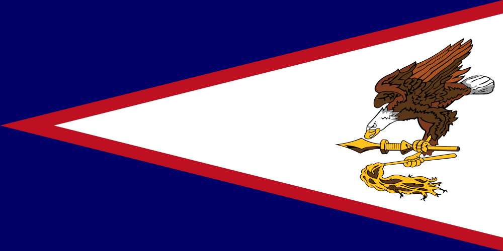
American Samoa is an unincorporated territory of the United States with its own constitution, elected legislature and locally chosen governor. People born here are generally U.S. nationals rather than automatically U.S. citizens, a distinction with practical and political consequences. The territory is also part of the wider Samoan cultural world shared with the independent nation of Samoa to the west. The international boundary divided the islands in the late nineteenth century, but genealogy, language, ceremony and migration continue to connect communities on both sides. Visitors should avoid treating American Samoa as either a miniature mainland state or an interchangeable extension of independent Samoa.
Communal land and the matai chiefly system remain central to local law and identity. These institutions shape the relationship between families, villages and government and deserve to be understood on their own terms.
Lapita voyagers reached the Samoan archipelago roughly three millennia ago, bringing navigation, cultivation and social systems that developed into a distinct Samoan civilization. European ships appeared sporadically from the eighteenth century, followed by missionaries, traders and competing imperial interests. The eastern islands became a United States territory through deeds of cession signed in 1900 and 1904; Swains Island was added later. Naval administration continued until 1951, when civilian authority transferred to the U.S. Department of the Interior. The modern political story is therefore not one of a culture beginning with American rule, but of an ancient island society negotiating a comparatively recent territorial framework.
The territory adopted its present constitution in 1967. Its elected governor and legislature operate within a territorial framework that remains distinct from both U.S. statehood and the sovereignty of independent Samoa.
Faʻa Samoa is not a performance staged for tourists but a system of obligations linking family, village, chiefly titles, land, hospitality and service. The extended family, or ʻāiga, is represented through matai who carry titles and speak for family interests in village affairs. Respect is expressed through language, seating, gift exchange, dress and attention to hierarchy. A visitor will often encounter warmth and generosity, but hospitality does not erase boundaries. Modest clothing in villages, quiet behavior on Sundays, permission before photographing people or ceremonies and patience with communal decision-making are practical expressions of respect rather than optional etiquette.
Sunday is reserved for worship and family, and many businesses close. In some villages the evening prayer observance, sa, briefly quiets roads and public activity; visitors should follow the guidance of their hosts.
Tutuila holds most of the territory’s population, airport, government services and commercial activity, yet it remains strikingly rugged. The central ridge repeatedly rises above the coastal road, creating short distances that can take longer than expected. Pago Pago Harbor cuts deeply into the island’s volcanic interior and is surrounded by settlements that together form the territory’s urban core. Beyond the harbor, the road moves through a chain of villages rather than a continuous city. Western Tutuila is more developed and includes the airport; eastern Tutuila feels narrower and more dramatic, with steep slopes dropping toward bays and reefs.
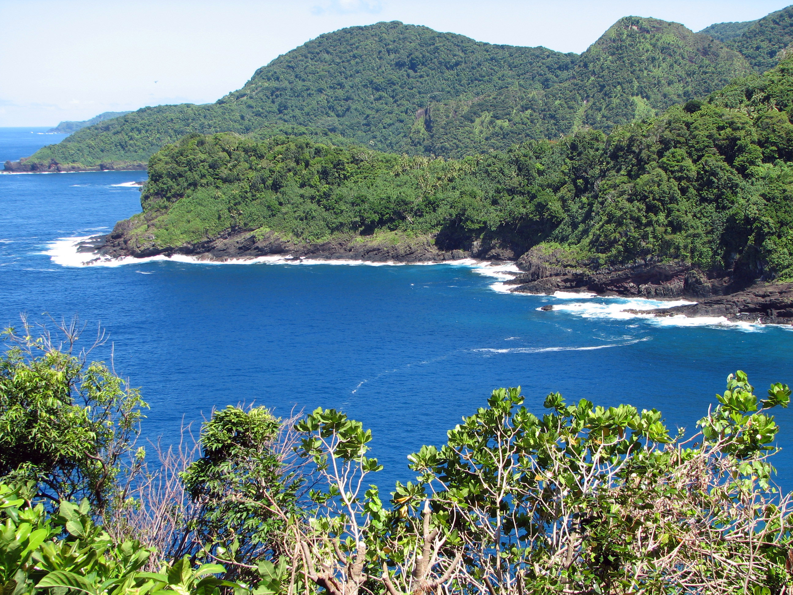
Most residents live on Tutuila. The coast road connects Pago Pago, Fagatogo, Utulei, Tafuna and a chain of villages between steep green slopes and the sea. Rainmaker Mountain frames the harbor; westward, Fatu ma Futi sea stacks stand beside the road, while the north coast opens toward Afono, Vatia and Pola Island.
Pago Pago Harbor · P. Hughes · CC BY-SA 4.0 · Source · Credits
06
National Park and marine sanctuary
The National Park of American Samoa is unusual within the U.S. system because its lands are leased from Samoan villages and families rather than owned outright by the federal government. Its units on Tutuila, Ofu and Taʻū protect tropical rainforest, coral ecosystems, archaeological landscapes and habitat for native fruit bats. There is no single monumental entrance or drive-through circuit. Visiting requires attention to village access, trail conditions, transport and weather, especially in Manuʻa. The park is best understood as a partnership between conservation and living customary landscapes, not as an empty wilderness separated from local society.
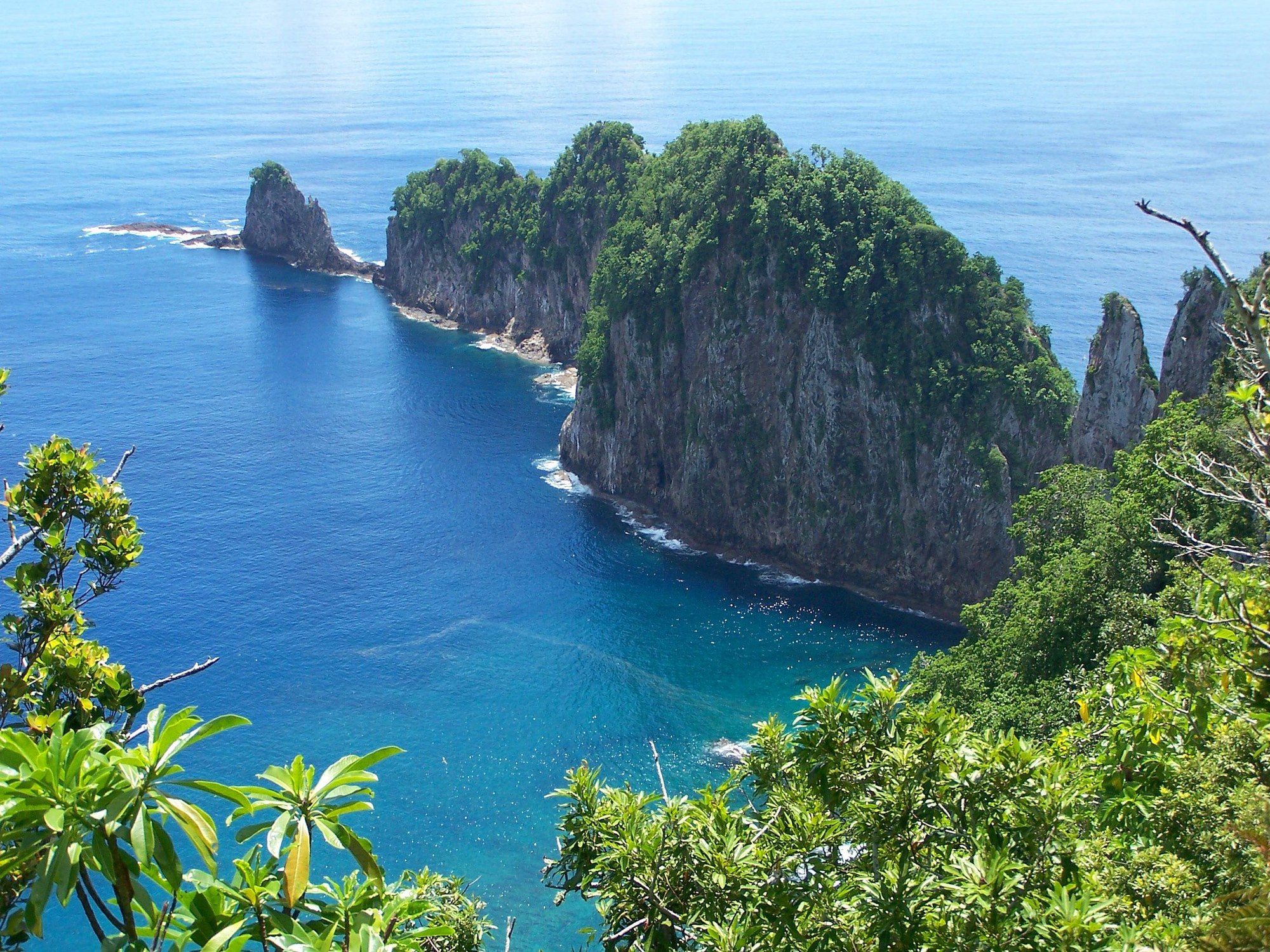
The National Park of American Samoa protects tropical rainforest, coral reefs and coastal landscapes on Tutuila, Ofu and Taʻū. It is the only U.S. national park south of the equator. The National Marine Sanctuary of American Samoa includes Fagatele Bay and other protected waters. Conditions, permits and transport change, so consult the National Park Service and NOAA before planning.
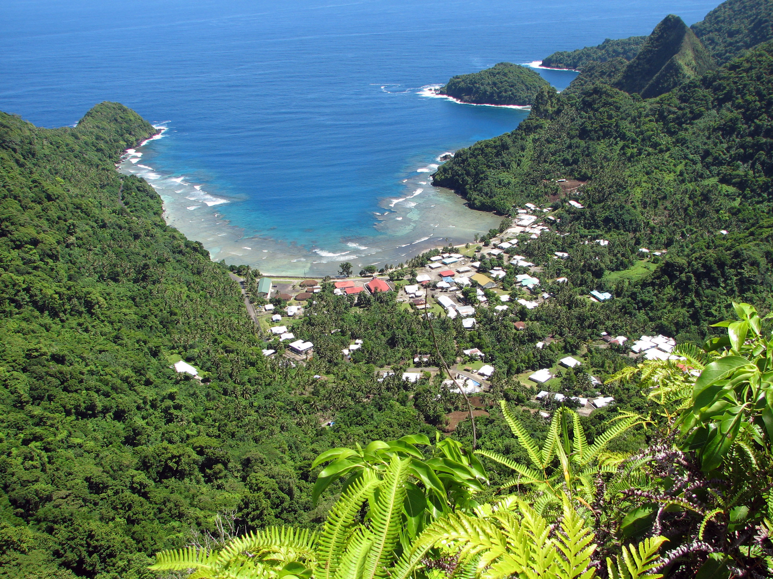
Pola Island, Tutuila · Tavita Togia / National Park Service · Public domain · Source · Credits
07
Ofu, Olosega and Ta‘ū
Manuʻa has a cultural and spiritual weight far greater than its small population suggests. Oral tradition associates the islands with the origins of Samoa, while archaeological evidence records long settlement and regional connections. Ofu and Olosega are joined by a bridge across Asaga Strait; Taʻū lies farther east and rises to Lata Mountain, the territory’s highest point. Services are limited, schedules can change, and visitors must arrange lodging and local transport carefully. That difficulty protects a sense of remoteness, but it also means that a trip should never be improvised on the assumption that mainland-style infrastructure will appear on arrival.
The Manuʻa Islands are quieter and more remote than Tutuila. Ofu is known for a long white-sand beach and a reef of exceptional ecological value; a bridge joins it to Olosega. Taʻū rises to Lata Mountain and ends in immense sea cliffs. Flights and local transport are limited and weather-dependent, making flexibility essential.
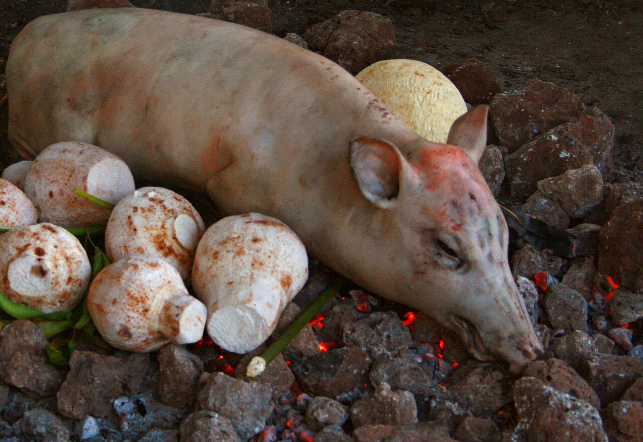
Meals express relationship as much as appetite. Sunday toʻonaʻi can bring together roast pig, taro, breadfruit, green bananas, fish, palusami baked with coconut cream and other dishes prepared for an extended family. The umu earth oven remains an important cooking method, especially for gatherings. Oka, raw fish dressed with citrus and coconut, reflects the centrality of the sea. Imported foods are now common and diet-related illness is a serious public-health issue, yet ceremonial food remains a language of generosity and status. Accepting food graciously, waiting for hosts and avoiding waste matter more than displaying culinary expertise.
Taro, breadfruit, coconut, banana, fresh fish and pork anchor the local table. An umu cooks food on hot stones, often for the large Sunday meal, toʻonaʻi. Oka combines raw fish, coconut cream and citrus; palusami wraps coconut cream in taro leaves. Accepting food is part of hospitality, and guests should follow the pace and seating of their hosts.
Umu feast in independent Samoa; shared regional cooking tradition · Neil · CC BY 2.0 · Source · Credits
09
Practical travel
American Samoa maintains its own entry rules, separate from the visa procedures used for the continental United States, and travelers must verify requirements with the territorial government and their airline before departure. Flights are limited, weather can disrupt outer-island connections and accommodation capacity is modest. Build flexibility into every itinerary and avoid arranging a tight onward connection after a Manuʻa trip. The territory uses the U.S. dollar, drives on the right and lies in the UTC−11 time zone. Because schedules, fares and entry procedures can change, this guide treats them as items to reconfirm rather than timeless facts.
Entry rules differ from those of the United States and depend on nationality. Verify permits with American Samoa Legal Affairs before booking. Hawaiian Airlines links Honolulu and Pago Pago; inter-island services can change. Drive on the right, allow time for slow coastal roads, protect reefs by using reef-safe practices, and carry travel insurance that explicitly covers the territory.
The islands are the exposed summits of volcanic structures rising from the Pacific. Tutuila, Aunuʻu and Manuʻa are high islands with steep ridges and short streams; Rose Atoll is a low coral atoll, while Swains is an isolated coral island far to the north. This mixture creates an exceptional range of habitats within a small land area. Narrow coastal flats support most settlement, while forested interiors remain comparatively intact. The surrounding exclusive economic zone is vastly larger than the land itself, reminding visitors that American Samoa is fundamentally an ocean territory whose geography is measured as much by channels, reefs and voyaging routes as by roads.
The territory stretches across volcanic islands and two remote coral islands. Tutuila holds most of the population, while the Manuʻa group, Aunuʻu, Swains Island and Rose Atoll each have a distinct landscape and degree of isolation.
Distances on the map can mislead. Tutuila’s coastal road bends around bays and ridges, and there is no road connection to Aunuʻu or the Manuʻa islands. Aunuʻu is reached by small boat from eastern Tutuila when conditions permit; Manuʻa requires a flight or occasional sea transport. Rose Atoll is protected and not a casual visitor destination, while Swains is privately owned and extremely difficult to reach. Download offline maps, mark your accommodation and transport contacts, and treat any route beyond Tutuila as an expedition requiring confirmation rather than a simple day trip.
Pago Pago Harbor divides central Tutuila and the island’s main road follows a narrow coastal shelf. Distances look short on a map, but villages, curves and steep terrain make journeys slower than expected.
American Samoa has a warm, humid tropical marine climate with relatively small temperature changes through the year. Rain is frequent, especially where moisture-laden trade winds meet volcanic slopes, and Pago Pago is notably wet. A comparatively drier season usually runs from about May to October, while the wetter period brings heavier rain and the main tropical-cyclone risk. Even in a drier month, showers can be intense and trails can become slippery within minutes. Lightweight rain protection, sun protection and quick-drying clothing are useful year-round; forecasts should be checked immediately before hiking or boat travel.
American Samoa has a hot, humid tropical climate throughout the year. May to October is generally drier; November to April brings heavier rain and the main tropical-cyclone season.
The rainforest is a layered island ecosystem rather than a decorative green backdrop. Ferns, vines, pandanus and native trees cover steep slopes that have escaped large-scale clearance, particularly inside protected areas. Cyclones periodically reshape the canopy, after which forest succession begins again. Trails may cross roots, mud and exposed ridges, and vegetation can conceal how sharply the ground falls away. Staying on established routes protects both visitors and fragile plant communities. The forest also connects ridge and reef: healthy vegetation stabilizes soil and reduces sediment washing onto corals after heavy rain.
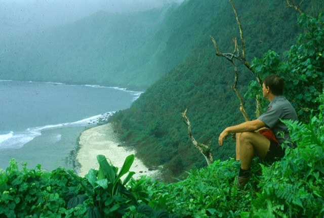
Dense rainforest covers the steep volcanic interior and supports tree ferns, lianas and many native plants. Trails can become muddy quickly, so footwear and weather awareness matter.
National Park of American Samoa · NPS image · National Park Service · Public domain · Source · Credits
13
Wildlife and flying foxes
The most memorable native mammals are flying foxes, large fruit bats that can be seen crossing the evening sky or feeding in forest trees. They are culturally significant and ecologically important pollinators and seed dispersers. Seabirds nest on cliffs and offshore islets, while the reefs support turtles, reef fish and occasional marine mammals. Wildlife watching should be quiet and distant. Do not approach roosts, nesting sites or turtles, and never assume that an animal visible near a village is available for handling. Protected species rules apply even when enforcement is not physically present.
Large Samoan flying foxes are among the territory’s most visible native mammals. Seabirds, reef fish, sea turtles and seasonal whales connect the islands to the wider Pacific ecosystem.
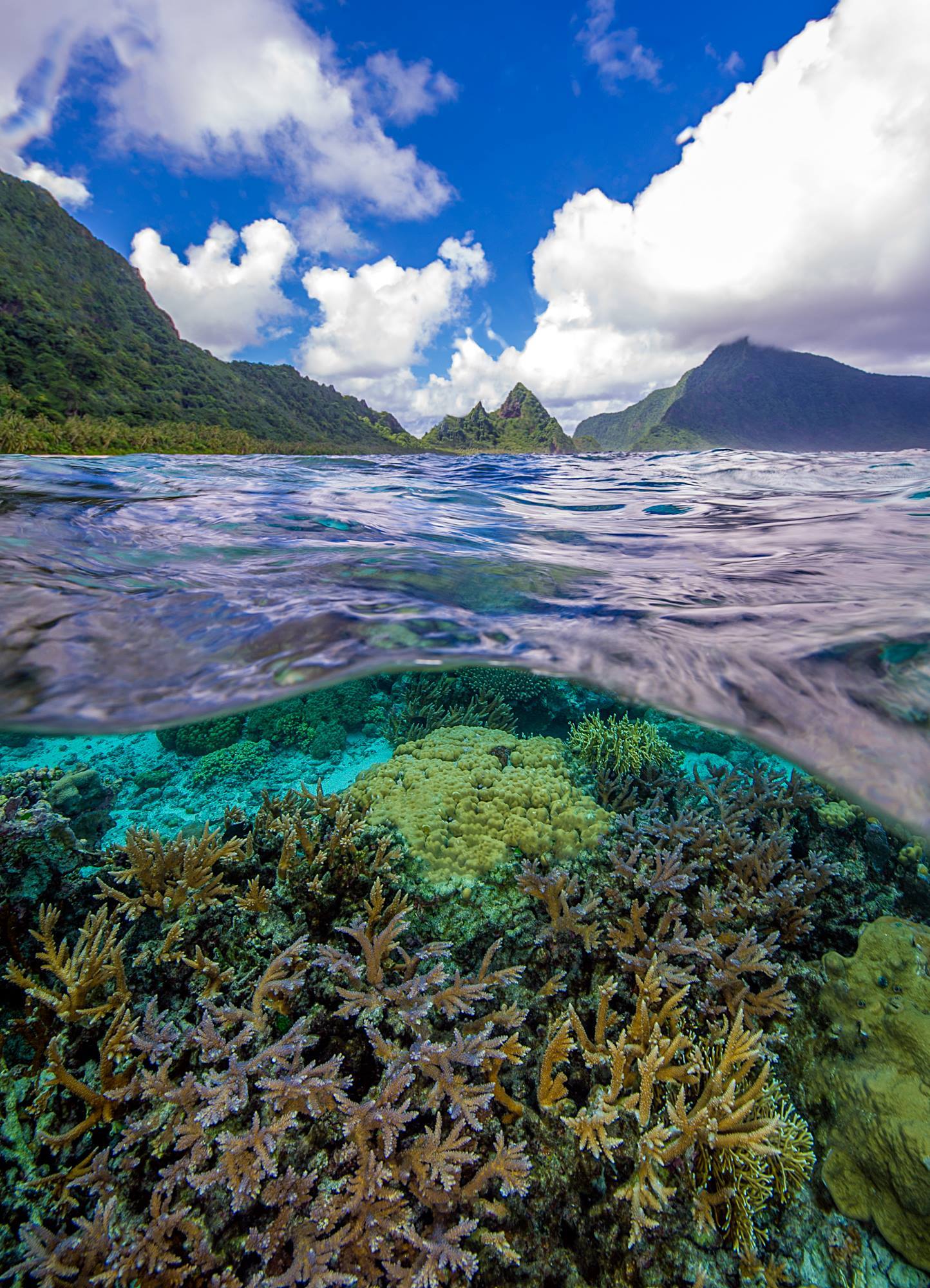
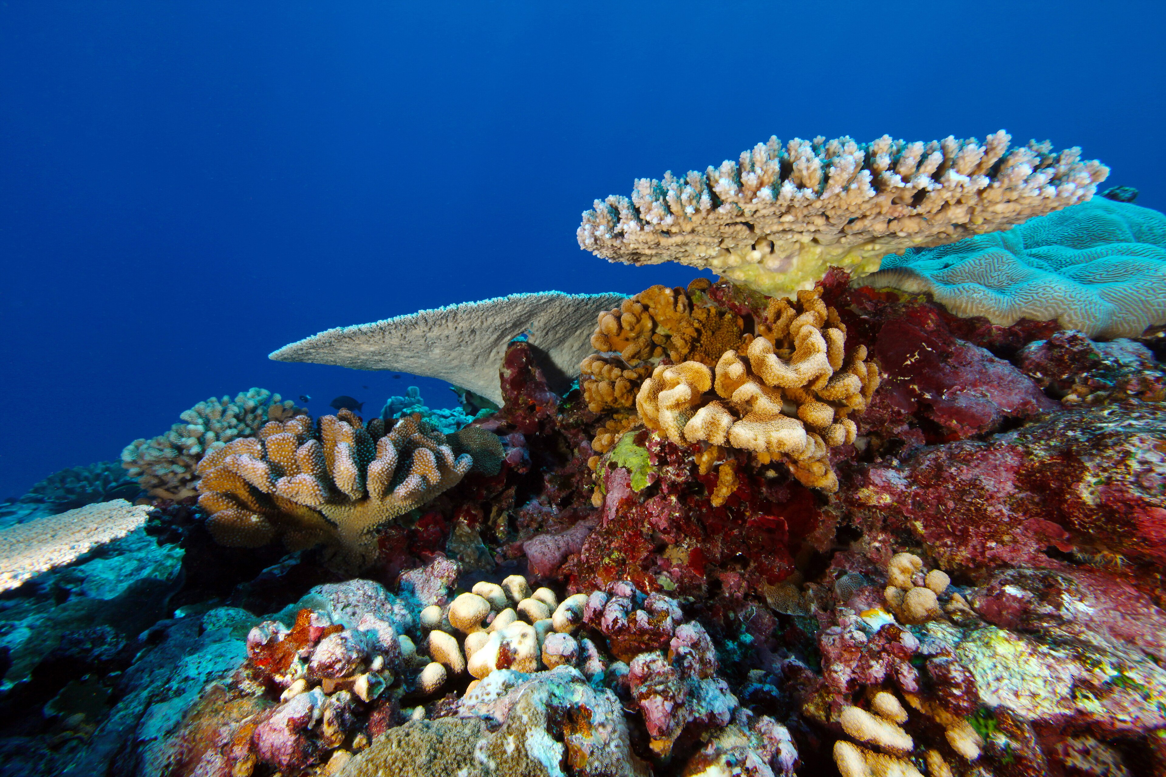
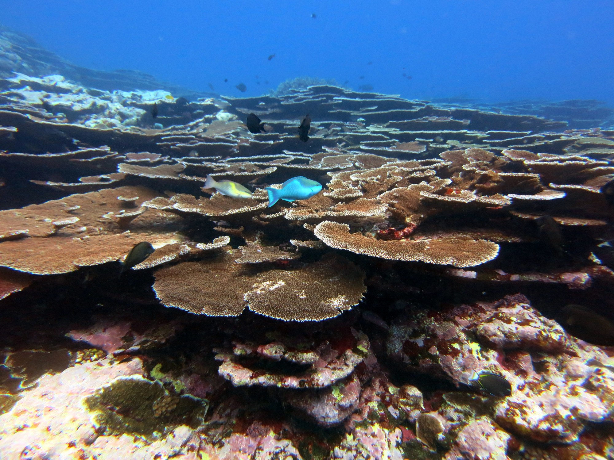
American Samoa’s reefs include sheltered lagoons, fringing reefs, outer slopes and protected bays shaped by waves, heat and storms. Some corals have attracted scientific attention for their tolerance of unusually warm water, but resilience is not immunity: bleaching, pollution, crown-of-thorns starfish and cyclone damage remain threats. Snorkelers should enter only at suitable access points, keep fins clear of living coral and avoid sunscreens or practices known to damage reefs. The safest and most informative experience comes with current local advice about tides, surge, visibility and culturally appropriate access.
Fringing reefs protect many villages and contain coral, giant clams and richly varied fish communities. Warming seas, storms, pollution and careless contact remain serious threats.
Corals of Fagatele Bay · Greg McFall / NOAA; National Marine Sanctuaries · CC BY 2.0 · Source · Credits
15
Pago Pago Harbor
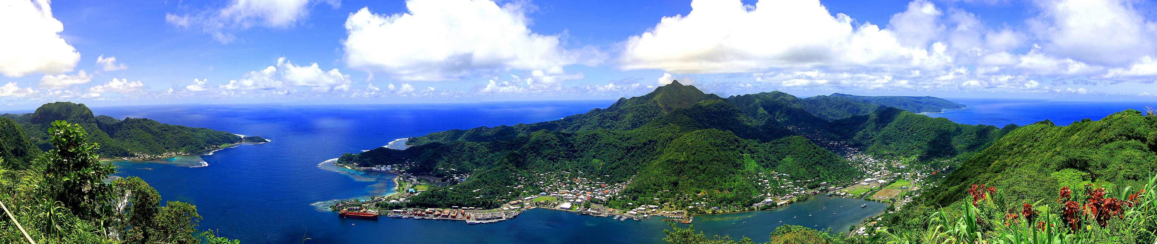
Pago Pago Harbor is one of the South Pacific’s great natural harbors, enclosed by steep volcanic walls and opening through a narrow entrance to the sea. The name Pago Pago is often used internationally for the territory’s capital area, although government institutions are concentrated around Fagatogo and neighboring villages. The harbor’s history includes naval administration, tuna processing and regional shipping. It is also a place where beauty and infrastructure sit side by side: rainforest ridges rise behind working docks, buses, churches, homes and government buildings. Exploring it makes most sense as a sequence of communities rather than a single downtown.
Pago Pago occupies one of the South Pacific’s deepest natural harbors. The dramatic caldera setting is also the territory’s administrative, shipping and commercial centre.
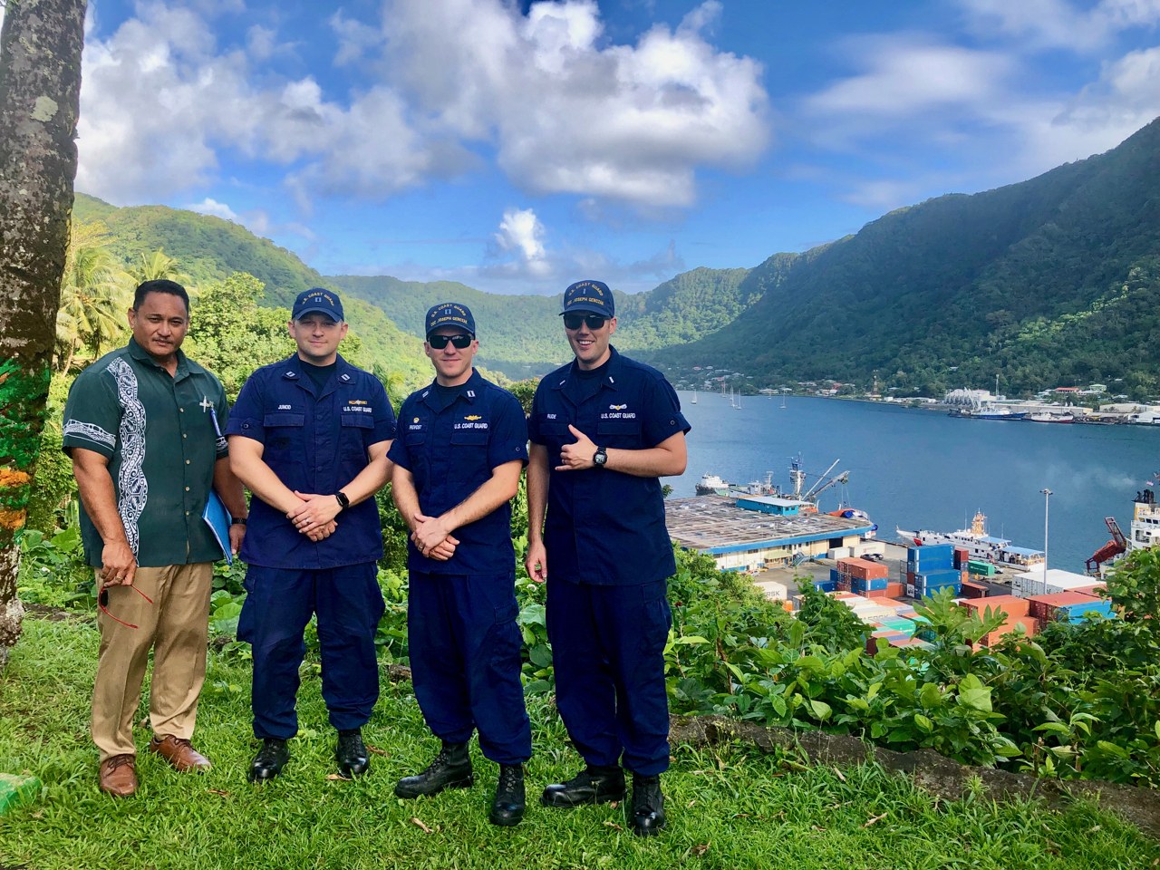
Coast Guard personnel overlooking Pago Pago Harbor · Sara Muir / U.S. Coast Guard · Public domain · Source · Credits
16
Fagatogo and the government district
Fagatogo is the civic heart of American Samoa, home to the territorial legislature, market and important public buildings. The market is a useful place to see local produce, prepared food, clothing and crafts, but it remains a working community space rather than a curated attraction. Nearby Utulei and other harbor villages contain government offices and shoreline facilities. Walking is possible in short sections, though heat, rain and discontinuous sidewalks require care. Visitors should photograph public architecture freely but ask before focusing on vendors, worshippers or people conducting family and government business.
Fagatogo contains the legislature, market and several historic civic buildings. It is the practical heart of government even though Pago Pago is commonly named as the capital.
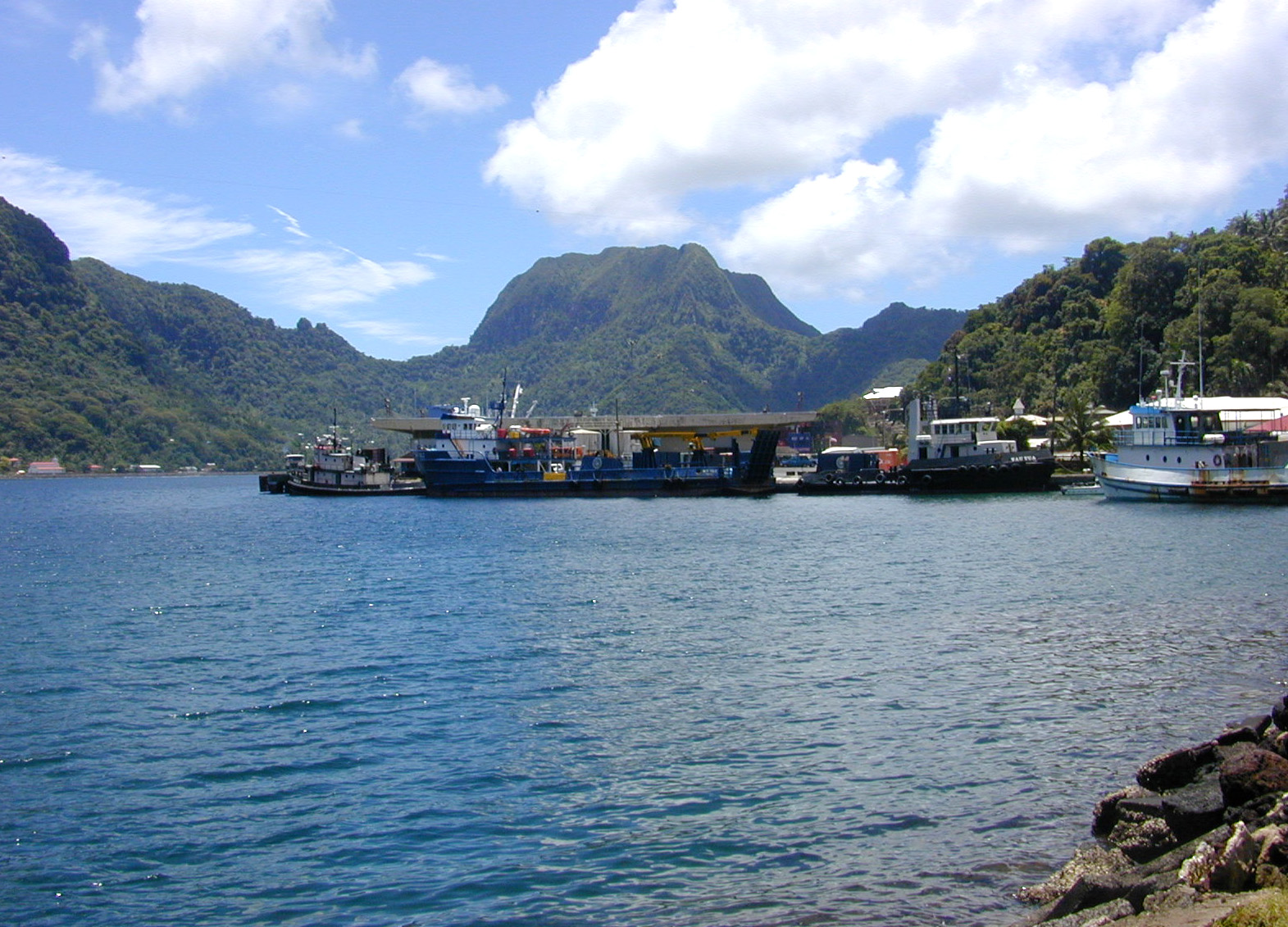
Fagatogo dock with Rainmaker Mountain · Eric Guinther · CC BY-SA 3.0 · Source · Credits
17
Western Tutuila
Western Tutuila contains Tafuna, the international airport and much of the territory’s modern commercial development. The landscape is broader than around Pago Pago Harbor, with more extensive settlement across the Tafuna plain. Shops, services and rental facilities are easier to find here, making the west practical for arrival and resupply. Continue toward Leone and the island’s western villages, however, and the territory’s history and village structure become more visible. Travel slowly: roadside activity, buses, school traffic, dogs and pedestrians can appear suddenly, and the road is not designed for hurried mainland driving.
The more populated western side includes Tafuna, Leone and the airport corridor. Shops and services are concentrated here, alongside wetlands, villages and important archaeological places.
Eastern Tutuila narrows into a dramatic sequence of bays, headlands and villages backed by steep rainforest. Routes toward Aunuʻu and the national-park landscapes around Vatia reveal how closely settlement follows the coast. Scenic stops may sit beside homes, churches or communal land, so a viewpoint is not automatically a public picnic area. Ask locally where to park and whether access is welcome. The area rewards early starts, when the light reaches across the ridges and traffic is lighter, but rain and rockfall can affect the road after severe weather.
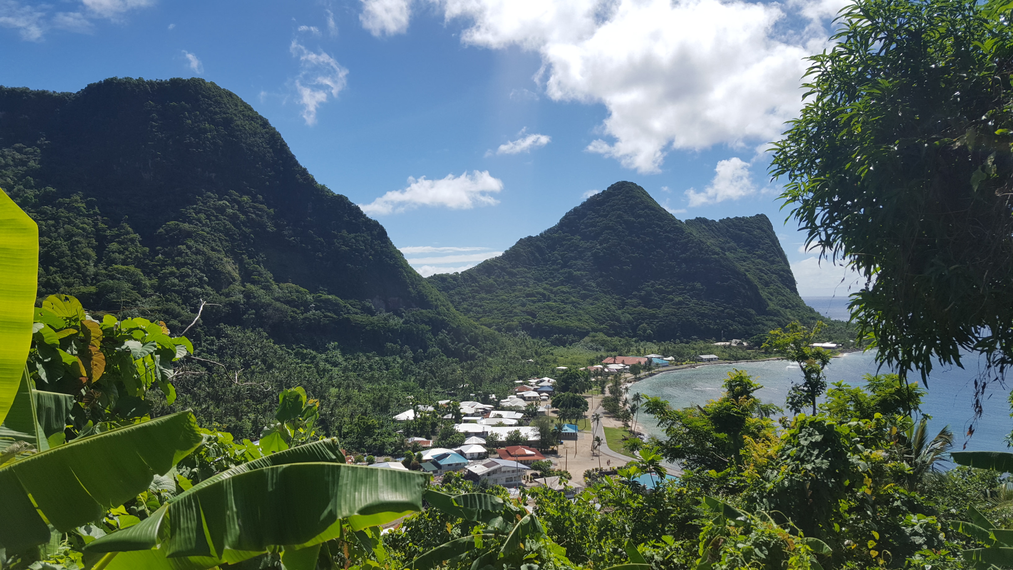
East of Pago Pago the coast narrows beneath forested ridges. Villages such as Afono and Vatia provide access to national-park landscapes and views toward Pola Island.
Afono village, Tutuila · Tavita Togia / National Park Service · Public domain · Source · Credits
19
Aunuʻu Island
Aunuʻu lies just offshore from eastern Tutuila and is reached by small local boats when sea conditions allow. The island contains a compact village landscape, wetlands and a volcanic interior, including features often described as quicksand or taro-marsh areas. There is little visitor infrastructure, so water, sun protection and a clear return arrangement are essential. Boat operation is weather-dependent and timetables may be informal. This is a community, not an excursion park: seek guidance on where to walk, keep away from cultivated plots and burial areas, and never assume that every path is public.
Aunuʻu lies just off eastern Tutuila and is reached by local boat. Its small community, taro wetlands and volcanic landscape reward visitors who arrange transport respectfully.
Aunuʻu Island off Tutuila · National Park Service; photographer not identified · Public domain · Source · Credits
20
Ofu and its beach
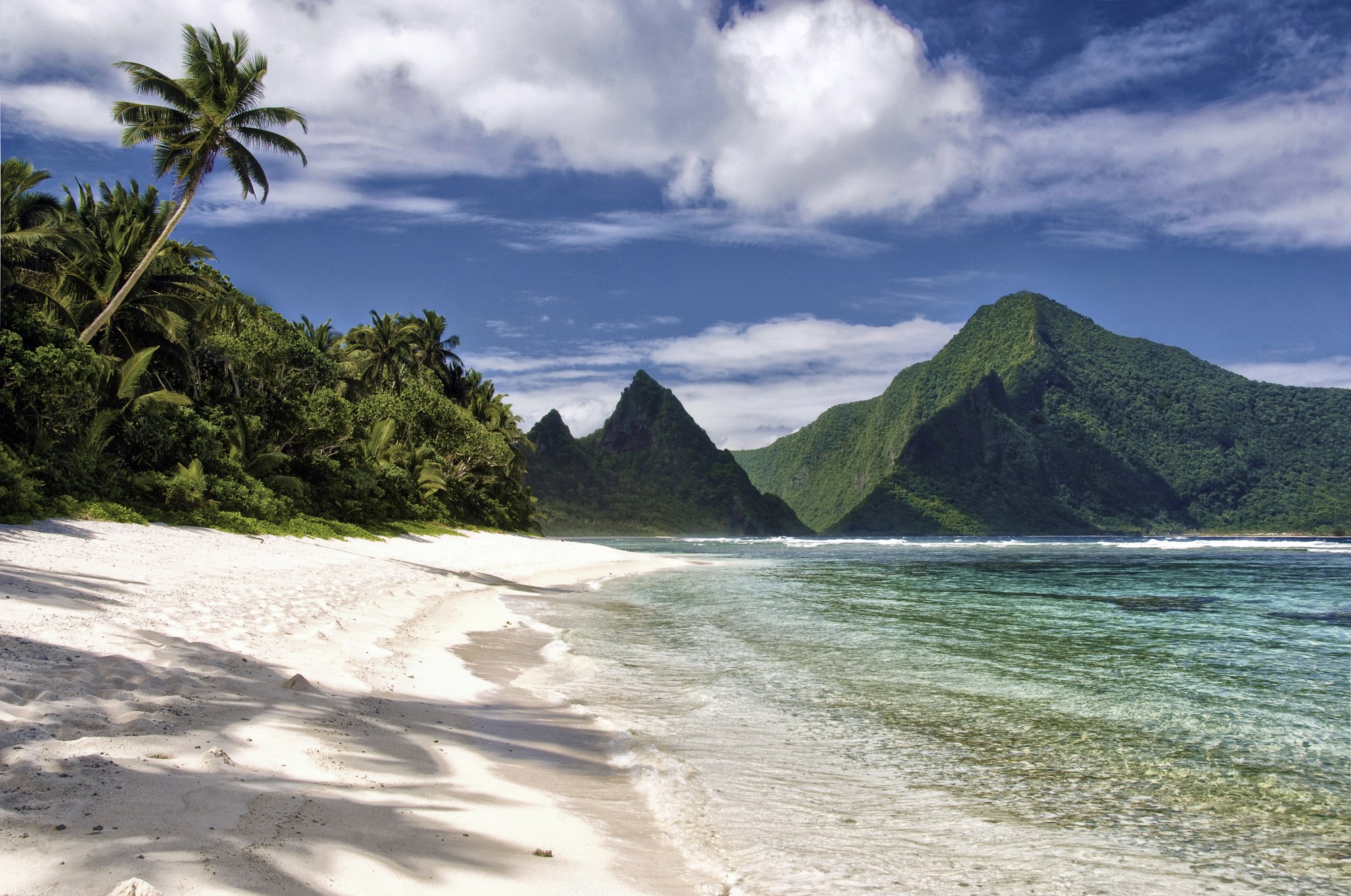
Ofu Beach is celebrated for pale sand, clear water and a reef backed by volcanic mountains, but its beauty should not obscure the practical realities of reaching it. Flights, lodging, food and ground transport must be organized in advance, and the reef is exposed to changing tides and ocean conditions. The national-park unit protects part of the coastline and adjacent marine environment. Visitors should avoid walking on coral, carry out all waste and ask hosts about village expectations. A quiet day here is memorable precisely because the place has not been reshaped around high-volume tourism.
Ofu combines a celebrated white-sand beach with a shallow lagoon and exceptionally studied coral reef. Access is limited, which helps preserve both its beauty and its quiet character.
Ofu Beach · Peter Craig / National Park Service · Public domain · Source · Credits
21
Olosega
Olosega is connected to Ofu by a short bridge over Asaga Strait, turning two islands into one small road journey while preserving distinct villages and identities. The surrounding mountains and channels produce dramatic views, but visitor services remain minimal. Walking or driving across the bridge gives a sense of the ocean’s role as both barrier and connection. Respect private homes and plantations, and arrange any hike with local knowledge: apparently obvious tracks can cross customary land or disappear into steep vegetation. The island’s scale encourages attention to everyday details rather than a checklist of attractions.
A short bridge joins Olosega to Ofu. Villages sit between mountain slopes and the sea, and local arrangements are essential for transport, accommodation and access.
Taʻū is the largest island in Manuʻa and the setting of Lata Mountain, which reaches the territory’s highest elevation. Much of the island’s southeastern landscape falls within the national park, protecting rainforest, cliffs and cultural sites. Taʻū is also central to Samoan origin traditions, giving the landscape historical and spiritual meaning beyond its scenery. Access and services are limited, and long hikes require local coordination, weather awareness and realistic fitness. Visitors should never interpret remoteness as emptiness: villages, family lands and oral histories give the island a densely inhabited cultural geography.
Taʻū is the largest of the Manuʻa Islands and rises to Lata Mountain, the territory’s highest point. Its rainforest and immense southern cliffs form one of the most powerful landscapes in Polynesia.
Taʻū sea cliffs · John Brooks / National Park Service · Public domain · Source · Credits
23
Rose Atoll
Rose Atoll, also known by its Samoan name Muliāva, is the easternmost point of the Samoan archipelago and a protected marine environment of exceptional ecological importance. Its small land area, lagoon and surrounding reefs support seabirds, turtles and marine life, but it is not a general tourism site. Access is controlled for conservation and research. The right way to include Rose Atoll in a journey is often through understanding rather than arrival: learn how the sanctuary fits into regional protection, avoid tour claims promising casual access and support policies that keep sensitive nesting and reef habitat undisturbed.
Rose Atoll is a remote, protected marine refuge and the southernmost point under United States jurisdiction. Access is strictly controlled to protect nesting seabirds, turtles and reef habitat.
Swains Island is geographically and culturally distinct from the main Samoan volcanic chain. It is a privately owned coral island with historical connections to Tokelau and a very small, fluctuating population. There is no regular visitor transport and no conventional tourism infrastructure. Maps can make it appear like another stop in the territory, but reaching it requires specific permission and exceptional logistics. Its inclusion in American Samoa’s political boundaries therefore tells a story about colonial-era administration and ocean networks more than it offers an itinerary item. Responsible guides should resist turning inaccessibility into a false promise.
Privately owned Swains Island is geographically and culturally linked to Tokelau. Its remoteness and restricted access mean it should be understood as a living community, not a conventional attraction.
Village life organizes space and time across the territory. Homes, churches, meeting houses and communal greens form recognizable social centers, and evening prayer periods may quiet movement through a community. Expectations differ, so observation and courteous questions matter more than memorizing a rigid list. Dress modestly away from beaches, do not enter a fale or use village facilities without invitation, and reduce noise during worship and family events. A traveler who treats villages only as scenery will miss the central fact of American Samoa: land and public life are embedded in relationships among families rather than separated into anonymous private and municipal zones.
Villages organize much of daily life through extended families, churches and matai leadership. Visitors should follow local guidance, avoid entering private land and respect evening prayer periods.
Vatia village · Eddy23 · CC BY-SA 4.0 · Source · Credits
26
Matai and communal land
The matai system gives titled family leaders responsibilities for land, representation, dispute resolution and service. Most land is held communally under customary tenure, which has helped protect Samoan control of the territory but also makes outside assumptions about ownership unreliable. A beach, trailhead or empty-looking grove may belong to an ʻāiga or village and require permission or a small locally determined fee. These arrangements are not informal obstacles to tourism; they are part of the constitutional and cultural fabric. Asking first protects relationships and often produces better information than relying on an old online map.
Matai titles carry family and village responsibilities rather than merely ceremonial status. Most land is communally held, helping protect Samoan continuity while shaping housing and investment.
Christianity is deeply woven into public and family life, with prominent congregational, Catholic, Methodist and other churches throughout the islands. Sunday is widely reserved for worship, rest and family meals, and commercial activity may be limited. Visitors are often welcome at services when dressed respectfully and guided by local custom, but worship should not be treated as a photo opportunity. The strength of Christianity coexists with older Samoan structures of title, land and kinship; it did not erase them. Scheduling a quiet Sunday and accepting slower service is one of the easiest ways to travel with, rather than against, local rhythms.
Christian churches are central to social life, music and community organization. Sunday is quiet and formal: services and family meals take priority, with limited transport and commerce.
Samoan and English are widely used, but language choice carries context. Samoan dominates many family, village and ceremonial settings, while English is common in government, education and commerce. Correct vowel length and the glottal stop can change meaning, which is why names such as Taʻū, Aunuʻu and Faʻasāmoa deserve careful spelling. Even a few greetings communicate attention: talofa for hello, fa‘afetai for thank you and tōfā for goodbye. Visitors should listen to local pronunciation and avoid performing ceremonial vocabulary they do not understand; fluency begins with respect for sound and spelling.
Samoan is widely spoken alongside English. Learning greetings and pronouncing names carefully is a simple sign of respect; the glottal stop can change a word’s meaning.
Performance connects entertainment with genealogy, history and collective discipline. Siva can emphasize controlled hand movements and storytelling, while faster group dances and slap dances create powerful rhythmic energy. Church choirs reveal another major strand of Samoan musical life, blending harmony, worship and community identity. At festivals, school events or village celebrations, applause is welcome, but recording should follow the host’s guidance. A short clip detached from its occasion can flatten a performance into spectacle, so captions should identify the group, event and permission whenever possible.
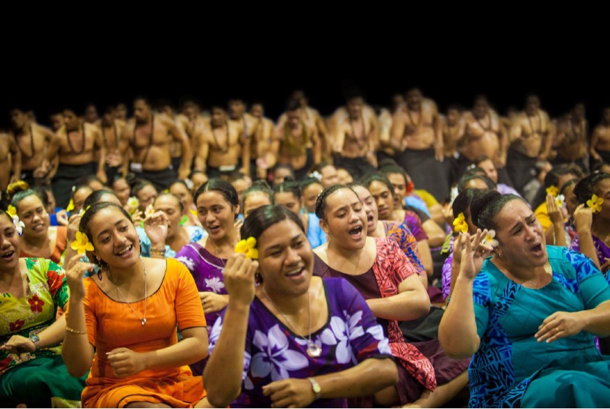
Choral singing, drumming and dance carry genealogy, humor and collective memory. The siva favors controlled, expressive movement, while group performances can be highly energetic.
Singers practicing for Flag Day · Matt McIntosh / NOAA · Public domain · Source · Credits
30
Crafts, siapo and weaving
Samoan material culture values patient, skilled work. Fine mats can carry ceremonial importance and may take months to produce; baskets, fans and household items demonstrate sophisticated weaving with pandanus and other fibers. Siapo barkcloth is made by beating and decorating plant material with repeated geometric and natural motifs. Quality varies in souvenir markets, and imported imitations can undercut local makers. Ask who made an object, what materials were used and whether a pattern has particular significance. Buying directly and crediting the artist turns a purchase into support for knowledge that must be taught across generations.
Fine mats, woven baskets, fans and siapo barkcloth unite practical skill with status and ceremony. Authentic pieces take time to make and should be bought directly from credited makers when possible.
The word tattoo entered European languages from Polynesian tatau, but the Samoan tradition is not a generic design catalogue. The male peʻa and female malu are associated with service, endurance, family support and social responsibility. Traditional application is physically demanding and undertaken within relationships involving the tattooist, assistants and family. Visitors should learn about the tradition without copying sacred or status-bearing patterns as casual decoration. Photography of a person’s tattoo requires consent, especially during ceremony or healing. Respect means recognizing that visual beauty is only the surface of a deeper commitment.
The peʻa and malu tattoo traditions carry family, service and cultural responsibility. They are demanding commitments embedded in Samoan society, not decorative motifs for casual copying.
American Samoa Flag Day commemorates the 1900 raising of the U.S. flag and has become the territory’s largest annual civic and cultural celebration. Programs may include fautasi racing, dance, music, sports, church participation and delegations from across the Samoan world. The event expresses both territorial history and contemporary village pride. Dates, venues and access arrangements can vary, so visitors should confirm the official program rather than build a trip around an archived schedule. Smaller church, school and village events may offer equally meaningful experiences when attendance is welcomed.
Flag Day in April is the territory’s largest civic celebration, with fautasi canoe races, dance, music and village competition. Dates and programs should be checked locally.
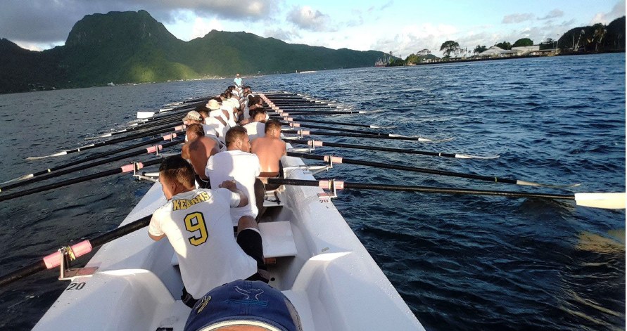
A fautasi is a long racing boat powered by a large, highly coordinated crew. Training demands weeks of discipline, and boats represent villages, making competition an expression of collective identity rather than an individual sport. Harbor races during Flag Day draw intense interest and can be affected by weather and safety decisions. Spectators should use designated viewing areas and avoid blocking working crews or family groups. The most impressive aspect is not simply speed but synchronization: dozens of paddlers translate a coxswain’s rhythm into a single moving hull.
Long fautasi racing canoes represent villages and require disciplined crews. Race season turns the harbor into a stage for rivalry, cooperation and communal pride.
Fautasi crew practicing for Flag Day · Apulu Veronika Molioʻo Mataʻutia Mortenson / NOAA · Public domain · Source · Credits
34
Hiking and viewpoints
Hiking ranges from short coastal walks to steep rainforest routes with major elevation gain. Heat and humidity can make modest distances strenuous, while sudden rain turns roots and volcanic soil slippery. Start early, carry more water than expected and tell someone your plan. Trails within the national park may cross village-leased land or begin near communities, so current ranger and local advice is essential. Do not rely on mobile reception, and avoid unofficial cliff routes. The reward is a landscape that reveals the islands’ volcanic structure from ridge to reef.
National-park trails reach rainforest ridges, historic sites and coastal viewpoints. Heat, sudden rain and steep ground require water, sturdy footwear and an early start.
American Samoa’s beaches are varied: white coral sand on Ofu, darker volcanic shores on Tutuila and small coves tucked between villages. Many are not public in the mainland sense, even when no gate or sign is visible. Ask where access is appropriate and whether a fee or family permission applies. Reef flats can be sharp, currents can accelerate through channels and waves may arrive from distant storms. Swim with local advice, wear suitable footwear where recommended and never confuse a calm-looking lagoon with guaranteed safety.
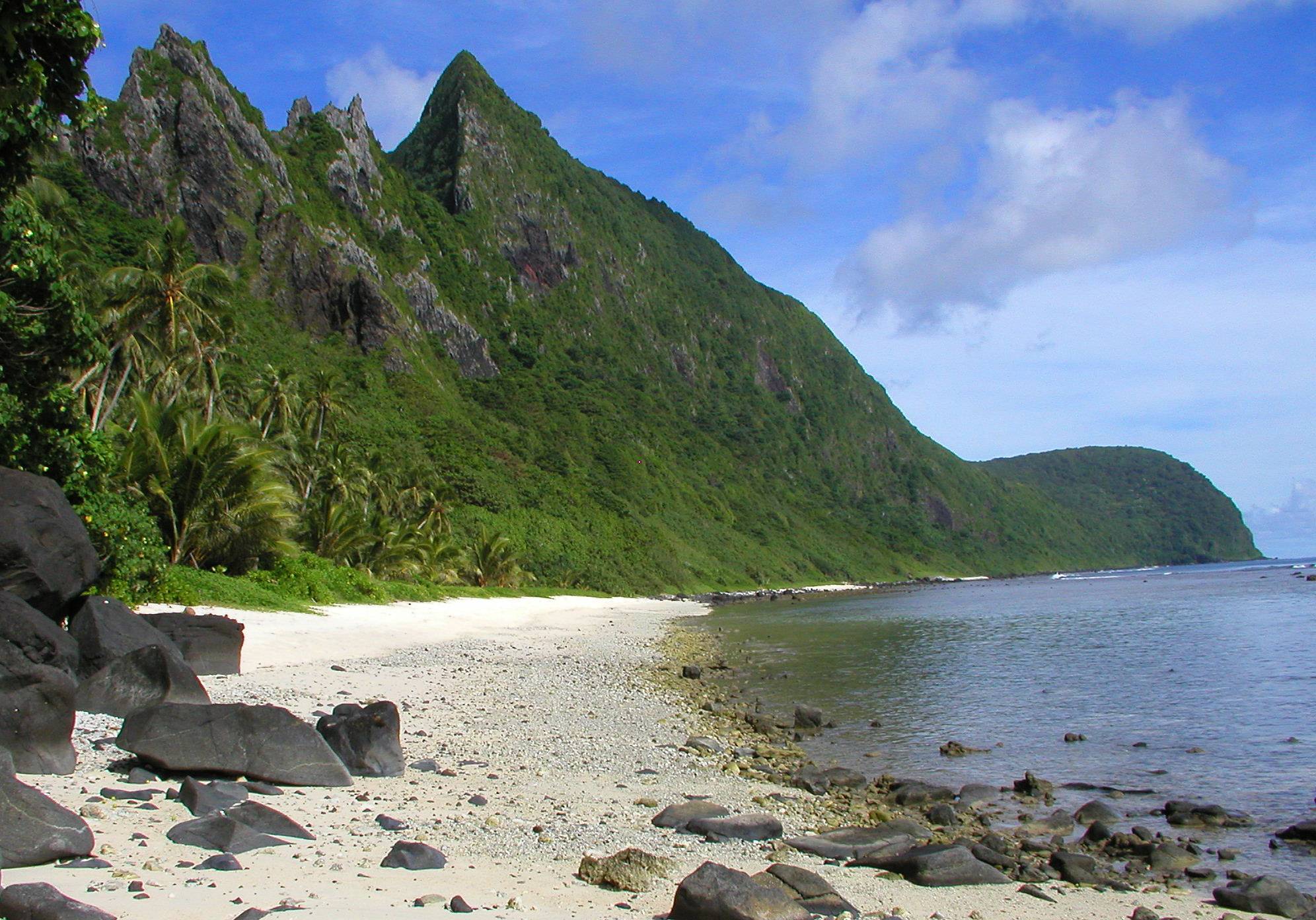
Beaches range from sheltered village coves to exposed ocean shorelines. Ask permission where access crosses village land and assess currents, tides and reef conditions before swimming.
Amalu Bay, Tutuila · Tavita Togia / National Park Service · Public domain · Source · Credits
36
Snorkeling and diving
The territory offers exceptional marine scenery but limited commercial infrastructure, so diving and snorkeling depend on current operator availability, equipment and weather. Protected bays may offer calmer conditions, while outer reefs can involve surge and strong currents. Verify certification requirements and emergency arrangements before committing to a dive. For snorkeling, use a buddy, remain within your ability and avoid narrow reef passages on a falling tide. Marine encounters should remain passive: do not chase turtles, feed fish, collect shells or anchor on coral.
Clear lagoons and reef slopes offer excellent marine viewing, especially around Ofu and protected bays. Use local guidance, avoid standing on coral and never remove marine life.
Fagatele Bay coral habitat · Wendy Cover / NOAA · Public domain · Source · Credits
37
Accommodation
Accommodation is concentrated on Tutuila and ranges from small hotels to locally run guest options. Manuʻa has far fewer rooms, and availability may depend on direct relationships rather than instant online booking. Confirm the exact village, transport from the airport or wharf, meal arrangements, payment method and cancellation terms. A reservation screenshot is not enough when flights change; keep a phone contact and reconfirm shortly before travel. Staying locally can deepen a visit, but guests should ask about household schedules, footwear, Sunday routines and expectations around shared spaces.
Most formal accommodation is on Tutuila, with much more limited options in Manuʻa. Confirm bookings and transport directly, because online listings and schedules can be outdated.
Colorful ʻaiga buses operate along Tutuila’s main roads and are both practical transport and part of local life. Routes and finishing times are not always published, and service becomes sparse later in the day. Rental cars give greater freedom, though roads are narrow, speeds should remain low and parking must not obstruct homes or communal areas. Outer-island flights and boats are the fragile link in any itinerary: weather, maintenance and demand can alter plans. Keep buffer days, reconfirm repeatedly and never promise a same-day international connection after returning from Manuʻa.
Buses provide a colorful and inexpensive way to travel around Tutuila, while rental cars offer flexibility. Flights and boats to outer islands are limited and vulnerable to weather disruption.
The U.S. dollar simplifies currency exchange, but island economics make many imported goods more expensive than visitors expect. Fuel, packaged food and specialist equipment travel long supply chains, while small local services may accept cash only. ATMs and card facilities are easiest to find on Tutuila; they should not be assumed in remote villages or outer islands. Carry a modest cash reserve in small denominations without displaying it. Budgeting should also include customary access fees, local guides, transport changes and the cost of extra nights if weather delays travel.
The U.S. dollar is used. Imported goods can be expensive, cards are accepted unevenly outside main centers, and carrying some cash is practical for buses and small businesses.
LBJ Tropical Medical Center on Tutuila provides the territory’s principal hospital services, but specialist care and outer-island facilities are limited. Comprehensive insurance should cover medical evacuation, and travelers should bring an adequate supply of prescribed medication in original packaging. Heat, dehydration, sun exposure, mosquito-borne illness, reef cuts and road accidents are more likely concerns than exotic adventure hazards. Clean and protect even small coral wounds, drink regularly and follow current public-health guidance. Emergency planning is especially important before Manuʻa travel, where transport itself can be weather-dependent.
Medical facilities are limited compared with the continental United States. Travelers should bring necessary medication, prevent mosquito bites and carry insurance that includes evacuation.
Mobile service and internet access are generally strongest in populated parts of Tutuila, while coverage and speed can fall sharply in mountain areas and on outer islands. International roaming arrangements may differ from the continental United States, despite the U.S. territorial status, so check costs before arrival. Save accommodation contacts, tickets, maps and insurance documents offline. A local SIM or eSIM may be useful when compatible, but visitors should verify activation and coverage rather than assume. In villages, direct conversation often solves practical problems faster than repeated online searching.
Mobile and internet coverage is strongest on populated Tutuila and less dependable on remote islands. Download maps and confirmations before traveling beyond the main urban corridor.
Small islands feel the effects of waste, erosion and climate pressure immediately. Carry reusable bottles and bags, minimize imported packaging and never leave rubbish beside an overflowing bin. Keep soil and sand out of reef water by staying on trails, and do not move coral, shells or cultural material. Climate change compounds coastal erosion, flooding and coral heat stress, while severe cyclones can damage both ecosystems and essential infrastructure. Low-impact travel cannot solve these problems, but it can avoid adding avoidable pressure and can direct spending toward local conservation and community services.
Limited land, fragile reefs and waste-management constraints make low-impact travel essential. Refill bottles, reduce packaging, keep plastics secured and follow all protected-area rules.
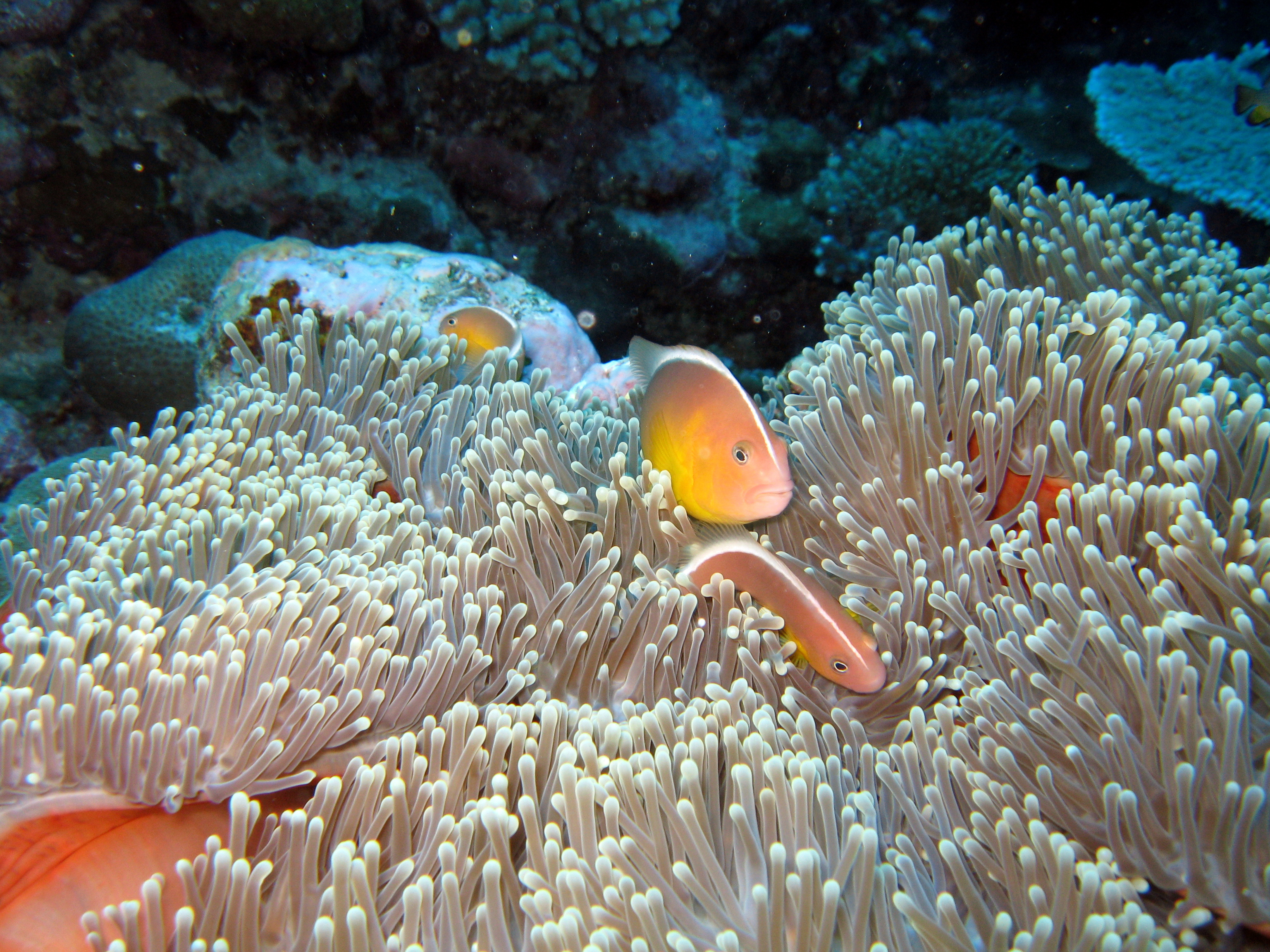
Anemonefish near Aunuʻu · Wendy Cover / NOAA; National Marine Sanctuaries · Public domain · Source · Credits
43
Responsible travel
Responsible travel in American Samoa begins with recognizing that hospitality is not entitlement. Ask before crossing land, photographing people, flying a drone, entering a church compound or attending an event. Choose locally owned accommodation, transport, food and guides when available, and credit artists and communities accurately. Avoid geotagging sensitive natural or cultural sites without permission. Build enough time that a delayed boat, funeral, church service or village decision does not become a conflict. The goal is to leave with relationships and understanding, not merely a collection of locations.
The best visits are based on patience and invitation. Support locally owned services, request permission before photography and allow community priorities to take precedence over an itinerary.
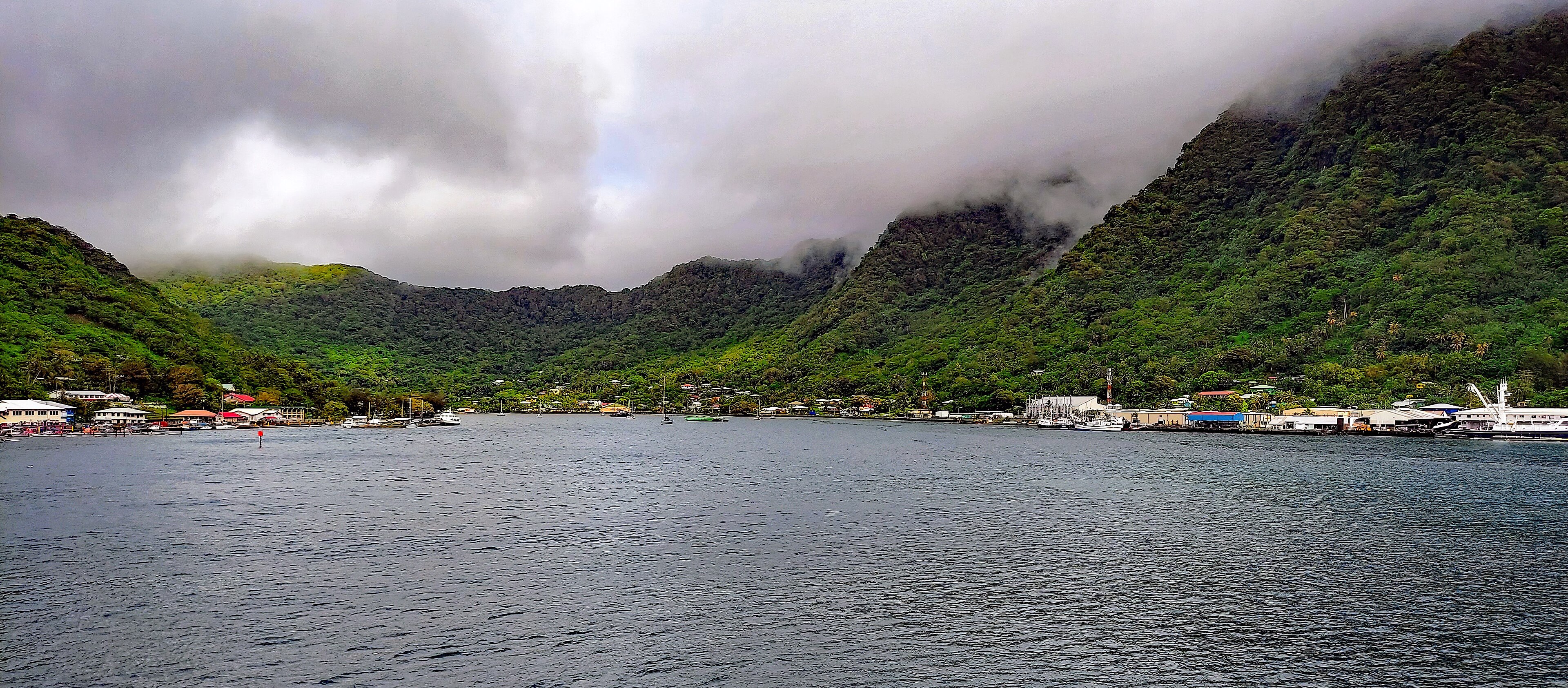
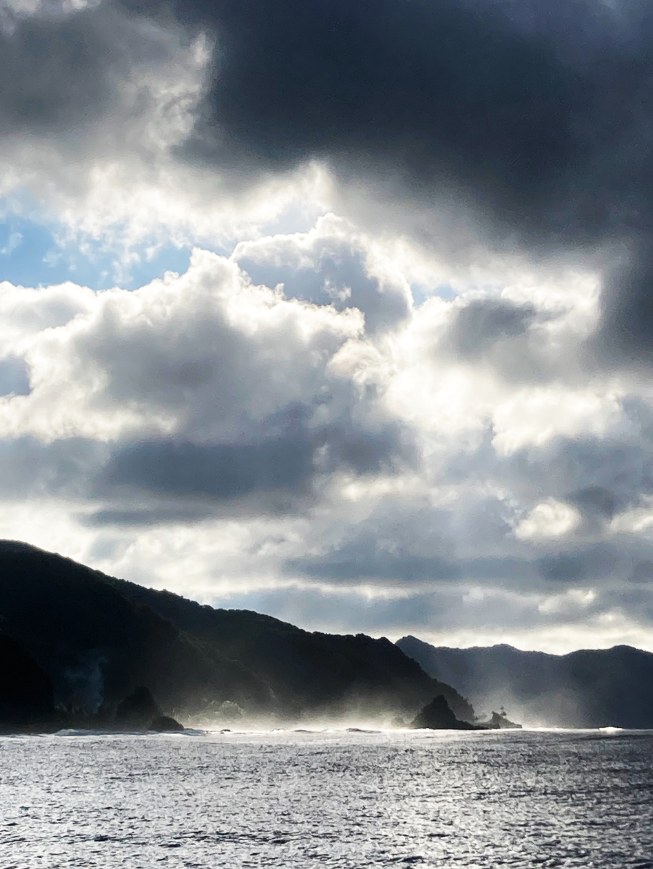
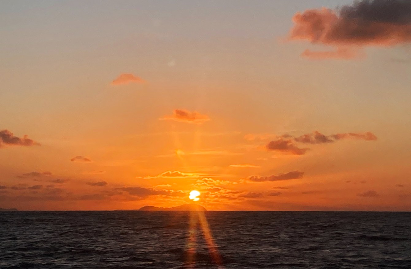
These two photographs show Tutuila’s coast and sunrise over Aunuʻu. Each caption identifies the photographer or credited institution, source and license. Select a photograph to enlarge it; the viewer also lets you browse the other documentary photographs on this page. The separate promotional guide cover is an AI illustration.
From Ofu’s pale sand to the flooded caldera of Pago Pago, these images follow the territory’s volcanic coast, villages and protected reefs. The gallery uses destination imagery with source records; it does not present generated scenes as documentary photographs.
Tutuila coast on a misty morning, 2023 · NOAA Fisheries / Ray Boland · Public domain · Source · CreditsSunrise over Aunuʻu · NOAA Fisheries / Ray Boland · Public domain · Source · Credits
Author’s Note
A journey here is shaped by the relationship between landscape and community. A path or beach can be part of family land, and a delay can reflect obligations that matter more locally than a visitor’s timetable. Ask first, make room for conversation and let the island’s everyday life set the pace.
Keep exploring
This World Travel Factbook is independent and free to use for all travelers. If you find it helpful, consider supporting its continued development.

.jpg)


.jpg)


.jpg)
.jpg)

