The National Park of American Samoa was established on 31 October 1988, protecting land and marine habitats across three islands — Tutuila, Ofu and Ta'ū. It is the only unit of the U.S. National Park system south of the equator, one of the less-visited parks in the system. Acreage figures need to distinguish land, water and leased areas; annual visitor counts also vary, so use current NPS reporting for either comparison.
Uniquely, the National Park does not own the land it protects. Its land arrangements rely on long-term leases with customary landholders and partnership with local villages, originally framed around 50-year terms. Do not assume that every original agreement has already been renewed. The park is run in ongoing partnership with the Village councils; park rangers include Samoan cultural interpreters, and the park's mission explicitly includes preserving traditional Samoan land use as much as biological diversity.
The park protects three biological zones: paleotropical rainforest (the only such system in the entire U.S. National Park system, with tree species related to those of Southeast Asia rather than the Americas), fringing coral reef and other protected marine areas, and traditional Samoan cultural landscape. Wildlife includes flying foxes (large fruit bats that help pollinate native trees and disperse seeds), hawksbill sea turtles and seabirds. Threat status and endemism differ by species; these animals should not all be labeled endangered or endemic as a group.
Tutuila Unit
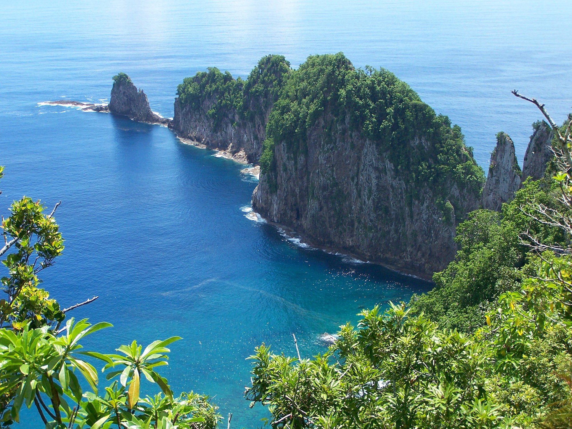
The most accessible unit and the one most day-trippers see. It covers the rainforest ridgeline north of Pago Pago Harbor around the north-central part of Tutuila, including the area above Pago Pago Harbor and near Vatia. The signature hike is the Mount 'Alava trail — 11.3 km round trip, challenging with steep and potentially slippery sections, with a spectacular ridge-top view over the harbor and out to Rainmaker Mountain. From Vatia the short walk to the Pola Island viewpoint delivers the park's most-photographed image: a 122-meter volcanic monolith exploding straight from the Pacific.
Ofu Unit
A short stretch of coast on Ofu's south side, plus the fringing coral reef offshore. This is the beach — a mile of empty white sand backed by jagged volcanic peaks and fronted by one of the best-preserved coral reefs in the U.S. system. You reach it by a small propeller flight from Pago Pago (about 40 minutes; weather-dependent). Ofu has limited visitor services, including the well-known Vaoto Lodge. Confirm current accommodation, meals, transport and cash arrangements before arrival rather than relying on an absolute count of guesthouses or restaurants. Snorkeling straight off the sand delivers healthy corals, parrotfish, and — if you are patient — reef sharks and green turtles.
Ta'ū Unit
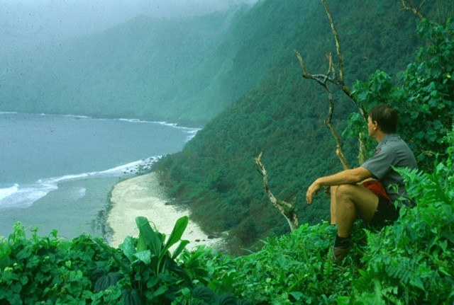
The largest and most remote unit covers much of the southern half of Ta'ū island. It protects a spectacular southern sea-cliff landscape below Lata Mountain, the culturally significant Saua site (traditionally held as the birthplace of the Polynesian world), and the rainforest of central Ta'ū. Lata's elevation of around 900 meters should not be read as the height of a single uninterrupted vertical cliff. Access is by a separate small-plane flight from Pago Pago; arrange a local guide and suitable ground transport with the village.
The South Cliffs of Ta'ū
The forested Lata massif rises above the dramatic southern sea-cliff landscape of Ta'ū. Photo: John Brooks / NPS, public domain.
Visitor Center
The park's visitor center is in Pago Pago, across from the Pago Way Service Station. Park entry is free; visitors do not need to collect a paid park pass. Check the NPS visitor information before traveling for current opening hours and trail conditions. Rangers can help explain the island units, village protocols and realistic transport options. Ask directly about any currently available cultural activities or homestays rather than assuming these are guaranteed programs.
02
National Marine Sanctuary of American Samoa
The National Marine Sanctuary of American Samoa (NMSAS) is part of the U.S. National Marine Sanctuary System — 13,581 square miles of protected coral reef and open Pacific, spread across six distinct protected areas around the archipelago. It began in 1986 as a tiny 0.25-square-mile protected area at Fagatele Bay on Tutuila and was expanded and renamed in 2012.
Together with the National Park, the sanctuary makes American Samoa a territory with an extensive network of federal and territorial marine protection. The percentage protected depends on boundaries and protection categories; it should not be confused with a universal ban on all activity or a guarantee of undisturbed habitat. The six units cover strikingly different environments — inshore coral reefs, seamounts, coral atolls, and open Pacific — and the science program produces some of the best long-term reef-monitoring data in the tropical Pacific.
Fagatele Bay Unit
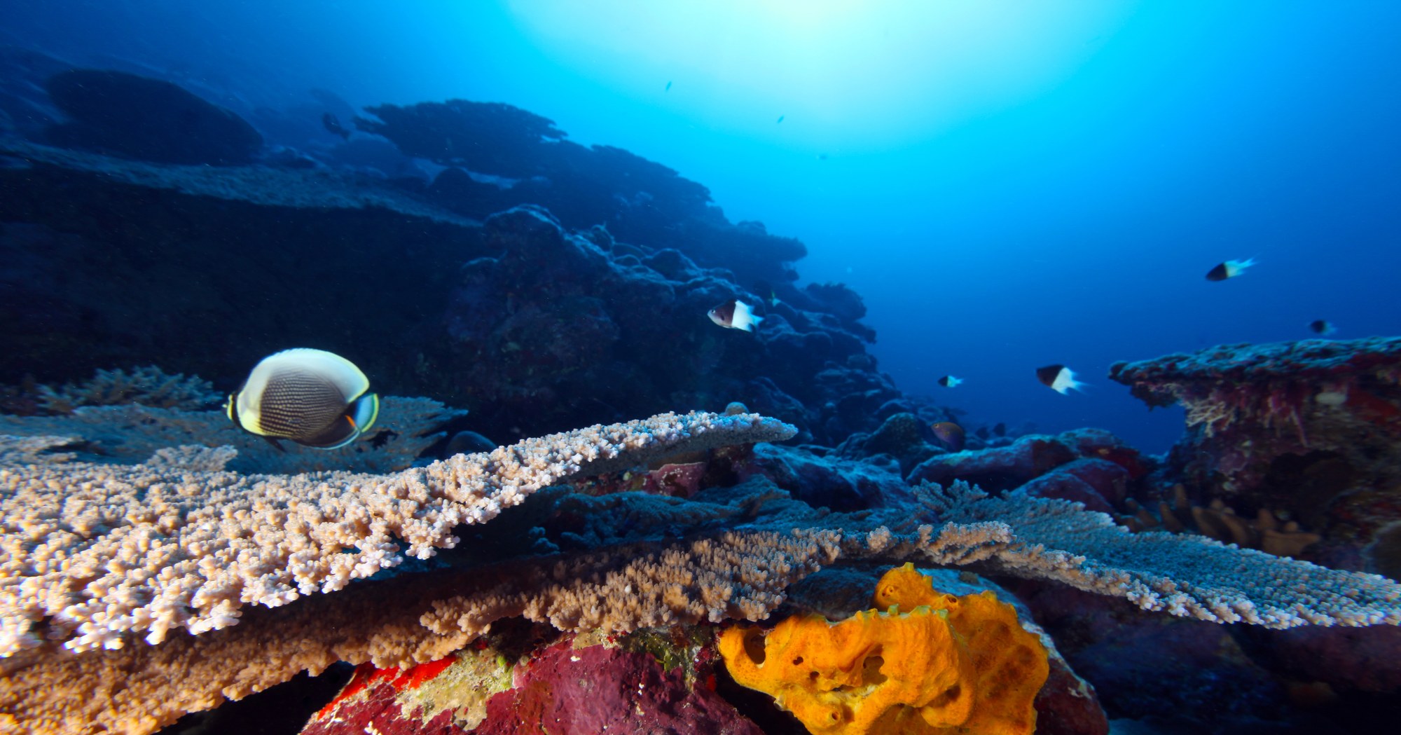
The original sanctuary — a flooded volcanic crater on Tutuila's south-west coast that forms an almost perfectly enclosed bay of clear water and healthy coral. This is the most accessible unit; a steep walking trail from a village access road drops down to the beach. The bay has a highly diverse coral community, including long-lived massive Porites colonies, together with butterflyfish, parrotfish, humphead wrasse, and — occasionally — reef sharks and green turtles. Visibility, waves and currents vary. Check local conditions rather than assuming that any season guarantees calm water.
Fagatele Bay
The original 1986 sanctuary — diverse coral communities in a flooded volcanic crater. Photo: Greg McFall / NOAA, public domain.
Fagalua / Fogāma'a Unit
The bay immediately east of Fagatele on Tutuila's south coast, added in the 2012 expansion. Similar coral community, less-known, generally quieter for snorkeling.
Aunu'u Unit
Waters surrounding the small island of Aunu'u off Tutuila's eastern tip. Rich in reef fish, seagrass, and mangrove habitat. Aunu'u itself is reached by short pass-boat from Auasi village; the sanctuary can be enjoyed by snorkeling from the island or from a chartered boat.
Ta'ū Unit
Waters around Ta'ū island in the Manu'a Group. Includes some of the healthiest reef in the whole territory, and one of the largest known Porites coral colonies on the planet — nicknamed "Big Momma" — roughly 6 meters tall and 41 meters in circumference, estimated at 500+ years old.
Muliāva Unit (Rose Atoll)
Rose Atoll — the southernmost point of the entire United States, at 14°32'S — is protected as both a Marine National Monument and part of the Sanctuary. It is one of the world's smallest atolls, uninhabited, with a lagoon of unusually pink sand (from coralline red algae) and enormous nesting colonies of seabirds and green turtles. Access is closed to visitors except for scientific research permits.
Vailulu'u Seamount & Swain's Island
Vailulu'u is an active undersea volcano rising 4,300 meters from the Pacific seabed east of Ta'ū, its summit still 590 meters below sea level. The crater hosts unique hydrothermal-vent ecosystems, including a remarkable aggregation of eels observed here in 2005 (Dysommina rugosa — the "cutthroat eel"). Swain's Island, added to the sanctuary in 2012, is a remote atoll about 350 km north of Tutuila with limited access; current habitation and travel arrangements require specific confirmation.
Tauese P.F. Sunia Ocean Center
The Sanctuary's small visitor center in Utulei on the harbor front. Free entry, excellent exhibits on Samoan marine culture and the sanctuary science program, and a good gift shop. An hour here before you head out to any of the sanctuary units repays itself many times over.
03
Planning a Visit
Base yourself on Tutuila for the first few days. Fly into Pago Pago (PPG). Get an entry permit sorted before arrival if you're not a U.S. national or from a visa-waiver country. Visit the park information center in Pago Pago; grab a rental car (confirm availability and rates before arrival); drive the coastal loop; walk Mount 'Alava; snorkel Fagatele Bay; visit the Sunia Ocean Center. Two full days is a minimum, three is comfortable.
Book Ofu ahead. Vaoto Lodge is small, family-run, and often full weeks in advance. Confirm the current operator and flight schedule directly; an older three-times-weekly timetable is not a current booking guarantee. Flights are weather-dependent and small planes can leave you stranded on either end if a storm rolls in. Pad at least a day of slack. Three nights on Ofu is the sweet spot — one for arrival and orientation, one full day for the beach and snorkel, one for exploring Olosega across the bridge and unwinding.
Ta'ū is a separate trip. Same small-plane logistics as Ofu but a different island. Add another 2-3 nights. Requires a village-arranged guide for hiking to the Ta'ū cliffs — do not attempt these on your own.
Best season: June-September is generally drier, while October-May is wetter. Tropical storms and cyclones are a heightened concern during the wet season. No season guarantees calm seas or an operating flight: use current forecasts and local advice.
Respect the villages. The National Park is on leased Samoan land. Ask before photographing people, do not swim near villages on Sundays, dress modestly in villages, and respond to offers of food or drink courteously; explain dietary or personal limits and follow your host’s guidance.