Midway is closed to public visitation; Wake requires military authorization. Palmyra allows only limited visits with prior approval. Read the access conditions →
01
At the edges of the map
Scattered across millions of square kilometers of Pacific Ocean—with one outlier in the Caribbean—the United States Minor Outlying Islands represent some of the most remote and inaccessible territories on Earth. These nine island groups are not a country in any conventional sense. They have no shared local government or permanent civilian community. What connects them is U.S. administration, with competing claims affecting some islands: and together they form one of the most extraordinary collections of wildlife refuges, military outposts, and historical sites anywhere on the planet.
The designation itself is a bureaucratic creation. In 1986, the International Organization for Standardization grouped these territories together under ISO code "UM" for statistical convenience—which is why they appear on virtually every country dropdown menu on the internet, despite having no permanent civilian communities. Yet behind this statistical abstraction lie islands of staggering natural beauty and profound historical significance.
Midway Atoll witnessed one of the most decisive naval battles in history, turning the tide of the Pacific War in June 1942. Wake Island endured a siege and Japanese invasion in December 1941. Howland Island was the intended destination of Amelia Earhart when she vanished over the Pacific in 1937. Johnston Atoll served as a nuclear test site and chemical weapons destruction facility during the Cold War. And Palmyra Atoll harbors one of the last pristine coral reef ecosystems left on Earth, a living laboratory for marine scientists studying what tropical oceans looked like before human impact.
For travelers, these islands present an honest paradox: they are among the most fascinating places in the American domain, yet almost entirely closed to the public. Most are protected as National Wildlife Refuges, accessible only with special permits. Wake Island hosts a U.S. Air Force installation. Understanding these remote outposts means understanding something essential about American reach, military history, and the raw power of the Pacific Ocean itself.
These are not nine interchangeable tropical holiday destinations. Pacific Islander connections, the histories of labor and war, and the work of present-day conservation teams give each its own identity. This cultural and natural-history guide separates learning about a place from obtaining permission to enter it.
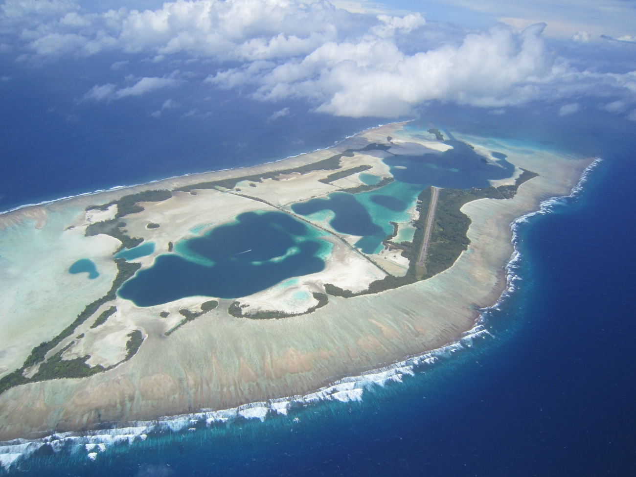
Palmyra: lagoons, reef flats, forest, and a former military airfield. Credit: USGC · Public Domain · Credits
The name "United States Minor Outlying Islands" is purely an administrative invention. People working on these islands generally identify the particular island or atoll rather than the statistical grouping. Created by the International Organization for Standardization in 1986, it groups nine geographically scattered territories under a single code (ISO 3166-1 alpha-2: UM) for statistical purposes. Before 1986, five of the Pacific islands were grouped as "United States Miscellaneous Pacific Islands" under a separate code.
The islands are neither administered collectively nor share a cultural or political history beyond being uninhabited territory under U.S. sovereignty. Each island has its own distinct story—some claimed under the Guano Islands Act of 1856, others acquired through military conquest or diplomatic agreement. The internet country code ".um" was assigned in 1997 but never carried a single public registration; IANA published its revocation report on 10 January 2007, and the delegation was finally deleted from the root zone on 20 April 2008.
Legally, all except Palmyra Atoll are unincorporated, unorganized territories of the United States. Palmyra holds the unique distinction of being the only incorporated territory—a legal technicality resulting from its separation from the Territory of Hawaii when Hawaii became a state in 1959. Its incorporation is a legal status distinct from refuge protection, landownership, and permission to enter.
The U.S. flag expresses the islands’ connection to the United States. There is no single indigenous language or common civilian culture for the entire statistical group. English is the practical language of U.S. administration, military operations, and most public information; this American English edition also serves the local-language layer. A full Czech edition is linked above.
U.S. administration should not be confused with an absence of competing claims. Haiti claims Navassa, while the Marshall Islands claims Wake. The legal and practical circumstances of each island matter more than the presence of one shared code in an online form.
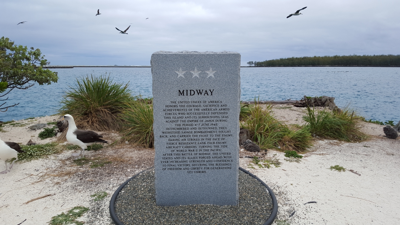
The U.S. flag at the Battle of Midway Memorial. Credit: Megan Nagel/USFWS · Public Domain · Credits
The nine island groups span an enormous swath of the globe. Eight lie in the Pacific Ocean—scattered across Polynesia, Micronesia, and the Hawaiian archipelago—while one sits in the Caribbean Sea between Haiti and Jamaica. Combined, their total land area is a mere approximately 34 square kilometers, but the exclusive economic zones surrounding them encompass hundreds of thousands of square kilometers of ocean.
Land-area figures vary by source, survey date, and the definition of emergent land. Reef flats, lagoons, refuge boundaries, and exclusive economic zones describe different areas. For orientation, the table below identifies each territory and its position rather than presenting an apparently exact total assembled from incompatible measurements.
These islands are all outside the customs territory of the United States. The Pacific islands are surrounded by large exclusive economic zones, and seven of them lie within the Pacific Islands Heritage Marine National Monument — the monument's name since 2 January 2025, when it was renamed from Pacific Remote Islands Marine National Monument to honor Pacific Islander heritage and the Hui Panalāʻau colonists.
The group is divided by an entire continent as well as by an ocean. Navassa is a raised limestone island in the Caribbean between Haiti and Jamaica; most of the Pacific territories are low coral islands or atolls. Midway is geographically part of the Hawaiian chain but outside the state of Hawaiʻi. The map includes all nine places and offers separate Pacific and Caribbean views.
The map includes all eight Pacific territories and Navassa in the Caribbean. Switch between the ocean regions or choose an individual marker. Locations are approximate and do not identify authorized landing sites, routes, or legal refuge boundaries; use current official charts and permissions for navigation.
OpenStreetMap ↗ · Coordinates and chapter links are also listed in the table.
The history of these islands is intertwined with American expansion across the Pacific, the brutal theater of World War II, and the shadowy operations of the Cold War. Most came under U.S. control through the Guano Islands Act of 1856, which allowed American citizens to claim any uninhabited island containing guano deposits. In the mid-19th century, guano—accumulated bird droppings rich in nitrogen and phosphorus—was enormously valuable as agricultural fertilizer, and dozens of Pacific islands were claimed under this law.
The Battle of Wake Island (December 1941) became one of the earliest American engagements of World War II. A small garrison of U.S. Marines and civilian contractors defended Wake against Japanese invasion for 16 days, initially repelling the first amphibious assault—a rare early success that boosted American morale. The island fell on December 23, 1941, and its defenders endured over three years of brutal captivity.
The Battle of Midway (June 4–7, 1942) was the turning point of the Pacific War. American codebreakers had deciphered Japanese plans to attack Midway Atoll, allowing Admiral Chester Nimitz to position his outnumbered fleet for an ambush. In a matter of minutes, American dive bombers destroyed three Japanese aircraft carriers, followed by a fourth later that day. Japan lost four fleet carriers, a cruiser, and hundreds of experienced pilots—losses from which the Imperial Japanese Navy never recovered.
During the Cold War, Johnston Atoll was associated with nuclear tests, including Starfish Prime in 1962, a high-altitude detonation that produced an artificial aurora and electromagnetic effects observed from Hawaiʻi. Later, the atoll stored chemical weapons and hosted JACADS, which began destruction in 1990 and completed it in 2000. Closure work continued through the military departure in 2004.
In 1935, the American Equatorial Islands Colonization Project settled young Hawaiian men — known collectively as the Hui Panalāʻau , most of them recruited from the Kamehameha Schools — on Baker, Howland and Jarvis islands to strengthen American sovereignty claims. Around 130 colonists served in rotation over seven years; in January 2025 the federal government recognized their history by renaming the surrounding marine monument in their memory. A Japanese attack on Howland killed two colonists in December 1941; the remaining settlements were evacuated in 1942. On July 2, 1937, Howland Island was the intended destination of Amelia Earhart during her attempted around-the-world flight. She never arrived, and her disappearance remains one of aviation's greatest mysteries.
Before aircraft carriers and coral surveys, bird droppings drew commercial attention to these islands. Seabirds carry nutrients from the ocean onto land, and in dry climates their accumulated guano became a valuable fertilizer. The Guano Islands Act of 1856 connected that agricultural demand to American territorial expansion: a commercial discovery could become a claim to an island. The resulting landscape was not empty of human consequences. Workers excavated deposits, built camps, and depended on irregular supply ships; their labor became part of the territorial story even where little survives beyond ruins and documentary records.
Navassa makes the human cost especially clear. Its phosphate industry relied on African American workers brought from the United States, and the violence of the 1889 uprising cannot be understood apart from conditions in the mining camp. On the equatorial Pacific islands, exploitation was followed by abandonment and later conservation. Reading an old landing site or a ruined track as industrial archaeology reveals a different island from the pristine refuge of a modern aerial photograph.
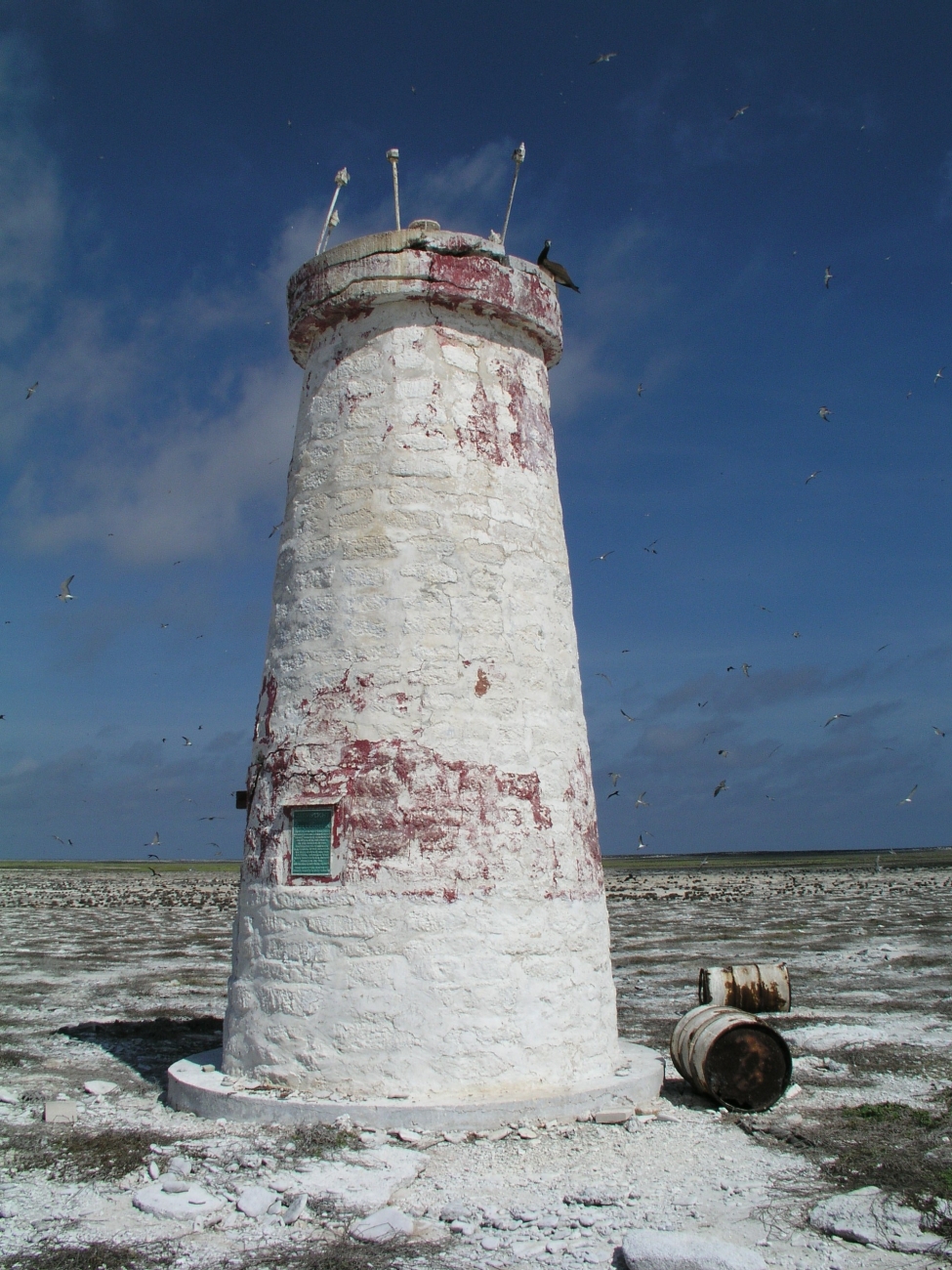
The remains of a beacon on Jarvis; a later trace of human presence, not a photograph of guano mining. Credit: USFWS, Pacific Islands · Public Domain · Credits
From 1935 to 1942, young men from Hawaiʻi lived in rotating groups on Baker, Howland, and Jarvis as part of the American Equatorial Islands Colonization Project. Many were Native Hawaiian students or graduates of the Kamehameha Schools. They built camps, observed weather, maintained equipment, and established a continuing human presence that strengthened the American claim. Their photographs and recollections describe work, companionship, improvised recreation, and the uncertainty of waiting for the next supply ship.
The project also exposes the distance between the language of an uninhabited island and the experience of the people sent to inhabit it. These were not anonymous caretakers on blank squares of a map. Two colonists were killed in the Japanese attack on Howland in December 1941, and the remaining settlements were evacuated in 1942. The name Pacific Islands Heritage Marine National Monument, adopted in January 2025, explicitly recognizes Pacific Islander connections and this history. The absence of a present-day resident population should never be mistaken for an absence of cultural memory.
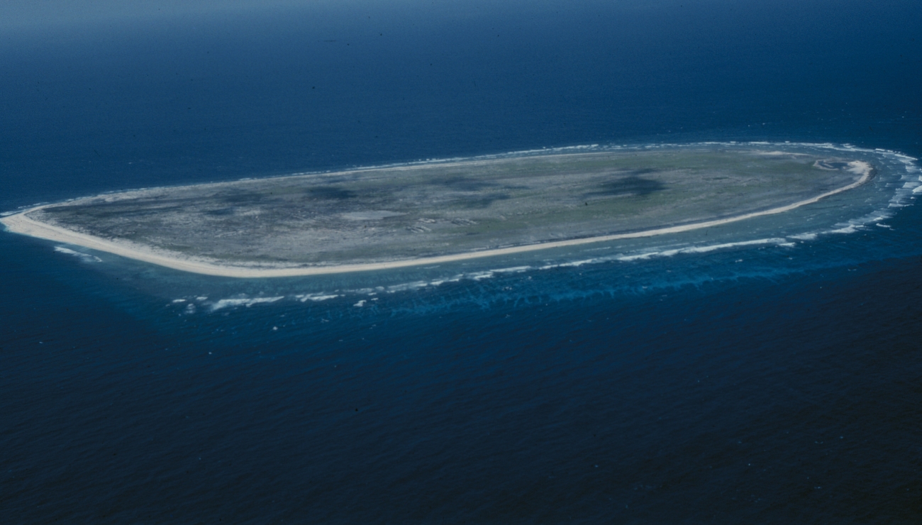
Baker today, one of the islands inhabited by Hui Panalāʻau. Credit: USFWS, Pacific Islands · Public Domain · Credits
The naval battle of June 4–7, 1942, was fought around an atoll whose airfield mattered far beyond the size of its land. American codebreaking helped Admiral Chester W. Nimitz anticipate the Japanese operation, but intelligence alone did not determine the outcome. Reconnaissance, timing, damage control, aircraft performance, and the decisions of individual commanders all shaped an extraordinarily complicated encounter. Four Japanese fleet carriers were lost, while the United States lost Yorktown and the destroyer Hammann.
Midway is often called the turning point of the Pacific War. That phrase captures its strategic weight, but it should not imply that the war was decided in one morning. Years of fighting followed. On the atoll itself, memorials, surviving structures, and the airfield connect the wider carrier battle to a tangible landscape. The Battle of Midway National Memorial shares its setting with a wildlife refuge; remembering the dead and protecting nesting birds are simultaneous responsibilities. A virtual visit is currently the appropriate public way to explore that connection.
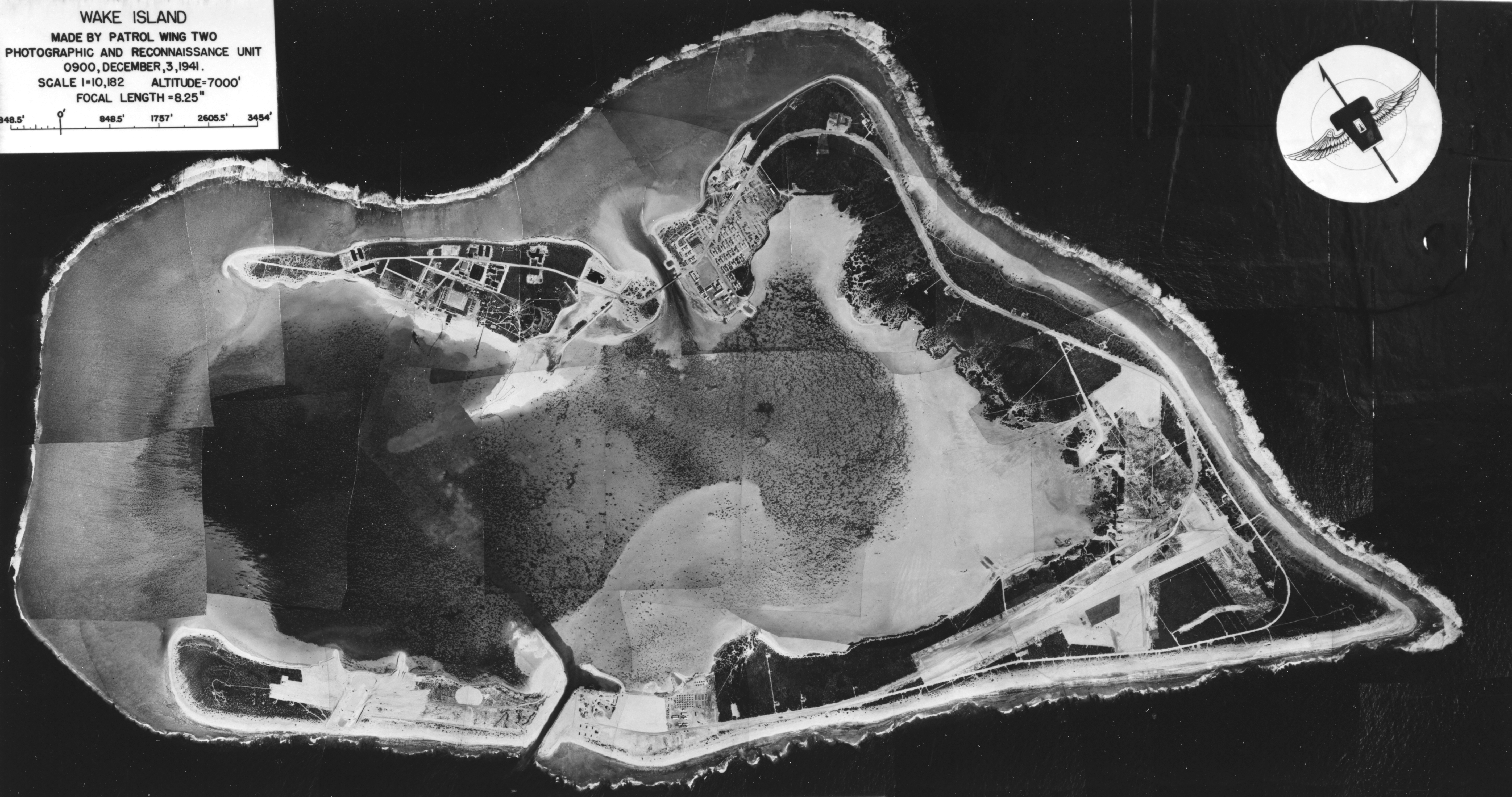
Wake was attacked in December 1941, immediately after the opening of war in the Pacific. The defenders repelled the first attempted Japanese landing on December 11; the island fell after a renewed assault on December 23. Military personnel and civilian construction workers shared the siege, and the civilians' role is essential to any account that extends beyond the familiar story of the Marine garrison.
Occupation brought imprisonment, forced labor, and further violence, including the killing of 98 American civilian prisoners in 1943. Surviving defenses and memorials belong to this history, but Wake is an active military installation rather than an open battlefield museum. Historical interest does not create permission to land or walk among the remains. Public archives and official military histories are the best starting point for understanding a place whose landscape remains operationally important.
Wake from the air on December 3, 1941, shortly before the siege. Credit: U.S. Navy · Public Domain · Credits
Midway Atoll lies almost exactly halfway between North America and Asia—hence its name—at the northwestern end of the Hawaiian archipelago, some 2,000 kilometers from Honolulu. Though geographically part of the Hawaiian chain, Midway was never incorporated into the state. Its three small islands—Sand, Eastern, and Spit—enclose a lagoon of stunning turquoise waters, surrounded by one of the most biologically rich coral reef systems in the Pacific.
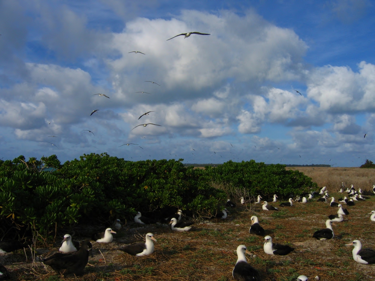
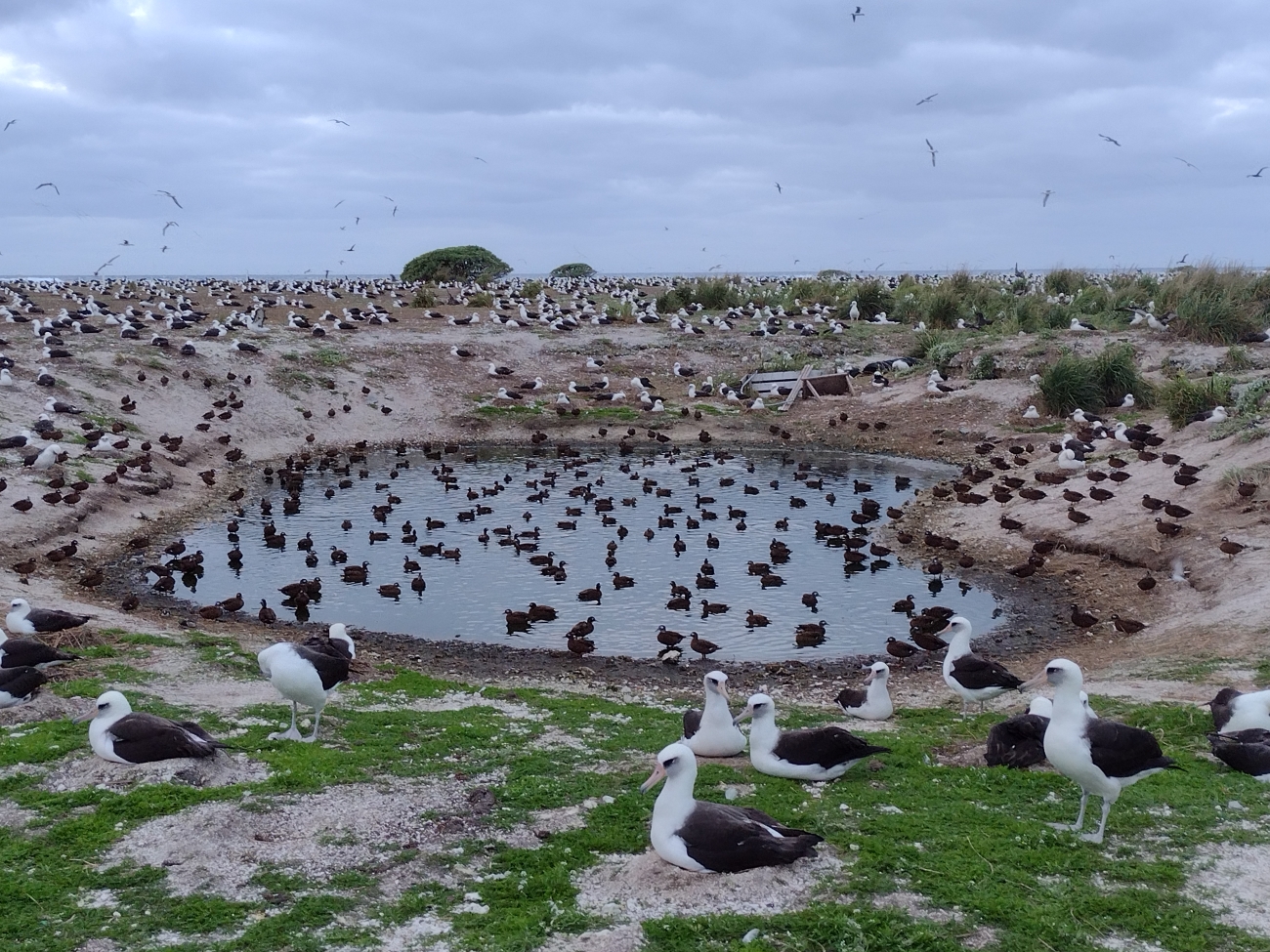
Midway lies within Papahānaumokuākea, a marine conservation landscape of exceptional natural and Hawaiian cultural significance. Its albatross colony is among the largest in the world. The 2025–26 count recorded 589,623 occupied Laysan albatross nests and 28,246 black-footed albatross nests. Nest totals must be distinguished from the much larger number of individual birds associated with a breeding season.
The current USFWS notice states that Midway Atoll National Wildlife Refuge and the Battle of Midway National Memorial are closed to public visitation. Authorized activity supports conservation management and airfield operations. Public virtual tours provide a way to explore the place without implying that historical tourism programs have reopened.
One of Midway's most heartbreaking contemporary stories is the impact of ocean plastic. Albatross parents, foraging across thousands of kilometers of Pacific, mistake floating plastic debris for food and feed it to their chicks. Photographer Chris Jordan's images of dead albatross chicks, their stomachs filled with bottle caps and cigarette lighters, became iconic symbols of the ocean plastic crisis.
Albatross nesting habitat on Eastern Island, Midway. Credit: Patte, David/USFWS · Public Domain · Credits
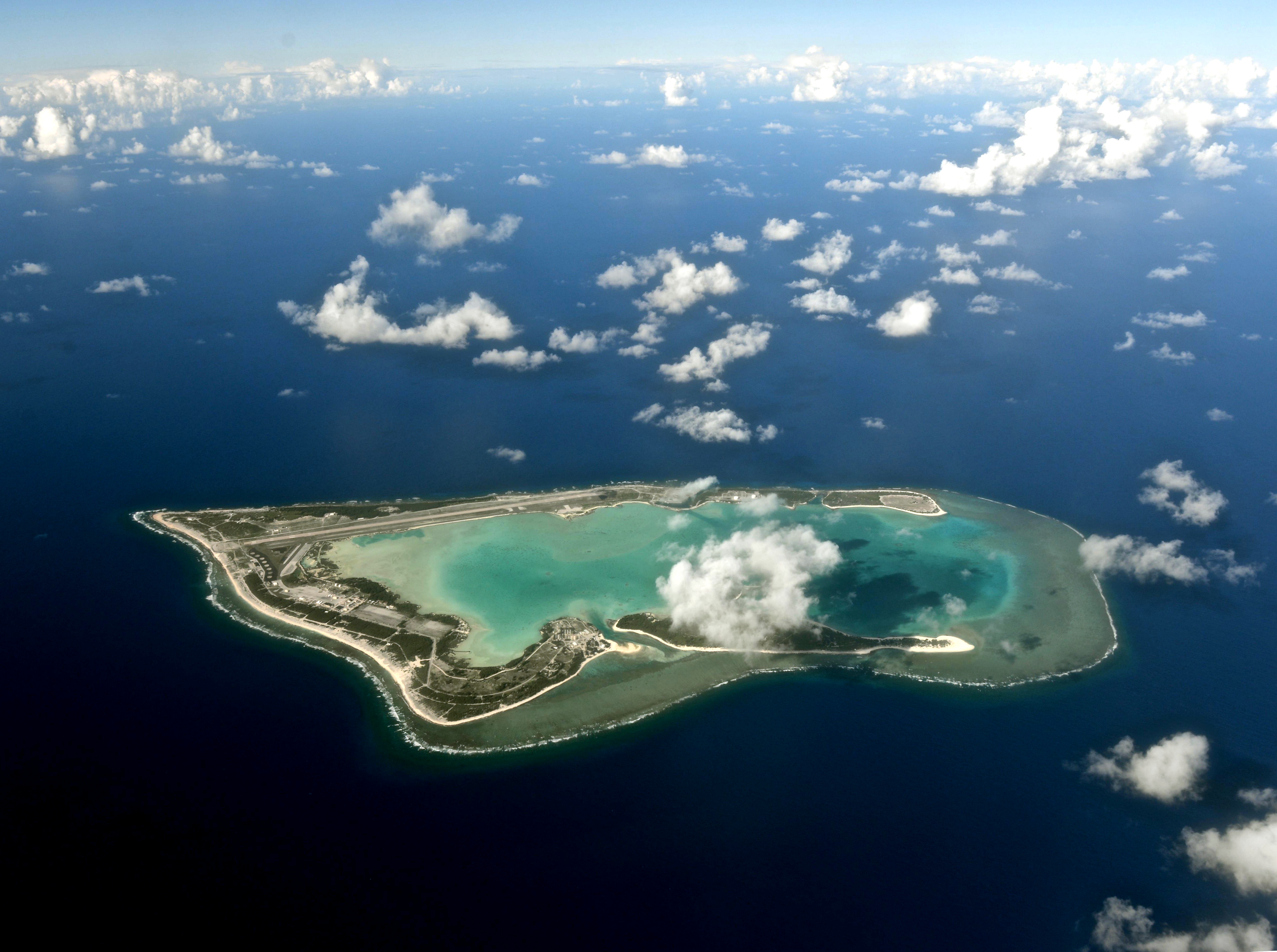
Wake Island—technically an atoll comprising three islands (Wake, Wilkes, and Peale)—sits in the North Pacific approximately 3,700 kilometers west of Honolulu and 2,400 kilometers east of Guam. Its roughly 6.5 square kilometers of land support an important military airfield. The U.S. Air Force operates Wake Island Airfield, maintaining a strategic refueling and emergency landing point for transpacific military and commercial aircraft.
The island's place in history was sealed during the Battle of Wake Island in December 1941. A garrison of 449 Marines, 68 Navy personnel, and approximately 1,200 civilian construction workers faced an overwhelming Japanese invasion force. In an extraordinary act of defiance, the defenders initially repelled the first assault on December 11—sinking two Japanese destroyers and damaging several other warships. When a much larger force returned on December 23, Wake finally fell.
Investment in runway and airfield infrastructure reflects Wake’s continuing role in Pacific logistics. Its approximately 9,800-foot runway supports authorized operations and diversions. There is no general tourism program, and interest in its military history does not provide permission to land.
The Marshall Islands' government has a longstanding sovereignty claim over Wake, which the Marshallese call "Ānen Kio" (island of the kio flower). This claim has never been formally resolved, though the United States exercises undisputed de facto control.
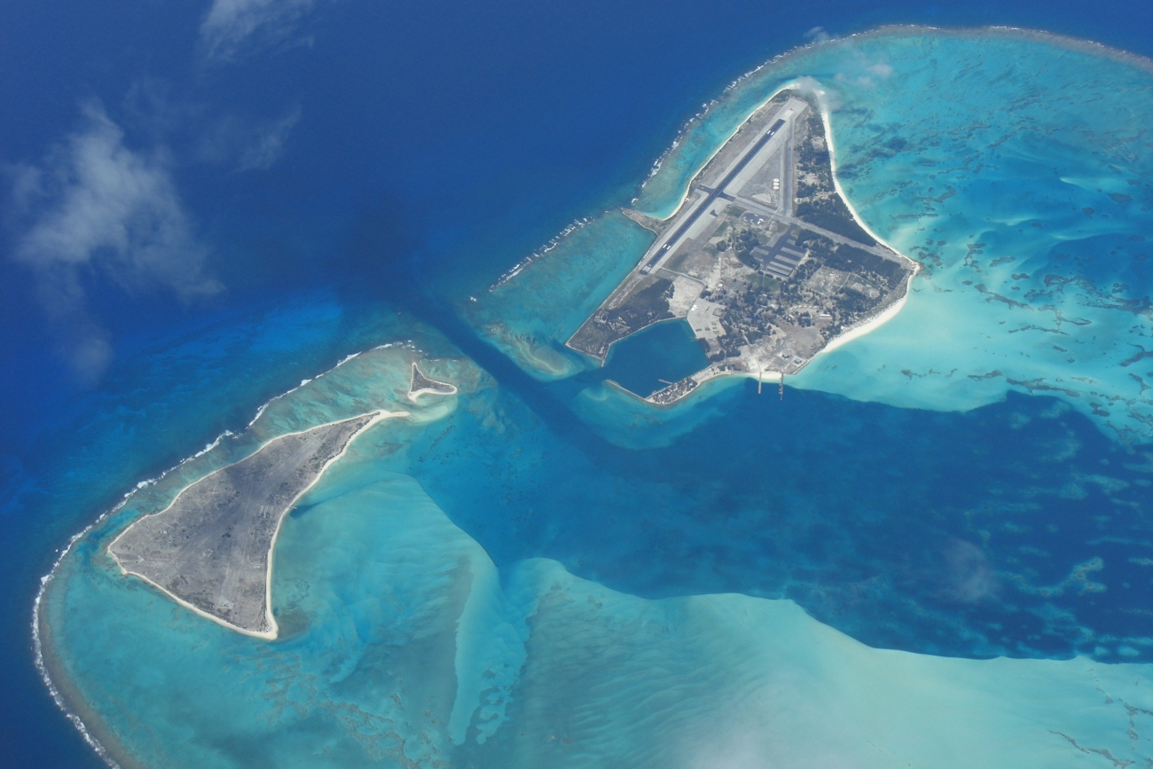
Wake Atoll and its airfield, July 2014. Credit: U.S. Air Force photo by Senior Airman Alexander W. Riedel · Public Domain · Credits
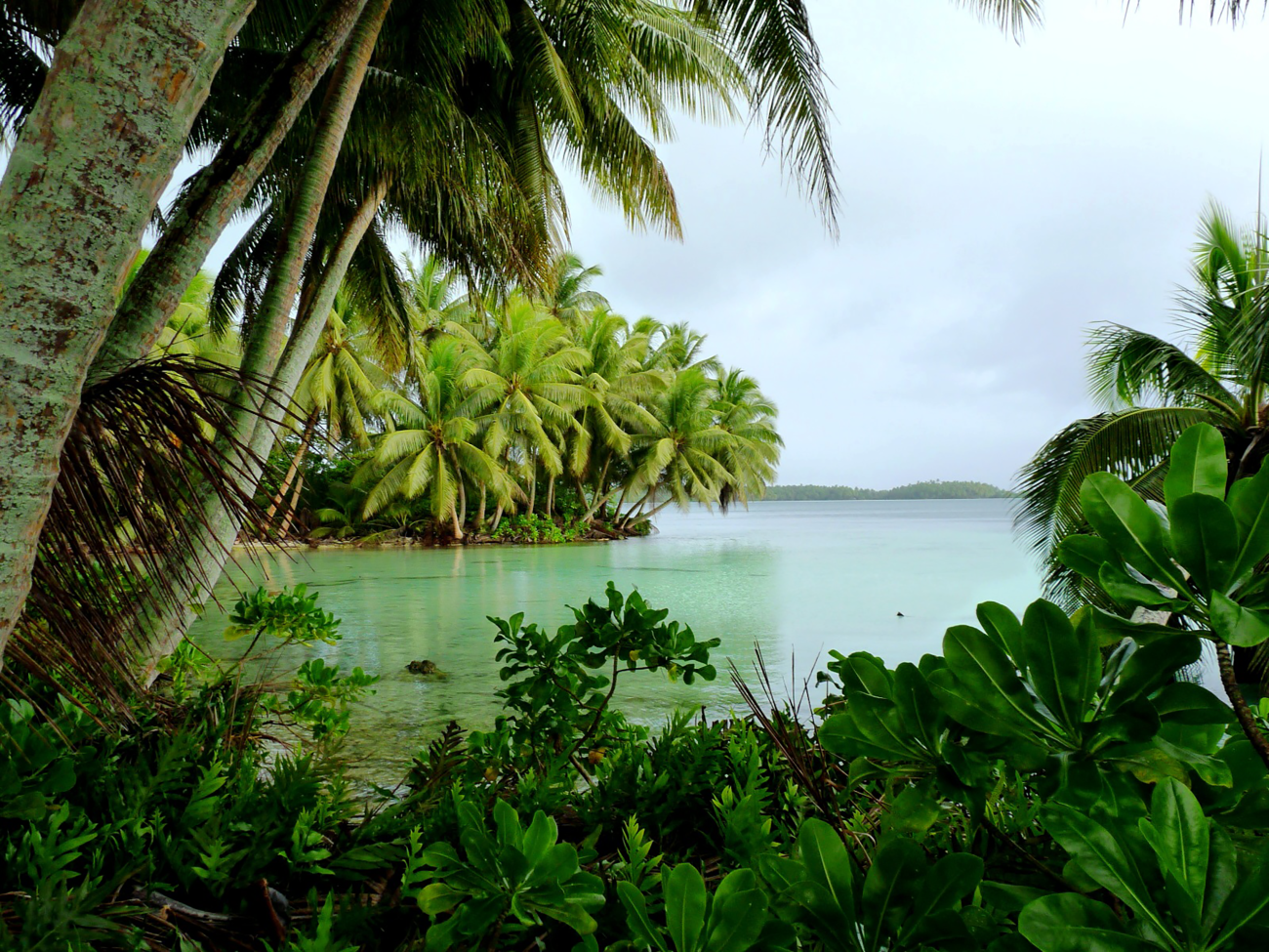
Palmyra Atoll is perhaps the most remarkable of all the Minor Outlying Islands—a lush, rain-drenched tropical paradise roughly 1,600 kilometers south of Honolulu that harbors one of the most pristine coral reef ecosystems remaining on Earth. Unlike the barren, sun-scorched atolls elsewhere in this collection, Palmyra receives abundant rainfall (over 4,400 mm annually) and supports dense tropical vegetation including towering coconut palms and Pisonia forests.
Legally, Palmyra holds a unique position. When Hawaii became a state in 1959, Palmyra—which had been part of the Territory of Hawaii—was explicitly excluded from statehood, making it the only remaining incorporated territory of the United States.
The atoll is jointly managed by the U.S. Fish and Wildlife Service and The Nature Conservancy, which purchased it in 2000. A small research station supports rotating teams of marine biologists studying coral reef health, shark populations, and tropical ecology in a system largely free from human disturbance. Palmyra's reefs teem with apex predators—the biomass of sharks and other large fish here is estimated to be among the highest anywhere on Earth.
Palmyra is also notable for its dark history. In 1974, a double murder on the atoll became one of the most sensational criminal cases in American history, later recounted in Vincent Bugliosi's book And the Sea Will Tell. During World War II, the U.S. Navy built an airfield and stationed up to 6,000 troops on this tiny atoll—though nature has since reclaimed much of the military infrastructure.
Access is tightly controlled. USFWS describes a limited private-vessel visiting process with prior approval and conditions on duration, vessel numbers, and waste retention. The Nature Conservancy operates the runway and research facilities, which require their own arrangements. A refuge permission must not be interpreted as a public resort booking.
Coastal forest reflects in a lagoon at Palmyra. Credit: Laura Beauregard/USFWS, Pacific Islands · Public Domain · Credits
Baker Island and Howland Island are tiny, low-lying coral islands both just north of the equator in the central Pacific, roughly 3,000 kilometers southwest of Honolulu. Both were claimed by the United States and Great Britain in the 19th century for their guano deposits, and both were extensively mined before being abandoned.
In 1935, the U.S. government launched the American Equatorial Islands Colonization Project, recruiting young Hawaiian men — the Hui Panalāʻau, mostly students and alumni of the Kamehameha Schools — to live on Baker, Howland and Jarvis islands as homesteaders. The program ended tragically when Japanese aircraft attacked Howland Island on December 8, 1941, killing two colonists—among the earliest American civilian casualties of World War II.
Howland Island's most famous connection is to Amelia Earhart. A landing strip had been prepared on Howland before Earhart’s expected arrival on July 2, 1937, during her around-the-world flight. The U.S. Coast Guard cutter Itasca waited offshore to guide her in by radio. Earhart's final transmissions indicated she was near Howland but could not locate the tiny island. She was never seen again. Today, the Earhart Light—a day beacon erected in her memory in 1938—still stands on Howland's western shore.
Both islands are now National Wildlife Refuges, closed to the public. They support important seabird colonies and green sea turtle nesting populations.
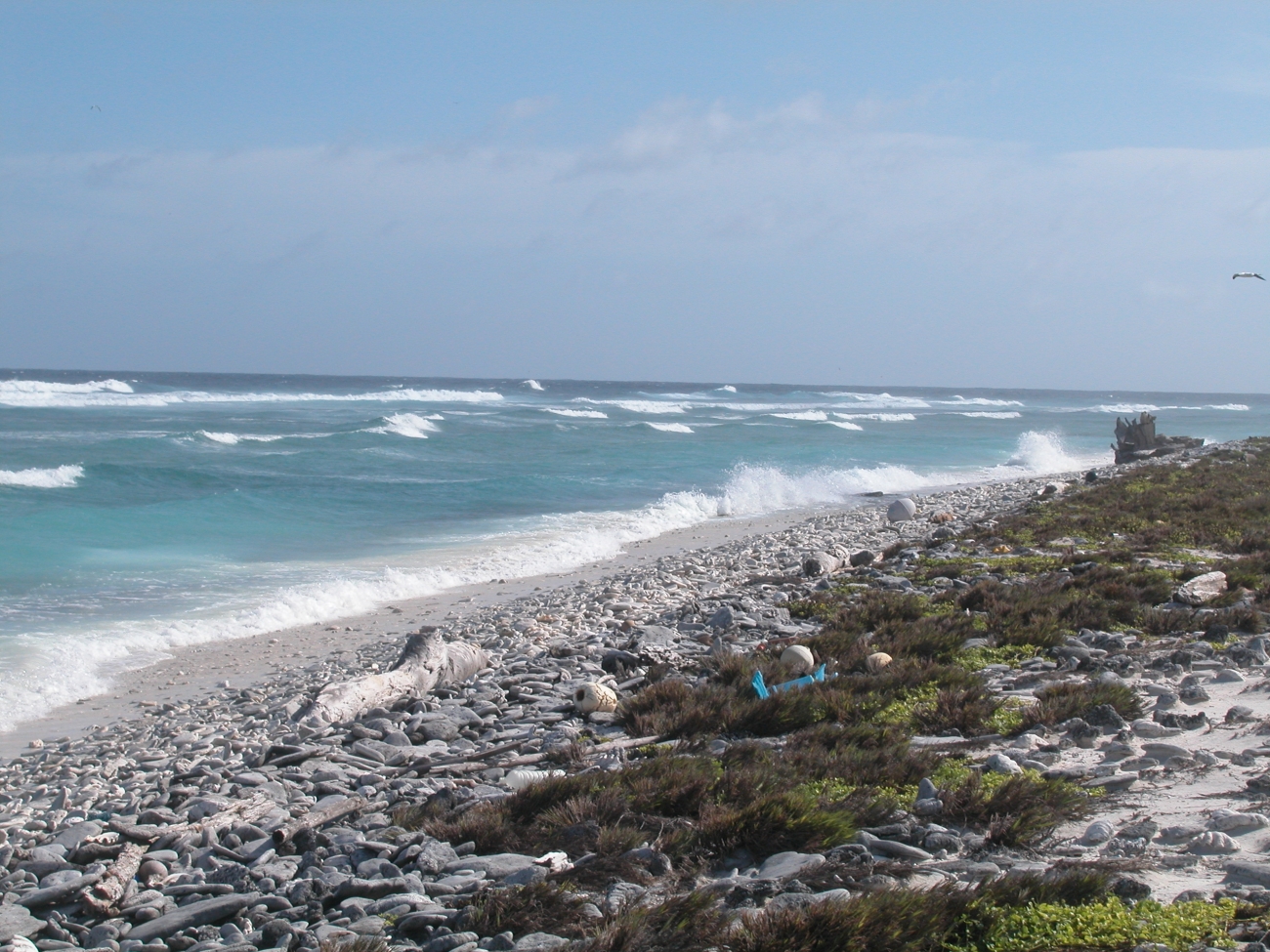
Waves reach Howland’s low coastline. Credit: C. Eggleston/USFWS, Pacific Islands · Public Domain · Credits
On July 2, 1937, Amelia Earhart and navigator Fred Noonan were attempting to reach Howland after departing Lae, New Guinea. The island was a tiny target in an enormous ocean, and the Coast Guard cutter Itasca waited nearby to support communications. The flight did not arrive. Radio records and the subsequent search establish the historical problem; they do not establish the many incompatible endings proposed in popular retellings.
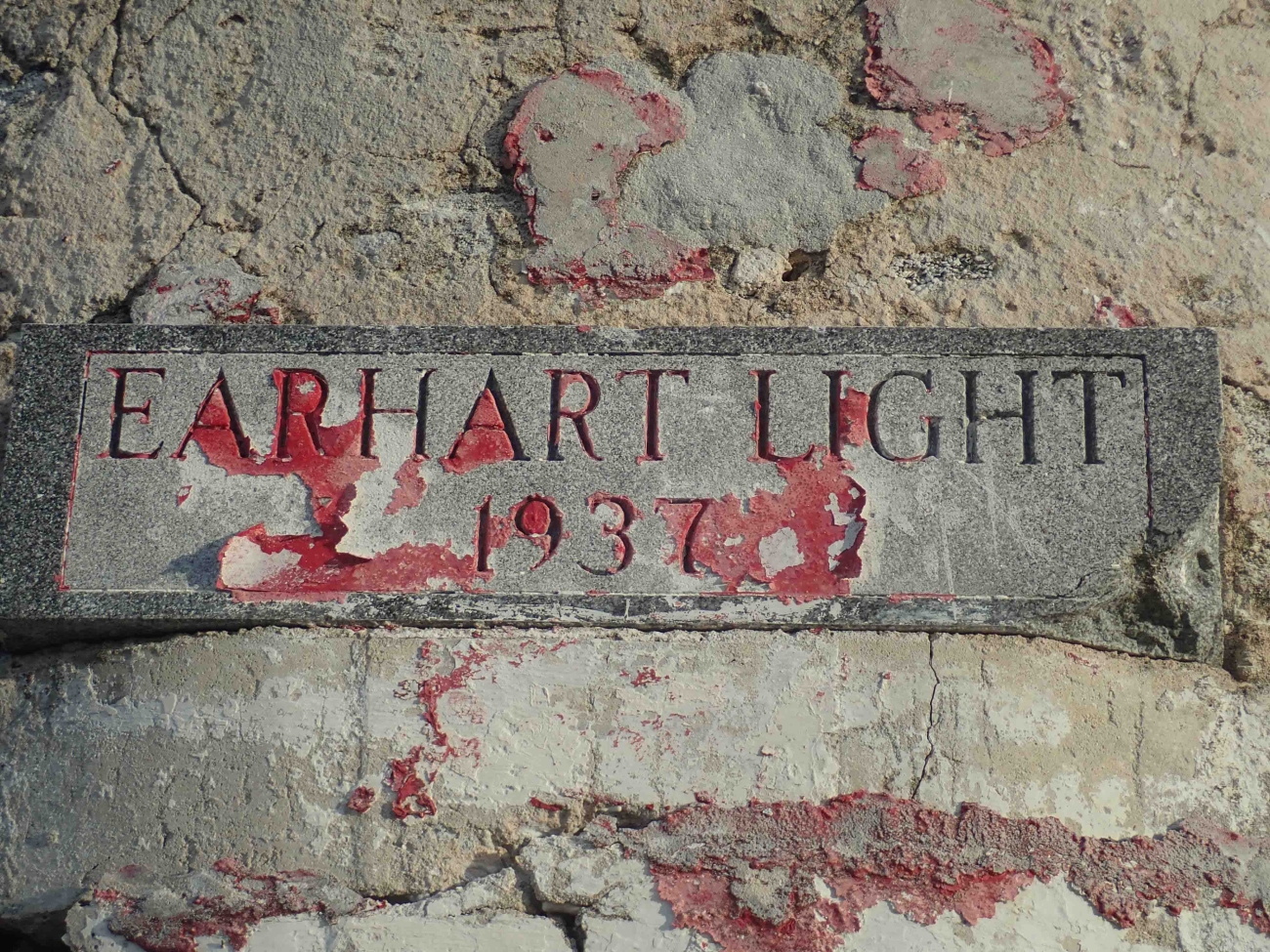
Howland's Earhart Light commemorates the aviator, but it is a day beacon rather than a conventional inhabited lighthouse. Its presence is a reminder that navigation depends on more than the existence of land: a position must be found, communicated, and reached with fuel remaining. This guide distinguishes that documented setting from speculation about the final fate of the aircraft. The island is a protected refuge, and neither the memorial nor the mystery makes it a public visitor attraction.
The Earhart day beacon on Howland. Credit: Dana Schot/USFWS, Pacific Islands · Public Domain · Credits
Jarvis Island, also known as Bunker Island, lies in the South Pacific roughly halfway between Hawaii and the Cook Islands. At approximately five square kilometers, it is a low coral island in the Line Islands but remains entirely uninhabited, undeveloped, and largely devoid of vegetation. The island rises barely 7 meters above sea level at its highest point—a flat, sun-blasted expanse of coral rubble and sparse grasses.
Like Baker and Howland, Jarvis was extensively mined for guano in the 19th century and was part of the 1935 colonization program. The young Hawaiian colonists who lived there described an existence of extreme monotony punctuated by the excitement of supply ships every few months. They were evacuated in 1942.
Today, Jarvis Island is a National Wildlife Refuge. Visitors require a special permit, rarely granted. The island's surrounding waters are among the richest in the central Pacific, supporting extensive coral reefs and large populations of reef fish, sea turtles, and nesting seabirds.
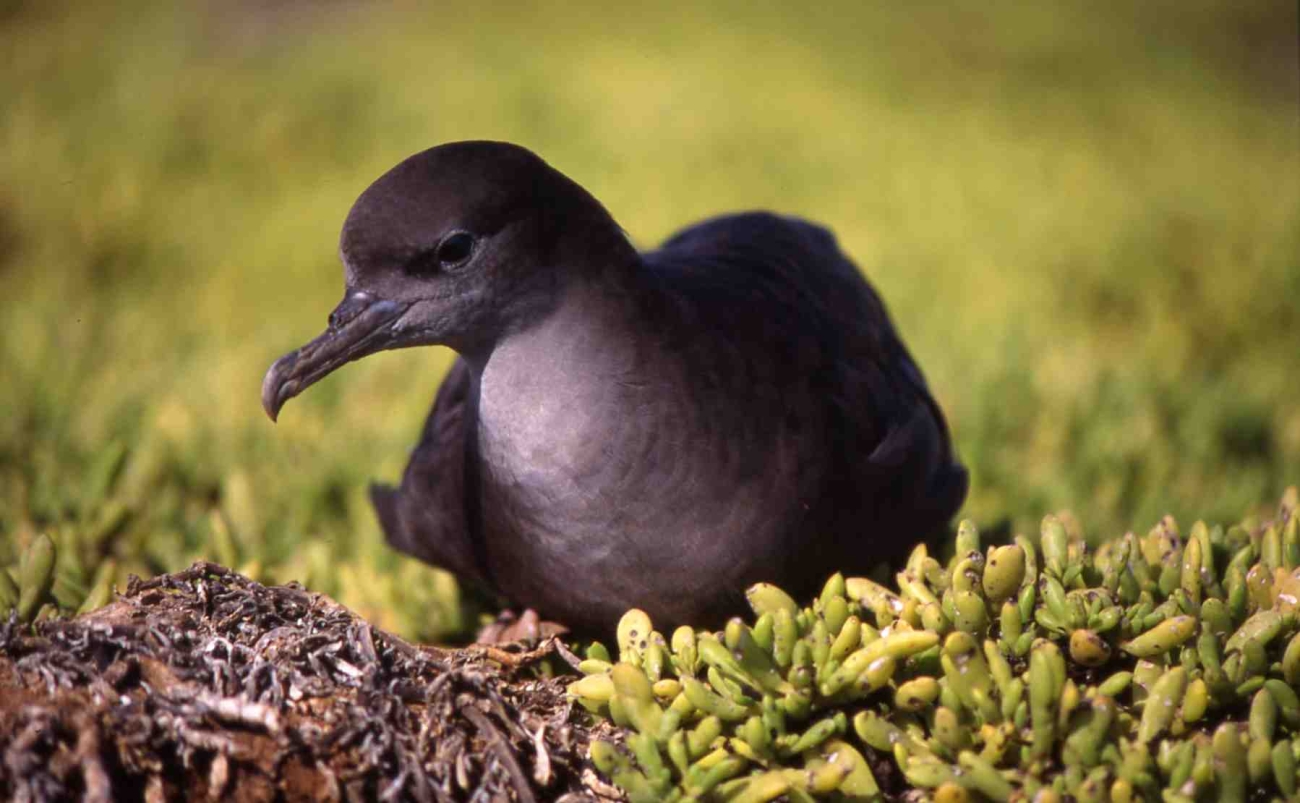
A wedge-tailed shearwater on Jarvis. Credit: USFWS, Pacific Islands · Public Domain · Credits
Johnston Atoll lies 1,300 kilometers southwest of Honolulu and has one of the most complex and troubling histories of any American territory. Originally a natural atoll of two small islands, Johnston was dramatically expanded during the Cold War by dredging operations that quadrupled its land area and created two entirely artificial islands.
During the late 1950s and early 1960s, Johnston served as a launch site for atmospheric nuclear tests. The most famous was Operation Fishbowl's Starfish Prime in July 1962—a 1.4-megaton thermonuclear warhead detonated at 400 kilometers altitude. The resulting electromagnetic pulse damaged electrical equipment in Hawaii, knocked out street lights in Honolulu, and created an artificial aurora visible across the Pacific. Several earlier tests had failed, contaminating the atoll with plutonium—contamination that persists to this day.
From 1971 to 2000, Johnston Atoll housed the Johnston Atoll Chemical Agent Disposal System (JACADS), the first facility to destroy the U.S. military's stockpile of chemical weapons, including nerve agents and mustard gas. The operation successfully destroyed over 6,000 tons of chemical munitions.
The military departed in 2004, and the atoll was transferred to the U.S. Fish and Wildlife Service. The island remains closed to general public visitation. Residual contamination is a site-management issue, while surrounding waters and seabird habitat retain substantial ecological value.
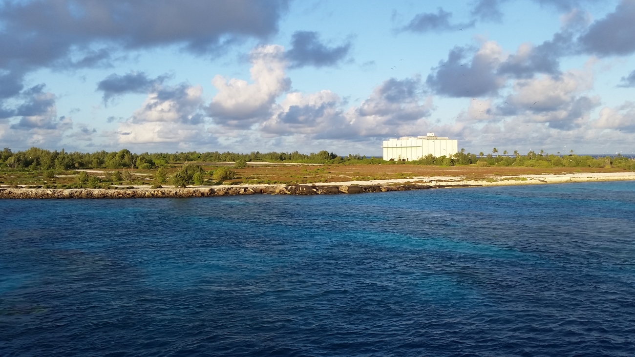
Johnston Atoll viewed from a vessel. Credit: USFWS, Pacific Islands · Public Domain · Credits
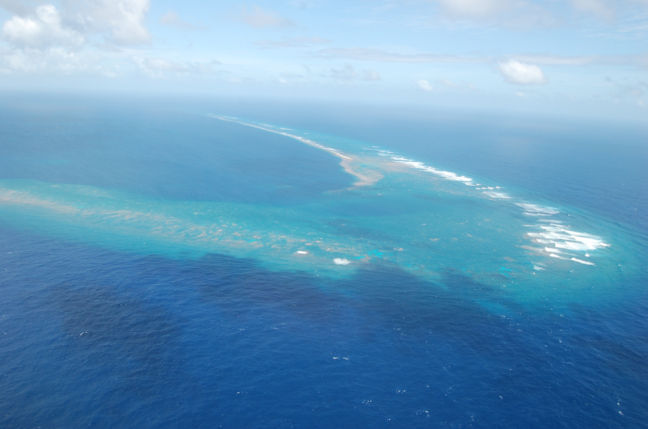
Kingman Reef barely qualifies as land. This triangular reef system, located about 60 kilometers north of Palmyra Atoll, is mostly submerged—only a few sandy spits rise above the waterline at low tide. Its total dry land area is estimated at just 0.01 square kilometers, making it the smallest territory in this collection.
What Kingman lacks in land, it compensates in marine biodiversity. Scientific surveys have found that Kingman's reefs are dominated by predators—sharks, groupers, and other apex species make up the majority of fish biomass, a distribution considered characteristic of truly pristine marine environments. This "inverted biomass pyramid" is so unusual that it has challenged conventional understanding of how reef ecosystems function.
Kingman Reef was briefly used as a seaplane base by Pan American Airways in the late 1930s, serving as a refueling stop on the Hawaii-to-American Samoa flying boat route. It is now a National Wildlife Refuge, closed to all public access.
Kingman Reef: most of the landscape lies underwater. Credit: USFWS, Pacific Islands · Public Domain · Credits
Navassa Island is the odd one out—the only territory in this collection located not in the Pacific but in the Caribbean Sea, roughly 55 kilometers west of Haiti's Tiburon Peninsula. This small, uninhabited, elevated limestone island (5.4 square kilometers) rises sharply from the sea behind sheer limestone cliffs of about 9–15 meters, climbing to a high point of 85 meters at Dunning Hill, its plateau covered in dense scrub and cactus.
The United States claimed Navassa in 1857 under the Guano Islands Act. The guano mining operations that followed were marked by brutal labor conditions—the workers, primarily African Americans from Baltimore, endured such harsh treatment that they revolted in 1889, killing several supervisors. The subsequent murder trial, Jones v. United States, reached the Supreme Court and established important legal precedents regarding U.S. sovereignty over claimed islands.
Haiti has maintained a competing sovereignty claim over Navassa since its independence, citing the island's location on the Haitian continental shelf. The dispute remains unresolved, though the United States exercises de facto control. Navassa is currently a National Wildlife Refuge, protecting diverse terrestrial and marine habitats. The Navassa Island iguana is considered extinct and must not be described as a surviving wildlife attraction.
The true wealth of the U.S. Minor Outlying Islands lies not in their land but in their ecosystems. Isolated by vast stretches of open ocean, these islands and their surrounding waters support biological communities of global significance.
🐦
Laysan Albatross
589,623 occupied nests counted on Midway in 2025/26 — the world's largest colony, holding ~70% of the species. (The "1 million" figure counts birds, not pairs.)
Hawaiian monk seal
An endangered seal associated with the Hawaiian archipelago, including the protected northwestern islands. Population estimates must be dated and sourced separately from a visit to one atoll.
🐢
Green Sea Turtle
Green sea turtles use marine and coastal habitats across the Pacific refuges; feeding areas, resting sites, and nesting beaches should be distinguished.
🦈
Reef Sharks
Palmyra and Kingman host apex predator populations rivaling anywhere on Earth—a sign of ecosystem health.
🪸
Coral Reefs
Among the most pristine remaining on the planet, with hundreds of species of hard corals and reef fish.
🦎
Navassa Iguana
The Navassa Island iguana is considered extinct: a reminder that later protection cannot recover every lost population.
Ocean plastic is one of several serious threats to these remote ecosystems, alongside invasive species and changing ocean conditions. Despite their extreme isolation, all of the islands accumulate marine debris carried by Pacific currents. Midway Atoll's albatross chicks have become tragic symbols of this global problem.
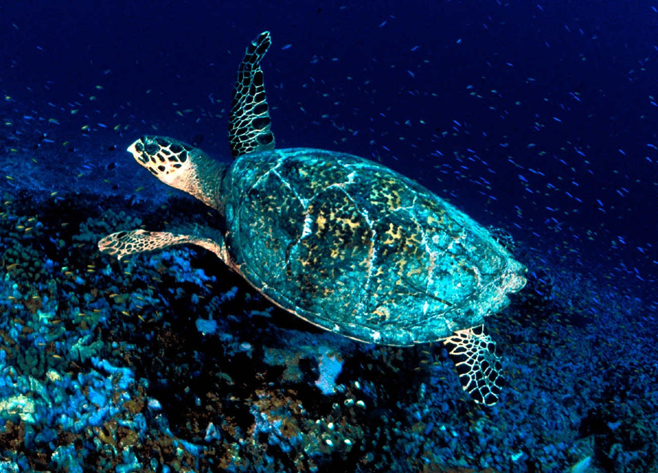
A hawksbill sea turtle in the waters around Jarvis. Credit: USFWS, Pacific Islands · Public Domain · Credits
Palmyra and Kingman are valuable to marine science because they allow researchers to investigate reefs with comparatively little direct local exploitation. Large predatory fish are conspicuous components of these systems. The expression inverted biomass pyramid describes particular survey results, not a universal law that every reef here contains more sharks than everything they eat. Mobile predators, survey boundaries, and the flow of energy through a reef all matter when interpreting the pattern.
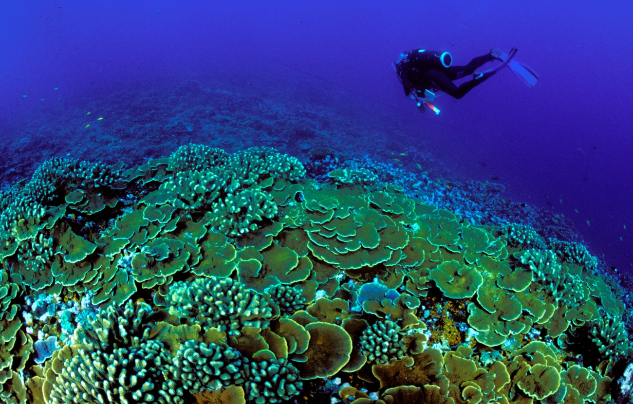
Remoteness also does not place coral outside the global climate system. Ocean warming, bleaching, changing chemistry, and marine debris can affect reefs far from towns and fishing ports. At Jarvis, equatorial ocean conditions make the connection between large-scale climate variability and local coral health especially important. A photograph of clear water records one moment at the surface; long-term monitoring reveals the less visible changes below.
A diver surveys coral habitat at Jarvis. Credit: USFWS, Pacific Islands · Public Domain · Credits
At Midway, a population estimate is often misunderstood because nests, breeding pairs, adults, and birds present during a season are different measures. The 2025–26 census reported 589,623 Laysan albatross nests and 28,246 black-footed albatross nests, a combined 617,869. These are nest counts, not a count of every bird using the atoll. The figures are dated observations and should remain attached to their season.
On the equatorial islands, boobies, frigatebirds, terns, and shearwaters use ground, shrubs, or trees in different ways. Their colonies link dry land to distant feeding grounds. A successful conservation program therefore has to consider both nesting habitat and conditions at sea. Visitors authorized for fieldwork must also learn how to move through a colony without disturbing birds or damaging nests; an apparently open patch of ground may be occupied in ways a newcomer does not recognize.
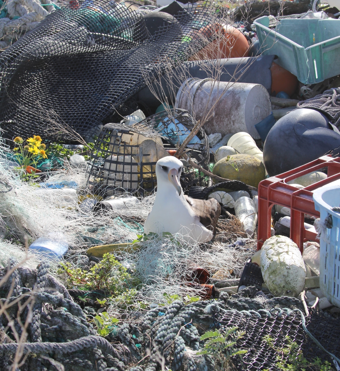
An island can be closed to visitors and still receive the waste of distant societies. Currents carry fishing gear, packaging, and fragments of consumer products across the ocean. On Midway, the plastic found among albatross colonies makes that connection painfully tangible. Chris Jordan's photographs became influential because they placed familiar manufactured objects inside a landscape that many viewers imagined to be beyond human reach.
The problem is larger than a single beach cleanup. Entanglement, ingestion, and the fragmentation of material operate at different scales, and removing visible debris does not remove its sources. For an authorized expedition, practical responsibility begins with cargo, packaging, waste storage, and the return journey: everything brought in must be managed according to the host's rules. For a reader at home, the islands offer evidence that a remote destination is still connected to ordinary decisions about materials and disposal.
An albatross nests among marine debris at Midway. Credit: Andy Collins/NOAA Office of National Marine Sanctuaries · Public Domain · Credits
Conservation here is active work rather than a decision simply to leave every place untouched. Introduced plants, rodents, and insects can transform nesting habitat or attack wildlife. On Midway, habitat management and protection of vulnerable birds sit alongside the upkeep of an operational airfield. On Johnston, the campaign against yellow crazy ants illustrates how a small invasive organism can require years of organized effort.
Palmyra provides another example of restoration within a research landscape. Work on introduced species and native forest connects terrestrial ecology with the surrounding sea: seabirds, trees, soil nutrients, and lagoon life belong to the same system. These projects need monitoring after an intervention as well as during it. A successful announcement is the beginning of a maintenance obligation, and the movement of every person and cargo shipment must avoid reintroducing the problem.
Laysan ducks use managed wetland habitat at Midway. Credit: Jon Plissner/USFWS · Public Domain · Credits
Climate differs substantially across the group. Baker, Howland, and Jarvis are close to the equator but can have dry, exposed terrestrial environments. Palmyra receives abundant rainfall and supports forest. Tropical latitude alone does not determine an island’s water supply or vegetation.
Midway Atoll, at 28°N latitude, experiences distinct seasons with cooler winters (15–20°C) and warm summers (24–28°C). Wake Island, at 19°N, enjoys a tropical marine climate with temperatures ranging from 24–32°C and a typhoon season from June through December.
Navassa Island in the Caribbean has a tropical climate around 26–30°C year-round, influenced by Caribbean hurricane patterns.
All of the low-lying atolls face existential threats from sea level rise. Sea-level rise, wave overwash, and changes in sediment movement threaten habitats and historical sites. Island responses are dynamic; a single global water-level figure cannot predict the precise fate of every shoreline.
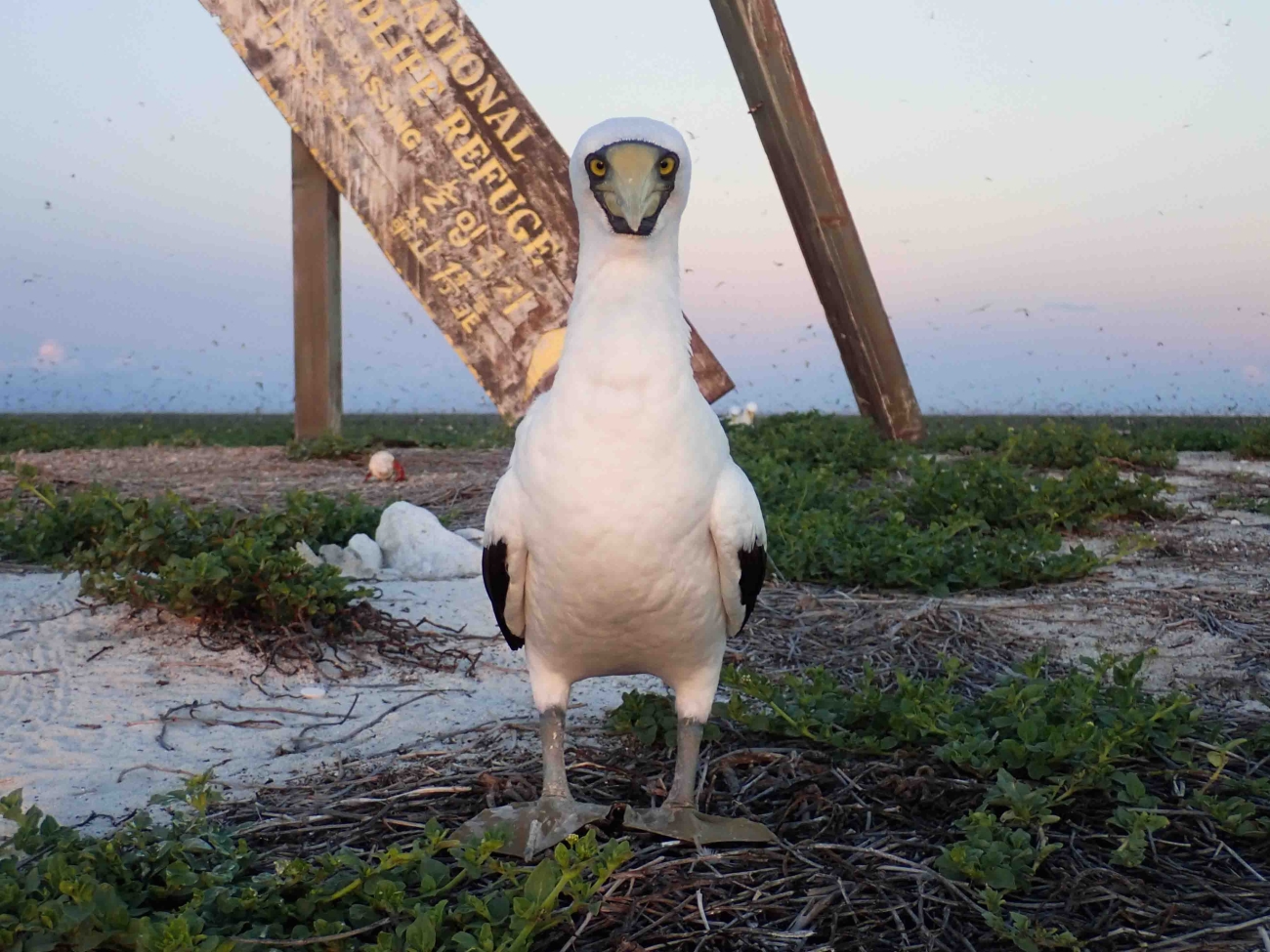
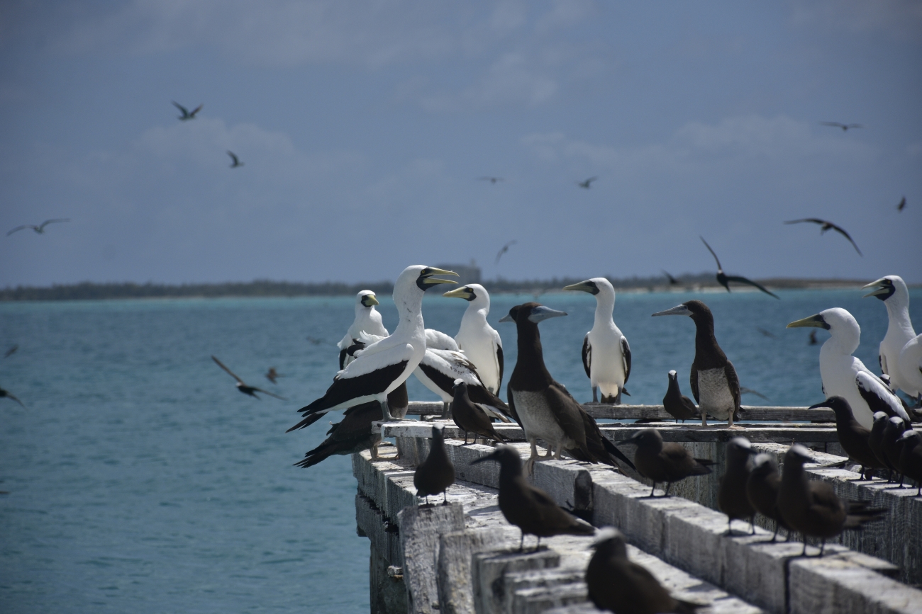
A masked booby on Baker’s exposed coral ground. Credit: Dana Schot/USFWS, Pacific Islands · Public Domain · Credits
Midway lies within Papahānaumokuākea, inscribed on the UNESCO World Heritage List in 2010 for its natural and cultural significance. Its Hawaiian cultural connections are integral to the designation. The World Heritage property and the subsequently expanded U.S. marine national monument are related designations with different boundaries; their areas should not be treated as interchangeable.
Baker, Howland, Jarvis, Johnston, Kingman, Palmyra, and Wake are associated with the Pacific Islands Heritage Marine National Monument, previously called the Pacific Remote Islands Marine National Monument. The January 2025 name change recognizes Pacific Islander heritage, including Hui Panalāʻau. Navassa belongs to a separate Caribbean refuge landscape.
Eight of the nine territories contain national wildlife refuges administered by USFWS; Wake has a different arrangement involving military administration and protection of surrounding waters. Describing all nine as identical refuges obscures the authority that actually controls access.
Fishing protections have been the subject of presidential proclamations, regulatory action, and litigation. NOAA described a further proclamation in June 2026. None of this creates a general visitor entitlement: fishing rules, refuge entry, private land access, and military airfield permission are different matters. Consult the current NOAA and USFWS requirements for the specific activity. This guide’s source review is dated October 9, 2026.
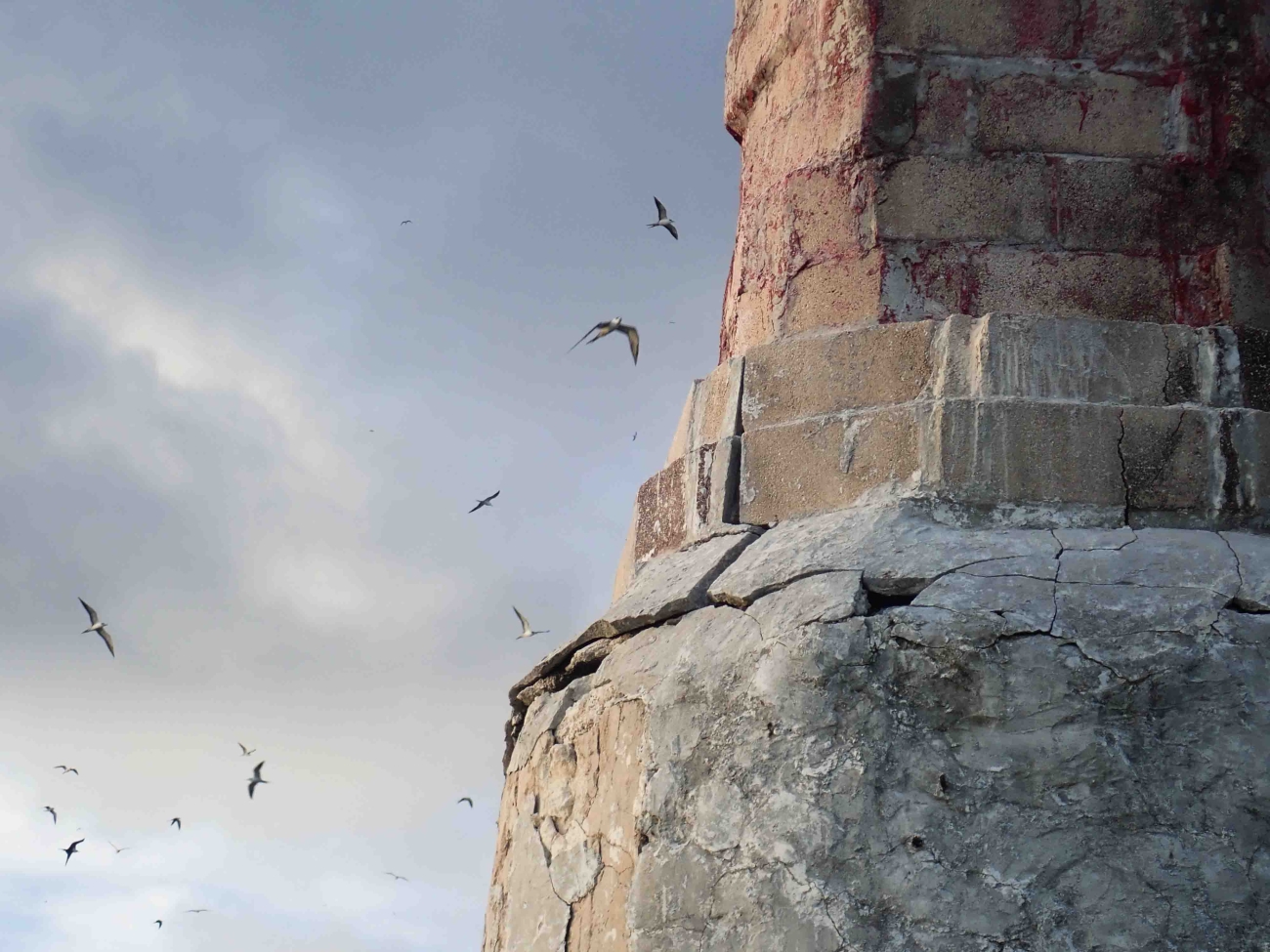
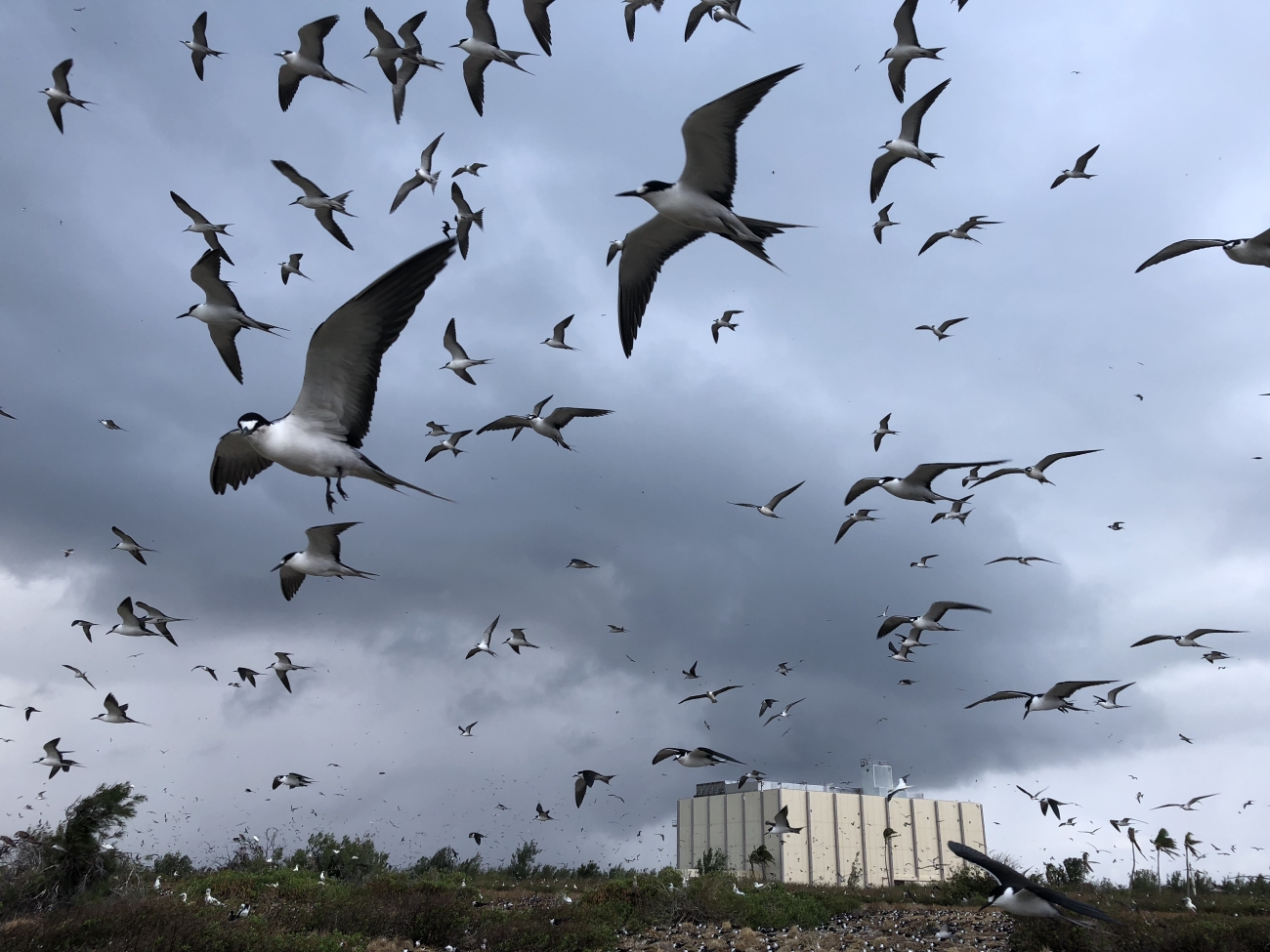
Sooty terns over Johnston Atoll within the Pacific marine conservation landscape. Credit: Eric Baker/USFWS, Pacific Islands · Public Domain · Credits
There is no single visitor permit for the nine territories. Midway Atoll National Wildlife Refuge and the Battle of Midway National Memorial remain closed to public visitation on the current USFWS page. Wake requires military authorization. Baker, Howland, Jarvis, Johnston, Kingman, and Navassa have their own refuge restrictions; an invitation from a private expedition does not replace approval from the responsible authority.
Palmyra has a narrowly defined exception for private vessels. USFWS describes visits of up to seven days with prior approval, no more than two vessels at one time and six in a month, and enough onboard capacity to retain all black and gray water. Those conditions are not a promise that an application will be accepted, nor do they grant access to privately managed facilities. Confirm the current refuge rules and any separate landowner or airfield permission before organizing transport. This access summary was checked on October 9, 2026.
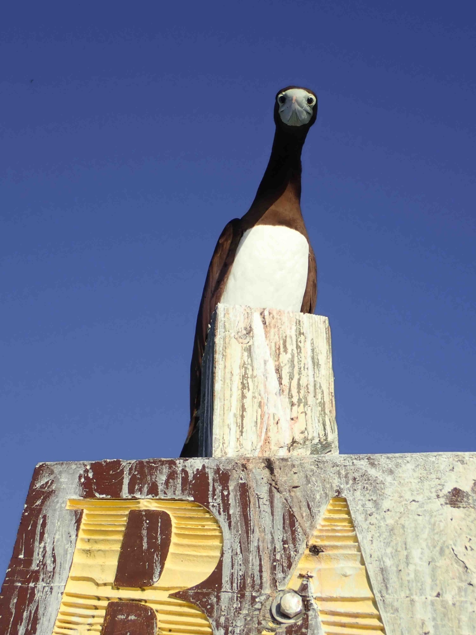
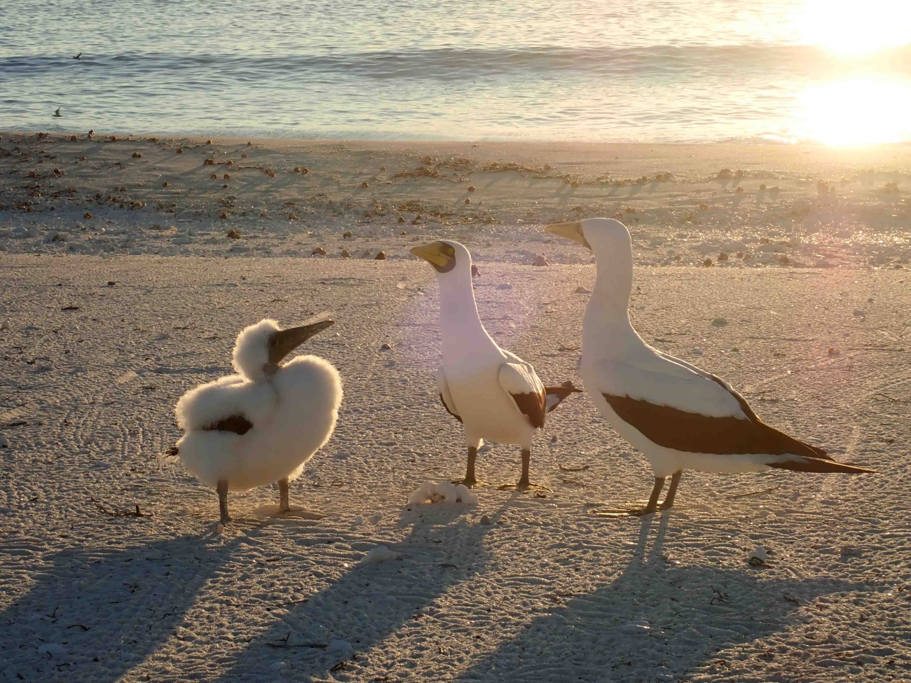
A brown booby on the Baker Island refuge sign. Credit: Dana Schot/USFWS, Pacific Islands · Public Domain · Credits
In practical terms, you almost certainly cannot visit these islands. But understanding how authorized personnel reach them illustrates their extreme remoteness.
Midway Atoll: Chartered aircraft from Honolulu (~2,000 km). USFWS rotates staff every few months.
Wake Island: Occasional military transport from Honolulu or Guam. 3,000-meter runway for large military aircraft.
Palmyra Atoll: Private vessel or charter aircraft from Honolulu (~1,600 km).
Other Pacific islands: Accessible only by vessel, typically departing from Honolulu. Journey times range from several days to over a week.
There is no public island-hopping network. Navassa belongs to the Caribbean logistical setting, not a route departing from Honolulu. Contact the responsible agency before approaching a transport provider, and distinguish a vessel’s physical ability to reach a place from permission to enter it.
Seabirds occupy a pier at Johnston; a structure is not an invitation to land. Credit: Jordan Akiyama/USFWS, Pacific Islands · Public Domain · Credits
Scientific or conservation work is a possible reason for authorized presence, not an alternative form of a holiday booking. Projects need a legitimate research purpose, a host organization, the relevant permits, and a plan for transport, accommodation, supplies, and the handling of samples or equipment. Collecting a specimen, operating a drone, landing a boat, and entering a nesting area can involve separate conditions.
Volunteer opportunities depend on a refuge's current staffing and program needs. An old blog post describing a volunteer season is not evidence that applications are open now. Consult current USFWS opportunities and the organizations managing the site, and consider the duration and isolation of a placement as carefully as its appeal. Work may be repetitive, physically demanding, and shared within a very small team; flexibility, preparation, and respect for operating procedures matter more than an ambition to reach an unusual point on a map.
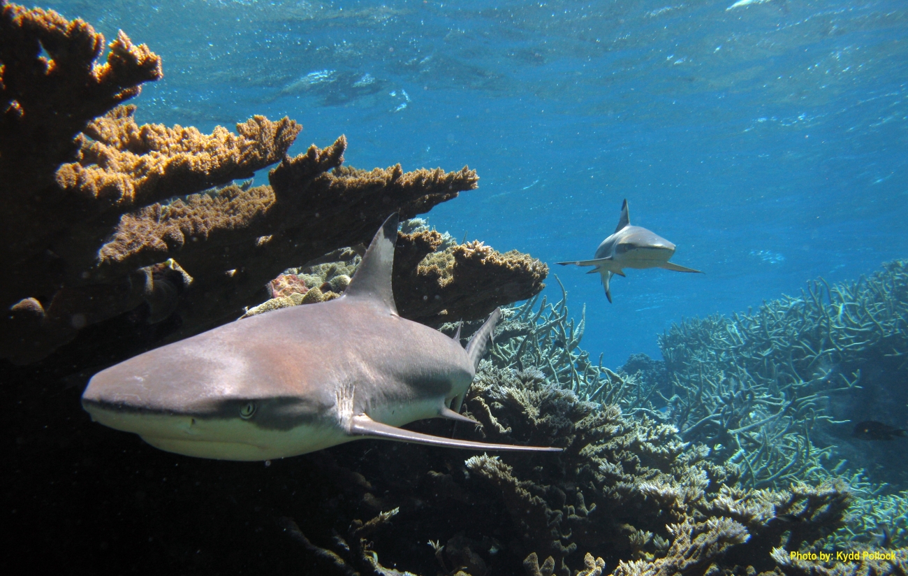
Gray reef sharks at Kingman, a focus of reef research. Credit: Amanda Pollock/USFWS · Public Domain · Credits
The most consequential passenger on a supply trip may be a seed in a shoe tread or an insect hidden in packaging. Hosts prescribe cleaning, inspection, and quarantine measures because a new introduction can undo years of conservation. Follow the destination's current protocol for footwear, clothing, tools, food, and cargo; rules can differ between islands and even between sites within one refuge.
An authorized visit also needs a realistic emergency plan. Do not infer medical or rescue capacity from the presence of an airstrip. Evacuation depends on distance, weather, aircraft or vessels, and operational approval. Discuss personal requirements with the host and appropriate medical professionals in advance. The practical issue is not simply what equipment to pack, but how the team will function if supplies, communications, or transport fail. No visitor should remove historic material or wildlife from a refuge without the permissions specifically required.
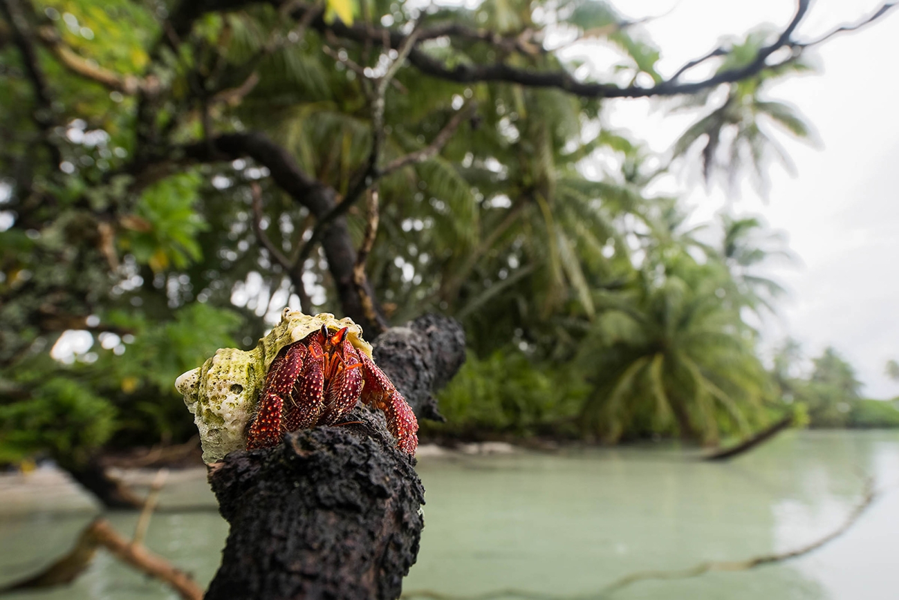
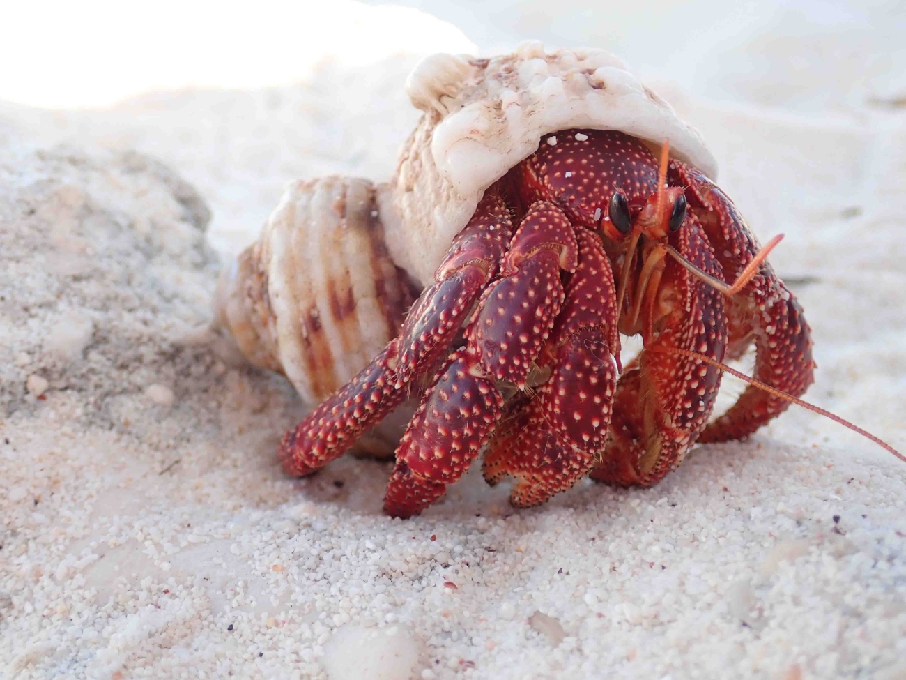
A hermit crab at Palmyra: island ecology extends beyond the most familiar species. Credit: Andrew S. Wright/USFWS, Pacific Islands · Public Domain · Credits
The U.S. dollar is the relevant currency, but that does not imply the presence of public shops, ATMs, or payment facilities. Operational sites may use U.S. electrical equipment; confirm the supply, plugs, and capacity with the host. There is no public tourism infrastructure shared by the nine territories.
The islands do not have a collective local government, legislature, or capital. Responsibility is divided among federal agencies and operators: USFWS manages wildlife refuges, the U.S. Air Force operates Wake’s airfield, and The Nature Conservancy owns and operates part of Palmyra’s land and facilities. The appropriate authority depends on the place and the activity.
Most islands are closed to general public access. Research can require special-use permission; Wake requires military authorization; Palmyra has a limited private-vessel approval process. A passport, visa, or ordinary permission to enter the United States does not by itself authorize a refuge landing or use of a military runway.
Medical and rescue capacity is site-specific and limited. Do not infer access to a public clinic from the presence of staff or an airstrip. Evacuation depends on weather, distance, transport availability, and approval. Authorized visitors need an advance plan with their host, including individual medical requirements and emergency communication arrangements.
Civilian roaming, personal internet access, and ordinary postal service cannot be assumed. Research and military sites may have their own communications systems, unavailable to visitors. Keep dates and UTC offsets explicit in every transport plan: the grouping spans the international date line, and headquarters and destination may use different operating times.
There is no shared national cuisine or public network of restaurants and markets across these territories. Operational stations depend on supplies and their own kitchen arrangements. The recipes below are Hawaiian and Pacific-inspired ideas retained from this guide’s food section, not claims that every station serves these dishes or that they originated on a particular refuge.
On Midway and Wake, catering follows the needs of the workplace and its resupply cycle; at Palmyra, it supports the research station. Shelf-stable ingredients, cold storage, and transport determine what can be prepared. The Hui Panalāʻau colonists had far fewer resources and waited for supply ships. Modern visitors must not assume that fishing or gathering food is permitted in a refuge.
🐟
Grilled Mahi-Mahi
Pacific-inspired fish fillets with oil, salt, pepper, and lime, cooked thoroughly. Use legally sourced fish; this recipe does not imply permission to fish in a refuge.
🍲
Pacific Seafood Stew
A regional recipe idea using coconut milk, onion, garlic, ginger, tomato, fish stock, lime, and thoroughly cooked seafood. It is not a documented national dish of the island grouping.
🍥
Haupia
Hawaiian coconut pudding. Whisk 400 ml coconut milk with 100 g sugar and 45 g cornstarch slaked in 120 ml water; cook over medium heat until it thickly coats a spoon, pour into a shallow pan, chill 3 hours, cut into squares.
🥛
Coconut Pudding, Pantry Variation
A home-kitchen variation using shelf-stable coconut ingredients. Adapt the method to the ingredients; this is not a verified standard recipe of any research station.
🫓
Island Flatbread
Flour, water, salt, and a little oil can make a simple unleavened pan bread. Its appeal is the short ingredient list, rather than any claim of island origin.
🍟
Taro Chips
A Hawaiian-inspired snack made from properly prepared, thoroughly cooked taro. Raw taro is unsuitable for eating. No claim is made about its position on a station’s resupply list.
There is no indigenous wine region, distillery trail, or public bar scene shared by these territories. Drinks arrive with supplies, while safe drinking water is part of the station's operating system. Storage, treatment, and available capacity are practical matters for the host to specify, not assumptions a visitor can make from the color of a lagoon.
Hawaiian food traditions help explain some of the provisions and recipes associated with Pacific logistics, but a Hawaiian cocktail is not thereby an authentic national drink of Baker or Kingman. Alcohol, where allowed, is subject to the relevant workplace, vessel, or military rules. Regional inspiration and local production are different things; the defining story here is provisioning and the operation of remote workplaces.
The group is often used to illustrate the extremes of civil time. Baker and Howland are conventionally associated with UTC−12, while Wake operates on UTC+12. A displayed noon can therefore carry different calendar dates even though the clock face looks the same. On islands without a civilian population, however, a map's time-zone label is not evidence of a local public timekeeping service.
For expedition planning, record the date, time, and UTC offset explicitly, and confirm the operating time used by the host, vessel, and airfield. Headquarters in Honolulu may use a different convention from the destination. Crossing the international date line also affects manifests, flight schedules, and reporting deadlines. The useful lesson is not a novelty claim about being first or last to see the New Year, but the need to make every operational timestamp unambiguous.
Remote stations exist because a supply chain keeps them connected to larger ports and airports. Food, fuel, spare parts, scientific equipment, waste containers, and the people who maintain them have to arrive in the right sequence. A missing component can matter more than its cost when the next delivery is far away. Weather and operational priorities can change a planned departure without providing an immediate alternative.
Communications are similarly site-specific. The presence of satellite connectivity at a research station or military installation does not mean that a visitor has access to a public mobile network or reliable personal internet service. Establish check-in arrangements with the host before departure, and use approved communication equipment. The islands' isolation is best understood as a logistical relationship: their apparent emptiness is supported by a large amount of work elsewhere.
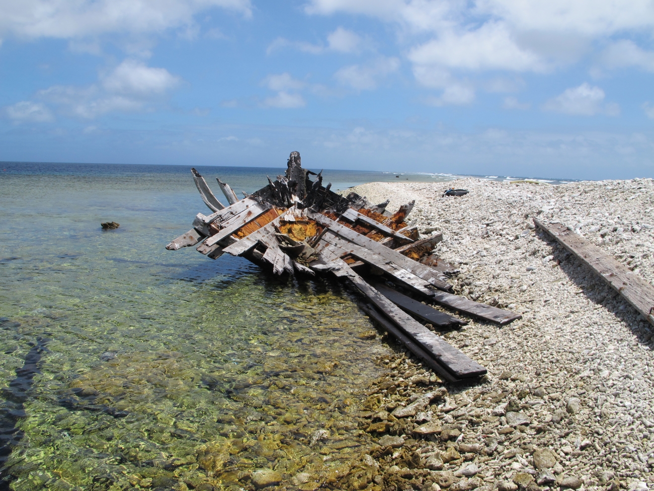
A wreck at Kingman documents the lasting footprint of a vessel. Credit: Amanda Pollock/USFWS, Pacific Islands · Public Domain · Credits
These territories have no shared modern civilian community from which to compile a conventional list of notable residents. Instead, the following people connect their varied histories to the wider world.
🧭
The Hui Panalāʻau
About 130 young Native Hawaiian men, most from the Kamehameha Schools, who lived in rotation on Baker, Howland and Jarvis from 1935 to 1942 to secure the American claim. Carl Kahalewai and Joseph Kealoha Keliʻihananui and Richard "Dickey" Whaley were among them; the last two were killed when Japanese aircraft struck Howland on 8 December 1941.
✈️
Amelia Earhart
Howland Island was the landfall she never made. The Coast Guard cutter Itasca heard her, could not fix her, and she vanished on 2 July 1937. The Earhart Light, a 1938 day beacon, still stands on the island's western shore.
⚓
Adm. Chester W. Nimitz
Commander-in-Chief, Pacific Fleet. Acting on broken Japanese naval code, he set the ambush at Midway in June 1942 that cost Japan four fleet carriers in a single day.
🎖️
Maj. James P.S. Devereux
Marine commander of the Wake Island garrison in December 1941, whose 449 Marines held off the first Japanese landing on 11 December — sinking the destroyers Hayate and Kisaragi — before the island fell on the 23rd. He spent the rest of the war a prisoner.
📷
Chris Jordan
The photographer whose Midway series — dead albatross chicks opened to show stomachs of bottle caps and lighters — did more than any report to make ocean plastic legible to the public.
📚
Vincent Bugliosi
The Manson prosecutor turned author, whose And the Sea Will Tell (1991) reconstructed the 1974 Palmyra double murder of Malcolm "Mac" and Eleanor Graham and the trials that followed.
The inscription at Earhart Light on Howland. Credit: Dana Schot/USFWS · Public Domain · Credits
"Shattered Sword: The Untold Story of the Battle of Midway"
by Jonathan Parshall & Anthony Tully — The definitive account of the Battle of Midway from the Japanese perspective
"Given Up for Dead: America's Heroic Stand at Wake Island"
by Bill Sloan — The gripping story of Wake Island's defense and its defenders' captivity
"And the Sea Will Tell"
by Vincent Bugliosi & Bruce Henderson — True crime classic about the 1974 double murder on Palmyra Atoll
"Eye of the Albatross: Visions of Hope and Survival"
by Carl Safina — Following Laysan albatrosses across the Pacific, centered on Midway Atoll
"The Last Stand of the Tin Can Sailors"
by James D. Hornfischer — An account of the Battle off Samar in 1944, providing wider Pacific naval-war context rather than a direct history of these islands
Because almost nobody can go, the primary sources matter more here than in any other entry in this factbook. These are the offices that actually hold the answers.
These islands appear on virtually every country selection dropdown, despite having zero permanent residents.
💣
Nuclear Aurora
The 1962 Starfish Prime nuclear test over Johnston Atoll created an artificial aurora visible 1,400 km away in Hawaii.
✈️
Earhart's Destination
Howland Island was Amelia Earhart's intended stop when she vanished in 1937—the memorial light still stands.
🦈
Shark Paradise
Surveys at Palmyra and Kingman have found unusually large predator biomass; interpreting an inverted biomass pyramid requires attention to survey boundaries and animal movement.
🐦
Gooney Birds
During WWII, Midway's albatrosses caused so many aircraft collisions that the Navy tried to relocate them. The birds returned.
⏱️
A Day Apart
Baker Island keeps UTC−12 and Wake keeps UTC+12 — 3,000 km of ocean, but a full calendar day between them. Operational schedules should always state their date and UTC offset.
Different kinds of area
Dry land, lagoon, reef flat, refuge, and exclusive economic zone are different measurements. Combining incompatible definitions or survey dates creates misleading totals.
⚖️
Constitutional Island
Palmyra Atoll is the only uninhabited incorporated U.S. territory—its incorporation is distinct from refuge protection and access permission.
Masked boobies on Baker Island. Credit: Dana Schot/USFWS, Pacific Islands · Public Domain · Credits
Have a photograph from an authorized visit or assignment? Send it to radimkaufmann@gmail.com with the exact location, your preferred credit, and confirmation that we may publish it.
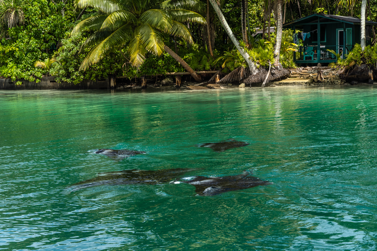
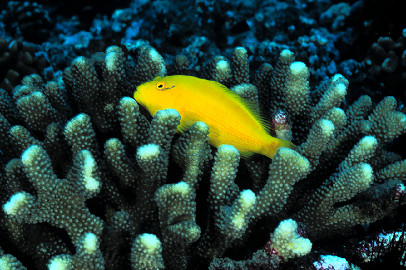
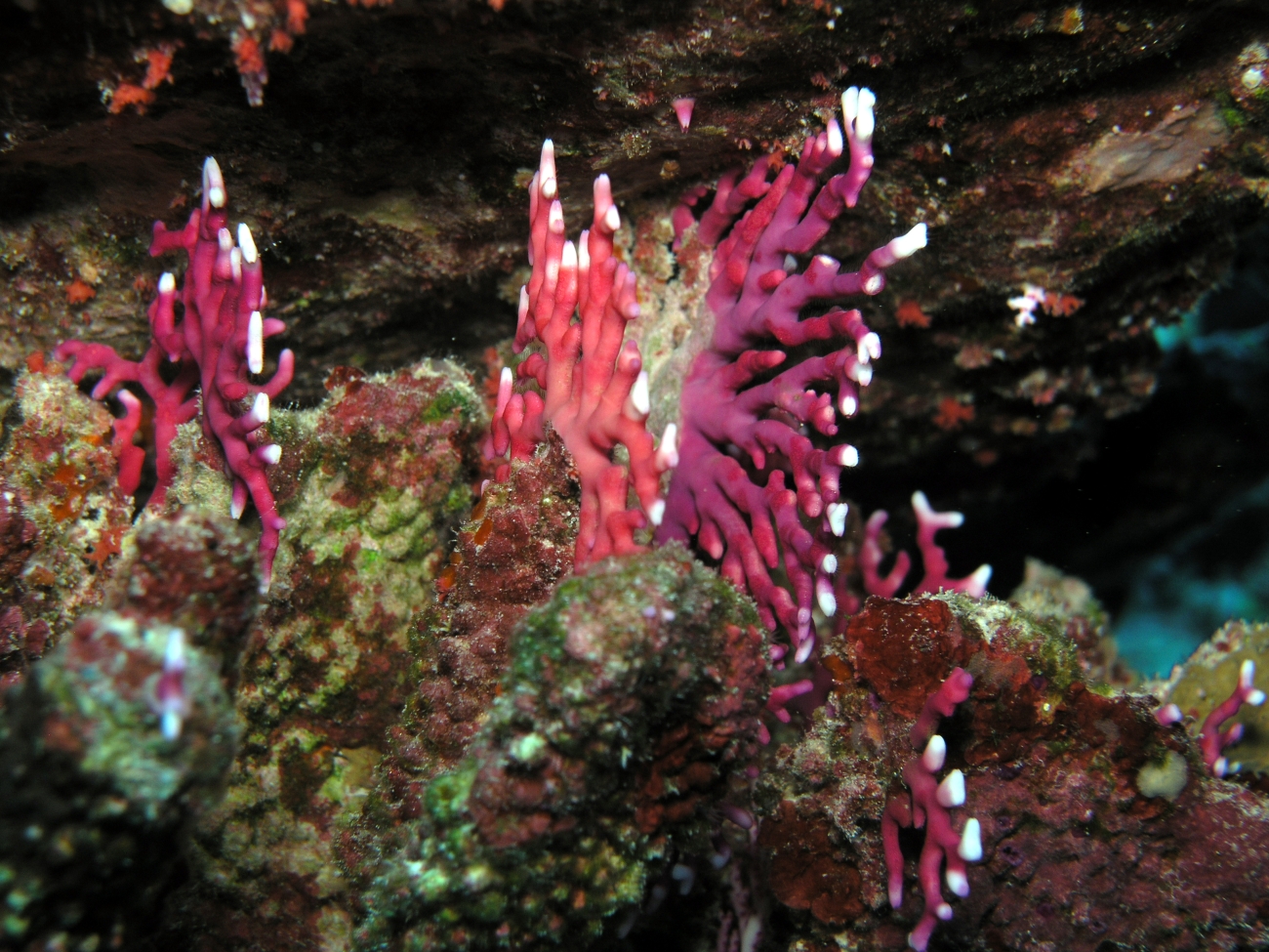
Manta rays in a Palmyra lagoon. Credit: Sarah Glover/USFWS, Pacific Islands · Public Domain · CreditsA reef fish at Jarvis. Credit: USFWS, Pacific Islands · Public Domain · CreditsA hermit crab on Baker. Credit: Dana Schot/USFWS · Public Domain · CreditsDistichopora violacea at Kingman Reef. Credit: JEMaragos/USFWS · Public Domain · Credits
The U.S. Minor Outlying Islands challenge everything we expect from a travel guide. You almost certainly cannot visit them. They have no hotels, no restaurants, no tourist infrastructure of any kind. Some retain complex legacies of military use and site remediation. One is mostly underwater. And yet these specks of coral and sand, scattered across the world's largest ocean, hold stories of extraordinary power—of decisive battles that shaped the 20th century, of aviators who vanished into the unknown, of nuclear fires that lit the Pacific sky, and of ecosystems so pristine they rewrite our understanding of how nature works.
Perhaps that is their greatest lesson: that the most remarkable places are not always the most accessible. That beauty and tragedy coexist on the same tiny atolls. And that sometimes the best thing humans can do for a place is simply leave it alone.
Nine Island Territories, Two Oceans, Many Stories
—Radim Kaufmann, 2026
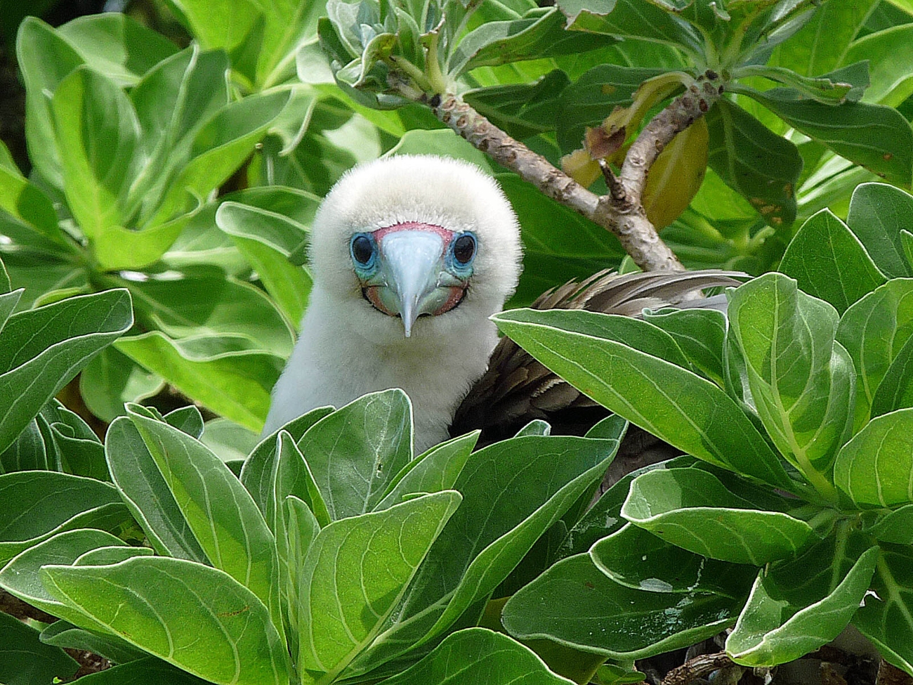
A red-footed booby at Palmyra. Credit: Laura Beauregard/USFWS · Public Domain · Credits
 ‹›
‹›